How to get to My Lock Locksmith by bus?
Click on the bus route to see step by step directions with maps, line arrival times and updated time schedules.
From Arlington Cinema 'N' Drafthouse, Arlington County
78 minFrom Costco Wholesale, Arlington County
80 minFrom Crowne Plaza Hotel-Crystal City Washington, D.c., Arlington County
65 minFrom Del Ray, Alexandria
45 minFrom Hilton Alexandria Mark Center, Alexandria
62 minFrom Tanger Outlets, Prince George's County
53 minFrom Days Inn by Wyndham Arlington Pentagon, Arlington County
81 minFrom Ballou High School, Washington
93 minFrom Lego Discovery Center Washington, D.C., Fairfax County
63 minFrom Transportation Security Administration - TSA Headquarters, Fairfax County
64 min
How to get to My Lock Locksmith by metro?
Click on the metro route to see step by step directions with maps, line arrival times and updated time schedules.
From Costco Wholesale, Arlington County
55 minFrom Crowne Plaza Hotel-Crystal City Washington, D.c., Arlington County
54 minFrom Del Ray, Alexandria
61 minFrom Ballou High School, Washington
92 minFrom Lego Discovery Center Washington, D.C., Fairfax County
76 minFrom Transportation Security Administration - TSA Headquarters, Fairfax County
67 min
Bus stops near My Lock Locksmith in Fairfax County
Metro station near My Lock Locksmith in Fairfax County
- Huntington, 49 min walk,VIEW
Bus lines to My Lock Locksmith in Fairfax County
What are the closest stations to My Lock Locksmith?
The closest stations to My Lock Locksmith are:
- Richmond Hwy @ Schooley Dr is 131 yards away, 2 min walk.
- Beacon Hill Rd @ Richmond Hwy is 179 yards away, 3 min walk.
- Richmond Hwy And Southgate Dr is 208 yards away, 3 min walk.
- Huntington is 4147 yards away, 49 min walk.
Which bus lines stop near My Lock Locksmith?
These bus lines stop near My Lock Locksmith: 151, 152, 171, F1X.
Which metro line stops near My Lock Locksmith?
YELLOW (Huntington)
What’s the nearest bus station to My Lock Locksmith in Fairfax County?
The nearest bus station to My Lock Locksmith in Fairfax County is Richmond Hwy @ Schooley Dr. It’s a 2 min walk away.
What time is the first metro to My Lock Locksmith in Fairfax County?
The YELLOW is the first metro that goes to My Lock Locksmith in Fairfax County. It stops nearby at 5:00 AM.
What time is the last metro to My Lock Locksmith in Fairfax County?
The YELLOW is the last metro that goes to My Lock Locksmith in Fairfax County. It stops nearby at 12:39 AM.
What time is the first bus to My Lock Locksmith in Fairfax County?
The 171 is the first bus that goes to My Lock Locksmith in Fairfax County. It stops nearby at 3:59 AM.
What time is the last bus to My Lock Locksmith in Fairfax County?
The 171 is the last bus that goes to My Lock Locksmith in Fairfax County. It stops nearby at 1:50 AM.
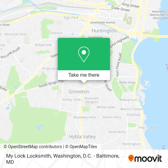
See My Lock Locksmith, Fairfax County, on the map
Public Transit to My Lock Locksmith in Fairfax County
Wondering how to get to My Lock Locksmith in Fairfax County? Moovit helps you find the best way to get to My Lock Locksmith with step-by-step directions from the nearest public transit station.
Moovit provides free maps and live directions to help you navigate through your city. View schedules, routes, timetables, and find out how long does it take to get to My Lock Locksmith in real time.
Looking for the nearest stop or station to My Lock Locksmith? Check out this list of stops closest to your destination: Richmond Hwy @ Schooley Dr; Beacon Hill Rd @ Richmond Hwy; Richmond Hwy And Southgate Dr; Huntington.
Bus: 151, 152, 171, F1X, 162, 159, 161.Metro: YELLOW.
Want to see if there’s another route that gets you there at an earlier time? Moovit helps you find alternative routes or times. Get directions from and directions to My Lock Locksmith easily from the Moovit App or Website.
We make riding to My Lock Locksmith easy, which is why over 1.5 million users, including users in Fairfax County, trust Moovit as the best app for public transit. You don’t need to download an individual bus app or train app, Moovit is your all-in-one transit app that helps you find the best bus time or train time available.
For information on prices of bus and metro, costs and ride fares to My Lock Locksmith, please check the Moovit app.
Use the app to navigate to popular places including to the airport, hospital, stadium, grocery store, mall, coffee shop, school, college, and university.
My Lock Locksmith Address: 6790 Richmond Hwy Alexandria, VA 22306 street in Fairfax County
- New Locks Installed,
- Outback Steakhouse,
- Locksmith Vehicle,
- Credit Union 1,
- Beacon Hill Road Emergency Homeless Shelter,
- STARBUCKS,
- Nails America,
- Capital Bail Bonds,
- Minute Key,
- Plumbers in My City Plumbers,
- Coinstar,
- WESTERN UNION,
- First National Bank ATM,
- Coinstar - Bitcoin ATM,
- Libertyx Bitcoin ATM,
- KeyMe,
- Kong Dog,
- Wendy's,
- The Beacon,
- Beacon Center (Beacon of Groveton)
Places Near My Lock Locksmith (Fairfax County)
- Warner Theatre, Washington,
- M&T Bank Stadium, Baltimore,
- Museum Of The Bible, Washington,
- National Museum of African American History and Culture, Washington,
- Rock Creek Tennis Center, Washington,
- PG Mall, Prince George's County,
- National Mall, Washington,
- The Anthem, Washington,
- Amazon Hq2, Arlington County,
- Washington National Cathedral, Washington,
- Washington DC VA Medical Center, Washington,
- Georgetown, Washington,
- Camden Yards, Baltimore,
- Marriott Marquis Washington, DC, Washington,
- National Zoo, Washington,
- Pennsylvania Ave NW (3rd st and pennsylvania), Washington,
- Sibley Memorial Hospital, Washington,
- Basilica of the National Shrine, Washington,
- Westfield Montgomery Mall, Montgomery County,
- Capital One Arena, Washington
How to get to popular places in Washington, D.C. - Baltimore, MD with public transit
Get around Fairfax County by public transit!
Traveling around Fairfax County has never been so easy. See step by step directions as you travel to any attraction, street or major public transit station. View bus and train schedules, arrival times, service alerts and detailed routes on a map, so you know exactly how to get to anywhere in Fairfax County.
When traveling to any destination around Fairfax County use Moovit's Live Directions with Get Off Notifications to know exactly where and how far to walk, how long to wait for your line, and how many stops are left. Moovit will alert you when it's time to get off — no need to constantly re-check whether yours is the next stop.
Wondering how to use public transit in Fairfax County or how to pay for public transit in Fairfax County? Moovit public transit app can help you navigate your way with public transit easily, and at minimum cost. It includes public transit fees, ticket prices, and costs. Looking for a map of Fairfax County public transit lines? Moovit public transit app shows all public transit maps in Fairfax County with all Bus, Train, Metro, Light Rail and Ferry routes and stops on an interactive map.
Washington, D.C. - Baltimore, MD has 5 transit type(s), including: Bus, Train, Metro, Light Rail and Ferry, operated by several transit agencies, including WMATA, Montgomery County Ride On, Fairfax Connector, TheBus, PRTC, DASH - Alexandria, Arlington Transit (ART), RTA of Central Maryland, MDOT MTA, MDOT MTA Light RailLink, MDOT MTA Commuter Bus, MDOT MTA Local Bus, FXBGO!, Virginia Railway Express (VRE) and MARC