How to get to My Place by bus?
Click on the bus route to see step by step directions with maps, line arrival times and updated time schedules.
From URB LOS CEDROS DE VILLA CHORRILLOS, Chorrillos
39 minFrom USIL - Frecuencia USIL, La Molina
37 minFrom Salaverry, San Miguel
43 minFrom Villa Maria del Triunfo, Villa Mari
43 minFrom Av. Tacna, Lima
33 minFrom Club Cultural Deportivo Lima, Chorrillos
42 minFrom Urbanización Las Delicias de Villa, Chorrillos
42 minFrom Plaza Grau, Lima
16 minFrom AVENIDA BRASIL CUADRA 12, Jesus Mari
28 minFrom Asia, Lima
38 min
How to get to My Place by metro?
Click on the metro route to see step by step directions with maps, line arrival times and updated time schedules.
Bus stops near My Place in Miraflores
Metro station near My Place in Miraflores
- Cabitos, 47 min walk,VIEW
Bus lines to My Place in Miraflores
- 1163, Santa Margarita (Ventanilla) - Jockey Plaza (Surco),VIEW
- 1276, Puente Benavides (Surco),VIEW
- EX5, Terminal Naranjal (Independencia) - Est. Plaza De Flores (Barranco),VIEW
- 1227, Tiwinza (Callao) - Ceres (Ate),VIEW
- C, Terminal Matellini (Chorrillos) - Estación Ramón Castilla (Centro De Lima),VIEW
- EX2, Terminal Naranjal (Independencia) - Est. 28 De Julio (Miraflores),VIEW
- L, Terminal Naranjal (Independencia) - Terminal Matellini (Chorrillos),VIEW
- 1180, Pamplona Alta (San Juan De Miraflores) - Torre Blanca (Carabayllo),VIEW
- 1182, San Juan de Miraflores - Carabayllo,VIEW
- 1183, Carabayllo - Surco - Carabayllo,VIEW
- 1482, Chorrillos - S.M.P.,VIEW
- 1123, José Gálvez (Villa María Del Triunfo) - Parque Kennedy (Miraflores),VIEW
- 303, Angamos (Miraflores) - Caja De Agua (San Juan De Lurigancho),VIEW
- 301, Amancaes (Rímac) - Plaza Butters (Barranco),VIEW
- 305, Condominios (Rímac) - 2 De Mayo (Miraflores),VIEW
What are the closest stations to My Place?
The closest stations to My Place are:
- Ricardo Palma is 166 meters away, 3 min walk.
- Calle General Suárez, 435 is 208 meters away, 3 min walk.
- Estación Ricardo Palma is 225 meters away, 3 min walk.
- Paseo De La República is 242 meters away, 4 min walk.
- Puente Ricardo Palma is 311 meters away, 5 min walk.
- Dos De Mayo is 399 meters away, 6 min walk.
- Pardo is 410 meters away, 6 min walk.
- 2 De Mayo is 446 meters away, 6 min walk.
- Cabitos is 3624 meters away, 47 min walk.
Which bus lines stop near My Place?
These bus lines stop near My Place: 1090, 1118, 1227, 303, 305, C, EX2.
Which metro line stops near My Place?
LINEA 1 (Separadora Industrial (Villa El Salvador) - Bayóvar (San Juan De Lurigancho))
What’s the nearest bus station to My Place in Miraflores?
The nearest bus stations to My Place in Miraflores are Ricardo Palma, Calle General Suárez, 435 and Estación Ricardo Palma. The closest one is a 3 min walk away.
What time is the first metro to My Place in Miraflores?
The LINEA 1 is the first metro that goes to My Place in Miraflores. It stops nearby at 5:17 AM.
What time is the last metro to My Place in Miraflores?
The LINEA 1 is the last metro that goes to My Place in Miraflores. It stops nearby at 10:31 PM.
What time is the first bus to My Place in Miraflores?
The 1180 is the first bus that goes to My Place in Miraflores. It stops nearby at 3:56 AM.
What time is the last bus to My Place in Miraflores?
The 301 is the last bus that goes to My Place in Miraflores. It stops nearby at 12:28 AM.
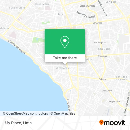
See My Place, Miraflores, on the map
Public Transit to My Place in Miraflores
Wondering how to get to My Place in Miraflores? Moovit helps you find the best way to get to My Place with step-by-step directions from the nearest public transit station.
Moovit provides free maps and live directions to help you navigate through your city. View schedules, routes, timetables, and find out how long does it take to get to My Place in real time.
Looking for the nearest stop or station to My Place? Check out this list of stops closest to your destination: Ricardo Palma; Calle General Suárez; Estación Ricardo Palma; Paseo De La República; Puente Ricardo Palma; Dos De Mayo; Pardo; 2 De Mayo; Cabitos.
Bus: 1090, 1118, 1227, 303, 305, C, EX2, 1163, 1276, EX5, L, 1180, 1182, 1183, 1482.Metro: LINEA 1.
Want to see if there’s another route that gets you there at an earlier time? Moovit helps you find alternative routes or times. Get directions from and directions to My Place easily from the Moovit App or Website.
We make riding to My Place easy, which is why over 1.5 million users, including users in Miraflores, trust Moovit as the best app for public transit. You don’t need to download an individual bus app or train app, Moovit is your all-in-one transit app that helps you find the best bus time or train time available.
For information on prices of bus and metro, costs and ride fares to My Place, please check the Moovit app.
Use the app to navigate to popular places including to the airport, hospital, stadium, grocery store, mall, coffee shop, school, college, and university.
My Place Address: Calle General Suárez 180 Municipal, 15074 Miraflores street in Miraflores
- calle belisario suarez miraflores,
- CALLE NARCISO DE LA COLINA,
- Suarez 130,
- Casa Museo Ricardo Palma,
- Mariel Hotel Boutique Lima,
- Edificio Platino,
- av ricardo palma 341,
- Piso 13,
- Culstudio,
- Centro De Atención Al Cliente Directv,
- Av Ricardo Palma esquina Ca General Suárez,
- Puku Puku,
- Casino Palacio Royale,
- Instituto Raúl Porras Barrenechea,
- Mariel Hotel,
- BATA PERU - Edificio Platino,
- Banco Interbank - Sede Ricardo Palma - Miraflores,
- Perú +Vision Care - Zeiss Vision Analysis Expert,
- Dr. Mendiola Solari-Oftalmólogo,
- Juan Fernando Mendiola Solari
Places Near My Place (Miraflores)
- Paradero Av.Brasil,
- Centro Comercial Plaza Norte, Independen,
- Av. La Marina, San Miguel,
- Parque de las Leyendas, San Miguel,
- Real Plaza Puruchuco, Ate,
- Miraflores, Miraflores,
- Gamarra,
- Parque Kennedy, Miraflores,
- Jockey Plaza, Santiago D,
- Aeropuerto Internacional Jorge Chávez, Ventanilla,
- Av. Salaverry, Jesus Mari,
- av arequipa, Lima,
- Larcomar, Miraflores,
- Av. Abancay, Lima,
- Barranco, Barranco,
- Real Plaza Salaverry, Jesus Mari,
- Mall Del Sur,
- Hospital Edgardo Rebagliati Martins, Jesus Mari,
- Plaza San Miguel, San Miguel,
- Circuito Mágico Del Agua, Lima
How to get to popular places in Lima with public transit
Get around Miraflores by public transit!
Traveling around Miraflores has never been so easy. See step by step directions as you travel to any attraction, street or major public transit station. View bus and train schedules, arrival times, service alerts and detailed routes on a map, so you know exactly how to get to anywhere in Miraflores.
When traveling to any destination around Miraflores use Moovit's Live Directions with Get Off Notifications to know exactly where and how far to walk, how long to wait for your line, and how many stops are left. Moovit will alert you when it's time to get off — no need to constantly re-check whether yours is the next stop.
Wondering how to use public transit in Miraflores or how to pay for public transit in Miraflores? Moovit public transit app can help you navigate your way with public transit easily, and at minimum cost. It includes public transit fees, ticket prices, and costs. Looking for a map of Miraflores public transit lines? Moovit public transit app shows all public transit maps in Miraflores with all Bus, Metro and Ferry routes and stops on an interactive map.
Lima has 3 transit type(s), including: Bus, Metro and Ferry, operated by several transit agencies, including Metro de Lima Línea 2 , Metro de Lima, Corredor Rojo, Metropolitano, Metropolitano - Alimentadores, Corredor Morado, Corredor Azul, Rutas Tradicionales, Transportes y Servicios La Esperanza S.A., Las Flores S.A., Virgen de la Asunción S.A., Consorcio HAM, Transportes y Service Canadá S.A., ETUL4SA and ETUCHISA