How to get to My Time Pune by bus?
Click on the bus route to see step by step directions with maps, line arrival times and updated time schedules.
From Bosch Chassis Systems India Ltd, Chakan Pune, Rajgurunagar
69 minFrom Bajaj Auto Yamunanagar Gate, Pune & Velhe
48 minFrom Capgemini, Pune & Velhe
39 minFrom Thermax Chowk, Pune & Velhe
54 minFrom Dudulgaon, Pune & Velhe
74 minFrom Bird Valley, Pune & Velhe
60 minFrom Talawade Road, Pune & Velhe
42 minFrom Sant Tukaram Maharaj Mandir, Pune & Velhe
47 minFrom Markal, Pune & Velhe
49 minFrom RTO Pimpri Chinchwad, Pune & Velhe
78 min
Bus stops near My Time Pune in Rajgurunagar
Bus lines to My Time Pune in Rajgurunagar
What are the closest stations to My Time Pune?
The closest stations to My Time Pune are:
- Tathastu Sai Park is 112 meters away, 2 min walk.
- Maharashtra Vajan Kata is 1233 meters away, 16 min walk.
Which bus line stops near My Time Pune?
314 (Ambethan Gaon)
What’s the nearest bus station to My Time Pune in Rajgurunagar?
The nearest bus station to My Time Pune in Rajgurunagar is Tathastu Sai Park. It’s a 2 min walk away.
What time is the first bus to My Time Pune in Rajgurunagar?
The 314 is the first bus that goes to My Time Pune in Rajgurunagar. It stops nearby at 5:14 AM.
What time is the last bus to My Time Pune in Rajgurunagar?
The 120 is the last bus that goes to My Time Pune in Rajgurunagar. It stops nearby at 11:26 PM.
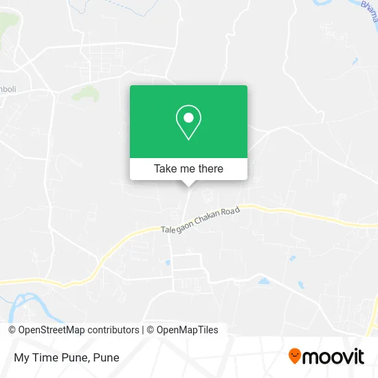
See My Time Pune, Rajgurunagar, on the map
Public Transit to My Time Pune in Rajgurunagar
Wondering how to get to My Time Pune in Rajgurunagar? Moovit helps you find the best way to get to My Time Pune with step-by-step directions from the nearest public transit station.
Moovit provides free maps and live directions to help you navigate through your city. View schedules, routes, timetables, and find out how long does it take to get to My Time Pune in real time.
Looking for the nearest stop or station to My Time Pune? Check out this list of stops closest to your destination: Tathastu Sai Park; Maharashtra Vajan Kata.
Bus: 314, 120, 343, 384, 343A, 343B, 385, 343C.
Want to see if there’s another route that gets you there at an earlier time? Moovit helps you find alternative routes or times. Get directions from and directions to My Time Pune easily from the Moovit App or Website.
We make riding to My Time Pune easy, which is why over 1.5 million users, including users in Rajgurunagar, trust Moovit as the best app for public transit. You don’t need to download an individual bus app or train app, Moovit is your all-in-one transit app that helps you find the best bus time or train time available.
For information on prices of bus, costs and ride fares to My Time Pune, please check the Moovit app.
Use the app to navigate to popular places including to the airport, hospital, stadium, grocery store, mall, coffee shop, school, college, and university.
My Time Pune Address: Mahalunge Ambethan Road खेड 410501 MH street in Rajgurunagar
- S K Gas Services,
- Gurukrupa Clinic,
- Sanjivani Enterprises,
- SS Services,
- Royal Medical,
- Ishwar Steel & Varieties Gift House,
- Aapla Bazaar,
- Mahalunge Gram Panchayat,
- Om Enterprises A Job Placement Agency,
- Skyline Broadband,
- Pragya Beauty Parlour,
- Vasudev Doodh Dairy,
- Maharashtra Industrial Laundry,
- Poorva Ladies Tailor,
- RS Engineers Quality Gas Equipments,
- Yashoda Car Wash & Detailing,
- Ishwariy Automobile,
- Annapurna Khanawal,
- Jai Hanuman Gym,
- Taj Caterers
Places Near My Time Pune (Rajgurunagar)
- Swaminarayan Mandir, Pune & Velhe,
- Fc Road, Pune & Velhe,
- Westend Mall, Pune & Velhe,
- Pune Okayama Friendship Garden, Pune & Velhe,
- Dagadusheth Halwai Ganapati Temple, Pune & Velhe,
- ISKCON Pune, Pune & Velhe,
- Vishwakarma Institute Of Technology (Vit), Pune & Velhe,
- Dagdusheth Halwai Ganpati Mandir, Pune & Velhe,
- Pvr Icon - Pavilion Mall, Pune & Velhe,
- BAPS Shri Swaminarayan Mandir, Pune & Velhe,
- Cognizant Deccan Campus (CDC), Paud,
- Laxmi Road, Pune & Velhe,
- Senapati Bapat Road, Pune & Velhe,
- Tulshibaug, Pune & Velhe,
- Symbiosis Lavale Bus Stop, Pune & Velhe,
- ISKCON Nvcc Temple, Pune & Velhe,
- M G Road, Pune & Velhe,
- Ion Digital Zone, Pune & Velhe,
- Chaturshringi Temple, Pune & Velhe,
- Sarasbaug, Pune & Velhe
How to get to popular places in Pune with public transit
Get around Rajgurunagar by public transit!
Traveling around Rajgurunagar has never been so easy. See step by step directions as you travel to any attraction, street or major public transit station. View bus and train schedules, arrival times, service alerts and detailed routes on a map, so you know exactly how to get to anywhere in Rajgurunagar.
When traveling to any destination around Rajgurunagar use Moovit's Live Directions with Get Off Notifications to know exactly where and how far to walk, how long to wait for your line, and how many stops are left. Moovit will alert you when it's time to get off — no need to constantly re-check whether yours is the next stop.
Wondering how to use public transit in Rajgurunagar or how to pay for public transit in Rajgurunagar? Moovit public transit app can help you navigate your way with public transit easily, and at minimum cost. It includes public transit fees, ticket prices, and costs. Looking for a map of Rajgurunagar public transit lines? Moovit public transit app shows all public transit maps in Rajgurunagar with all Bus, Train and Metro routes and stops on an interactive map.
Pune has 3 transit type(s), including: Bus, Train and Metro, operated by several transit agencies, including Pune Metro (Maha Metro), PMPML, PMPML Night Bus Service (Ratrani) and Central Railways (Indian Railways)