How to get to NCATS by bus?
Click on the bus route to see step by step directions with maps, line arrival times and updated time schedules.
From Bethesda North Marriott Hotel & Conference Center, Montgomery County
57 minFrom Westfield Montgomery Mall, Montgomery County
55 minFrom Park Potomac Place, Montgomery County
40 minFrom Wheaton High School, Montgomery County
76 minFrom Kentlands, Montgomery County
24 minFrom Intercounty Connector (ICC)/MD 200, Montgomery County
46 minFrom Pike & Rose (Pike and Rose), Montgomery County
52 minFrom The Music Center At Strathmore, Montgomery County
54 minFrom Georgia Ave & Icc Park & Ride Lot, Montgomery County
51 minFrom Germantown, Maryland, Montgomery County
64 min
Bus stops near NCATS in Montgomery County
Metro station near NCATS in Montgomery County
- Shady Grove, 28 min walk,VIEW
Bus lines to NCATS in Montgomery County
What are the closest stations to NCATS?
The closest stations to NCATS are:
- Medical Center Dr & @9800 is 164 yards away, 3 min walk.
- Medical Center Way & Shady Grove Rd is 183 yards away, 3 min walk.
- Shady Grove Rd & Medical Center Way is 257 yards away, 4 min walk.
- Medical Center Dr & Medical Center Wy is 257 yards away, 4 min walk.
- Shady Grove Medical Center - South & Medical Center Way is 362 yards away, 5 min walk.
- Shady Grove is 2347 yards away, 28 min walk.
Which bus lines stop near NCATS?
These bus lines stop near NCATS: 43, 56, 66, PINK.
What’s the nearest metro station to NCATS in Montgomery County?
The nearest metro station to NCATS in Montgomery County is Shady Grove. It’s a 28 min walk away.
What’s the nearest bus station to NCATS in Montgomery County?
The nearest bus stations to NCATS in Montgomery County are Medical Center Dr & @9800 and Medical Center Way & Shady Grove Rd. The closest one is a 3 min walk away.
What time is the first metro to NCATS in Montgomery County?
The RED is the first metro that goes to NCATS in Montgomery County. It stops nearby at 5:00 AM.
What time is the last metro to NCATS in Montgomery County?
The RED is the last metro that goes to NCATS in Montgomery County. It stops nearby at 12:42 AM.
What time is the first bus to NCATS in Montgomery County?
The 43 is the first bus that goes to NCATS in Montgomery County. It stops nearby at 5:11 AM.
What time is the last bus to NCATS in Montgomery County?
The 43 is the last bus that goes to NCATS in Montgomery County. It stops nearby at 12:00 AM.
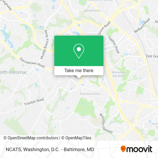
See NCATS, Montgomery County, on the map
Public Transit to NCATS in Montgomery County
Wondering how to get to NCATS in Montgomery County? Moovit helps you find the best way to get to NCATS with step-by-step directions from the nearest public transit station.
Moovit provides free maps and live directions to help you navigate through your city. View schedules, routes, timetables, and find out how long does it take to get to NCATS in real time.
Looking for the nearest stop or station to NCATS? Check out this list of stops closest to your destination: Medical Center Dr & @9800; Medical Center Way & Shady Grove Rd; Shady Grove Rd & Medical Center Way; Medical Center Dr & Medical Center Wy; Shady Grove Medical Center - South & Medical Center Way; Shady Grove.
Bus: 43, 56, 66, PINK, 301, 45.Metro: RED.
Want to see if there’s another route that gets you there at an earlier time? Moovit helps you find alternative routes or times. Get directions from and directions to NCATS easily from the Moovit App or Website.
We make riding to NCATS easy, which is why over 1.5 million users, including users in Montgomery County, trust Moovit as the best app for public transit. You don’t need to download an individual bus app or train app, Moovit is your all-in-one transit app that helps you find the best bus time or train time available.
For information on prices of bus and metro, costs and ride fares to NCATS, please check the Moovit app.
Use the app to navigate to popular places including to the airport, hospital, stadium, grocery store, mall, coffee shop, school, college, and university.
NCATS Address: 9800 Medical Center Dr street in Montgomery County
- Regenxbio,
- Grove Shady Adventist Hospital,
- Adventist HealthCare Shady Grove Medical Center,
- Metro Newport News,
- Montgomery County Fire Station 32,
- SWTCH,
- Shady Grove Adventist Hospital Operating Rooms,
- Bloom Health Centers,
- Comprehensive Primary Care,
- Neurological Surgery Group,
- Rcca,
- Jeff Jacobson MD,
- Kung Fu 12 Szechuan,
- Shady Grove EPTU ER,
- Shell Recharge,
- 343 Prettyman Drive,
- Shady Grove Adventist Hospital Cafeteria,
- Coinstar - Bitcoin ATM,
- Shady Grove Medical Center,
- Fallsgrove Village Center
Places Near NCATS (Montgomery County)
- Washington DC VA Medical Center, Washington,
- Warner Theatre, Washington,
- Amazon Hq2, Arlington County,
- Museum Of The Bible, Washington,
- PG Mall, Prince George's County,
- Marriott Marquis Washington, DC, Washington,
- Georgetown, Washington,
- Basilica of the National Shrine, Washington,
- National Zoo, Washington,
- The Anthem, Washington,
- National Mall, Washington,
- Camden Yards, Baltimore,
- Rock Creek Tennis Center, Washington,
- M&T Bank Stadium, Baltimore,
- Sibley Memorial Hospital, Washington,
- Capital One Arena, Washington,
- Pennsylvania Ave NW (3rd st and pennsylvania), Washington,
- Washington National Cathedral, Washington,
- National Museum of African American History and Culture, Washington,
- Westfield Montgomery Mall, Montgomery County
How to get to popular places in Washington, D.C. - Baltimore, MD with public transit
Get around Montgomery County by public transit!
Traveling around Montgomery County has never been so easy. See step by step directions as you travel to any attraction, street or major public transit station. View bus and train schedules, arrival times, service alerts and detailed routes on a map, so you know exactly how to get to anywhere in Montgomery County.
When traveling to any destination around Montgomery County use Moovit's Live Directions with Get Off Notifications to know exactly where and how far to walk, how long to wait for your line, and how many stops are left. Moovit will alert you when it's time to get off — no need to constantly re-check whether yours is the next stop.
Wondering how to use public transit in Montgomery County or how to pay for public transit in Montgomery County? Moovit public transit app can help you navigate your way with public transit easily, and at minimum cost. It includes public transit fees, ticket prices, and costs. Looking for a map of Montgomery County public transit lines? Moovit public transit app shows all public transit maps in Montgomery County with all Bus, Train, Metro, Light Rail and Ferry routes and stops on an interactive map.
Washington, D.C. - Baltimore, MD has 5 transit type(s), including: Bus, Train, Metro, Light Rail and Ferry, operated by several transit agencies, including WMATA, Montgomery County Ride On, Fairfax Connector, TheBus, PRTC, DASH - Alexandria, Arlington Transit (ART), RTA of Central Maryland, MDOT MTA, MDOT MTA Light RailLink, MDOT MTA Commuter Bus, MDOT MTA Local Bus, FXBGO!, Virginia Railway Express (VRE) and MARC