How to get to NE 105 St@Biscayne Blvd by bus?
Click on the bus route to see step by step directions with maps, line arrival times and updated time schedules.
From Jackson Memorial Hospital, Miami
63 minFrom Miami Norland Senior High School, Miami Gardens
93 minFrom Institute of Contemporary Art, Miami
32 minFrom Miami VA Hospital, Miami
62 minFrom S/120 Bus Stop, Miami Beach
62 minFrom Aventura Mall, Miami
38 minFrom Hotel Croydon Miami Beach, Miami Beach
56 minFrom Allapattah, Miami
61 minFrom Aventura, FL, Miami
44 minFrom Consulado General Del Ecuador en Miami, Miami
64 min
Bus stops near NE 105 St@Biscayne Blvd in Miami
Bus lines to NE 105 St@Biscayne Blvd in Miami
What are the closest stations to NE 105 St@Biscayne Blvd?
The closest stations to NE 105 St@Biscayne Blvd are:
- Biscayne Bd & Ne 105 St is 187 yards away, 3 min walk.
- Biscayne Bd@ne 104 St is 305 yards away, 4 min walk.
- Biscayne Bd & # 10700 is 334 yards away, 4 min walk.
Which bus lines stop near NE 105 St@Biscayne Blvd?
These bus lines stop near NE 105 St@Biscayne Blvd: 203, 3.
What’s the nearest bus station to NE 105 St@Biscayne Blvd in Miami?
The nearest bus station to NE 105 St@Biscayne Blvd in Miami is Biscayne Bd & Ne 105 St. It’s a 3 min walk away.
What time is the first bus to NE 105 St@Biscayne Blvd in Miami?
The 3 is the first bus that goes to NE 105 St@Biscayne Blvd in Miami. It stops nearby at 3:35 AM.
What time is the last bus to NE 105 St@Biscayne Blvd in Miami?
The 3 is the last bus that goes to NE 105 St@Biscayne Blvd in Miami. It stops nearby at 2:31 AM.
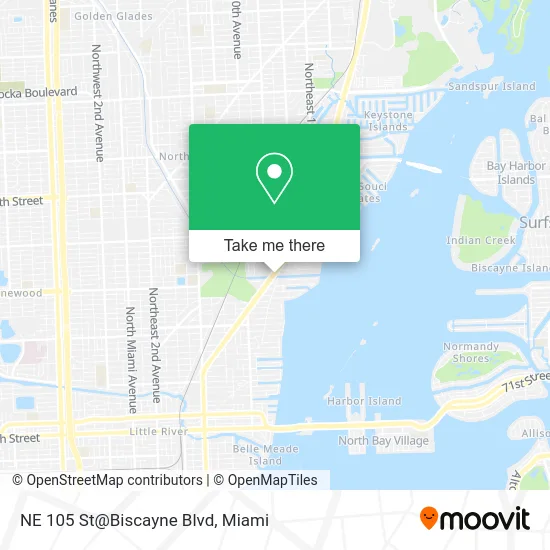
See NE 105 St@Biscayne Blvd, Miami, on the map
Public Transit to NE 105 St@Biscayne Blvd in Miami
Wondering how to get to NE 105 St@Biscayne Blvd in Miami? Moovit helps you find the best way to get to NE 105 St@Biscayne Blvd with step-by-step directions from the nearest public transit station.
Moovit provides free maps and live directions to help you navigate through your city. View schedules, routes, timetables, and find out how long does it take to get to NE 105 St@Biscayne Blvd in real time.
Looking for the nearest stop or station to NE 105 St@Biscayne Blvd? Check out this list of stops closest to your destination: Biscayne Bd & Ne 105 St; Biscayne Bd@ne 104 St; Biscayne Bd & # 10700.
Bus: 203, 3, MSHEST.
Want to see if there’s another route that gets you there at an earlier time? Moovit helps you find alternative routes or times. Get directions from and directions to NE 105 St@Biscayne Blvd easily from the Moovit App or Website.
We make riding to NE 105 St@Biscayne Blvd easy, which is why over 1.5 million users, including users in Miami, trust Moovit as the best app for public transit. You don’t need to download an individual bus app or train app, Moovit is your all-in-one transit app that helps you find the best bus time or train time available.
For information on prices of bus, costs and ride fares to NE 105 St@Biscayne Blvd, please check the Moovit app.
Use the app to navigate to popular places including to the airport, hospital, stadium, grocery store, mall, coffee shop, school, college, and university.
NE 105 St@Biscayne Blvd Address: 10459 Biscayne Blvd Miami, FL 33138 street in Miami
- Shore at This Bay Motel,
- Aflac,
- Emc HQ,
- Amazon Locker-Abaco,
- Burlington Stores 1103,
- Kmart,
- Miami Shores,
- Terry's Face Painting,
- Seritage Growth Properties,
- Rossstore/ALDI,
- ALDI SÜD,
- Appliance Repair Wolf,
- Rosamia.Club,
- Travis Harris Photography & Design,
- Towers of Quayside Tower 2,
- Amazon Locker-Warnell,
- Chevron,
- Caesar's Acai Bowl,
- TSP Carrier,
- Mystic Moments
Places Near NE 105 St@Biscayne Blvd (Miami)
- Zoo Miami, Miami,
- Sawgrass mall ( FL ), Miami Beach,
- Little Havana, Miami,
- Keiser University Flagship Campus, West Palm Beach,
- Richard E. Gerstein Justice Building, Miami,
- Wynwood, Miami,
- Port of Miami Cruise Terminal, Miami,
- Miami-Dade County Courthouse, Miami,
- Aventura Mall, Miami Beach,
- Hard Rock Stadium, Miami Gardens,
- Miami VA Hospital, Miami,
- Bayside Marketplace, Miami,
- Marlins Park, Miami,
- Dolphin Mall Bus, Miami,
- Aventura Mall, Miami,
- Brickell City Centre, Miami,
- Dolphin Mall, Miami,
- Sawgrass Mall, Miami,
- Miami Freedom Park, Miami,
- Miami Design District, Miami
How to get to popular places in Miami with public transit
Get around Miami by public transit!
Traveling around Miami has never been so easy. See step by step directions as you travel to any attraction, street or major public transit station. View bus and train schedules, arrival times, service alerts and detailed routes on a map, so you know exactly how to get to anywhere in Miami.
When traveling to any destination around Miami use Moovit's Live Directions with Get Off Notifications to know exactly where and how far to walk, how long to wait for your line, and how many stops are left. Moovit will alert you when it's time to get off — no need to constantly re-check whether yours is the next stop.
Wondering how to use public transit in Miami or how to pay for public transit in Miami? Moovit public transit app can help you navigate your way with public transit easily, and at minimum cost. It includes public transit fees, ticket prices, and costs. Looking for a map of Miami public transit lines? Moovit public transit app shows all public transit maps in Miami with all Bus, Train, Light Rail and Ferry routes and stops on an interactive map.
Miami has 4 transit type(s), including: Bus, Train, Light Rail and Ferry, operated by several transit agencies, including Broward County Transit, Miami-Dade Transit, Metrorail, Palm Tran, Tri-Rail, Brightline, MARTY, City of Homestead Trolley, Key West Transit, Treasure Coast Connector, GoLine IRT, Amtrak, Greyhound-us, FlixBus-us and Aventura Express Shuttle Bus