How to get to NIP RH by bus?
Click on the bus route to see step by step directions with maps, line arrival times and updated time schedules.
From Sam's Club, Puebla
36 minFrom Plaza Tolin, Puebla
25 minFrom Templo San Francisco Acatepec, Santa Isabel Cholula
39 minFrom Iglesia de la Medalla Milagrosa, Puebla
28 minFrom Plaza Centro Mayor Zabaleta, Puebla
34 minFrom Tepeyahualco de Hidalgo Puebla, Vicente Guerrero
55 minFrom San Francisco Totimehuacan, Puebla
47 minFrom La Guadalupana, Puebla
58 minFrom Ameyal, Puebla
55 minFrom Chalchicomula de Sesma y Sus Alrededores, Puebla
52 min
Bus stops near NIP RH in San Andrés Cholula
- Avenida De La Reforma, 2720c, 1 min walk,VIEW
- Avenida De La Reforma, 2711, 1 min walk,VIEW
- Edificio Empresarial, 2 min walk,VIEW
- Av. Reforma-29 Norte, 2 min walk,VIEW
- Avenida De La Reforma, 2722, 2 min walk,VIEW
- Reforma, 2 min walk,VIEW
- Diagonal Defensores De La República, 2, 2 min walk,VIEW
- Diagonal Defensores De La República, 2704, 2 min walk,VIEW
- Diagonal Defensores De La República-27 Norte, 2 min walk,VIEW
- 2 Poniente-29 Norte, 3 min walk,VIEW
Bus lines to NIP RH in San Andrés Cholula
- TRANSPORTE NOCTURNO, Paseo Bravo - Cholula (Circular),VIEW
- RUTA 5, Ramal Jardines De La Montaña - Exrancho Colorado (Ida),VIEW
- RUTA 35, Ramal 1, Heroes Del 5 De Mayo- Lomas Del Cristo,VIEW
- RECORRIDO 4, San Andrés Cholula - Paseo Bravo (Circular),VIEW
- RUTA 26A, Ramal 2, Sanctorum - El Carmen,VIEW
- RUTA 26B, Ramal 4, El Carmen - Ferrocarrilera,VIEW
- RUTA 53N, Ramal 1, Malintzi - La Providencia,VIEW
- RUTA PORTES GIL, Ruta Portes Gil - Ocoyucan - Puebla (Circuito),VIEW
- RUTA 1, Puebla,VIEW
- RUTA 3, Ramal 3, La Flor - Francisco I. Madero,VIEW
- RUTA S25, Ramal 5, Cholula Centro - Puebla Centro,VIEW
- RUTA 55, Ramal 1, Xilotzingo - Aquiles Serdán (Regreso),VIEW
- RUTA S14A, Ramal 4, Santa María Xixitla - Puebla Centro,VIEW
- RUTA PUEBLA-CHOLULA, Ramal 2 , Puebla - Cetis (Ida),VIEW
- RUTA S1 "A" HUEJOTZINGO, Ramal Ozolco - Cholula Puebla (Circuito),VIEW
- RUTA 3A, Ramal 1 Zaragoza - Bello Horizonte (Ida),VIEW
- RUTA 11A, Ramal 3, Magnolias - San Baltazar Campeche 1,VIEW
- RUTA 11B, Ramal 4, Loma Bonita - Barrio De Santiago (Ida),VIEW
- RUTA 11C, Ramal 2 Magnolias - Barrio De Santiago _I,VIEW
- RUTA S23, Ramal 1, Santa María Acuexcomac - Centro,VIEW
What are the closest stations to NIP RH?
The closest stations to NIP RH are:
- Avenida De La Reforma, 2720c is 21 meters away, 1 min walk.
- Avenida De La Reforma, 2711 is 54 meters away, 1 min walk.
- Edificio Empresarial is 75 meters away, 2 min walk.
- Av. Reforma-29 Norte is 87 meters away, 2 min walk.
- Avenida De La Reforma, 2722 is 89 meters away, 2 min walk.
- Reforma is 104 meters away, 2 min walk.
- Diagonal Defensores De La República, 2 is 117 meters away, 2 min walk.
- Diagonal Defensores De La República, 2704 is 125 meters away, 2 min walk.
- Diagonal Defensores De La República-27 Norte is 126 meters away, 2 min walk.
- 2 Poniente-29 Norte is 203 meters away, 3 min walk.
Which bus lines stop near NIP RH?
These bus lines stop near NIP RH: A3 - A, RUTA 44A, RUTA 1, RUTA 26A, RUTA 35, RUTA 52, RUTA 55, RUTA REMANENTE 1.
What’s the nearest bus station to NIP RH in San Andrés Cholula?
The nearest bus stations to NIP RH in San Andrés Cholula are Avenida De La Reforma, 2720c and Avenida De La Reforma, 2711. The closest one is a 1 min walk away.
What time is the first bus to NIP RH in San Andrés Cholula?
The TRANSPORTE NOCTURNO is the first bus that goes to NIP RH in San Andrés Cholula. It stops nearby at 3:03 AM.
What time is the last bus to NIP RH in San Andrés Cholula?
The TRANSPORTE NOCTURNO is the last bus that goes to NIP RH in San Andrés Cholula. It stops nearby at 2:55 AM.
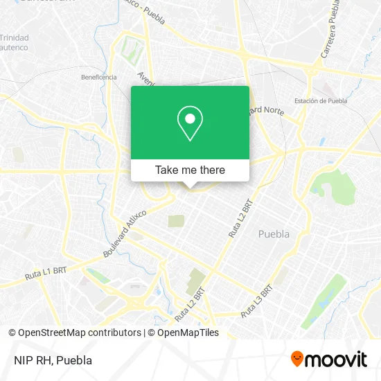
See NIP RH, San Andrés Cholula, on the map
Public Transit to NIP RH in San Andrés Cholula
Wondering how to get to NIP RH in San Andrés Cholula? Moovit helps you find the best way to get to NIP RH with step-by-step directions from the nearest public transit station.
Moovit provides free maps and live directions to help you navigate through your city. View schedules, routes, timetables, and find out how long does it take to get to NIP RH in real time.
Looking for the nearest stop or station to NIP RH? Check out this list of stops closest to your destination: Avenida De La Reforma; Avenida De La Reforma; Edificio Empresarial; Av. Reforma-29 Norte; Avenida De La Reforma; Reforma; Diagonal Defensores De La República; Diagonal Defensores De La República; Diagonal Defensores De La República-27 Norte; 2 Poniente-29 Norte.
Bus: A3 - A, RUTA 44A, RUTA 1, RUTA 26A, RUTA 35, RUTA 52, RUTA 55, RUTA REMANENTE 1, TRANSPORTE NOCTURNO, RUTA 5, RECORRIDO 4, RUTA 26B, RUTA 53N, RUTA PORTES GIL, RUTA 3, RUTA S25, RUTA S14A, RUTA PUEBLA-CHOLULA, RUTA S1 "A" HUEJOTZINGO, RUTA 3A, RUTA 11A, RUTA 11B, RUTA M7, RUTA 53 SUR.
Want to see if there’s another route that gets you there at an earlier time? Moovit helps you find alternative routes or times. Get directions from and directions to NIP RH easily from the Moovit App or Website.
We make riding to NIP RH easy, which is why over 1.5 million users, including users in San Andrés Cholula, trust Moovit as the best app for public transit. You don’t need to download an individual bus app or train app, Moovit is your all-in-one transit app that helps you find the best bus time or train time available.
For information on prices of bus, costs and ride fares to NIP RH, please check the Moovit app.
Use the app to navigate to popular places including to the airport, hospital, stadium, grocery store, mall, coffee shop, school, college, and university.
NIP RH Address: Avenida reforma 2704 street in San Andrés Cholula
- Canaco,
- Retenes Y baleros De Puebla,
- Iglesia de Santa Teresita del Niño Jesús,
- Torre Omega La Porta,
- Jams Electrónica,
- Coco Print,
- Consultorio Medico,
- Little Caesars Pizza,
- Despacho de Seguros Honesta,
- Consultorios del Sector Privado de Audiología y de Terapia Ocupacional, física y del Lenguaje,
- Barrio San Miguelito,
- Cocom Beer Garden,
- Rambo Amortiguadores,
- Autotransportes Zitlaltepec,
- Desayunos y Comidas Linda Maria,
- Clínica Dental Proboca,
- Centró De San Pedro Cholula,
- Avenida 3 Poniente & Calle 29 Sur,
- Escuela Guardería Imss-Telmex,
- Gabinete de Especialidades Medicas San Alejandro
Places Near NIP RH (San Andrés Cholula)
- Plaza Las Animas, Puebla,
- Galerías Serdán, San Pedro Cholula,
- Hospital Imss La Margarita, Puebla,
- Hospital General Regional 36 IMSS San Alejandro, San Andrés Cholula,
- Complejo Cultural Universitario, Ocoyucan,
- Centro Comercial Angelópolis, San Andrés Cholula,
- SAT, San Andrés Cholula,
- Estadio Cuauhtémoc, Puebla,
- Ciudad Judicial del Estado de Puebla, San Andrés Cholula,
- Centro Integral de Servicios CIS, San Andrés Cholula,
- Zona de los Fuertes, Puebla,
- Ciudad Universitaria, Puebla,
- 25 Zona Militar, Puebla,
- Plaza Dorada Centro Comercial, Puebla,
- Centro de Desarrollo Comunitario Tres Cruces, Puebla,
- Tres Cruces, Puebla,
- Hospital Traumatología y Ortopedia de Puebla, San Pedro Cholula,
- Parque Ecologico, Pue., San Andrés Cholula,
- Secretaria de Finanzas, Puebla,
- Parque Puebla, Puebla
How to get to popular places in Puebla with public transit
Get around San Andrés Cholula by public transit!
Traveling around San Andrés Cholula has never been so easy. See step by step directions as you travel to any attraction, street or major public transit station. View bus and train schedules, arrival times, service alerts and detailed routes on a map, so you know exactly how to get to anywhere in San Andrés Cholula.
When traveling to any destination around San Andrés Cholula use Moovit's Live Directions with Get Off Notifications to know exactly where and how far to walk, how long to wait for your line, and how many stops are left. Moovit will alert you when it's time to get off — no need to constantly re-check whether yours is the next stop.
Wondering how to use public transit in San Andrés Cholula or how to pay for public transit in San Andrés Cholula? Moovit public transit app can help you navigate your way with public transit easily, and at minimum cost. It includes public transit fees, ticket prices, and costs. Looking for a map of San Andrés Cholula public transit lines? Moovit public transit app shows all public transit maps in San Andrés Cholula with all bus routes and stops on an interactive map.
Puebla has 1 transit type(s), including: bus, operated by several transit agencies, including RUTA, RUTA Alimentadoras, Rutas Convencionales and Líneas temporales