How to get to NQ Kitchen & Bath by bus?
Click on the bus route to see step by step directions with maps, line arrival times and updated time schedules.
From Tri-Rail Shuttle To FLL Airport, Hollywood
53 minFrom Amazon warehouse, Miami
106 minFrom 16900 NW 12th Ave, Miami Gardens
97 minFrom Griffin Road And 441, Hollywood
70 minFrom Fort Lauderdale Airport, Hollywood
51 minFrom Brandsmart USA - Clearance Center, Fl, Davie
87 minFrom Uhealth Sole Mia Medical Center - Parking Garage, Miami
83 minFrom Dexter's Apartment, Miami Beach
80 minFrom North Miami Senior Highschool, Miami
90 minFrom Walmart Supercenter, Hollywood
55 min
How to get to NQ Kitchen & Bath by train?
Click on the train route to see step by step directions with maps, line arrival times and updated time schedules.
Bus stops near NQ Kitchen & Bath in Hallandale Beach
Train stations near NQ Kitchen & Bath in Hallandale Beach
Bus lines to NQ Kitchen & Bath in Hallandale Beach
What are the closest stations to NQ Kitchen & Bath?
The closest stations to NQ Kitchen & Bath are:
- Hallandale Beach Boulevard/Southwest 7th Avenue is 93 yards away, 2 min walk.
- Northwest 1st Street/Northwest 6th Avenue is 201 yards away, 3 min walk.
- Aventura is 3952 yards away, 47 min walk.
- Hollywood Station is 4392 yards away, 52 min walk.
Which bus lines stop near NQ Kitchen & Bath?
These bus lines stop near NQ Kitchen & Bath: 06, 28.
Which train line stops near NQ Kitchen & Bath?
BLFM (Mco)
What’s the nearest bus station to NQ Kitchen & Bath in Hallandale Beach?
The nearest bus station to NQ Kitchen & Bath in Hallandale Beach is Hallandale Beach Boulevard/Southwest 7th Avenue. It’s a 2 min walk away.
What time is the first train to NQ Kitchen & Bath in Hallandale Beach?
The TRIRAIL is the first train that goes to NQ Kitchen & Bath in Hallandale Beach. It stops nearby at 4:16 AM.
What time is the last train to NQ Kitchen & Bath in Hallandale Beach?
The FLORIDIAN is the last train that goes to NQ Kitchen & Bath in Hallandale Beach. It stops nearby at 5:29 PM.
What time is the first bus to NQ Kitchen & Bath in Hallandale Beach?
The 06 is the first bus that goes to NQ Kitchen & Bath in Hallandale Beach. It stops nearby at 5:12 AM.
What time is the last bus to NQ Kitchen & Bath in Hallandale Beach?
The 28 is the last bus that goes to NQ Kitchen & Bath in Hallandale Beach. It stops nearby at 12:57 AM.
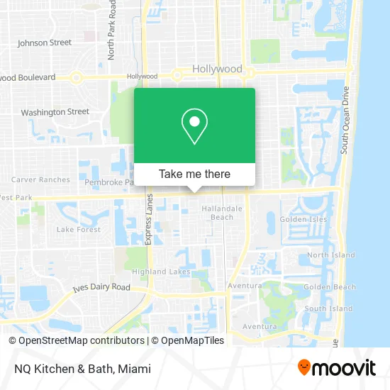
See NQ Kitchen & Bath, Hallandale Beach, on the map
Public Transit to NQ Kitchen & Bath in Hallandale Beach
Wondering how to get to NQ Kitchen & Bath in Hallandale Beach? Moovit helps you find the best way to get to NQ Kitchen & Bath with step-by-step directions from the nearest public transit station.
Moovit provides free maps and live directions to help you navigate through your city. View schedules, routes, timetables, and find out how long does it take to get to NQ Kitchen & Bath in real time.
Looking for the nearest stop or station to NQ Kitchen & Bath? Check out this list of stops closest to your destination: Hallandale Beach Boulevard/Southwest 7th Avenue; Northwest 1st Street/Northwest 6th Avenue; Aventura; Hollywood Station.
Bus: 06, 28.Train: BLFM, TRIRAIL, FLORIDIAN, SILVER METEOR.
Want to see if there’s another route that gets you there at an earlier time? Moovit helps you find alternative routes or times. Get directions from and directions to NQ Kitchen & Bath easily from the Moovit App or Website.
We make riding to NQ Kitchen & Bath easy, which is why over 1.5 million users, including users in Hallandale Beach, trust Moovit as the best app for public transit. You don’t need to download an individual bus app or train app, Moovit is your all-in-one transit app that helps you find the best bus time or train time available.
For information on prices of bus and train, costs and ride fares to NQ Kitchen & Bath, please check the Moovit app.
Use the app to navigate to popular places including to the airport, hospital, stadium, grocery store, mall, coffee shop, school, college, and university.
NQ Kitchen & Bath Address: 613 W Hallandale Beach Blvd Hallandale Beach, FL 33009 street in Hallandale Beach
- The UPS Store,
- Fred Astaire Dance Studio - Hallandale Beach,
- Brows & Brows,
- Luxhair Studio,
- Arahova Milano's,
- Empero Gourmet House,
- Uvabon Nail Salon,
- Spiritual Food Ministries,
- Samba Spa Lounge & Massage,
- Morgan's Ice Cream,
- Pastinos Pastas & Vinos,
- WING STOP,
- Holy Avocado,
- Florida Hurricane Victims,
- Dow Corning,
- Giáo Xứ Đức Mẹ La Vang - Our Lady Of La Vang Vietnamese Mission,
- Adt Security Services,
- Lucca D'Vie Spa,
- Special Connections Academy,
- Hena Music and Art Academy
Places Near NQ Kitchen & Bath (Hallandale Beach)
- Dolphin Mall, Miami,
- Bayside Marketplace, Miami,
- Hard Rock Stadium, Miami Gardens,
- Miami Freedom Park, Miami,
- Port of Miami Cruise Terminal, Miami,
- Sawgrass Mall, Miami,
- Miami VA Hospital, Miami,
- Marlins Park, Miami,
- Miami-Dade County Courthouse, Miami,
- Zoo Miami, Miami,
- Dolphin Mall Bus, Miami,
- Aventura Mall, Miami,
- Keiser University Flagship Campus, West Palm Beach,
- Sawgrass mall ( FL ), Miami Beach,
- Aventura Mall, Miami Beach,
- Miami Design District, Miami,
- Wynwood, Miami,
- Brickell City Centre, Miami,
- Richard E. Gerstein Justice Building, Miami,
- Little Havana, Miami
How to get to popular places in Miami with public transit
Get around Hallandale Beach by public transit!
Traveling around Hallandale Beach has never been so easy. See step by step directions as you travel to any attraction, street or major public transit station. View bus and train schedules, arrival times, service alerts and detailed routes on a map, so you know exactly how to get to anywhere in Hallandale Beach.
When traveling to any destination around Hallandale Beach use Moovit's Live Directions with Get Off Notifications to know exactly where and how far to walk, how long to wait for your line, and how many stops are left. Moovit will alert you when it's time to get off — no need to constantly re-check whether yours is the next stop.
Wondering how to use public transit in Hallandale Beach or how to pay for public transit in Hallandale Beach? Moovit public transit app can help you navigate your way with public transit easily, and at minimum cost. It includes public transit fees, ticket prices, and costs. Looking for a map of Hallandale Beach public transit lines? Moovit public transit app shows all public transit maps in Hallandale Beach with all Bus, Train, Light Rail and Ferry routes and stops on an interactive map.
Miami has 4 transit type(s), including: Bus, Train, Light Rail and Ferry, operated by several transit agencies, including Broward County Transit, Miami-Dade Transit, Metrorail, Palm Tran, Tri-Rail, Brightline, MARTY, City of Homestead Trolley, Key West Transit, Treasure Coast Connector, GoLine IRT, Amtrak, Greyhound-us, FlixBus-us and Aventura Express Shuttle Bus