How to get to N. College Park by bus?
Click on the bus route to see step by step directions with maps, line arrival times and updated time schedules.
From I-95 Exit 33 - Laurel/Burtonsville (Sandy Spring Rd/MD 198), Prince George's County
79 minFrom Silver Spring Civic Building (Silver Spring Civic Center), Montgomery County
61 minFrom Exit 19 - I-95/495 / US 50 (John Hanson Hwy) / Annapolis, Washington, Prince George's County
104 minFrom WMATA Carmen Turner Facility, Prince George's County
85 minFrom Brookside Gardens, Montgomery County
53 minFrom Montgomery College-Takoma Park/Silver Spring, Montgomery County
56 minFrom Providence Hospital, Washington
59 minFrom The Mall at Prince Georges, Prince George's County
37 minFrom Coolidge High School, Washington
64 minFrom Walmart Supercenter Fort Totten - Riggs Rd NE, Washington
57 min
How to get to N. College Park by train?
Click on the train route to see step by step directions with maps, line arrival times and updated time schedules.
How to get to N. College Park by metro?
Click on the metro route to see step by step directions with maps, line arrival times and updated time schedules.
From Silver Spring Civic Building (Silver Spring Civic Center), Montgomery County
68 minFrom WMATA Carmen Turner Facility, Prince George's County
113 minFrom Brookside Gardens, Montgomery County
94 minFrom Montgomery College-Takoma Park/Silver Spring, Montgomery County
70 minFrom Providence Hospital, Washington
70 minFrom The Mall at Prince Georges, Prince George's County
56 minFrom Coolidge High School, Washington
72 minFrom Walmart Supercenter Fort Totten - Riggs Rd NE, Washington
59 min
Bus stops near N. College Park in Prince George's County
Metro station near N. College Park in Prince George's County
- Greenbelt, 39 min walk,VIEW
Bus lines to N. College Park in Prince George's County
What are the closest stations to N. College Park?
The closest stations to N. College Park are:
- Baltimore Av+Ikea Center Bl is 196 yards away, 3 min walk.
- Edgewood Rd+Rhode Island Av is 634 yards away, 8 min walk.
- Baltimore Ave / Sunnyside Ave is 825 yards away, 10 min walk.
- Greenbelt is 3258 yards away, 39 min walk.
Which bus lines stop near N. College Park?
These bus lines stop near N. College Park: 302, M44, P1X.
Which train line stops near N. College Park?
MARC (Inbound - Camden)
Which metro line stops near N. College Park?
GREEN (Greenbelt)
What’s the nearest bus station to N. College Park in Prince George's County?
The nearest bus station to N. College Park in Prince George's County is Baltimore Av+Ikea Center Bl. It’s a 3 min walk away.
What time is the first metro to N. College Park in Prince George's County?
The GREEN is the first metro that goes to N. College Park in Prince George's County. It stops nearby at 4:59 AM.
What time is the last metro to N. College Park in Prince George's County?
The GREEN is the last metro that goes to N. College Park in Prince George's County. It stops nearby at 12:42 AM.
What time is the first train to N. College Park in Prince George's County?
The MARC is the first train that goes to N. College Park in Prince George's County. It stops nearby at 5:39 AM.
What time is the last train to N. College Park in Prince George's County?
The MARC is the last train that goes to N. College Park in Prince George's County. It stops nearby at 8:01 PM.
What time is the first bus to N. College Park in Prince George's County?
The M42 is the first bus that goes to N. College Park in Prince George's County. It stops nearby at 5:03 AM.
What time is the last bus to N. College Park in Prince George's County?
The P1X is the last bus that goes to N. College Park in Prince George's County. It stops nearby at 12:43 AM.
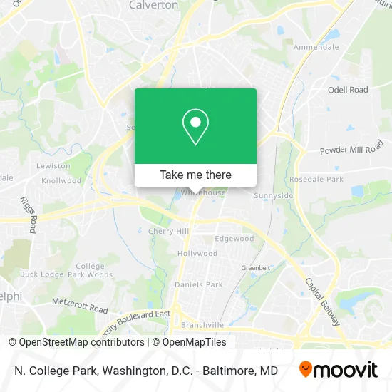
See N. College Park, Prince George's County, on the map
Public Transit to N. College Park in Prince George's County
Wondering how to get to N. College Park in Prince George's County? Moovit helps you find the best way to get to N. College Park with step-by-step directions from the nearest public transit station.
Moovit provides free maps and live directions to help you navigate through your city. View schedules, routes, timetables, and find out how long does it take to get to N. College Park in real time.
Looking for the nearest stop or station to N. College Park? Check out this list of stops closest to your destination: Baltimore Av+Ikea Center Bl; Edgewood Rd+Rhode Island Av; Baltimore Ave / Sunnyside Ave; Greenbelt.
Bus: 302, M44, P1X, M42, P19, P12.Train: MARC.Metro: GREEN, YELLOW, MARC.
Want to see if there’s another route that gets you there at an earlier time? Moovit helps you find alternative routes or times. Get directions from and directions to N. College Park easily from the Moovit App or Website.
We make riding to N. College Park easy, which is why over 1.7 million users, including users in Prince George's County, trust Moovit as the best app for public transit. You don’t need to download an individual bus app or train app, Moovit is your all-in-one transit app that helps you find the best bus time or train time available.
For information on prices of bus, metro and train, costs and ride fares to N. College Park, please check the Moovit app.
Get to N. College Park with public transit and pay for the ride in the Moovit app. In addition to all info you may need for your trip to N. College Park, including live directions, real-time arrivals and fare prices, you can also buy public transit passes for your rides. No need for cash or paper tickets to get to N. College Park - everything you need is accessible in the app with a click of the button.
Use the app to navigate to popular places including to the airport, hospital, stadium, grocery store, mall, coffee shop, school, college, and university.
N. College Park Address: 10260 Baltimore Avenue street in Prince George's County
- Buffalo Wild Wings,
- IKEA - College Park,
- Wynfield Park Apartments,
- Wawa,
- Holiday Inn Washington College Park an IHG Hotel,
- IKEA,
- College Park Holiday Inn,
- Exit 25 - US 1 (Baltimore Ave) / Laurel, College Park,
- Entrance I-495 S,
- The Home Depot,
- Rhode Island Ave and Sunnyside Ave,
- Iglesia Pentecostal Monte Sinai,
- Angel Acupressure,
- Mundo Latino Market,
- Growing Up Acupressure,
- Cherry Hill, Maryland,
- DGGJ Management,
- Montgomery Rd,
- 10501 Rhode Island Avenue,
- Hampton Inn-Hampton Inn College Park
Places Near N. College Park (Prince George's County)
- Westfield Montgomery Mall, Montgomery County,
- Museum Of The Bible, Washington,
- PG Mall, Prince George's County,
- Warner Theatre, Washington,
- Washington DC VA Medical Center, Washington,
- Capital One Arena, Washington,
- Amazon Hq2, Arlington County,
- National Theatre, Washington,
- Basilica of the National Shrine, Washington,
- National Museum of African American History and Culture, Washington,
- Georgetown, Washington,
- Sibley Memorial Hospital, Washington,
- Marriott Marquis Washington, DC, Washington,
- National Zoo, Washington,
- M&T Bank Stadium, Baltimore,
- Rock Creek Tennis Center, Washington,
- The Anthem, Washington,
- Washington National Cathedral, Washington,
- Pennsylvania Ave NW (3rd st and pennsylvania), Washington,
- Camden Yards, Baltimore
How to get to popular places in Washington, D.C. - Baltimore, MD with public transit
Get around Prince George's County by public transit!
Traveling around Prince George's County has never been so easy. See step by step directions as you travel to any attraction, street or major public transit station. View bus and train schedules, arrival times, service alerts and detailed routes on a map, so you know exactly how to get to anywhere in Prince George's County.
When traveling to any destination around Prince George's County use Moovit's Live Directions with Get Off Notifications to know exactly where and how far to walk, how long to wait for your line, and how many stops are left. Moovit will alert you when it's time to get off — no need to constantly re-check whether yours is the next stop.
Wondering how to use public transit in Prince George's County or how to pay for public transit in Prince George's County? Moovit public transit app can help you navigate your way with public transit easily, and at minimum cost. It includes public transit fees, ticket prices, and costs. Looking for a map of Prince George's County public transit lines? Moovit public transit app shows all public transit maps in Prince George's County with all Bus, Train, Metro, Light Rail and Ferry routes and stops on an interactive map.
Washington, D.C. - Baltimore, MD has 5 transit type(s), including: Bus, Train, Metro, Light Rail and Ferry, operated by several transit agencies, including WMATA, Montgomery County Ride On, Fairfax Connector, TheBus, PRTC, DASH - Alexandria, Arlington Transit (ART), RTA of Central Maryland, MDOT MTA, MDOT MTA Light RailLink, MDOT MTA Commuter Bus, MDOT MTA Local Bus, FXBGO!, Virginia Railway Express (VRE) and MARC