How to get to N. S. Devdas by bus?
Click on the bus route to see step by step directions with maps, line arrival times and updated time schedules.
From Deutsche Bank, Pune & Velhe
47 minFrom Rto Phule Nagar, Pune & Velhe
52 minFrom Kendriya Vidyalaya Ganeshkhind, Pune & Velhe
55 minFrom Suryadatta College Of Management, Paud
58 minFrom IBM, TPO, yerawada, Pune & Velhe
49 minFrom Warje Malwadi Road, Pune & Velhe
42 minFrom Spicer Adventist University, Pune & Velhe
50 minFrom B. T. Kawade Road, Pune & Velhe
49 minFrom Maharashtra Ssc and Hsc board office, Pune & Velhe
37 minFrom Symbiosis International University, Pune & Velhe
47 min
How to get to N. S. Devdas by metro?
Click on the metro route to see step by step directions with maps, line arrival times and updated time schedules.
Bus stops near N. S. Devdas in Pune & Velhe
Metro station near N. S. Devdas in Pune & Velhe
- Swargate, 46 min walk,VIEW
Bus lines to N. S. Devdas in Pune & Velhe
- 26, Shivajinagar - Dhankawadi,VIEW
- 38, Dhankawadi - Na.Ta.Wadi,VIEW
- 39, Dhankawadi - Pune Station,VIEW
- 38M, Dhankawadi - Na.Ta.Wadi (Ladies Sp),VIEW
- 215, Chintamani Dnyanpeeth Ambegaon Pathar,VIEW
- 24, Katraj - MH Board Samtanagar,VIEW
- 27, Bharati Vidyapeeth - Shivajinagar,VIEW
- 42, Gujarwadi Phata Pmt Bus Stand - Nigdi Bhakti Shakti Terminal,VIEW
- 90, Katraj - Gokhale Nagar,VIEW
- 103, Katraj - Kothrud Depot,VIEW
- 130, Narhegaon - Swargate,VIEW
- 216, Bharati Vidyapeeth - Shivajinagar,VIEW
- 235, Katraj - Kharadi Gaon,VIEW
- 236, Kesnand Phata Wagholi - Katraj,VIEW
- 290, Jambhulwadi - Swargate,VIEW
- 297, Rajas Society - Shivajinagar,VIEW
- 298, Gujarwadi Phata Pmt Bus Stand - Chinchwad SKF Company,VIEW
- 299, Gujarwadi Phata Pmt Bus Stand - Bhosari Gaon,VIEW
- 301, Shewalewadi Depot - Katraj,VIEW
- 339, Santnagar RTO Office - Gujarwadi Phata PMT Bus Stand,VIEW
What are the closest stations to N. S. Devdas?
The closest stations to N. S. Devdas are:
- Gulab Nagar is 552 meters away, 8 min walk.
- Post Office - Gulabnagar is 747 meters away, 10 min walk.
- Shankar Maharaj Math is 822 meters away, 11 min walk.
- Swargate is 3576 meters away, 46 min walk.
Which bus lines stop near N. S. Devdas?
These bus lines stop near N. S. Devdas: 103, 216, 24B, 298, 299, 301, 38.
Which metro line stops near N. S. Devdas?
PURPLE (Towards Swargate)
What’s the nearest bus station to N. S. Devdas in Pune & Velhe?
The nearest bus station to N. S. Devdas in Pune & Velhe is Gulab Nagar. It’s a 8 min walk away.
What time is the first metro to N. S. Devdas in Pune & Velhe?
The PURPLE is the first metro that goes to N. S. Devdas in Pune & Velhe. It stops nearby at 6:00 AM.
What time is the last metro to N. S. Devdas in Pune & Velhe?
The PURPLE is the last metro that goes to N. S. Devdas in Pune & Velhe. It stops nearby at 11:33 PM.
What time is the first bus to N. S. Devdas in Pune & Velhe?
The RATRANI 2 is the first bus that goes to N. S. Devdas in Pune & Velhe. It stops nearby at 3:06 AM.
What time is the last bus to N. S. Devdas in Pune & Velhe?
The RATRANI 2 is the last bus that goes to N. S. Devdas in Pune & Velhe. It stops nearby at 3:08 AM.
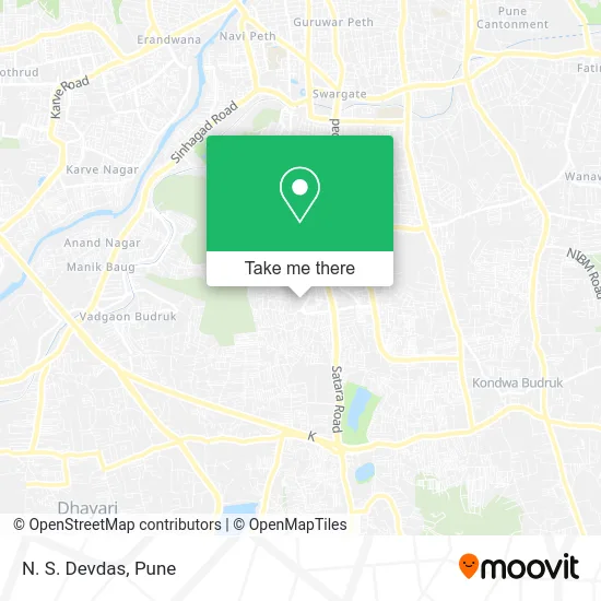
See N. S. Devdas, Pune & Velhe, on the map
Public Transit to N. S. Devdas in Pune & Velhe
Wondering how to get to N. S. Devdas in Pune & Velhe? Moovit helps you find the best way to get to N. S. Devdas with step-by-step directions from the nearest public transit station.
Moovit provides free maps and live directions to help you navigate through your city. View schedules, routes, timetables, and find out how long does it take to get to N. S. Devdas in real time.
Looking for the nearest stop or station to N. S. Devdas? Check out this list of stops closest to your destination: Gulab Nagar; Post Office - Gulabnagar; Shankar Maharaj Math; Swargate.
Bus: 103, 216, 24B, 298, 299, 301, 38, 26, 39, 38M, 215, 24, 27, 42, 90.Metro: PURPLE.
Want to see if there’s another route that gets you there at an earlier time? Moovit helps you find alternative routes or times. Get directions from and directions to N. S. Devdas easily from the Moovit App or Website.
We make riding to N. S. Devdas easy, which is why over 1.5 million users, including users in Pune & Velhe, trust Moovit as the best app for public transit. You don’t need to download an individual bus app or train app, Moovit is your all-in-one transit app that helps you find the best bus time or train time available.
For information on prices of bus and metro, costs and ride fares to N. S. Devdas, please check the Moovit app.
Use the app to navigate to popular places including to the airport, hospital, stadium, grocery store, mall, coffee shop, school, college, and university.
N. S. Devdas Address: पुणे 411043 MH street in Pune & Velhe
- Imperial Motors Stores-TATA Motors,
- Padmavati Nagar Society,
- Sumangal Karyalaya & Lodge,
- Balwadi Teacher Training Course,
- Lord Hanuman N Shani Dev Temple,
- Rajesh Band,
- ICICI Bank,
- Hatti Chowk,
- Ekatmik Bal Vikas Seva Yojana Anganwadi,
- Drishti Eye Clinic,
- Rajak Scrap Center,
- Sharp Electrical & Company,
- Shree Amruteshwar Ganesh Mandir,
- Komal Sweets,
- Umesh Mobile Shop & Gift Shop,
- Arena Fitness,
- D. L. Lonkar,
- Shankar Mandir Temple,
- Shiv Shakti Plywood & Hardware,
- Grahak Suvidha Kendra
Places Near N. S. Devdas (Pune & Velhe)
- Laxmi Road, Pune & Velhe,
- Ion Digital Zone, Pune & Velhe,
- Vishwakarma Institute Of Technology (Vit), Pune & Velhe,
- Dagdusheth Halwai Ganpati Mandir, Pune & Velhe,
- Symbiosis Lavale Bus Stop, Pune & Velhe,
- Westend Mall, Pune & Velhe,
- ISKCON Nvcc Temple, Pune & Velhe,
- Pune Okayama Friendship Garden, Pune & Velhe,
- Senapati Bapat Road, Pune & Velhe,
- Fc Road, Pune & Velhe,
- Dagadusheth Halwai Ganapati Temple, Pune & Velhe,
- Chaturshringi Temple, Pune & Velhe,
- Swaminarayan Mandir, Pune & Velhe,
- Tulshibaug, Pune & Velhe,
- M G Road, Pune & Velhe,
- ISKCON Pune, Pune & Velhe,
- BAPS Shri Swaminarayan Mandir, Pune & Velhe,
- Pvr Icon - Pavilion Mall, Pune & Velhe,
- Sarasbaug, Pune & Velhe,
- Cognizant Deccan Campus (CDC), Paud
How to get to popular places in Pune with public transit
Get around Pune & Velhe by public transit!
Traveling around Pune & Velhe has never been so easy. See step by step directions as you travel to any attraction, street or major public transit station. View bus and train schedules, arrival times, service alerts and detailed routes on a map, so you know exactly how to get to anywhere in Pune & Velhe.
When traveling to any destination around Pune & Velhe use Moovit's Live Directions with Get Off Notifications to know exactly where and how far to walk, how long to wait for your line, and how many stops are left. Moovit will alert you when it's time to get off — no need to constantly re-check whether yours is the next stop.
Wondering how to use public transit in Pune & Velhe or how to pay for public transit in Pune & Velhe? Moovit public transit app can help you navigate your way with public transit easily, and at minimum cost. It includes public transit fees, ticket prices, and costs. Looking for a map of Pune & Velhe public transit lines? Moovit public transit app shows all public transit maps in Pune & Velhe with all Bus, Train and Metro routes and stops on an interactive map.
Pune has 3 transit type(s), including: Bus, Train and Metro, operated by several transit agencies, including Pune Metro (Maha Metro), PMPML, PMPML Night Bus Service (Ratrani) and Central Railways (Indian Railways)