How to get to Namlo by bus?
Click on the bus route to see step by step directions with maps, line arrival times and updated time schedules.
From Fells Point, Baltimore
61 minFrom Baltimore Poly Tech High School, Baltimore
49 minFrom Enoch Pratt Free Library - Central Library, Baltimore
58 minFrom Sinai Hospital, Baltimore
51 minFrom Druid Hill Park, Baltimore
72 minFrom The Johns Hopkins Hospital, Baltimore
49 minFrom I-83 Exit 16 (Timonium Road), Baltimore County
55 minFrom Mondawmin Mall, Baltimore
60 minFrom Power Plant Live, Baltimore
48 minFrom Baltimore City Circuit Court, Baltimore
47 min
Bus stops near Namlo in Baltimore County
Bus lines to Namlo in Baltimore County
What are the closest stations to Namlo?
The closest stations to Namlo are:
- Northern Pkwy & Marietta Ave Eb is 871 yards away, 11 min walk.
- Mcclean Blvd & Perring Manor Rd Nb is 1040 yards away, 13 min walk.
Which bus lines stop near Namlo?
These bus lines stop near Namlo: 33, 36, 54.
What’s the nearest bus station to Namlo in Baltimore County?
The nearest bus station to Namlo in Baltimore County is Northern Pkwy & Marietta Ave Eb. It’s a 11 min walk away.
What time is the first bus to Namlo in Baltimore County?
The 54 is the first bus that goes to Namlo in Baltimore County. It stops nearby at 3:12 AM.
What time is the last bus to Namlo in Baltimore County?
The 54 is the last bus that goes to Namlo in Baltimore County. It stops nearby at 2:55 AM.
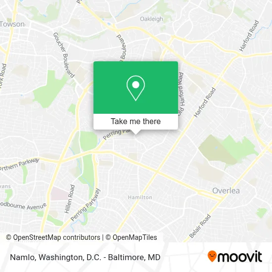
See Namlo, Baltimore County, on the map
Public Transit to Namlo in Baltimore County
Wondering how to get to Namlo in Baltimore County? Moovit helps you find the best way to get to Namlo with step-by-step directions from the nearest public transit station.
Moovit provides free maps and live directions to help you navigate through your city. View schedules, routes, timetables, and find out how long does it take to get to Namlo in real time.
Looking for the nearest stop or station to Namlo? Check out this list of stops closest to your destination: Northern Pkwy & Marietta Ave Eb; Mcclean Blvd & Perring Manor Rd Nb.
Bus: 33, 36, 54, 154.
Want to see if there’s another route that gets you there at an earlier time? Moovit helps you find alternative routes or times. Get directions from and directions to Namlo easily from the Moovit App or Website.
We make riding to Namlo easy, which is why over 1.7 million users, including users in Baltimore County, trust Moovit as the best app for public transit. You don’t need to download an individual bus app or train app, Moovit is your all-in-one transit app that helps you find the best bus time or train time available.
For information on prices of bus and light rail, costs and ride fares to Namlo, please check the Moovit app.
Use the app to navigate to popular places including to the airport, hospital, stadium, grocery store, mall, coffee shop, school, college, and university.
Namlo Address: 7100 Darlington Dr street in Baltimore County
- Northeast Regional Recreation Center (NERRC),
- Pizza Boli's,
- Home Services at the Home Depot,
- Experts Garage Door Repair Installation Process,
- Shoprite Pharmacy,
- Home Depot,
- Truck Rental Center at the Home Depot,
- Home Services at the Home Depot,
- Uniquelystyled,
- Hair Chemistry,
- Pink & Sassy Llc,
- Salon Affairs Hairstudio,
- Global Vision Center,
- Shop Rite Of Perring Parkway,
- Blue Rhino Propane Exchange,
- Western Union,
- Coinme,
- Keyme Locksmiths,
- Odimas Service,
- Western Union
Places Near Namlo (Baltimore County)
- Camden Yards, Baltimore,
- Westfield Montgomery Mall, Montgomery County,
- The Anthem, Washington,
- Sibley Memorial Hospital, Washington,
- Capital One Arena, Washington,
- National Theatre, Washington,
- Pennsylvania Ave NW (3rd st and pennsylvania), Washington,
- Basilica of the National Shrine, Washington,
- PG Mall, Prince George's County,
- Museum Of The Bible, Washington,
- Rock Creek Tennis Center, Washington,
- Warner Theatre, Washington,
- National Zoo, Washington,
- Washington DC VA Medical Center, Washington,
- Georgetown, Washington,
- Washington National Cathedral, Washington,
- Marriott Marquis Washington, DC, Washington,
- Amazon Hq2, Arlington County,
- National Museum of African American History and Culture, Washington,
- M&T Bank Stadium, Baltimore
How to get to popular places in Washington, D.C. - Baltimore, MD with public transit
Get around Baltimore County by public transit!
Traveling around Baltimore County has never been so easy. See step by step directions as you travel to any attraction, street or major public transit station. View bus and train schedules, arrival times, service alerts and detailed routes on a map, so you know exactly how to get to anywhere in Baltimore County.
When traveling to any destination around Baltimore County use Moovit's Live Directions with Get Off Notifications to know exactly where and how far to walk, how long to wait for your line, and how many stops are left. Moovit will alert you when it's time to get off — no need to constantly re-check whether yours is the next stop.
Wondering how to use public transit in Baltimore County or how to pay for public transit in Baltimore County? Moovit public transit app can help you navigate your way with public transit easily, and at minimum cost. It includes public transit fees, ticket prices, and costs. Looking for a map of Baltimore County public transit lines? Moovit public transit app shows all public transit maps in Baltimore County with all Bus, Train, Metro, Light Rail and Ferry routes and stops on an interactive map.
Washington, D.C. - Baltimore, MD has 5 transit type(s), including: Bus, Train, Metro, Light Rail and Ferry, operated by several transit agencies, including WMATA, Montgomery County Ride On, Fairfax Connector, TheBus, PRTC, DASH - Alexandria, Arlington Transit (ART), RTA of Central Maryland, MDOT MTA, MDOT MTA Light RailLink, MDOT MTA Commuter Bus, MDOT MTA Local Bus, FXBGO!, Virginia Railway Express (VRE) and MARC