How to get to Nancy Orphanos by bus?
Click on the bus route to see step by step directions with maps, line arrival times and updated time schedules.
From The Red Light District, Fort Lauderdale
92 minFrom Sawgrass Mills Mall Commercial Center, Plantation
48 minFrom Amerant Bank, Fort Lauderdale
77 minFrom Central Terminal, Fort Lauderdale
59 minFrom Las olas Blvd, Fort Lauderdale
64 minFrom Broward College Central Campus, Davie
49 minFrom Amerant Bank Arena, Plantation
55 minFrom Red Carpet Inn Fort Lauderdale Airport / Cruise Port, Hollywood
114 minFrom Swap Shop, Fort Lauderdale
40 minFrom Las Olas, Fort Lauderdale
61 min
Bus stops near Nancy Orphanos in Plantation
Bus lines to Nancy Orphanos in Plantation
What are the closest stations to Nancy Orphanos?
The closest stations to Nancy Orphanos are:
- Sunset Strip/Northwest 68th Avenue is 45 yards away, 1 min walk.
- Sunrise Boulevard/Northwest 70th Avenue is 3868 yards away, 46 min walk.
Which bus lines stop near Nancy Orphanos?
These bus lines stop near Nancy Orphanos: 72, 81.
What’s the nearest bus station to Nancy Orphanos in Plantation?
The nearest bus station to Nancy Orphanos in Plantation is Sunset Strip/Northwest 68th Avenue. It’s a 1 min walk away.
What time is the first bus to Nancy Orphanos in Plantation?
The 81 is the first bus that goes to Nancy Orphanos in Plantation. It stops nearby at 4:37 AM.
What time is the last bus to Nancy Orphanos in Plantation?
The 81 is the last bus that goes to Nancy Orphanos in Plantation. It stops nearby at 12:26 AM.
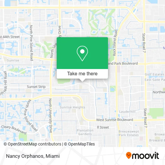
See Nancy Orphanos, Plantation, on the map
Public Transit to Nancy Orphanos in Plantation
Wondering how to get to Nancy Orphanos in Plantation? Moovit helps you find the best way to get to Nancy Orphanos with step-by-step directions from the nearest public transit station.
Moovit provides free maps and live directions to help you navigate through your city. View schedules, routes, timetables, and find out how long does it take to get to Nancy Orphanos in real time.
Looking for the nearest stop or station to Nancy Orphanos? Check out this list of stops closest to your destination: Sunset Strip/Northwest 68th Avenue; Sunrise Boulevard/Northwest 70th Avenue.
Bus: 72, 81, 36.
Want to see if there’s another route that gets you there at an earlier time? Moovit helps you find alternative routes or times. Get directions from and directions to Nancy Orphanos easily from the Moovit App or Website.
We make riding to Nancy Orphanos easy, which is why over 1.5 million users, including users in Plantation, trust Moovit as the best app for public transit. You don’t need to download an individual bus app or train app, Moovit is your all-in-one transit app that helps you find the best bus time or train time available.
For information on prices of bus and train, costs and ride fares to Nancy Orphanos, please check the Moovit app.
Use the app to navigate to popular places including to the airport, hospital, stadium, grocery store, mall, coffee shop, school, college, and university.
Nancy Orphanos Address: 6775 Sunset Strip Sunrise, FL 33313 street in Plantation
- Sunrise Brazilian Jiujitsu,
- Nature Design Unisex S,
- Mirror Decor, Inc.,
- Church of Jesus Christ Apstlc Mnstry,
- City Of Sunrise Florida,
- City of Sunrise Village Civic Center,
- Laveaux Barber Shop,
- Advance Truck Parts,
- Dutch Pot Jamaican Restaurant,
- Knight's Kitchen Jamaican Restaurant,
- Oral Tech Dental Lab,
- Santos J Salvadore, MD,
- International Pentecostal City Mission Church,
- House of Prayer Worldwide Church Seventh,
- Amazon Locker-Scissors,
- Pretty Pooch,
- Southern Baptist Convention,
- Al's Heating & Cooling Repair,
- Kamal Singh,
- CF Famiy Child Care
Places Near Nancy Orphanos (Plantation)
- Sawgrass mall ( FL ), Miami Beach,
- Sawgrass Mall, Miami,
- Dolphin Mall Bus, Miami,
- Richard E. Gerstein Justice Building, Miami,
- Zoo Miami, Miami,
- Aventura Mall, Miami,
- Miami Freedom Park, Miami,
- Port of Miami Cruise Terminal, Miami,
- Keiser University Flagship Campus, West Palm Beach,
- Wynwood, Miami,
- Bayside Marketplace, Miami,
- Marlins Park, Miami,
- Miami Design District, Miami,
- Miami-Dade County Courthouse, Miami,
- Brickell City Centre, Miami,
- Dolphin Mall, Miami,
- Miami VA Hospital, Miami,
- Aventura Mall, Miami Beach,
- Hard Rock Stadium, Miami Gardens,
- Little Havana, Miami
How to get to popular places in Miami with public transit
Get around Plantation by public transit!
Traveling around Plantation has never been so easy. See step by step directions as you travel to any attraction, street or major public transit station. View bus and train schedules, arrival times, service alerts and detailed routes on a map, so you know exactly how to get to anywhere in Plantation.
When traveling to any destination around Plantation use Moovit's Live Directions with Get Off Notifications to know exactly where and how far to walk, how long to wait for your line, and how many stops are left. Moovit will alert you when it's time to get off — no need to constantly re-check whether yours is the next stop.
Wondering how to use public transit in Plantation or how to pay for public transit in Plantation? Moovit public transit app can help you navigate your way with public transit easily, and at minimum cost. It includes public transit fees, ticket prices, and costs. Looking for a map of Plantation public transit lines? Moovit public transit app shows all public transit maps in Plantation with all Bus, Train, Light Rail and Ferry routes and stops on an interactive map.
Miami has 4 transit type(s), including: Bus, Train, Light Rail and Ferry, operated by several transit agencies, including Broward County Transit, Miami-Dade Transit, Metrorail, Palm Tran, Tri-Rail, Brightline, MARTY, City of Homestead Trolley, Key West Transit, Treasure Coast Connector, GoLine IRT, Amtrak, Greyhound-us, FlixBus-us and Aventura Express Shuttle Bus