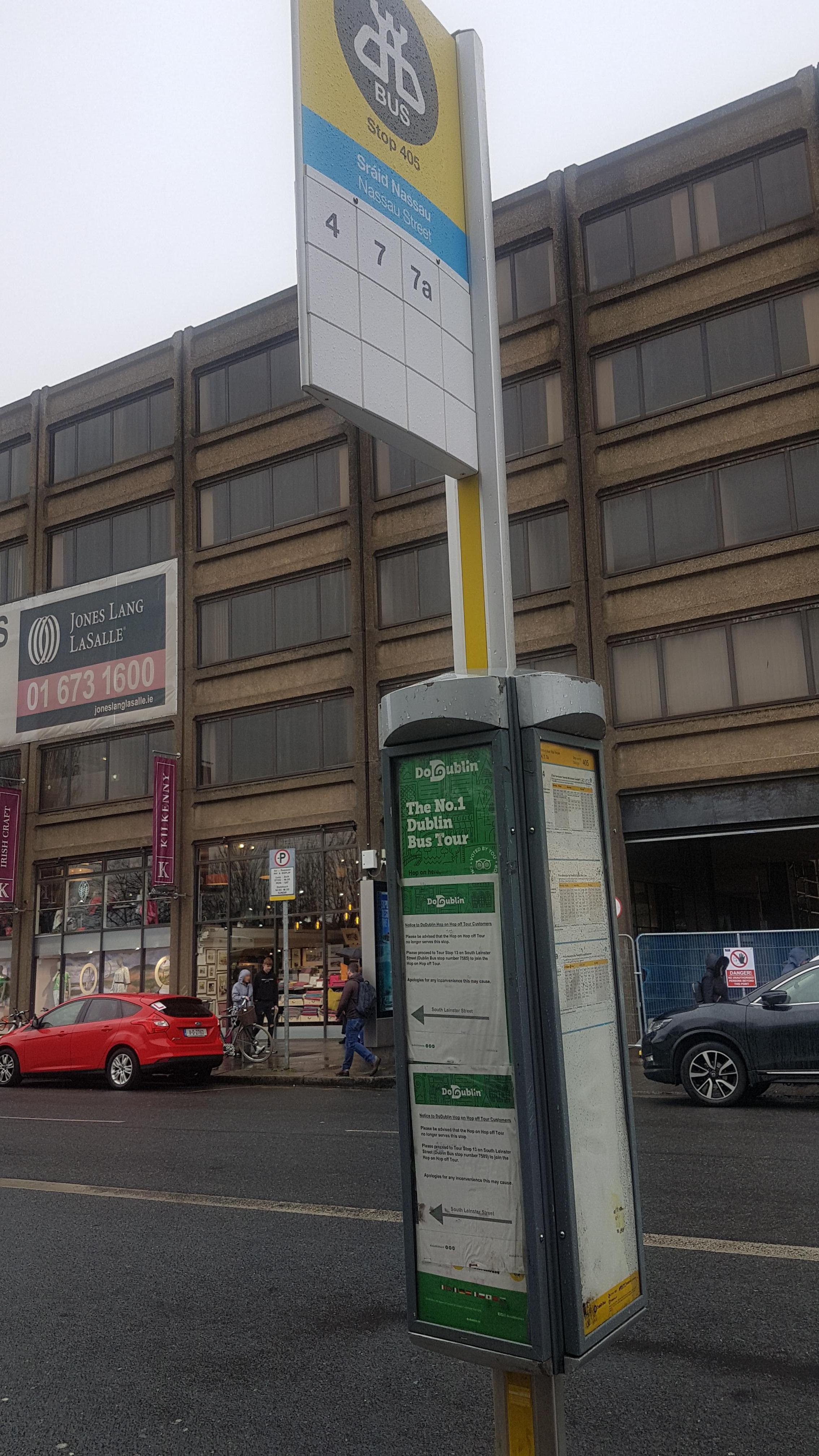
Nassau Street stop - Thursday schedule
| Line | Direction | Time |
|---|---|---|
| 19 | Merrion Square | 4:14 AM |
| 19 | Merrion Square | 4:44 AM |
| 19 | Merrion Square | 5:14 AM |
| 4 | Monkstown Ave | 5:42 AM |
| 19 | Merrion Square | 5:44 AM |
| 7 | Brides Glen | 5:53 AM |
| 4 | Monkstown Ave | 5:57 AM |
| 7A | Loughlinstown Pk | 6:08 AM |
| 4 | Monkstown Ave | 6:12 AM |
| 7 | Brides Glen | 6:23 AM |
| 19 | Merrion Square | 6:27 AM |
| 4 | Monkstown Ave | 6:27 AM |
| 7A | Loughlinstown Pk | 6:39 AM |
| 4 | Monkstown Ave | 6:44 AM |
| 19 | Merrion Square | 6:47 AM |
| 7 | Brides Glen | 6:56 AM |
| 4 | Monkstown Ave | 6:59 AM |
| 845 | Earlsfort Terrace | 7:05 AM |
| 19 | Merrion Square | 7:07 AM |
| 7A | Loughlinstown Pk | 7:09 AM |
| 4 | Monkstown Ave | 7:14 AM |
| 845 | Earlsfort Terrace | 7:20 AM |
| 7 | Brides Glen | 7:21 AM |
| 845 | Earlsfort Terrace | 7:25 AM |
| 4 | Monkstown Ave | 7:26 AM |
Directions to Nassau Street stop (Dublin) with public transit
The following transit lines have routes that pass near Nassau Street
How to get to Nassau Street stop by bus?
Click on the bus route to see step by step directions with maps, line arrival times and updated time schedules.
How to get to Nassau Street stop by train?
Click on the train route to see step by step directions with maps, line arrival times and updated time schedules.
Bus stops near Nassau Street stop in Dublin
- Nassau Street, 1 min walk,
- National Gallery, 2 min walk,
- Clare Street, 4 min walk,
- Dublin (Kildare Street), 5 min walk,
- Dawson Street, 5 min walk,
- Kildare Street, 5 min walk,
- Pearse Street, 11 min walk,
- Shaw Street, 12 min walk,
Light Rail stations near Nassau Street station in Dublin
- Dawson, 4 min walk,
Train stations near Nassau Street station in Dublin
- Dublin Pearse, 8 min walk,
Bus lines to Nassau Street stop in Dublin
- 901M, Nassau Street,
- 980A, Nassau Street,
- 980B, Nassau Street,
- E1, Ballywaltrim,
- E2, Dun Laoghaire,
- 7B, Shankill,
- 7D, Mountjoy Square,
- 26, Merrion Square,
- DUBLIN CITY SOUTH, D'OLIER STREET - DUNDRUM, OUTSIDE LUAS STATION, Dundrum Luas,
- 180, Clones Diamond,
- 11, Phoenix Pk,
- 11B, Phoenix Pk,
- 37, Wilton Terrace,
- 38, Burlington Road,
- 38A, Burlington Road,
- 38B, Burlington Road,
- 38D, Burlington Road,
- 39, Ongar,
- 39A, Ucd,
- 70, Dunboyne,
What are the closest stations to Nassau Street?
The closest stations to Nassau Street are:
- Nassau Street is 6 meters away, 1 min walk.
- National Gallery is 151 meters away, 2 min walk.
- Dawson is 235 meters away, 4 min walk.
- Clare Street is 300 meters away, 4 min walk.
- Dublin (Kildare Street) is 328 meters away, 5 min walk.
- Dawson Street is 339 meters away, 5 min walk.
- Kildare Street is 360 meters away, 5 min walk.
- Dublin Pearse is 547 meters away, 8 min walk.
- Pearse Street is 812 meters away, 11 min walk.
- Shaw Street is 847 meters away, 12 min walk.
Which bus lines stop near Nassau Street?
These bus lines stop near Nassau Street: 19, 26, 39A, 4, 784, 7A, E1.
Which train lines stop near Nassau Street?
These train lines stop near Nassau Street: COMMUTER, DART.
What’s the nearest light rail station to Nassau Street in Dublin?
The nearest light rail station to Nassau Street in Dublin is Dawson. It’s a 4 min walk away.
What’s the nearest train station to Nassau Street in Dublin?
The nearest train station to Nassau Street in Dublin is Dublin Pearse. It’s a 8 min walk away.
What’s the nearest bus station to Nassau Street in Dublin?
The nearest bus station to Nassau Street in Dublin is Nassau Street. It’s a 1 min walk away.
What time is the first light rail to Nassau Street in Dublin?
The GREEN is the first light rail that goes to Nassau Street in Dublin. It stops nearby at 6:53 AM.
What time is the last light rail to Nassau Street in Dublin?
The GREEN is the last light rail that goes to Nassau Street in Dublin. It stops nearby at 11:45 PM.
What time is the first train to Nassau Street in Dublin?
The DART is the first train that goes to Nassau Street in Dublin. It stops nearby at 9:01 AM.
What time is the last train to Nassau Street in Dublin?
The DART is the last train that goes to Nassau Street in Dublin. It stops nearby at 12:13 AM.
What time is the first bus to Nassau Street in Dublin?
The DUBLIN CITY SOUTH, D'OLIER STREET - DUNDRUM, OUTSIDE LUAS STATION is the first bus that goes to Nassau Street in Dublin. It stops nearby at 3:01 AM.
What time is the last bus to Nassau Street in Dublin?
The 2 is the last bus that goes to Nassau Street in Dublin. It stops nearby at 4:14 AM.
Nassau Street station
 Taken by rose b.
See Nassau Street stop, Dublin, on the map
Public transit to Nassau Street stop (ID: 405) in Dublin
Looking for directions to Nassau Street in Dublin, Ireland?
Download the Moovit App to find the current schedule and step-by-step directions for Bus or Train routes that pass through Nassau Street.
Looking for the nearest stops closest to Nassau Street ? Check out this list of closest stops to your destination: Nassau Street; National Gallery; Dawson; Clare Street; Dublin (Kildare Street); Dawson Street; Kildare Street; Dublin Pearse; Pearse Street; Shaw Street.
Bus: 19, 26, 39A, 4, 784, 7A, E1, 901M, 980A, 980B, E2, 7B, 180, 11, 11B, 37, 38, 40, 32X, 41X.Train: COMMUTER, DART, RAIL, RAIL, RAIL.
We make riding on public transit to Nassau Street easy, which is why over 1.5 million users, including users in Dublin trust Moovit as the best app for public transit.
Use the app to navigate to popular places including to the airport, hospital, stadium, grocery store, mall, coffee shop, school, college, and university.
Nassau Street stop’s code is 405
The first line to this stop is 19, at 4:14 AM, and the last line is 19 at 12:19 AM.
6 Nassau Street, Dublin, Ireland
This stop serves Bus Átha Cliath – Dublin Bus, Kearns Transport, Nitelink, Dublin Bus and Collins Coaches’s lines
Bus stops near Nassau Street stop
Light Rail station near Nassau Street station
Train station near Nassau Street station
Popular public transit stations in Dublin
Get around Dublin by public transit!
Traveling around Dublin has never been so easy. See step by step directions as you travel to any attraction, street or major public transit station. View bus and train schedules, arrival times, service alerts and detailed routes on a map, so you know exactly how to get to anywhere in Dublin.
When traveling to any destination around Dublin use Moovit's Live Directions with Get Off Notifications to know exactly where and how far to walk, how long to wait for your line, and how many stops are left. Moovit will alert you when it's time to get off — no need to constantly re-check whether yours is the next stop.
Wondering how to use public transit in Dublin or how to pay for public transit in Dublin? Moovit public transit app can help you navigate your way with public transit easily, and at minimum cost. It includes public transit fees, ticket prices, and costs. Looking for a map of Dublin public transit lines? Moovit public transit app shows all public transit maps in Dublin with all Bus, Train and Light Rail routes and stops on an interactive map.
Ireland has 3 transit type(s), including: Bus, Train and Light Rail, operated by several transit agencies, including Luas, Bus Átha Cliath – Dublin Bus, Bus Éireann, Go-Ahead Ireland, Nitelink, Dublin Bus, Citylink, City Direct, Kenneally's Bus Service, Aircoach, TFI Local Link Mayo, Irish Rail, Express Bus, JJ/Bernard Kavanagh, Dublin Coach and Kearns Transport