Directions to National Automobile Service (Baltimore) with public transportation
The following transit lines have routes that pass near National Automobile Service
 Bus: 21, 94, 95, CITYLINK GOLD, CITYLINK SILVER.
- Train: ACELA, CARDINAL, CAROLINIAN, CRESCENT, NORTHEAST REGIONAL.
How to get to National Automobile Service by bus?
Click on the bus route to see step by step directions with maps, line arrival times and updated time schedules.
From Nick's Fish House, Baltimore
43 minFrom Eastern Ave (eastern avenue and dundalk av), Baltimore
50 minFrom I-695 @ Exit 17 (Security Blvd/MD 122), Baltimore County
61 minFrom Saint Agnes Hospital, Baltimore
56 minFrom I-695 Exit 29 (Loch Raven Blvd (MD 542)/Cromwell Bridge Rd), Baltimore County
58 minFrom Maryland, Baltimore
43 minFrom Sinai Hospital, Baltimore
41 minFrom University Of Maryland Baltimore (Umbc), Baltimore County
67 minFrom Towson, MD, Baltimore County
40 minFrom Dundalk, Maryland, Baltimore County
61 min
Bus stops near National Automobile Service in Baltimore
Light Rail stations near National Automobile Service in Baltimore
- North Avenue, 13 min walk,VIEW
Train station near National Automobile Service in Baltimore
- Baltimore Penn Station, 37 min walk,VIEW
Bus lines to National Automobile Service in Baltimore
What are the closest stations to National Automobile Service?
The closest stations to National Automobile Service are:
- Howard St & 23rd St Sb is 90 yards away, 2 min walk.
- Maryland Ave & 23rd St Sb is 220 yards away, 3 min walk.
- Howard St & 25th St Sb is 440 yards away, 6 min walk.
- Charles St & 22nd St is 521 yards away, 7 min walk.
- Charles St & 22nd St Nb is 521 yards away, 7 min walk.
- North Avenue is 1058 yards away, 13 min walk.
- Baltimore Penn Station is 3153 yards away, 37 min walk.
Which bus lines stop near National Automobile Service?
These bus lines stop near National Automobile Service: 21, 94, 95, CITYLINK GOLD, CITYLINK SILVER, PURPLE ROUTE.
What’s the nearest light rail station to National Automobile Service in Baltimore?
The nearest light rail station to National Automobile Service in Baltimore is North Avenue. It’s a 13 min walk away.
What’s the nearest bus station to National Automobile Service in Baltimore?
The nearest bus station to National Automobile Service in Baltimore is Howard St & 23rd St Sb. It’s a 2 min walk away.
What time is the first light rail to National Automobile Service in Baltimore?
The LIGHT RAILLINK is the first light rail that goes to National Automobile Service in Baltimore. It stops nearby at 3:42 AM.
What time is the last light rail to National Automobile Service in Baltimore?
The LIGHT RAILLINK is the last light rail that goes to National Automobile Service in Baltimore. It stops nearby at 1:30 AM.
What time is the first train to National Automobile Service in Baltimore?
The ACELA is the first train that goes to National Automobile Service in Baltimore. It stops nearby at 5:34 AM.
What time is the last train to National Automobile Service in Baltimore?
The SILVER METEOR is the last train that goes to National Automobile Service in Baltimore. It stops nearby at 7:57 AM.
What time is the first bus to National Automobile Service in Baltimore?
The 94 is the first bus that goes to National Automobile Service in Baltimore. It stops nearby at 4:05 AM.
What time is the last bus to National Automobile Service in Baltimore?
The 94 is the last bus that goes to National Automobile Service in Baltimore. It stops nearby at 2:39 AM.
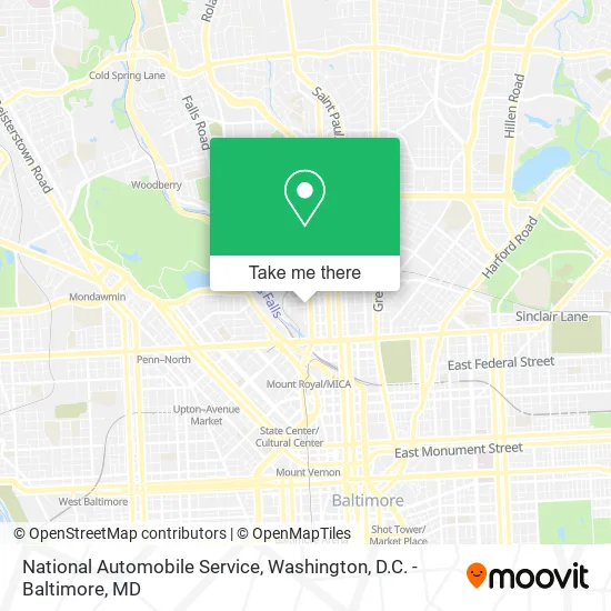
See National Automobile Service, Baltimore, on the map
Public Transit to National Automobile Service in Baltimore
Wondering how to get to National Automobile Service in Baltimore? Moovit helps you find the best way to get to National Automobile Service with step-by-step directions from the nearest public transit station.
Moovit provides free maps and live directions to help you navigate through your city. View schedules, routes, timetables, and find out how long does it take to get to National Automobile Service in real time.
Looking for the nearest stop or station to National Automobile Service? Check out this list of stops closest to your destination: Howard St & 23rd St Sb; Maryland Ave & 23rd St Sb; Howard St & 25th St Sb; Charles St & 22nd St; Charles St & 22nd St Nb; North Avenue; Baltimore Penn Station.
Bus: 21, 94, 95, CITYLINK GOLD, CITYLINK SILVER, PURPLE ROUTE, 51.Train: ACELA, CARDINAL, CAROLINIAN, CRESCENT, NORTHEAST REGIONAL.
Want to see if there’s another route that gets you there at an earlier time? Moovit helps you find alternative routes or times. Get directions from and directions to National Automobile Service easily from the Moovit App or Website.
We make riding to National Automobile Service easy, which is why over 1.5 million users, including users in Baltimore, trust Moovit as the best app for public transit. You don’t need to download an individual bus app or train app, Moovit is your all-in-one transit app that helps you find the best bus time or train time available.
For information on prices of bus, costs and ride fares to National Automobile Service, please check the Moovit app.
Use the app to navigate to popular places including to the airport, hospital, stadium, grocery store, mall, coffee shop, school, college, and university.
National Automobile Service Address: 300 W 23rd St Baltimore, MD 21211 street in Baltimore
- Known AS Monique,
- Seventy Times Seven Wellness Mission,
- NextCar,
- Majestic Hall of Events,
- Stidham Productio,
- US State Inspection State Inspection,
- Sunoco,
- Bitcoin of America ATM,
- Plant Baked by Sarah,
- Nigeriancbcs,
- Medcity Family Clinic,
- Tasteful of Soul,
- Workforce Reception Center,
- Maryland Ave and W 23rd St,
- Angels Ate Lemons,
- E2-E4 Records,
- Historic Old Goucher,
- Maryland Working Families,
- Church Bar,
- Balloons Couture
Places Near National Automobile Service (Baltimore)
- PG Mall, Prince George's County,
- The Anthem, Washington,
- Marriott Marquis Washington, DC, Washington,
- Warner Theatre, Washington,
- Sibley Memorial Hospital, Washington,
- Museum Of The Bible, Washington,
- Rock Creek Tennis Center, Washington,
- Westfield Montgomery Mall, Montgomery County,
- Georgetown, Washington,
- M&T Bank Stadium, Baltimore,
- Camden Yards, Baltimore,
- National Theatre, Washington,
- Washington National Cathedral, Washington,
- Amazon Hq2, Arlington County,
- Basilica of the National Shrine, Washington,
- Pennsylvania Ave NW (3rd st and pennsylvania), Washington,
- National Zoo, Washington,
- Washington DC VA Medical Center, Washington,
- Capital One Arena, Washington,
- National Museum of African American History and Culture, Washington
How to get to popular places in Washington, D.C. - Baltimore, MD with public transit
Get around Baltimore by public transit!
Traveling around Baltimore has never been so easy. See step by step directions as you travel to any attraction, street or major public transit station. View bus and train schedules, arrival times, service alerts and detailed routes on a map, so you know exactly how to get to anywhere in Baltimore.
When traveling to any destination around Baltimore use Moovit's Live Directions with Get Off Notifications to know exactly where and how far to walk, how long to wait for your line, and how many stops are left. Moovit will alert you when it's time to get off — no need to constantly re-check whether yours is the next stop.
Wondering how to use public transit in Baltimore or how to pay for public transit in Baltimore? Moovit public transit app can help you navigate your way with public transit easily, and at minimum cost. It includes public transit fees, ticket prices, and costs. Looking for a map of Baltimore public transit lines? Moovit public transit app shows all public transit maps in Baltimore with all Bus, Train, Metro, Light Rail and Ferry routes and stops on an interactive map.
Washington, D.C. - Baltimore, MD has 5 transit type(s), including: Bus, Train, Metro, Light Rail and Ferry, operated by several transit agencies, including WMATA, Montgomery County Ride On, Fairfax Connector, TheBus, PRTC, DASH - Alexandria, Arlington Transit (ART), RTA of Central Maryland, MDOT MTA, MDOT MTA Light RailLink, MDOT MTA Commuter Bus, MDOT MTA Local Bus, FXBGO!, Virginia Railway Express (VRE) and MARC