How to get to National Life Insurance by bus?
Click on the bus route to see step by step directions with maps, line arrival times and updated time schedules.
From Griffin Road & Davie Road, Davie
81 minFrom Archbishop Edward A McCrthy HGH Sch (Archbishop McCarthy High School), Davie
69 minFrom Seminole Hard Rock Hotel & Casino Hollywood (Seminole Hard Rock Hollywood Casino), Davie
75 minFrom Miami Lakes, Hialeah
157 minFrom St Thomas University, Miami
94 minFrom West Park, Florida, Hallandale Beach
51 minFrom Nova Southeastern University, Davie
83 minFrom Seminole Hard Rock Hotel & Casino Hollywood, Davie
75 minFrom Hollywood Blvd & 441, Hollywood
43 minFrom Miami International Autodrome F1 Track, Miami Gardens
78 min
Bus stops near National Life Insurance in Miramar-Pembroke Pines
Bus lines to National Life Insurance in Miramar-Pembroke Pines
What are the closest stations to National Life Insurance?
The closest stations to National Life Insurance are:
- Pines Boulevard/Southwest 114th Avenue is 954 yards away, 12 min walk.
- Pembroke Road/Hiatus Road is 1114 yards away, 14 min walk.
Which bus lines stop near National Life Insurance?
These bus lines stop near National Life Insurance: 05, 07.
What’s the nearest bus station to National Life Insurance in Miramar-Pembroke Pines?
The nearest bus station to National Life Insurance in Miramar-Pembroke Pines is Pines Boulevard/Southwest 114th Avenue. It’s a 12 min walk away.
What time is the first bus to National Life Insurance in Miramar-Pembroke Pines?
The 07 is the first bus that goes to National Life Insurance in Miramar-Pembroke Pines. It stops nearby at 5:10 AM.
What time is the last bus to National Life Insurance in Miramar-Pembroke Pines?
The 07 is the last bus that goes to National Life Insurance in Miramar-Pembroke Pines. It stops nearby at 11:24 PM.
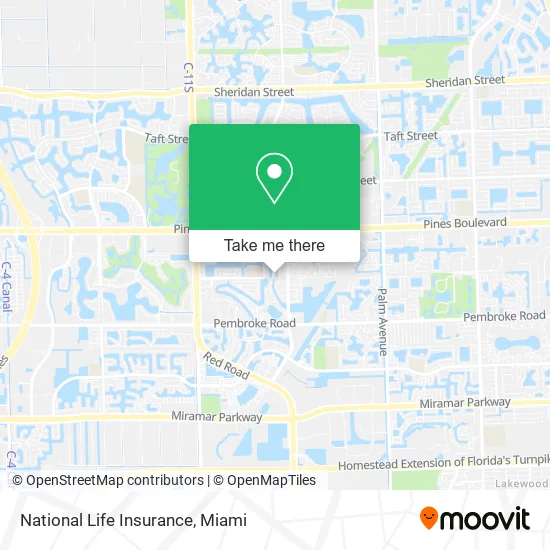
See National Life Insurance, Miramar-Pembroke Pines, on the map
Public Transit to National Life Insurance in Miramar-Pembroke Pines
Wondering how to get to National Life Insurance in Miramar-Pembroke Pines? Moovit helps you find the best way to get to National Life Insurance with step-by-step directions from the nearest public transit station.
Moovit provides free maps and live directions to help you navigate through your city. View schedules, routes, timetables, and find out how long does it take to get to National Life Insurance in real time.
Looking for the nearest stop or station to National Life Insurance? Check out this list of stops closest to your destination: Pines Boulevard/Southwest 114th Avenue; Pembroke Road/Hiatus Road.
Bus: 05, 07.
Want to see if there’s another route that gets you there at an earlier time? Moovit helps you find alternative routes or times. Get directions from and directions to National Life Insurance easily from the Moovit App or Website.
We make riding to National Life Insurance easy, which is why over 1.5 million users, including users in Miramar-Pembroke Pines, trust Moovit as the best app for public transit. You don’t need to download an individual bus app or train app, Moovit is your all-in-one transit app that helps you find the best bus time or train time available.
For information on prices of bus and train, costs and ride fares to National Life Insurance, please check the Moovit app.
Use the app to navigate to popular places including to the airport, hospital, stadium, grocery store, mall, coffee shop, school, college, and university.
National Life Insurance Address: 865 SW 113th Ln Pembroke Pines, FL 33025 street in Miramar-Pembroke Pines
- Towing & Locksout,
- Towing Near Me,
- 5 Star Mobile Locksmith,
- Locksmith Service,
- R&A Blue Sonoworlds,
- Campus Chiropractic,
- Pembroke Tree Service Pros,
- Tracy Morin,
- Carolina Bred Clothing and Accessories,
- Rancho Nando,
- Kak Immigration Services,
- Chef K Provisions,
- Fajas Y Mas Pembroke Pines,
- AT&T Communications,
- Carissimi Theresa A Dr DC,
- The Door Christian Church,
- Akumin,
- Sweet Tea Olive Massage Therapist (Sweet T Oil Massage),
- T.J. Maxx,
- Eli Boutique
Places Near National Life Insurance (Miramar-Pembroke Pines)
- Aventura Mall, Miami,
- Dolphin Mall Bus, Miami,
- Wynwood, Miami,
- Zoo Miami, Miami,
- Aventura Mall, Miami Beach,
- Keiser University Flagship Campus, West Palm Beach,
- Miami VA Hospital, Miami,
- Sawgrass mall ( FL ), Miami Beach,
- Miami Design District, Miami,
- Dolphin Mall, Miami,
- Little Havana, Miami,
- Miami Freedom Park, Miami,
- Sawgrass Mall, Miami,
- Richard E. Gerstein Justice Building, Miami,
- Bayside Marketplace, Miami,
- Hard Rock Stadium, Miami Gardens,
- Marlins Park, Miami,
- Port of Miami Cruise Terminal, Miami,
- Brickell City Centre, Miami,
- Miami-Dade County Courthouse, Miami
How to get to popular places in Miami with public transit
Get around Miramar-Pembroke Pines by public transit!
Traveling around Miramar-Pembroke Pines has never been so easy. See step by step directions as you travel to any attraction, street or major public transit station. View bus and train schedules, arrival times, service alerts and detailed routes on a map, so you know exactly how to get to anywhere in Miramar-Pembroke Pines.
When traveling to any destination around Miramar-Pembroke Pines use Moovit's Live Directions with Get Off Notifications to know exactly where and how far to walk, how long to wait for your line, and how many stops are left. Moovit will alert you when it's time to get off — no need to constantly re-check whether yours is the next stop.
Wondering how to use public transit in Miramar-Pembroke Pines or how to pay for public transit in Miramar-Pembroke Pines? Moovit public transit app can help you navigate your way with public transit easily, and at minimum cost. It includes public transit fees, ticket prices, and costs. Looking for a map of Miramar-Pembroke Pines public transit lines? Moovit public transit app shows all public transit maps in Miramar-Pembroke Pines with all Bus, Train, Light Rail and Ferry routes and stops on an interactive map.
Miami has 4 transit type(s), including: Bus, Train, Light Rail and Ferry, operated by several transit agencies, including Broward County Transit, Miami-Dade Transit, Metrorail, Palm Tran, Tri-Rail, Brightline, MARTY, City of Homestead Trolley, Key West Transit, Treasure Coast Connector, GoLine IRT, Amtrak, Greyhound-us, FlixBus-us and Aventura Express Shuttle Bus