How to get to Nationwide Insurance by bus?
Click on the bus route to see step by step directions with maps, line arrival times and updated time schedules.
From Quarterdeck Restaurant, Arlington County
64 minFrom Walmart, Fairfax County
48 minFrom Arlington, VA, Arlington County
47 minFrom Embassy of France, Washington
81 minFrom Courtyard Alexandria Pentagon South, Alexandria
61 minFrom French Embassy, Washington
83 minFrom Thomas Jefferson Community Center & Theatre, Arlington County
57 minFrom Quarterdeck, Arlington County
64 minFrom George H.W. Bush Center For Intelligence (CIA Headquarters), Fairfax County
57 minFrom The Westin Arlington Gateway, Arlington County
34 min
How to get to Nationwide Insurance by metro?
Click on the metro route to see step by step directions with maps, line arrival times and updated time schedules.
Bus stops near Nationwide Insurance in Fairfax County
Metro stations near Nationwide Insurance in Fairfax County
Bus lines to Nationwide Insurance in Fairfax County
What are the closest stations to Nationwide Insurance?
The closest stations to Nationwide Insurance are:
- Leesburg Pk+Haycock Rd is 217 yards away, 3 min walk.
- Metro West Falls Ch/Vt-Uva S Bay C is 998 yards away, 12 min walk.
- Dunn Loring Merrifield Metro Station is 1455 yards away, 17 min walk.
- East Falls Church is 1709 yards away, 20 min walk.
Which bus line stops near Nationwide Insurance?
F20 (West To Tysons)
Which metro line stops near Nationwide Insurance?
ORANGE (Vienna)
What’s the nearest metro station to Nationwide Insurance in Fairfax County?
The nearest metro station to Nationwide Insurance in Fairfax County is Dunn Loring Merrifield Metro Station. It’s a 17 min walk away.
What’s the nearest bus station to Nationwide Insurance in Fairfax County?
The nearest bus station to Nationwide Insurance in Fairfax County is Leesburg Pk+Haycock Rd. It’s a 3 min walk away.
What time is the first metro to Nationwide Insurance in Fairfax County?
The ORANGE is the first metro that goes to Nationwide Insurance in Fairfax County. It stops nearby at 5:04 AM.
What time is the last metro to Nationwide Insurance in Fairfax County?
The SILVER is the last metro that goes to Nationwide Insurance in Fairfax County. It stops nearby at 12:39 AM.
What time is the first bus to Nationwide Insurance in Fairfax County?
The F20 is the first bus that goes to Nationwide Insurance in Fairfax County. It stops nearby at 4:56 AM.
What time is the last bus to Nationwide Insurance in Fairfax County?
The F20 is the last bus that goes to Nationwide Insurance in Fairfax County. It stops nearby at 2:06 AM.
See Nationwide Insurance, Fairfax County, on the map
Public Transit to Nationwide Insurance in Fairfax County
Wondering how to get to Nationwide Insurance in Fairfax County? Moovit helps you find the best way to get to Nationwide Insurance with step-by-step directions from the nearest public transit station.
Moovit provides free maps and live directions to help you navigate through your city. View schedules, routes, timetables, and find out how long does it take to get to Nationwide Insurance in real time.
Looking for the nearest stop or station to Nationwide Insurance? Check out this list of stops closest to your destination: Leesburg Pk+Haycock Rd; Metro West Falls Ch/Vt-Uva S Bay C; Dunn Loring Merrifield Metro Station; East Falls Church.
Bus: F20, 703.Metro: ORANGE, SILVER.
Want to see if there’s another route that gets you there at an earlier time? Moovit helps you find alternative routes or times. Get directions from and directions to Nationwide Insurance easily from the Moovit App or Website.
We make riding to Nationwide Insurance easy, which is why over 1.5 million users, including users in Fairfax County, trust Moovit as the best app for public transit. You don’t need to download an individual bus app or train app, Moovit is your all-in-one transit app that helps you find the best bus time or train time available.
For information on prices of bus and metro, costs and ride fares to Nationwide Insurance, please check the Moovit app.
Use the app to navigate to popular places including to the airport, hospital, stadium, grocery store, mall, coffee shop, school, college, and university.
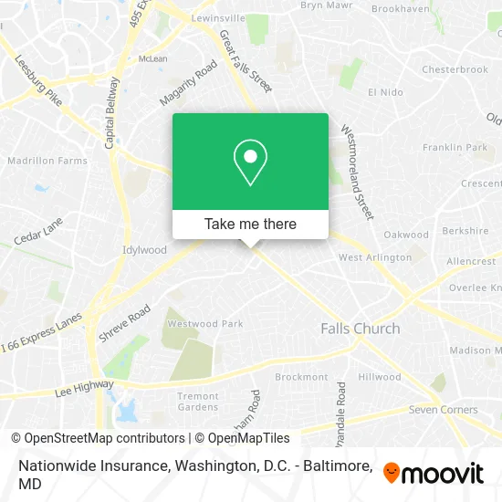
Nationwide Insurance Address: 7115 Leesburg Pike Falls Church, VA 22043 street in Fairfax County
- Alcohol and Drug Testing Center,
- Nova Intelligence Inve,
- Grand Travel and Tour,
- BBQ Chicken (BB.Q Chicken),
- CM Chicken Falls Church,
- Nvhomes,
- Fairfax, VA / Broad St,
- The Wellness Center at West Fa,
- Home2 Suites-Falls Church,
- Travel Horizons,
- Flippin Pizza,
- Universal Hot Tubs,
- Stratford Motor Lodge,
- Bad Girls Entertainment,
- Transport and Tours,
- Robbins Dustin,
- Federal Armored Express,
- Fort Hunt Cleaners,
- Avalon Bay,
- Kirchenbauer Financial Management & Consulting
Places Near Nationwide Insurance (Fairfax County)
- Georgetown, Washington,
- The Anthem, Washington,
- National Museum of African American History and Culture, Washington,
- Washington National Cathedral, Washington,
- M&T Bank Stadium, Baltimore,
- Warner Theatre, Washington,
- Camden Yards, Baltimore,
- Capital One Arena, Washington,
- Pennsylvania Ave NW (3rd st and pennsylvania), Washington,
- National Zoo, Washington,
- Basilica of the National Shrine, Washington,
- Sibley Memorial Hospital, Washington,
- National Mall, Washington,
- Westfield Montgomery Mall, Montgomery County,
- Marriott Marquis Washington, DC, Washington,
- Amazon Hq2, Arlington County,
- Museum Of The Bible, Washington,
- Rock Creek Tennis Center, Washington,
- PG Mall, Prince George's County,
- Washington DC VA Medical Center, Washington
How to get to popular places in Washington, D.C. - Baltimore, MD with public transit
Get around Fairfax County by public transit!
Traveling around Fairfax County has never been so easy. See step by step directions as you travel to any attraction, street or major public transit station. View bus and train schedules, arrival times, service alerts and detailed routes on a map, so you know exactly how to get to anywhere in Fairfax County.
When traveling to any destination around Fairfax County use Moovit's Live Directions with Get Off Notifications to know exactly where and how far to walk, how long to wait for your line, and how many stops are left. Moovit will alert you when it's time to get off — no need to constantly re-check whether yours is the next stop.
Wondering how to use public transit in Fairfax County or how to pay for public transit in Fairfax County? Moovit public transit app can help you navigate your way with public transit easily, and at minimum cost. It includes public transit fees, ticket prices, and costs. Looking for a map of Fairfax County public transit lines? Moovit public transit app shows all public transit maps in Fairfax County with all Bus, Train, Metro, Light Rail and Ferry routes and stops on an interactive map.
Washington, D.C. - Baltimore, MD has 5 transit type(s), including: Bus, Train, Metro, Light Rail and Ferry, operated by several transit agencies, including WMATA, Montgomery County Ride On, Fairfax Connector, TheBus, PRTC, DASH - Alexandria, Arlington Transit (ART), RTA of Central Maryland, MDOT MTA, MDOT MTA Light RailLink, MDOT MTA Commuter Bus, MDOT MTA Local Bus, FXBGO!, Virginia Railway Express (VRE) and MARC