How to get to Nationwide Insurance by bus?
Click on the bus route to see step by step directions with maps, line arrival times and updated time schedules.
From DC Superior Court Building A, Washington
97 minFrom AMC Theatres-Loews Georgetown 14, Washington
68 minFrom Yard House, Washington
91 minFrom Players Club, Washington
96 minFrom Marriott-Washington DC Marquis (Marriott Marquis Washington, DC), Washington
93 minFrom Holiday Inn-Washington Capitol Natl Mall, Washington
95 minFrom Washington Monument, Washington
98 minFrom United States Patent & Trademark Office (USPTO), Alexandria
38 minFrom The Darcy Hotel Washington DC, Washington
87 minFrom Rayburn House Office Building, Washington
100 min
Bus stops near Nationwide Insurance in Fairfax County
Bus lines to Nationwide Insurance in Fairfax County
What are the closest stations to Nationwide Insurance?
The closest stations to Nationwide Insurance are:
- Leesburg Pk+Forest Dr is 312 yards away, 4 min walk.
- S Dinwiddie St Wb @ 14th St S Ns is 318 yards away, 5 min walk.
- Leesburg Pk+S George Mason Dr is 351 yards away, 5 min walk.
Which bus lines stop near Nationwide Insurance?
These bus lines stop near Nationwide Insurance: 31, A40, A66, A76.
What’s the nearest bus station to Nationwide Insurance in Fairfax County?
The nearest bus station to Nationwide Insurance in Fairfax County is Leesburg Pk+Forest Dr. It’s a 4 min walk away.
What time is the first bus to Nationwide Insurance in Fairfax County?
The 75 is the first bus that goes to Nationwide Insurance in Fairfax County. It stops nearby at 5:41 AM.
What time is the last bus to Nationwide Insurance in Fairfax County?
The A40 is the last bus that goes to Nationwide Insurance in Fairfax County. It stops nearby at 2:38 AM.
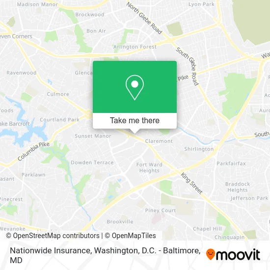
See Nationwide Insurance, Fairfax County, on the map
Public Transit to Nationwide Insurance in Fairfax County
Wondering how to get to Nationwide Insurance in Fairfax County? Moovit helps you find the best way to get to Nationwide Insurance with step-by-step directions from the nearest public transit station.
Moovit provides free maps and live directions to help you navigate through your city. View schedules, routes, timetables, and find out how long does it take to get to Nationwide Insurance in real time.
Looking for the nearest stop or station to Nationwide Insurance? Check out this list of stops closest to your destination: Leesburg Pk+Forest Dr; S Dinwiddie St Wb @ 14th St S Ns; Leesburg Pk+S George Mason Dr.
Bus: 31, A40, A66, A76, 75.
Want to see if there’s another route that gets you there at an earlier time? Moovit helps you find alternative routes or times. Get directions from and directions to Nationwide Insurance easily from the Moovit App or Website.
We make riding to Nationwide Insurance easy, which is why over 1.5 million users, including users in Fairfax County, trust Moovit as the best app for public transit. You don’t need to download an individual bus app or train app, Moovit is your all-in-one transit app that helps you find the best bus time or train time available.
For information on prices of bus and metro, costs and ride fares to Nationwide Insurance, please check the Moovit app.
Use the app to navigate to popular places including to the airport, hospital, stadium, grocery store, mall, coffee shop, school, college, and university.
Nationwide Insurance Address: 4900 Leesburg Pike Alexandria, VA 22302 street in Fairfax County
- Orbat Associates,
- McOnsult Tax Relief,
- United Group Insurance,
- Washington Insurance seguros Baratos auto Baratos Falls Church,
- Skyline Travel,
- El Mouqaiss Insurances & Tax Works,
- Ethiopian Travel Agency,
- Capitol Classic Executive,
- GTBS,
- M&E Tax Services,
- National Assn of Self Employed,
- Cockroaches Exterminators,
- Calvary Baptist Church,
- Skyline Plaza (Council Skyline Plaza),
- Skyline Plaza North,
- Anderson Dental Associate,
- Hampton by Hilton-Alexandria (Hampton Inn),
- RE/MAX,
- Gala Futons and Furniture,
- Irina Babb
Places Near Nationwide Insurance (Fairfax County)
- Marriott Marquis Washington, DC, Washington,
- Amazon Hq2, Arlington County,
- Pennsylvania Ave NW (3rd st and pennsylvania), Washington,
- National Mall, Washington,
- National Zoo, Washington,
- Georgetown, Washington,
- Basilica of the National Shrine, Washington,
- Capital One Arena, Washington,
- National Museum of African American History and Culture, Washington,
- Camden Yards, Baltimore,
- Museum Of The Bible, Washington,
- Sibley Memorial Hospital, Washington,
- Washington DC VA Medical Center, Washington,
- Rock Creek Tennis Center, Washington,
- Westfield Montgomery Mall, Montgomery County,
- Warner Theatre, Washington,
- M&T Bank Stadium, Baltimore,
- The Anthem, Washington,
- PG Mall, Prince George's County,
- Washington National Cathedral, Washington
How to get to popular places in Washington, D.C. - Baltimore, MD with public transit
Get around Fairfax County by public transit!
Traveling around Fairfax County has never been so easy. See step by step directions as you travel to any attraction, street or major public transit station. View bus and train schedules, arrival times, service alerts and detailed routes on a map, so you know exactly how to get to anywhere in Fairfax County.
When traveling to any destination around Fairfax County use Moovit's Live Directions with Get Off Notifications to know exactly where and how far to walk, how long to wait for your line, and how many stops are left. Moovit will alert you when it's time to get off — no need to constantly re-check whether yours is the next stop.
Wondering how to use public transit in Fairfax County or how to pay for public transit in Fairfax County? Moovit public transit app can help you navigate your way with public transit easily, and at minimum cost. It includes public transit fees, ticket prices, and costs. Looking for a map of Fairfax County public transit lines? Moovit public transit app shows all public transit maps in Fairfax County with all Bus, Train, Metro, Light Rail and Ferry routes and stops on an interactive map.
Washington, D.C. - Baltimore, MD has 5 transit type(s), including: Bus, Train, Metro, Light Rail and Ferry, operated by several transit agencies, including WMATA, Montgomery County Ride On, Fairfax Connector, TheBus, PRTC, DASH - Alexandria, Arlington Transit (ART), RTA of Central Maryland, MDOT MTA, MDOT MTA Light RailLink, MDOT MTA Commuter Bus, MDOT MTA Local Bus, FXBGO!, Virginia Railway Express (VRE) and MARC