How to get to Natural High Tree Service by bus?
Click on the bus route to see step by step directions with maps, line arrival times and updated time schedules.
From Shell, Indianapolis City (Balance)
51 minFrom Amazon Locker-Barsanofrio, Indianapolis City (Balance)
51 minFrom Midtown Indiana Polis, Indianapolis City (Balance)
68 minFrom Chipotle, Indianapolis City (Balance)
57 minFrom Washington Square Mall, Indianapolis City (Balance)
47 minFrom IUPUI: Gymnasium (The Jungle), Indianapolis City (Balance)
51 minFrom Chuck E Cheese's, Southport
94 minFrom Retails Neighborhood Pet Place, Indianapolis City (Balance)
51 minFrom 38th and Boulevard, Indianapolis City (Balance)
62 minFrom KRS Construction, Indianapolis City (Balance)
28 min
Bus stop near Natural High Tree Service in Indianapolis City (Balance)
- Prospect St & Sherman Dr, 7 min walk,VIEW
Bus lines to Natural High Tree Service in Indianapolis City (Balance)
- 56, Emerson/Thompson,VIEW
What are the closest stations to Natural High Tree Service?
The closest stations to Natural High Tree Service are:
- Prospect St & Sherman Dr is 566 yards away, 7 min walk.
Which bus lines stop near Natural High Tree Service?
These bus lines stop near Natural High Tree Service: 26, 56.
What’s the nearest bus station to Natural High Tree Service in Indianapolis City (Balance)?
The nearest bus station to Natural High Tree Service in Indianapolis City (Balance) is Prospect St & Sherman Dr. It’s a 7 min walk away.
What time is the first bus to Natural High Tree Service in Indianapolis City (Balance)?
The 56 is the first bus that goes to Natural High Tree Service in Indianapolis City (Balance). It stops nearby at 5:18 AM.
What time is the last bus to Natural High Tree Service in Indianapolis City (Balance)?
The 56 is the last bus that goes to Natural High Tree Service in Indianapolis City (Balance). It stops nearby at 10:12 PM.
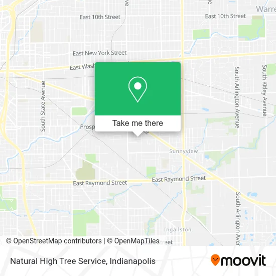
See Natural High Tree Service, Indianapolis City (Balance), on the map
Public Transit to Natural High Tree Service in Indianapolis City (Balance)
Wondering how to get to Natural High Tree Service in Indianapolis City (Balance)? Moovit helps you find the best way to get to Natural High Tree Service with step-by-step directions from the nearest public transit station.
Moovit provides free maps and live directions to help you navigate through your city. View schedules, routes, timetables, and find out how long does it take to get to Natural High Tree Service in real time.
Looking for the nearest stop or station to Natural High Tree Service? Check out this list of stops closest to your destination: Prospect St & Sherman Dr.
Bus: 26, 56.
Want to see if there’s another route that gets you there at an earlier time? Moovit helps you find alternative routes or times. Get directions from and directions to Natural High Tree Service easily from the Moovit App or Website.
We make riding to Natural High Tree Service easy, which is why over 1.5 million users, including users in Indianapolis City (Balance), trust Moovit as the best app for public transit. You don’t need to download an individual bus app or train app, Moovit is your all-in-one transit app that helps you find the best bus time or train time available.
For information on prices of bus, costs and ride fares to Natural High Tree Service, please check the Moovit app.
Use the app to navigate to popular places including to the airport, hospital, stadium, grocery store, mall, coffee shop, school, college, and university.
Natural High Tree Service Address: 4000 Terrace Ave street in Indianapolis City (Balance)
- Jackson Painting,
- Mad Home Improvement Company,
- Southeastern Supply Co.,
- Kingston Dr,
- XXL Karaoke,
- Tom's Tree Cutt Ers,
- Abney Masonry,
- Quality Roofing Services,
- Bone Dry Roofing,
- Earthy Floors,
- Aleman Auto Services,
- Beech Grove Towing,
- Southeastern And Sherman,
- Main Event,
- Ram Tool & Supply,
- Uptons Famous Pet Training Center,
- Iglesia Hermandad Cristiana,
- Pinnacle Flooring and Installation,
- Tienda Guatemalteca,
- Apex Property Management
Places Near Natural High Tree Service (Indianapolis City (Balance))
- Eskenazi Hospital, Indianapolis City (Balance),
- Lilly Corporate Center (Eli Lilly & Co), Indianapolis City (Balance),
- Cotter's Massage Parlor With Happy Endings, Indianapolis City (Balance),
- Indiana Convention Center, Indianapolis City (Balance),
- Indianapolis Motor Speedway, Speedway,
- Train Ride At Castleton Mall, Indianapolis City (Balance),
- Plainfield, IN, Plainfield,
- THE BALT, Indianapolis City (Balance),
- Jersey Barn, Indianapolis City (Balance),
- I U Health Methodist Hospital, Indianapolis City (Balance),
- Castleton Square Mall, Indianapolis,
- St. Vincent Hospital - Indianapolis, Indianapolis City (Balance),
- St. Vincent entrance #1, Indianapolis City (Balance),
- Lucas Oil Stadium, Indianapolis City (Balance),
- Indianapolis Airport Zone 2, Indianapolis City (Balance),
- I-465 / I-65 Interchange, Indianapolis City (Balance),
- Indiana, Indianapolis City (Balance),
- Gainbridge Fieldhouse, Indianapolis City (Balance),
- 119 W 19th St Parking, Indianapolis City (Balance),
- Methodist Hospital of Indianapolis, Indianapolis City (Balance)
How to get to popular places in Indianapolis with public transit
Get around Indianapolis City (Balance) by public transit!
Traveling around Indianapolis City (Balance) has never been so easy. See step by step directions as you travel to any attraction, street or major public transit station. View bus and train schedules, arrival times, service alerts and detailed routes on a map, so you know exactly how to get to anywhere in Indianapolis City (Balance).
When traveling to any destination around Indianapolis City (Balance) use Moovit's Live Directions with Get Off Notifications to know exactly where and how far to walk, how long to wait for your line, and how many stops are left. Moovit will alert you when it's time to get off — no need to constantly re-check whether yours is the next stop.
Wondering how to use public transit in Indianapolis City (Balance) or how to pay for public transit in Indianapolis City (Balance)? Moovit public transit app can help you navigate your way with public transit easily, and at minimum cost. It includes public transit fees, ticket prices, and costs. Looking for a map of Indianapolis City (Balance) public transit lines? Moovit public transit app shows all public transit maps in Indianapolis City (Balance) with all bus routes and stops on an interactive map.
Indianapolis has 1 transit type(s), including: bus, operated by several transit agencies, including IndyGo, FlixBus-us and Greyhound-us