How to get to Navjeevan Health Care by bus?
Click on the bus route to see step by step directions with maps, line arrival times and updated time schedules.
From Tungareshwar, Vasai
27 minFrom Royal Garden Resort, Vasai
107 minFrom Shree Swami Samartha Math Bhuigaon in Vasai East, Vasai
45 minFrom Iskcon Temple in Mira Road, Mira Bhayandar
176 minFrom Pleasant Park Mira Road, Mira Bhayandar
162 minFrom Bhaktivedanta Hospital, Mira Bhayandar
176 minFrom Balasaheb Thakre Udyan, Mira Bhayandar
187 minFrom Seven Eleven Club, Mira Bhayandar
189 minFrom Bhaktivedanta Hospital, Mira Bhayandar
176 minFrom Oberoi Mall, Goregaon, Mira Bhayandar
171 min
Bus stops near Navjeevan Health Care in Vasai
Ferry stations near Navjeevan Health Care in Vasai
Bus lines to Navjeevan Health Care in Vasai
What are the closest stations to Navjeevan Health Care?
The closest stations to Navjeevan Health Care are:
- Zenda Bazar is 82 meters away, 2 min walk.
- Saint John Bosco High School is 132 meters away, 2 min walk.
- Government College is 353 meters away, 5 min walk.
- Vasai is 1980 meters away, 26 min walk.
- Panju Island is 3492 meters away, 45 min walk.
Which bus lines stop near Navjeevan Health Care?
These bus lines stop near Navjeevan Health Care: 112, 117, 130, 306.
What’s the nearest bus station to Navjeevan Health Care in Vasai?
The nearest bus stations to Navjeevan Health Care in Vasai are Zenda Bazar and Saint John Bosco High School. The closest one is a 2 min walk away.
What’s the nearest ferry station to Navjeevan Health Care in Vasai?
The nearest ferry station to Navjeevan Health Care in Vasai is Vasai. It’s a 26 min walk away.
What time is the first bus to Navjeevan Health Care in Vasai?
The 112 is the first bus that goes to Navjeevan Health Care in Vasai. It stops nearby at 5:18 AM.
What time is the last bus to Navjeevan Health Care in Vasai?
The 112 is the last bus that goes to Navjeevan Health Care in Vasai. It stops nearby at 10:51 PM.
What time is the first ferry to Navjeevan Health Care in Vasai?
The ⛴ is the first ferry that goes to Navjeevan Health Care in Vasai. It stops nearby at 6:00 AM.
What time is the last ferry to Navjeevan Health Care in Vasai?
The ⛴ is the last ferry that goes to Navjeevan Health Care in Vasai. It stops nearby at 10:05 PM.
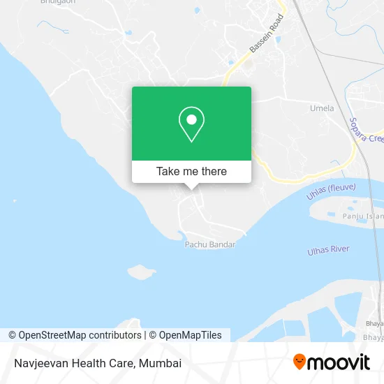
See Navjeevan Health Care, Vasai, on the map
Public Transit to Navjeevan Health Care in Vasai
Wondering how to get to Navjeevan Health Care in Vasai? Moovit helps you find the best way to get to Navjeevan Health Care with step-by-step directions from the nearest public transit station.
Moovit provides free maps and live directions to help you navigate through your city. View schedules, routes, timetables, and find out how long does it take to get to Navjeevan Health Care in real time.
Looking for the nearest stop or station to Navjeevan Health Care? Check out this list of stops closest to your destination: Zenda Bazar; Saint John Bosco High School; Government College; Vasai; Panju Island.
Bus: 112, 117, 130, 306, 113.Ferry: ⛴, ⛴.
Want to see if there’s another route that gets you there at an earlier time? Moovit helps you find alternative routes or times. Get directions from and directions to Navjeevan Health Care easily from the Moovit App or Website.
We make riding to Navjeevan Health Care easy, which is why over 1.5 million users, including users in Vasai, trust Moovit as the best app for public transit. You don’t need to download an individual bus app or train app, Moovit is your all-in-one transit app that helps you find the best bus time or train time available.
For information on prices of bus and train, costs and ride fares to Navjeevan Health Care, please check the Moovit app.
Use the app to navigate to popular places including to the airport, hospital, stadium, grocery store, mall, coffee shop, school, college, and university.
Navjeevan Health Care Address: Koliwada Marg Vasai 401201 MH street in Vasai
- K Star Photography,
- Choyang India,
- Someshwar Mitra Mandal,
- Roots & Wings Doll Studio,
- Ekvira Vegetables,
- Radhe Telecom,
- Looks Hair Cutting Salon,
- Vasai's Marine Drive,
- Bhakti Clinic,
- M K B,
- K G N Auto Parts,
- Vinodrai Gunvantrai & Company,
- Zenda Bazar Bus Stop,
- Megha Beauty Salon,
- Shri Ganesh Tutorials,
- Vinodras Gunvantray & Co,
- Meatweat,
- Vasai Cha Vighnaharta,
- Iqra Clothes,
- Shankarra Panwala House
Places Near Navjeevan Health Care (Vasai)
- J. J. Hospital, Byculla,
- R CITY MALL, Ghatkopar East,
- Oberoi Mall, Dindoshi,
- Oberoi Sky City, Borivali East,
- Rani Baug, Byculla,
- NESCO, Goregaon,
- Worli Sea Face,
- Ikea, Worli,
- Hinduja Hospital, Mahim,
- INFINITI Mall (Infinity Mall, andheri), Versova,
- Juhu Beach,
- Bombay Exhibition Center, Goregaon,
- Bhaucha Dhakka,
- Inorbit Mall, Malad West,
- Govardhan Ecovillage, Palghar (St),
- Malabar Hill, Malabar Hill,
- Mumbai University, Kalina,
- Dome @ Nsci - Svp Stadium Mumbai, Worli,
- TCS Olympus, Thane,
- Gateway Of India
How to get to popular places in Mumbai with public transit
Get around Vasai by public transit!
Traveling around Vasai has never been so easy. See step by step directions as you travel to any attraction, street or major public transit station. View bus and train schedules, arrival times, service alerts and detailed routes on a map, so you know exactly how to get to anywhere in Vasai.
When traveling to any destination around Vasai use Moovit's Live Directions with Get Off Notifications to know exactly where and how far to walk, how long to wait for your line, and how many stops are left. Moovit will alert you when it's time to get off — no need to constantly re-check whether yours is the next stop.
Wondering how to use public transit in Vasai or how to pay for public transit in Vasai? Moovit public transit app can help you navigate your way with public transit easily, and at minimum cost. It includes public transit fees, ticket prices, and costs. Looking for a map of Vasai public transit lines? Moovit public transit app shows all public transit maps in Vasai with all Bus, Train, Metro and Ferry routes and stops on an interactive map.
Mumbai has 4 transit type(s), including: Bus, Train, Metro and Ferry, operated by several transit agencies, including MMMOCL (Maha Mumbai Metro Operation Corporation Ltd.), NMM CIDCO (Navi Mumbai Metro Maha Metro), Reliance Mumbai Metro, MMRCL (Mumbai Metro Rail Corporation Ltd), BEST (Brihanmumbai Electricity Supply & Transport), BEST AC Services, A.C.Trains (Air-Conditioning Trains), W.R. (Western Railways), C.R. (Central Railways), C.R.MEMU (Central Railways Shuttle MEMU Trains), H.R. (Harbour Railways), T.R.(Trans Harbour Railways), U.R.(Uran-Ulwe Railways), I.R.(Indian Railways) and TMT (Thane Municipal Transport)