How to get to Navtecs by bus?
Click on the bus route to see step by step directions with maps, line arrival times and updated time schedules.
From Kozağaç Parkı, Meram
67 minFrom Konya Zirve Düğün ve Toplantı Merkezi, Selçuklu
58 minFrom Natura Park, Selçuklu
75 minFrom Filistin Gazze, Selçuklu
35 minFrom Sakarya Tramvay Durağı, Selçuklu
32 minFrom İçeri Çumra-Simi Köyü Yolu, Selçuklu
55 minFrom Yağbasan Mezarlığı, Selçuklu
61 minFrom Zafer Sanayi, Selçuklu
61 minFrom Konya Şehirlerarası Otobüs Terminali (Konya Şehirler Arası Otobüs Terminali), Selçuklu
54 min
Bus stops near Navtecs in Selçuklu
Light Rail stations near Navtecs in Selçuklu
- Nalçacı (T27), 17 min walk,VIEW
Bus lines to Navtecs in Selçuklu
What are the closest stations to Navtecs?
The closest stations to Navtecs are:
- Hocacihan İHl is 2 meters away, 2 min walk.
- Özcan is 607 meters away, 9 min walk.
- Sosyal is 669 meters away, 10 min walk.
- Nalçacı (T27) is 1319 meters away, 17 min walk.
Which bus lines stop near Navtecs?
These bus lines stop near Navtecs: 65-A, 69-A.
What’s the nearest light rail station to Navtecs in Selçuklu?
The nearest light rail station to Navtecs in Selçuklu is Nalçacı (T27). It’s a 17 min walk away.
What’s the nearest bus station to Navtecs in Selçuklu?
The nearest bus station to Navtecs in Selçuklu is Hocacihan İHl. It’s a 2 min walk away.
What time is the first light rail to Navtecs in Selçuklu?
The 153-A is the first light rail that goes to Navtecs in Selçuklu. It stops nearby at 3:50 AM.
What time is the last light rail to Navtecs in Selçuklu?
The 153-A is the last light rail that goes to Navtecs in Selçuklu. It stops nearby at 1:47 AM.
What time is the first bus to Navtecs in Selçuklu?
The 70-A is the first bus that goes to Navtecs in Selçuklu. It stops nearby at 6:04 AM.
What time is the last bus to Navtecs in Selçuklu?
The 65-A is the last bus that goes to Navtecs in Selçuklu. It stops nearby at 1:06 AM.
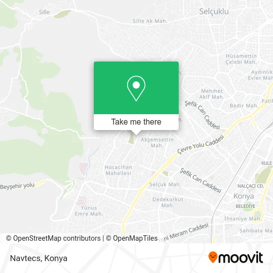
See Navtecs, Selçuklu, on the map
Public Transit to Navtecs in Selçuklu
Wondering how to get to Navtecs in Selçuklu? Moovit helps you find the best way to get to Navtecs with step-by-step directions from the nearest public transit station.
Moovit provides free maps and live directions to help you navigate through your city. View schedules, routes, timetables, and find out how long does it take to get to Navtecs in real time.
Looking for the nearest stop or station to Navtecs? Check out this list of stops closest to your destination: Hocacihan İHl; Özcan; Sosyal; Nalçacı (T27).
Bus: 65-A, 69-A, 70-A, 98-A, 71-A, 72-A.
Want to see if there’s another route that gets you there at an earlier time? Moovit helps you find alternative routes or times. Get directions from and directions to Navtecs easily from the Moovit App or Website.
We make riding to Navtecs easy, which is why over 1.5 million users, including users in Selçuklu, trust Moovit as the best app for public transit. You don’t need to download an individual bus app or train app, Moovit is your all-in-one transit app that helps you find the best bus time or train time available.
For information on prices of bus and light rail, costs and ride fares to Navtecs, please check the Moovit app.
Use the app to navigate to popular places including to the airport, hospital, stadium, grocery store, mall, coffee shop, school, college, and university.
Navtecs Address: Anadolu Caddesi, 42080 Akşemsettin, Selçuklu street in Selçuklu
- Kuaför Derviş,
- ONUR KIRTASİYE,
- Akyüz Etliekmek,
- İyitascilar Mermer Mezar ve Fırın Işi,
- Örengül Tuhafiye Züccaciye,
- Hocacihan Anadolu İ.H.L,
- Örengül Tuhafiye,
- Hocacihan Province,
- Selçuklu Hocacihan Anadolu İmam Hatip Lisesi (Selçuklu Hocacihan Anadolu i. H. L.),
- Selçuklu Hocacihan Anadolu İmam Hatip Lisesi,
- Yorgunn,
- Lale Zar Dugun Salonu,
- Kahvaltı Sofrası,
- Zümram Fast Food,
- Sehit Er Ali Bağcı Kislasi,
- Kahve Vakti,
- Koçak Döner,
- Hocacihan Tımarhanesi,
- Taşpınar,
- Gencay Siteleri
Places Near Navtecs (Selçuklu)
- Kerhâne, Selçuklu,
- Konya Otogar, Selçuklu,
- Kelebekler Vadisi, Selçuklu,
- Fatih Işıklar - Özalkent Dolmuşu, Selçuklu,
- Konya Beyhekim Devlet Hastanesi, Selçuklu,
- Konya Havalimanı, Selçuklu,
- Adliye Sancak Dolmuşu, Selçuklu,
- Otogar Aydınlık Dolmuşu, Selçuklu,
- Kent Plaza (Konya Kent Plaza Alisveris Merkezi), Selçuklu,
- Konya YHT Garı, Selçuklu,
- Meram Tıp Fakültesi, Meram,
- Büsan Sanayi, Selçuklu,
- Konya Tren Garı, Selçuklu,
- Selçuklu Kongre Merkezi, Selçuklu,
- Bosna Kampüs Dolmuş Duragı, Selçuklu,
- Konya Yüksek Hızlı Tren Garı (Konya YHT Garı), Selçuklu,
- Konya Real Avm, Selçuklu,
- Selçuklu Nüfus Müdürlüğü, Selçuklu,
- Konya Şehir Hastanesi, Selçuklu,
- Bosna Hersek Mh Mutlu Son Masaj Salonu, Selçuklu
How to get to popular places in Konya with public transit
Get around Selçuklu by public transit!
Traveling around Selçuklu has never been so easy. See step by step directions as you travel to any attraction, street or major public transit station. View bus and train schedules, arrival times, service alerts and detailed routes on a map, so you know exactly how to get to anywhere in Selçuklu.
When traveling to any destination around Selçuklu use Moovit's Live Directions with Get Off Notifications to know exactly where and how far to walk, how long to wait for your line, and how many stops are left. Moovit will alert you when it's time to get off — no need to constantly re-check whether yours is the next stop.
Wondering how to use public transit in Selçuklu or how to pay for public transit in Selçuklu? Moovit public transit app can help you navigate your way with public transit easily, and at minimum cost. It includes public transit fees, ticket prices, and costs. Looking for a map of Selçuklu public transit lines? Moovit public transit app shows all public transit maps in Selçuklu with all Bus and Light Rail routes and stops on an interactive map.
Konya has 2 transit type(s), including: Bus and Light Rail, operated by several transit agencies, including ATUS and Havaş