How to get to Nay Informatica e Games by bus?
Click on the bus route to see step by step directions with maps, line arrival times and updated time schedules.
From Nilópolis, Nilópolis
47 minFrom Rua Otávio Tarquino 410, Nova Iguaçu
27 minFrom Hospital Da Mulher Heloneida Studart, São João De Meriti
56 minFrom Universidade Estácio de Sá, Nova Iguaçu
37 minFrom shopping nova iguaçu, Nova Iguaçu
32 minFrom Rua Oscar Soares, Nova Iguaçu
35 minFrom Coelho da Rocha, São João De Meriti
48 minFrom Morro do Danon, Nova Iguaçu
58 minFrom Avenida Getúlio de Moura, São João De Meriti
62 minFrom Cabuçu, Nova Iguaçu
79 min
Bus stops near Nay Informatica e Games in Nova Iguaçu
Bus lines to Nay Informatica e Games in Nova Iguaçu
What are the closest stations to Nay Informatica e Games?
The closest stations to Nay Informatica e Games are:
- Rua Luísa Maier, 3838 is 84 meters away, 2 min walk.
- Avenida Henrique Duque Estrada Mayer, 3839-3865 is 90 meters away, 2 min walk.
- Estrada De Santa Rita, 942-1010 is 1109 meters away, 15 min walk.
Which bus lines stop near Nay Informatica e Games?
These bus lines stop near Nay Informatica e Games: 137, 501B.
What’s the nearest bus station to Nay Informatica e Games in Nova Iguaçu?
The nearest bus stations to Nay Informatica e Games in Nova Iguaçu are Rua Luísa Maier, 3838 and Avenida Henrique Duque Estrada Mayer, 3839-3865. The closest one is a 2 min walk away.
What time is the first bus to Nay Informatica e Games in Nova Iguaçu?
The 497B is the first bus that goes to Nay Informatica e Games in Nova Iguaçu. It stops nearby at 4:04 AM.
What time is the last bus to Nay Informatica e Games in Nova Iguaçu?
The 138 is the last bus that goes to Nay Informatica e Games in Nova Iguaçu. It stops nearby at 12:21 AM.
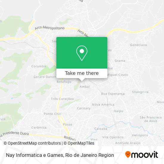
See Nay Informatica e Games, Nova Iguaçu, on the map
Public Transit to Nay Informatica e Games in Nova Iguaçu
Wondering how to get to Nay Informatica e Games in Nova Iguaçu? Moovit helps you find the best way to get to Nay Informatica e Games with step-by-step directions from the nearest public transit station.
Moovit provides free maps and live directions to help you navigate through your city. View schedules, routes, timetables, and find out how long does it take to get to Nay Informatica e Games in real time.
Looking for the nearest stop or station to Nay Informatica e Games? Check out this list of stops closest to your destination: Rua Luísa Maier; Avenida Henrique Duque Estrada Mayer; Estrada De Santa Rita.
Bus: 137, 501B, 138, 497B, 135, 139.
Want to see if there’s another route that gets you there at an earlier time? Moovit helps you find alternative routes or times. Get directions from and directions to Nay Informatica e Games easily from the Moovit App or Website.
We make riding to Nay Informatica e Games easy, which is why over 1.5 million users, including users in Nova Iguaçu, trust Moovit as the best app for public transit. You don’t need to download an individual bus app or train app, Moovit is your all-in-one transit app that helps you find the best bus time or train time available.
For information on prices of bus, costs and ride fares to Nay Informatica e Games, please check the Moovit app.
Use the app to navigate to popular places including to the airport, hospital, stadium, grocery store, mall, coffee shop, school, college, and university.
Nay Informatica e Games Address: Rua Paraopeba, 492 Parque Flora Nova Iguaçu-RJ 26040-600 street in Nova Iguaçu
- Avenida Henrique Duque Estrada Meyer / Rua Luíza Maier,
- Weverton Tavares,
- ciep 334 ambaí,
- C. I. E. P. 334 Moacir J. P. Gerk,
- Cantinho do Pastel,
- Avenida Henrique Duque Estrada Meyer 3950,
- Estrada Ambaí-Figueira 10,
- Shangrila Coop Confeccao - Ambai,
- Paty Quentinhas,
- Avenida Henrique Duque Estrada Meyer,
- Rua Ariy Maia, 274,
- Bazar das Minas Ambai,
- Rua Miguel Couto, 105,
- Autoescola Ambai,
- Nestlé Distribuidora,
- Rua Enedino Lourenço / Estrada do Ambaí,
- Rua Camapuã 260,
- Ambaí,
- Ambaí,
- Rua Yula, 132
Places Near Nay Informatica e Games (Nova Iguaçu)
- Hospital Pedro Ernesto, Vila Isabel,
- Rio De Janeiro,
- Museu Do Amanhã, Centro,
- Rua Licínio Cardoso, São Francisco Xavier,
- Hospital Federal Do Andaraí, Andaraí,
- Feira Livre da Gloria, Glória,
- Avenida Rio Branco, Centro,
- Rua Ulysses Guimarães 16, Cidade Nova,
- Avenida Venezuela 134, Saúde,
- Rodoviária Novo Rio (Rodoviária do Rio de Janeiro), Santo Cristo,
- Shopping RioSul, Botafogo,
- Shopping Rio Sul, Botafogo,
- Norte Shopping, Cachambi,
- Shopping Nova América, Del Castilho,
- Feirão De Malhas, Duque De Caxias,
- Niterói, Niterói,
- Shopping Downtown, Barra Da Tijuca,
- Praia do Arpoador, Ipanema,
- Hospital Federal Cardoso Fontes, Jacarepaguá,
- Hospital Municipal Ronaldo Gazolla, Acari
How to get to popular places in Rio de Janeiro Region with public transit
Get around Nova Iguaçu by public transit!
Traveling around Nova Iguaçu has never been so easy. See step by step directions as you travel to any attraction, street or major public transit station. View bus and train schedules, arrival times, service alerts and detailed routes on a map, so you know exactly how to get to anywhere in Nova Iguaçu.
When traveling to any destination around Nova Iguaçu use Moovit's Live Directions with Get Off Notifications to know exactly where and how far to walk, how long to wait for your line, and how many stops are left. Moovit will alert you when it's time to get off — no need to constantly re-check whether yours is the next stop.
Wondering how to use public transit in Nova Iguaçu or how to pay for public transit in Nova Iguaçu? Moovit public transit app can help you navigate your way with public transit easily, and at minimum cost. It includes public transit fees, ticket prices, and costs. Looking for a map of Nova Iguaçu public transit lines? Moovit public transit app shows all public transit maps in Nova Iguaçu with all Bus, Train, Metro, Light Rail, Ferry, Cable Car, Gondola and Funicular routes and stops on an interactive map.
Rio de Janeiro Region has 8 transit type(s), including: Bus, Train, Metro, Light Rail, Ferry, Cable Car, Gondola and Funicular, operated by several transit agencies, including TrensRJ, Metrô Rio, VLT Carioca, Barcas Rio, BRT MOBI-Rio, Auto Viação Alpha, Auto Viação Tijuca, Gire Transportes, Transurb, Viação Nossa Senhora das Graças, Consórcio INTERSUL, Braso Lisboa (Municipal), Caprichosa Auto Ônibus, Auto Viação Três Amigos and Rodoviária Âncora Matias