How to get to Negara Max Auto by bus?
Click on the bus route to see step by step directions with maps, line arrival times and updated time schedules.
From Parquesur, Leganés
73 minFrom LEROY MERLIN, Leganés
81 minFrom El Corte Inglés El Bercial, Área Metropolitana De Madrid Y Corredor Del Henares
82 minFrom Recinto Ferial de Fuenlabrada, Fuenlabrada
30 minFrom Centro Deportivo Militar La Dehesa, Madrid
52 minFrom Getafe, Madrid, Getafe
86 minFrom Tanatorio de Leganés, Leganés
50 minFrom Calle de la Vidauba, 24, Madrid
55 minFrom San Martín de la Vega, Madrid
52 minFrom Sector 3 - Getafe, Getafe
79 min
How to get to Negara Max Auto by train?
Click on the train route to see step by step directions with maps, line arrival times and updated time schedules.
From Parquesur, Leganés
96 minFrom LEROY MERLIN, Leganés
97 minFrom El Corte Inglés El Bercial, Área Metropolitana De Madrid Y Corredor Del Henares
98 minFrom Recinto Ferial de Fuenlabrada, Fuenlabrada
97 minFrom Centro Deportivo Militar La Dehesa, Madrid
74 minFrom Getafe, Madrid, Getafe
88 minFrom Tanatorio de Leganés, Leganés
91 minFrom Calle de la Vidauba, 24, Madrid
61 minFrom San Martín de la Vega, Madrid
61 minFrom Sector 3 - Getafe, Getafe
98 min
How to get to Negara Max Auto by metro?
Click on the metro route to see step by step directions with maps, line arrival times and updated time schedules.
From Parquesur, Leganés
68 minFrom LEROY MERLIN, Leganés
72 minFrom El Corte Inglés El Bercial, Área Metropolitana De Madrid Y Corredor Del Henares
61 minFrom Recinto Ferial de Fuenlabrada, Fuenlabrada
54 minFrom Centro Deportivo Militar La Dehesa, Madrid
80 minFrom Getafe, Madrid, Getafe
74 minFrom Tanatorio de Leganés, Leganés
71 minFrom Calle de la Vidauba, 24, Madrid
78 minFrom San Martín de la Vega, Madrid
80 minFrom Sector 3 - Getafe, Getafe
58 min
Bus stops near Negara Max Auto in Móstoles
Metro station near Negara Max Auto in Móstoles
- Manuela Malasaña, 17 min walk,VIEW
Train station near Negara Max Auto in Móstoles
- Móstoles, 25 min walk,VIEW
Bus lines to Negara Max Auto in Móstoles
What are the closest stations to Negara Max Auto?
The closest stations to Negara Max Auto are:
- Av. Carlos V - Veracruz is 390 meters away, 6 min walk.
- Simón Hernández - Pol. Ind. Fuensanta is 398 meters away, 6 min walk.
- Av. Onu - Sao Paulo is 823 meters away, 11 min walk.
- Ctra. M-506 - Urb. Parque Miraflores is 1017 meters away, 14 min walk.
- Manuela Malasaña is 1320 meters away, 17 min walk.
- Móstoles is 1951 meters away, 25 min walk.
Which bus lines stop near Negara Max Auto?
These bus lines stop near Negara Max Auto: 525, 526, 527.
Which train line stops near Negara Max Auto?
C5 (Móstoles - El Soto)
Which metro line stops near Negara Max Auto?
M-12 (MetroSur Andén 1)
What’s the nearest metro station to Negara Max Auto in Móstoles?
The nearest metro station to Negara Max Auto in Móstoles is Manuela Malasaña. It’s a 17 min walk away.
What’s the nearest train station to Negara Max Auto in Móstoles?
The nearest train station to Negara Max Auto in Móstoles is Móstoles. It’s a 25 min walk away.
What’s the nearest bus station to Negara Max Auto in Móstoles?
The nearest bus stations to Negara Max Auto in Móstoles are Av. Carlos V - Veracruz and Simón Hernández - Pol. Ind. Fuensanta. The closest one is a 6 min walk away.
What time is the first metro to Negara Max Auto in Móstoles?
The M-12 is the first metro that goes to Negara Max Auto in Móstoles. It stops nearby at 6:05 AM.
What time is the last metro to Negara Max Auto in Móstoles?
The M-12 is the last metro that goes to Negara Max Auto in Móstoles. It stops nearby at 2:18 AM.
What time is the first train to Negara Max Auto in Móstoles?
The C5 is the first train that goes to Negara Max Auto in Móstoles. It stops nearby at 5:18 AM.
What time is the last train to Negara Max Auto in Móstoles?
The C5 is the last train that goes to Negara Max Auto in Móstoles. It stops nearby at 12:36 AM.
What time is the first bus to Negara Max Auto in Móstoles?
The N503 is the first bus that goes to Negara Max Auto in Móstoles. It stops nearby at 3:03 AM.
What time is the last bus to Negara Max Auto in Móstoles?
The N503 is the last bus that goes to Negara Max Auto in Móstoles. It stops nearby at 2:31 AM.
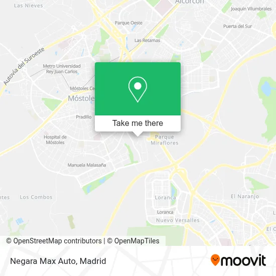
See Negara Max Auto, Móstoles, on the map
Public Transit to Negara Max Auto in Móstoles
Wondering how to get to Negara Max Auto in Móstoles? Moovit helps you find the best way to get to Negara Max Auto with step-by-step directions from the nearest public transit station.
Moovit provides free maps and live directions to help you navigate through your city. View schedules, routes, timetables, and find out how long does it take to get to Negara Max Auto in real time.
Looking for the nearest stop or station to Negara Max Auto? Check out this list of stops closest to your destination: Av. Carlos V - Veracruz; Simón Hernández - Pol. Ind. Fuensanta; Av. Onu - Sao Paulo; Ctra. M-506 - Urb. Parque Miraflores; Manuela Malasaña; Móstoles.
Bus: 525, 526, 527, 1, 523, N503, 1, 5.Train: C5.Metro: M-12.
Want to see if there’s another route that gets you there at an earlier time? Moovit helps you find alternative routes or times. Get directions from and directions to Negara Max Auto easily from the Moovit App or Website.
We make riding to Negara Max Auto easy, which is why over 1.5 million users, including users in Móstoles, trust Moovit as the best app for public transit. You don’t need to download an individual bus app or train app, Moovit is your all-in-one transit app that helps you find the best bus time or train time available.
For information on prices of bus, metro and train, costs and ride fares to Negara Max Auto, please check the Moovit app.
Use the app to navigate to popular places including to the airport, hospital, stadium, grocery store, mall, coffee shop, school, college, and university.
Negara Max Auto Address: Calle Venus, 28936 Móstoles street in Móstoles
- Instalaciones Roa S.L,
- Pol. Ind. La Fuensanta,
- Calle Venus, 3,
- Mini Polígono La Fuensanta,
- Roberauto,
- Quarta Premium Car,
- Sercotel,
- Calle Venus,
- Martonda,
- Wasky,
- Cepsa,
- Cars Marobe Formación,
- Retrofootball Craft,
- Nuevo Camino Obras,
- Cafetería Helen,
- Pingcomet,
- Gem Madrid,
- Diocarnes,
- Gurman Polski,
- Mercurio 1
Places Near Negara Max Auto (Móstoles)
- Centro Comercial Islazul, Área Metropolitana De Madrid Y Corredor Del Henares,
- Hospital Universitario Ramón y Cajal, Madrid,
- Mendez Alvaro, Madrid,
- Palacio De Vistalegre, Área Metropolitana De Madrid Y Corredor Del Henares,
- Hospital Universitario La Paz, Madrid,
- Calle de López de Hoyos 169, Madrid,
- Estacion de Chamartin, Madrid,
- Rastro De Madrid, Área Metropolitana De Madrid Y Corredor Del Henares,
- Wizink Center, Madrid,
- Centro Comercial La Vaguada, Área Metropolitana De Madrid Y Corredor Del Henares,
- Mercadillo de Majadahonda, Majadahonda,
- Plaza Mayor, Madrid,
- Hospital Clínico Universitario San Carlos, Madrid,
- Sala La Riviera, Madrid,
- Centro Comercial La Gavia, Área Metropolitana De Madrid Y Corredor Del Henares,
- Estadio Wanda Metropolitano, Área Metropolitana De Madrid Y Corredor Del Henares,
- Nassica, Área Metropolitana De Madrid Y Corredor Del Henares,
- Tres Aguas, Alcorcón,
- Plenilunio, Área Metropolitana De Madrid Y Corredor Del Henares,
- Centro Comercial Oasiz Madrid, Área Metropolitana De Madrid Y Corredor Del Henares
How to get to popular places in Madrid with public transit
Get around Móstoles by public transit!
Traveling around Móstoles has never been so easy. See step by step directions as you travel to any attraction, street or major public transit station. View bus and train schedules, arrival times, service alerts and detailed routes on a map, so you know exactly how to get to anywhere in Móstoles.
When traveling to any destination around Móstoles use Moovit's Live Directions with Get Off Notifications to know exactly where and how far to walk, how long to wait for your line, and how many stops are left. Moovit will alert you when it's time to get off — no need to constantly re-check whether yours is the next stop.
Wondering how to use public transit in Móstoles or how to pay for public transit in Móstoles? Moovit public transit app can help you navigate your way with public transit easily, and at minimum cost. It includes public transit fees, ticket prices, and costs. Looking for a map of Móstoles public transit lines? Moovit public transit app shows all public transit maps in Móstoles with all Bus, Train, Metro and Light Rail routes and stops on an interactive map.
Madrid has 4 transit type(s), including: Bus, Train, Metro and Light Rail, operated by several transit agencies, including Metro de Madrid, Metro Ligero, Tranvía de Parla, Renfe Cercanías - Servicios de Autobús especiales, Renfe Cercanias, Renfe Cercanías, EMT, Interurbanos, Urbanos de Alcalá de Henares, Urbanos de Alcobendas, Urbanos de Alcorcón, Urbanos de Algete, Urbanos de Aranjuez, Urbanos de Arganda del Rey and Urbanos de Arroyomolinos