How to get to Neide Nails by bus?
Click on the bus route to see step by step directions with maps, line arrival times and updated time schedules.
From Belleville, NJ, Belleville
49 minFrom Liberty State Park, Jersey City
64 minFrom Secaucus Junction, Secaucus
94 minFrom IKEA Elizabeth Shuttle Bus To Manhattan, Elizabeth
31 minFrom NJ 440, Jersey City
68 minFrom Elizabeth, NJ, Elizabeth
43 minFrom Hudson County Courthouse, Jersey City
65 minFrom West Orange, NJ, West Orange
52 minFrom Walmart, Jersey City
74 minFrom Liberty Science Center, Jersey City
65 min
How to get to Neide Nails by train?
Click on the train route to see step by step directions with maps, line arrival times and updated time schedules.
Bus stops near Neide Nails in Newark
Light Rail stations near Neide Nails in Newark
- Penn Station Light Rail Departure, 29 min walk,VIEW
Train station near Neide Nails in Newark
- Newark Penn Station, 31 min walk,VIEW
Bus lines to Neide Nails in Newark
What are the closest stations to Neide Nails?
The closest stations to Neide Nails are:
- Broad St at Emmet St is 781 yards away, 10 min walk.
- Broad St at Wright St is 866 yards away, 11 min walk.
- South St at Broad St is 942 yards away, 12 min walk.
- Penn Station Light Rail Departure is 2324 yards away, 29 min walk.
- Newark Penn Station is 2589 yards away, 31 min walk.
Which bus lines stop near Neide Nails?
These bus lines stop near Neide Nails: 24, 62.
Which train lines stop near Neide Nails?
These train lines stop near Neide Nails: NC, NJCL, RED.
What’s the nearest light rail station to Neide Nails in Newark?
The nearest light rail station to Neide Nails in Newark is Penn Station Light Rail Departure. It’s a 29 min walk away.
What’s the nearest bus station to Neide Nails in Newark?
The nearest bus station to Neide Nails in Newark is Broad St at Emmet St. It’s a 10 min walk away.
What time is the first light rail to Neide Nails in Newark?
The NLR is the first light rail that goes to Neide Nails in Newark. It stops nearby at 4:30 AM.
What time is the last light rail to Neide Nails in Newark?
The NLR is the last light rail that goes to Neide Nails in Newark. It stops nearby at 1:15 AM.
What time is the first train to Neide Nails in Newark?
The RED is the first train that goes to Neide Nails in Newark. It stops nearby at 3:10 AM.
What time is the last train to Neide Nails in Newark?
The RED is the last train that goes to Neide Nails in Newark. It stops nearby at 2:55 AM.
What time is the first bus to Neide Nails in Newark?
The 62 is the first bus that goes to Neide Nails in Newark. It stops nearby at 3:06 AM.
What time is the last bus to Neide Nails in Newark?
The 62 is the last bus that goes to Neide Nails in Newark. It stops nearby at 3:08 AM.
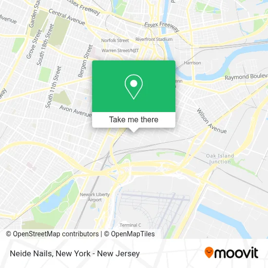
See Neide Nails, Newark, on the map
Public Transit to Neide Nails in Newark
Wondering how to get to Neide Nails in Newark? Moovit helps you find the best way to get to Neide Nails with step-by-step directions from the nearest public transit station.
Moovit provides free maps and live directions to help you navigate through your city. View schedules, routes, timetables, and find out how long does it take to get to Neide Nails in real time.
Looking for the nearest stop or station to Neide Nails? Check out this list of stops closest to your destination: Broad St at Emmet St; Broad St at Wright St; South St at Broad St; Penn Station Light Rail Departure; Newark Penn Station.
Bus: 24, 62, 67, 319, 40.Train: NC, NJCL, RED, ACELA, CARDINAL, CAROLINIAN, CRESCENT, KEYSTONE SERVICE.
Want to see if there’s another route that gets you there at an earlier time? Moovit helps you find alternative routes or times. Get directions from and directions to Neide Nails easily from the Moovit App or Website.
We make riding to Neide Nails easy, which is why over 1.5 million users, including users in Newark, trust Moovit as the best app for public transit. You don’t need to download an individual bus app or train app, Moovit is your all-in-one transit app that helps you find the best bus time or train time available.
For information on prices of bus, train and light rail, costs and ride fares to Neide Nails, please check the Moovit app.
Use the app to navigate to popular places including to the airport, hospital, stadium, grocery store, mall, coffee shop, school, college, and university.
Neide Nails Address: 179 Emmet St street in Newark
- Valley Provisions Inc. "A Casa do Mario",
- Casa Do Mario,
- Ocean Seafood Depot,
- Uniqlofts,
- Newark Flooring Express,
- Ironbound Surfaces,
- A and T Towing,
- A&T Towing Inc,
- N. Edison and Newark,
- Mely Mar 2 Bar Restaurant,
- Jed Display,
- M Bross,
- Newport Centre,
- Ace Pet Shop,
- Liberty State Towing,
- Prince Window & Door,
- Rodriguez Distribution Inc,
- Ecuamerica Transportation,
- East Coast Flooring Supply,
- Branch Brook Park Playground
Places Near Neide Nails (Newark)
- Wall Street, Manhattan,
- Pier 83, Manhattan,
- SoHo, Manhattan,
- Bellevue Hospital, Manhattan,
- Mountainside Hospital, Glen Ridge,
- 26 Federal Plaza, Manhattan,
- 911 Memorial, Manhattan,
- qqqq, Manhattan,
- San Gennaro Feast, Manhattan,
- 3 Stone St, Manhattan,
- Chinatown, Manhattan,
- 111 Centre New York City Supreme Court, Manhattan,
- Katz's Deli, Manhattan,
- Queens Center Mall, Queens,
- Rockefeller Center, Manhattan,
- 66 John Street, Manhattan,
- 1 Police Plaza, Manhattan,
- 376 Hudson Street, Manhattan,
- Times Square, Manhattan,
- Hudson Yards, Manhattan
How to get to popular places in New York - New Jersey with public transit
Get around Newark by public transit!
Traveling around Newark has never been so easy. See step by step directions as you travel to any attraction, street or major public transit station. View bus and train schedules, arrival times, service alerts and detailed routes on a map, so you know exactly how to get to anywhere in Newark.
When traveling to any destination around Newark use Moovit's Live Directions with Get Off Notifications to know exactly where and how far to walk, how long to wait for your line, and how many stops are left. Moovit will alert you when it's time to get off — no need to constantly re-check whether yours is the next stop.
Wondering how to use public transit in Newark or how to pay for public transit in Newark? Moovit public transit app can help you navigate your way with public transit easily, and at minimum cost. It includes public transit fees, ticket prices, and costs. Looking for a map of Newark public transit lines? Moovit public transit app shows all public transit maps in Newark with all Bus, Train, Subway, Light Rail, Ferry and Cable Car routes and stops on an interactive map.
New York - New Jersey has 6 transit type(s), including: Bus, Train, Subway, Light Rail, Ferry and Cable Car, operated by several transit agencies, including MTA Subway, Metro-North Railroad, LIRR, PATH, MTA New York City Transit - Express routes, MTA Bus, NJ Transit, NYC Ferry, NICE bus, Bee-Line Bus, NJ Transit Rail, Norwalk Transit District, Hartford Line, River Valley Transit and HART