Directions to Neidinha Modas (Olinda) with public transportation
The following transit lines have routes that pass near Neidinha Modas
How to get to Neidinha Modas by bus?
Click on the bus route to see step by step directions with maps, line arrival times and updated time schedules.
From Rua Imperial., São José
35 minFrom Paulista, Paulista
75 minFrom Avenida República do Líbano 251, Pina
50 minFrom Cabaré de Odete, Olinda
51 minFrom Estância, Estância
47 minFrom Jiquiá, Jiquiá
64 minFrom Av. Herculano Bandeira, Pina
48 minFrom Pco pronto clínica oftalmologi, Boa Vista
40 minFrom Av. Mascarenhas de Moraes, Imbiribeira
42 minFrom Instituto de Olhos do Recife (IOR), Graças
30 min
Bus stops near Neidinha Modas in Olinda
Bus lines to Neidinha Modas in Olinda
- 852 CAIXA D'ÁGUA / TI XAMBÁ, Via Alto da Bondade Sentido TI Xambá,VIEW
- 894 TI XAMBÁ / CÓRREGO DO ABACAXI, Ti Xambá,VIEW
- 846 ÁGUAS COMPRIDAS (BACURAU), Águas Compridas (Bacurau),VIEW
- 741 DOIS UNIDOS, Via Prefeitura,VIEW
- 744 DOIS UNIDOS (BACURAU), Dois Unidos (Bacurau),VIEW
- 746 ALTO DO CAPITÃO, Via Maracanã,VIEW
- 760 DOIS UNIDOS / DERBY, Via Aacd,VIEW
- 800 DOIS UNIDOS / AFOGADOS, Dois Unidos / Afogados,VIEW
- C108 DOIS UNIDOS / TORRE, Dois Unidos / Torre,VIEW
- C114 ALTO DO ROSÁRIO ESPERANÇA / DOIS UNIDOS, Alto do Rosário Esperança / Dois Unidos,VIEW
What are the closest stations to Neidinha Modas?
The closest stations to Neidinha Modas are:
- Rua Francisco Gomes, 39 is 51 meters away, 1 min walk.
- Estrada De Caixa D`Água, 865 is 111 meters away, 2 min walk.
- 120128 - Rua Hidelbrando De Vasconcelos 845 is 412 meters away, 6 min walk.
Which bus lines stop near Neidinha Modas?
These bus lines stop near Neidinha Modas: 760 DOIS UNIDOS / DERBY, 800 DOIS UNIDOS / AFOGADOS, 844 SANTA CASA / TI XAMBÁ, 852 CAIXA D'ÁGUA / TI XAMBÁ.
What’s the nearest bus station to Neidinha Modas in Olinda?
The nearest bus station to Neidinha Modas in Olinda is Rua Francisco Gomes, 39. It’s a 1 min walk away.
What time is the first bus to Neidinha Modas in Olinda?
The 744 DOIS UNIDOS (BACURAU) is the first bus that goes to Neidinha Modas in Olinda. It stops nearby at 3:10 AM.
What time is the last bus to Neidinha Modas in Olinda?
The 744 DOIS UNIDOS (BACURAU) is the last bus that goes to Neidinha Modas in Olinda. It stops nearby at 3:10 AM.
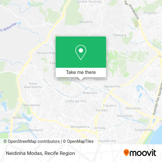
See Neidinha Modas, Olinda, on the map
Public Transit to Neidinha Modas in Olinda
Wondering how to get to Neidinha Modas in Olinda? Moovit helps you find the best way to get to Neidinha Modas with step-by-step directions from the nearest public transit station.
Moovit provides free maps and live directions to help you navigate through your city. View schedules, routes, timetables, and find out how long does it take to get to Neidinha Modas in real time.
Looking for the nearest stop or station to Neidinha Modas? Check out this list of stops closest to your destination: Rua Francisco Gomes; Estrada De Caixa D`Água; 120128 - Rua Hidelbrando De Vasconcelos 845.
Bus: 760 DOIS UNIDOS / DERBY, 800 DOIS UNIDOS / AFOGADOS, 844 SANTA CASA / TI XAMBÁ, 852 CAIXA D'ÁGUA / TI XAMBÁ, 894 TI XAMBÁ / CÓRREGO DO ABACAXI, 846 ÁGUAS COMPRIDAS (BACURAU), 741 DOIS UNIDOS, 744 DOIS UNIDOS (BACURAU), 746 ALTO DO CAPITÃO.
Want to see if there’s another route that gets you there at an earlier time? Moovit helps you find alternative routes or times. Get directions from and directions to Neidinha Modas easily from the Moovit App or Website.
We make riding to Neidinha Modas easy, which is why over 1.5 million users, including users in Olinda, trust Moovit as the best app for public transit. You don’t need to download an individual bus app or train app, Moovit is your all-in-one transit app that helps you find the best bus time or train time available.
For information on prices of bus and subway, costs and ride fares to Neidinha Modas, please check the Moovit app.
Use the app to navigate to popular places including to the airport, hospital, stadium, grocery store, mall, coffee shop, school, college, and university.
Neidinha Modas Address: Travessa Francisco Gomes, 98 Caixa d'Água Olinda-PE 53210-231 street in Olinda
- Milton Gás Ultragaz,
- Rainha do Pastel,
- Granja Bom Preco,
- Avenida Leopoldino Canudo de Melo,
- Atacarejo,
- Rosa de Saron,
- terminal de dois unidos,
- Mercadinho Confio,
- Escola Municipal Monsenhor Viana,
- Descarpack Descartáveis do Nordeste,
- Vicunha Têxtil,
- Francisco Arcanjo dos Santos Junior Comercio,
- Igreja ⛪ Assembléia de Deus,
- Thales K.C Moveis,
- DF Transportes,
- Erlange e Carmem Moveis Ltda,
- Marley,
- Lenildo Cabeleireiro,
- Travessa da Rua José Mendonça da Silva,
- Pizzaria Shallon
Places Near Neidinha Modas (Olinda)
- Shopping RioMar Recife, Pina,
- Parque da Jaqueira, Jaqueira,
- llll, Fundão,
- Hospital Altino Ventura, Iputinga,
- Shopping Recife, Boa Viagem,
- Hospital Eduardo Campus Da Pessoa Idosa, Areias,
- Arena de Pernambuco, São Lourenço Da Mata,
- tuuuuu, Olinda,
- Shopping Patteo Olinda, Olinda,
- Hospital Agamenon Magalhães, Tamarineira,
- Marco Zero, Bairro Do Recife,
- Hospital Maria Lucinda, Parnamirim,
- Hospital Universitário Oswaldo Cruz, Santo Amaro,
- hospital otavio de freitas - UTI, Tejipió,
- Centro de Convenções de Pernambuco, Olinda,
- Imip (Instituto Materno-Infantil De Pernambuco), Coelhos,
- Hospital Geral De Areias, Areias,
- Imbiribeira, Imbiribeira,
- SHOPPING GUARARAPES, Jaboatão Dos Guararapes,
- SHOPPING TACARUNA, Santo Amaro
How to get to popular places in Recife Region with public transit
Get around Olinda by public transit!
Traveling around Olinda has never been so easy. See step by step directions as you travel to any attraction, street or major public transit station. View bus and train schedules, arrival times, service alerts and detailed routes on a map, so you know exactly how to get to anywhere in Olinda.
When traveling to any destination around Olinda use Moovit's Live Directions with Get Off Notifications to know exactly where and how far to walk, how long to wait for your line, and how many stops are left. Moovit will alert you when it's time to get off — no need to constantly re-check whether yours is the next stop.
Wondering how to use public transit in Olinda or how to pay for public transit in Olinda? Moovit public transit app can help you navigate your way with public transit easily, and at minimum cost. It includes public transit fees, ticket prices, and costs. Looking for a map of Olinda public transit lines? Moovit public transit app shows all public transit maps in Olinda with all Bus, Train and Subway routes and stops on an interactive map.
Recife Region has 3 transit type(s), including: Bus, Train and Subway, operated by several transit agencies, including CBTU (Metrorec), BRT (Via Livre), Grande Recife, BORBOREMA IMPERIAL (TIP), BORBOREMA IMPERIAL (B.V), RODOVIÁRIA POTENGY, EMPRESA METROPOLITANA, CONSÓRCIO RECIFE, SÃO JUDAS TADEU, Expresso 1002, Rodotur Turismo, Complementar Recife, Sistema Municipal - Jaboatão, Sistema Municipal - Cabo and Sistema Municipal - Ipojuca