Directions to Neighborhood Properties (Charlottesville) with public transportation
The following transit lines have routes that pass near Neighborhood Properties
 Bus: AFTON EXPRESS, GREYHOUND US0600, BUCKINGHAM, 29, BUCKINGHAM.
- Train: NORTHEAST REGIONAL, CARDINAL, CRESCENT.
How to get to Neighborhood Properties by bus?
Click on the bus route to see step by step directions with maps, line arrival times and updated time schedules.
How to get to Neighborhood Properties by train?
Click on the train route to see step by step directions with maps, line arrival times and updated time schedules.
Bus stops near Neighborhood Properties in Charlottesville
Train station near Neighborhood Properties in Charlottesville
- Charlottesville Amtrak Station, 47 min walk,VIEW
Bus lines to Neighborhood Properties in Charlottesville
- BUCKINGHAM, Barracks Road Mcdonalds,VIEW
- 29, 29 North Connect,VIEW
- BUCKINGHAM, Westminster Canterbury,VIEW
- FOOTHILLS EXPRESS, Charlottesville,VIEW
- T, Inbound,VIEW
- AFTON EXPRESS, Afton Express,VIEW
- CROZET, Crozet Evening Loop,VIEW
- CROZET, Crozet Connect East,VIEW
- CROZET, Crozet Connect West,VIEW
- LOVINGSTON, Nelson Center,VIEW
- 6, Outbound,VIEW
What are the closest stations to Neighborhood Properties?
The closest stations to Neighborhood Properties are:
- Northgate Primary Care is 61 yards away, 2 min walk.
- Lee St @ Uva Cancer Center is 104 yards away, 2 min walk.
- Uva Hospital is 106 yards away, 2 min walk.
- Jpa at Uva Hospital is 225 yards away, 4 min walk.
- W Main St at 11th St Eastbound is 470 yards away, 7 min walk.
- Charlottesville Amtrak Station is 3928 yards away, 47 min walk.
Which bus lines stop near Neighborhood Properties?
These bus lines stop near Neighborhood Properties: AFTON EXPRESS, GREYHOUND US0600.
Which train line stops near Neighborhood Properties?
NORTHEAST REGIONAL (Roanoke)
What’s the nearest bus station to Neighborhood Properties in Charlottesville?
The nearest bus stations to Neighborhood Properties in Charlottesville are Northgate Primary Care, Lee St @ Uva Cancer Center and Uva Hospital. The closest one is a 2 min walk away.
What time is the first train to Neighborhood Properties in Charlottesville?
The NORTHEAST REGIONAL is the first train that goes to Neighborhood Properties in Charlottesville. It stops nearby at 10:07 AM.
What time is the last train to Neighborhood Properties in Charlottesville?
The CRESCENT is the last train that goes to Neighborhood Properties in Charlottesville. It stops nearby at 8:52 PM.
What time is the first bus to Neighborhood Properties in Charlottesville?
The AFTON EXPRESS is the first bus that goes to Neighborhood Properties in Charlottesville. It stops nearby at 6:15 AM.
What time is the last bus to Neighborhood Properties in Charlottesville?
The T is the last bus that goes to Neighborhood Properties in Charlottesville. It stops nearby at 10:15 PM.
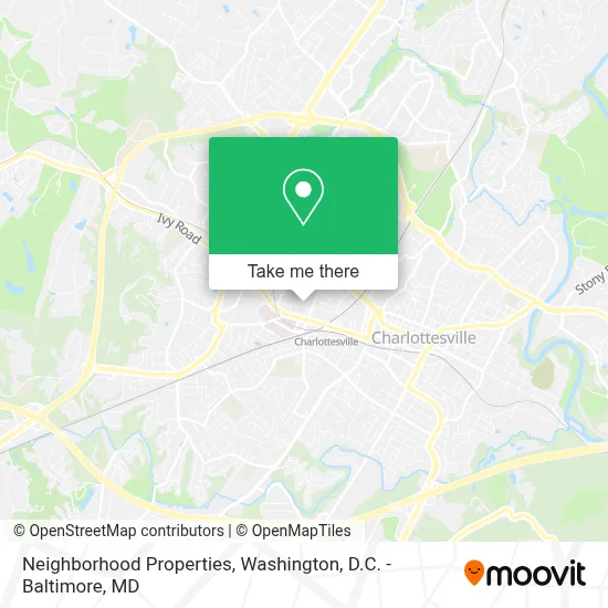
See Neighborhood Properties, Charlottesville, on the map
Public Transit to Neighborhood Properties in Charlottesville
Wondering how to get to Neighborhood Properties in Charlottesville? Moovit helps you find the best way to get to Neighborhood Properties with step-by-step directions from the nearest public transit station.
Moovit provides free maps and live directions to help you navigate through your city. View schedules, routes, timetables, and find out how long does it take to get to Neighborhood Properties in real time.
Looking for the nearest stop or station to Neighborhood Properties? Check out this list of stops closest to your destination: Northgate Primary Care; Lee St @ Uva Cancer Center; Uva Hospital; Jpa at Uva Hospital; W Main St at 11th St Eastbound; Charlottesville Amtrak Station.
Bus: AFTON EXPRESS, GREYHOUND US0600, BUCKINGHAM, 29, BUCKINGHAM, FOOTHILLS EXPRESS, T, CROZET, CROZET, CROZET, 6.Train: NORTHEAST REGIONAL, CARDINAL, CRESCENT.
Want to see if there’s another route that gets you there at an earlier time? Moovit helps you find alternative routes or times. Get directions from and directions to Neighborhood Properties easily from the Moovit App or Website.
We make riding to Neighborhood Properties easy, which is why over 1.7 million users, including users in Charlottesville, trust Moovit as the best app for public transit. You don’t need to download an individual bus app or train app, Moovit is your all-in-one transit app that helps you find the best bus time or train time available.
For information on prices of bus and train, costs and ride fares to Neighborhood Properties, please check the Moovit app.
Use the app to navigate to popular places including to the airport, hospital, stadium, grocery store, mall, coffee shop, school, college, and university.
Neighborhood Properties Address: 1025 Wertland St street in Charlottesville
- The Wertland Apartments,
- University Apartments,
- 1029 Wertland Street Apartments,
- Ten-Ten Apartments,
- Dovecote on Wertland Apartments,
- Well House Café,
- The Fred Apartments,
- Stacey Hall,
- Red Hub Food Co.,
- Courtyard Marriott Parking,
- Cville Classic Cars,
- Ubike Bike Share,
- Vowles House,
- Wellington Court Apartments,
- Courtyard Charlottesville - University Medical Center,
- Livers House,
- Mudhouse Coffee,
- An-Noor Educational Foundation And Islamic Study Center,
- Wertland Street Historic District,
- Habitat For Humanity
Places Near Neighborhood Properties (Charlottesville)
- National Museum of African American History and Culture, Washington,
- Pennsylvania Ave NW (3rd st and pennsylvania), Washington,
- Camden Yards, Baltimore,
- Westfield Montgomery Mall, Montgomery County,
- M&T Bank Stadium, Baltimore,
- Amazon Hq2, Arlington County,
- Georgetown, Washington,
- National Zoo, Washington,
- Marriott Marquis Washington, DC, Washington,
- Sibley Memorial Hospital, Washington,
- Rock Creek Tennis Center, Washington,
- PG Mall, Prince George's County,
- Warner Theatre, Washington,
- Museum Of The Bible, Washington,
- Basilica of the National Shrine, Washington,
- Capital One Arena, Washington,
- National Theatre, Washington,
- The Anthem, Washington,
- Washington National Cathedral, Washington,
- Washington DC VA Medical Center, Washington
How to get to popular places in Washington, D.C. - Baltimore, MD with public transit
Get around Charlottesville by public transit!
Traveling around Charlottesville has never been so easy. See step by step directions as you travel to any attraction, street or major public transit station. View bus and train schedules, arrival times, service alerts and detailed routes on a map, so you know exactly how to get to anywhere in Charlottesville.
When traveling to any destination around Charlottesville use Moovit's Live Directions with Get Off Notifications to know exactly where and how far to walk, how long to wait for your line, and how many stops are left. Moovit will alert you when it's time to get off — no need to constantly re-check whether yours is the next stop.
Wondering how to use public transit in Charlottesville or how to pay for public transit in Charlottesville? Moovit public transit app can help you navigate your way with public transit easily, and at minimum cost. It includes public transit fees, ticket prices, and costs. Looking for a map of Charlottesville public transit lines? Moovit public transit app shows all public transit maps in Charlottesville with all Bus, Train, Metro, Light Rail and Ferry routes and stops on an interactive map.
Washington, D.C. - Baltimore, MD has 5 transit type(s), including: Bus, Train, Metro, Light Rail and Ferry, operated by several transit agencies, including WMATA, Montgomery County Ride On, Fairfax Connector, TheBus, PRTC, DASH - Alexandria, Arlington Transit (ART), RTA of Central Maryland, MDOT MTA, MDOT MTA Light RailLink, MDOT MTA Commuter Bus, MDOT MTA Local Bus, FXBGO!, Virginia Railway Express (VRE) and MARC