How to get to Neil Miransky, do by bus?
Click on the bus route to see step by step directions with maps, line arrival times and updated time schedules.
From Coconut Grove Arts Festival, Miami
42 minFrom Red Coach, Miami
90 minFrom Little Havana To Go, Miami
83 minFrom Calle Ocho, Miami
84 minFrom DoubleTree by Hilton Hotel Miami Airport & Convention Center, North Westside
44 minFrom Colombian Consulate, Miami
49 minFrom Sam's Club, North Westside
76 minFrom Miracle Mile & Downtown Coral Gables, Miami
46 minFrom Mt Sinai Medical Center, Miami
51 minFrom Florida International University-Modesto A. Maidique Campus, South Westside
63 min
How to get to Neil Miransky, do by train?
Click on the train route to see step by step directions with maps, line arrival times and updated time schedules.
Bus stops near Neil Miransky, do in Miami
Train station near Neil Miransky, do in Miami
- Dadeland South, 21 min walk,VIEW
Bus lines to Neil Miransky, do in Miami
What are the closest stations to Neil Miransky, do?
The closest stations to Neil Miransky, do are:
- Sw 72 St & Sw 62 Pl is 245 yards away, 4 min walk.
- Sw 72 St @ Sw 61 Ct is 341 yards away, 5 min walk.
- S Dixie Hwy & Sw 70 St is 925 yards away, 12 min walk.
- Dadeland South is 1736 yards away, 21 min walk.
Which bus lines stop near Neil Miransky, do?
These bus lines stop near Neil Miransky, do: 37, 72, 73.
Which train lines stop near Neil Miransky, do?
These train lines stop near Neil Miransky, do: GREEN, ORANGE.
What’s the nearest train station to Neil Miransky, do in Miami?
The nearest train station to Neil Miransky, do in Miami is Dadeland South. It’s a 21 min walk away.
What’s the nearest bus station to Neil Miransky, do in Miami?
The nearest bus station to Neil Miransky, do in Miami is Sw 72 St & Sw 62 Pl. It’s a 4 min walk away.
What time is the first train to Neil Miransky, do in Miami?
The GREEN is the first train that goes to Neil Miransky, do in Miami. It stops nearby at 5:00 AM.
What time is the last train to Neil Miransky, do in Miami?
The GREEN is the last train that goes to Neil Miransky, do in Miami. It stops nearby at 1:04 AM.
What time is the first bus to Neil Miransky, do in Miami?
The 400 is the first bus that goes to Neil Miransky, do in Miami. It stops nearby at 3:25 AM.
What time is the last bus to Neil Miransky, do in Miami?
The 400 is the last bus that goes to Neil Miransky, do in Miami. It stops nearby at 2:28 AM.
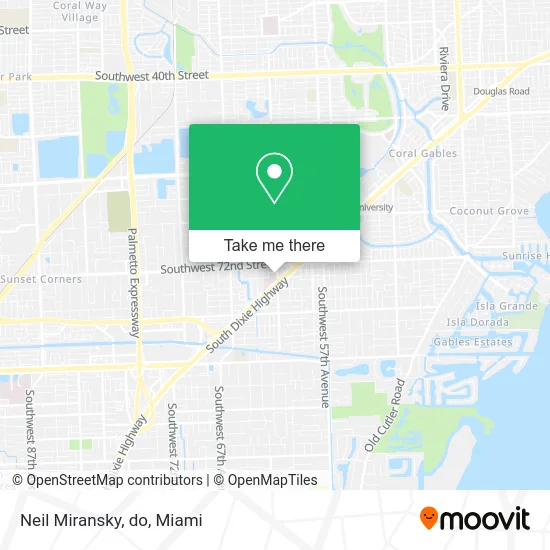
See Neil Miransky, do, Miami, on the map
Public Transit to Neil Miransky, do in Miami
Wondering how to get to Neil Miransky, do in Miami? Moovit helps you find the best way to get to Neil Miransky, do with step-by-step directions from the nearest public transit station.
Moovit provides free maps and live directions to help you navigate through your city. View schedules, routes, timetables, and find out how long does it take to get to Neil Miransky, do in real time.
Looking for the nearest stop or station to Neil Miransky, do? Check out this list of stops closest to your destination: Sw 72 St & Sw 62 Pl; Sw 72 St @ Sw 61 Ct; S Dixie Hwy & Sw 70 St; Dadeland South.
Bus: 37, 72, 73, 400.Train: GREEN, ORANGE.
Want to see if there’s another route that gets you there at an earlier time? Moovit helps you find alternative routes or times. Get directions from and directions to Neil Miransky, do easily from the Moovit App or Website.
We make riding to Neil Miransky, do easy, which is why over 1.5 million users, including users in Miami, trust Moovit as the best app for public transit. You don’t need to download an individual bus app or train app, Moovit is your all-in-one transit app that helps you find the best bus time or train time available.
For information on prices of bus, train and light rail, costs and ride fares to Neil Miransky, do, please check the Moovit app.
Use the app to navigate to popular places including to the airport, hospital, stadium, grocery store, mall, coffee shop, school, college, and university.
Neil Miransky, do Address: 6200 SW 73rd St South Miami, FL 33143 street in Miami
- Steven J Olszewski MD,
- Benjamin and Blank,
- Addiction Treatment Program,
- SMH Lobby Coffee,
- Glenda Muguruza, MD,
- Miami VIP Surgery,
- South Miami Hospital, Main Entrance - Valet,
- au bon pain,
- United Community ATM,
- Anesthesia Assoc of Greater Mmi PA,
- Baptist Health South Florida South Miami Hospital,
- Dr. Alejandro Jose Centurion, M.D.,
- Miami Cancer Institute South Miami,
- Camila Masias, MD,
- Dr Siddhartha Venkatappa MD,
- Dr. Christopher William Hodgkins MD,
- Thomas Philip San Giovanni, MD,
- Jorge L Gomez,
- Bryon Anderson Tompkins, MD,
- Mosa Surgery
Places Near Neil Miransky, do (Miami)
- Marlins Park, Miami,
- Port of Miami Cruise Terminal, Miami,
- Brickell City Centre, Miami,
- Aventura Mall, Miami Beach,
- Sawgrass mall ( FL ), Miami Beach,
- Keiser University Flagship Campus, West Palm Beach,
- Little Havana, Miami,
- Zoo Miami, Miami,
- Sawgrass Mall, Miami,
- Bayside Marketplace, Miami,
- Hard Rock Stadium, Miami Gardens,
- Wynwood, Miami,
- Richard E. Gerstein Justice Building, Miami,
- Miami VA Hospital, Miami,
- Aventura Mall, Miami,
- Dolphin Mall, Miami,
- Miami Freedom Park, Miami,
- Dolphin Mall Bus, Miami,
- Miami Design District, Miami,
- Miami-Dade County Courthouse, Miami
How to get to popular places in Miami with public transit
Get around Miami by public transit!
Traveling around Miami has never been so easy. See step by step directions as you travel to any attraction, street or major public transit station. View bus and train schedules, arrival times, service alerts and detailed routes on a map, so you know exactly how to get to anywhere in Miami.
When traveling to any destination around Miami use Moovit's Live Directions with Get Off Notifications to know exactly where and how far to walk, how long to wait for your line, and how many stops are left. Moovit will alert you when it's time to get off — no need to constantly re-check whether yours is the next stop.
Wondering how to use public transit in Miami or how to pay for public transit in Miami? Moovit public transit app can help you navigate your way with public transit easily, and at minimum cost. It includes public transit fees, ticket prices, and costs. Looking for a map of Miami public transit lines? Moovit public transit app shows all public transit maps in Miami with all Bus, Train, Light Rail and Ferry routes and stops on an interactive map.
Miami has 4 transit type(s), including: Bus, Train, Light Rail and Ferry, operated by several transit agencies, including Broward County Transit, Miami-Dade Transit, Metrorail, Palm Tran, Tri-Rail, Brightline, MARTY, City of Homestead Trolley, Key West Transit, Treasure Coast Connector, GoLine IRT, Amtrak, Greyhound-us, FlixBus-us and Aventura Express Shuttle Bus