Directions to Neoit (Novo Mundo) with public transportation
The following transit lines have routes that pass near Neoit
How to get to Neoit by bus?
Click on the bus route to see step by step directions with maps, line arrival times and updated time schedules.
From Hospital Ônix Mateus Leme, Bom Retiro
50 minFrom Alameda Princesa Izabel, Bigorrilho
37 minFrom Av. João Gualberto, 623, Alto Da Glória
44 minFrom Electrolux Do Brasil Sa, Guabirotuba
48 minFrom Hipermercado Condor Cajuru, Cajuru
70 minFrom Rua Silveira Peixoto 1040, Batel
24 minFrom Rua Delegado Leopoldo Belczak, Capão Da Imbúia
54 minFrom Rua Natal, Cajuru
69 minFrom Parque São José, São José Dos Pinhais
94 minFrom Rua Visconde de Nácar, Centro
31 min
Bus stops near Neoit in Novo Mundo
Bus lines to Neoit in Novo Mundo
- 673 FORMOSA, Formosa → Praça Rui Barbosa,VIEW
- 020 INTERBAIRROS II (HORÁRIO), Capão Raso → Campina do Siqueira,VIEW
- 027 CAPÃO RASO / CAMPINA DO SIQUEIRA, Terminal Capão Raso → Terminal Campina Do Siqueira,VIEW
- 021 INTERBAIRROS II (ANTI-HORÁRIO), Campina do Siqueira → Capão Raso,VIEW
- 620 SANTA CRUZ, Senador Accioly Filho → Terminal Capão Raso,VIEW
- 654 CAMPO ALEGRE, Terminal CIC → Terminal Capão Raso,VIEW
- 828 CAMPO COMPRIDO / CAPÃO RASO, Terminal Capão Raso → Terminal Campo Comprido,VIEW
- 831 FAZENDINHA / CAPÃO RASO, Terminal Fazendinha → Terminal Capão Raso,VIEW
- 615 UBERLÂNDIA, Terminal Portão ↺ Uberlândia (Circular),VIEW
What are the closest stations to Neoit?
The closest stations to Neoit are:
- Rua Pedro Zagonel, 754 is 251 meters away, 4 min walk.
- R. Sebastião Malucelli, 794 is 264 meters away, 4 min walk.
- R. Sebastião Malucelli, 736 is 300 meters away, 5 min walk.
- R. Deputado Waldemiro Pedroso, 781 is 329 meters away, 5 min walk.
- Rua João Surian, Mercado Feliz is 522 meters away, 7 min walk.
Which bus lines stop near Neoit?
These bus lines stop near Neoit: 020 INTERBAIRROS II (HORÁRIO), 673 FORMOSA.
What’s the nearest bus station to Neoit in Novo Mundo?
The nearest bus stations to Neoit in Novo Mundo are Rua Pedro Zagonel, 754 and R. Sebastião Malucelli, 794. The closest one is a 4 min walk away.
What time is the first bus to Neoit in Novo Mundo?
The 654 CAMPO ALEGRE is the first bus that goes to Neoit in Novo Mundo. It stops nearby at 5:13 AM.
What time is the last bus to Neoit in Novo Mundo?
The 673 FORMOSA is the last bus that goes to Neoit in Novo Mundo. It stops nearby at 12:35 AM.
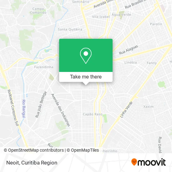
See Neoit, Novo Mundo, on the map
Public Transit to Neoit in Novo Mundo
Wondering how to get to Neoit in Novo Mundo? Moovit helps you find the best way to get to Neoit with step-by-step directions from the nearest public transit station.
Moovit provides free maps and live directions to help you navigate through your city. View schedules, routes, timetables, and find out how long does it take to get to Neoit in real time.
Looking for the nearest stop or station to Neoit? Check out this list of stops closest to your destination: Rua Pedro Zagonel; R. Sebastião Malucelli; R. Sebastião Malucelli; R. Deputado Waldemiro Pedroso; Rua João Surian.
Bus: 020 INTERBAIRROS II (HORÁRIO), 673 FORMOSA, 027 CAPÃO RASO / CAMPINA DO SIQUEIRA, 021 INTERBAIRROS II (ANTI-HORÁRIO), 620 SANTA CRUZ, 654 CAMPO ALEGRE, 828 CAMPO COMPRIDO / CAPÃO RASO, 831 FAZENDINHA / CAPÃO RASO, 615 UBERLÂNDIA.
Want to see if there’s another route that gets you there at an earlier time? Moovit helps you find alternative routes or times. Get directions from and directions to Neoit easily from the Moovit App or Website.
We make riding to Neoit easy, which is why over 1.5 million users, including users in Novo Mundo, trust Moovit as the best app for public transit. You don’t need to download an individual bus app or train app, Moovit is your all-in-one transit app that helps you find the best bus time or train time available.
For information on prices of bus, costs and ride fares to Neoit, please check the Moovit app.
Use the app to navigate to popular places including to the airport, hospital, stadium, grocery store, mall, coffee shop, school, college, and university.
Neoit Address: Rua Gustavo Schier, 794 Novo Mundo Curitiba-PR 81050-130 street in Novo Mundo
- Bistrocke,
- Veiga Mimos,
- Chute Boxe - Capão Raso,
- Rua Primo Lourenço Tosin,
- Ale Marketing Direto,
- Fenix Solucao,
- Mv Transportes,
- Encanto de Bellas,
- Alig S Confecções,
- Contasiak,
- Jna - Empreendimentos Imobiliários,
- J Carneiro Confeccoes,
- Minha Sala,
- Sol e Lua - Moda Feminina,
- Comércio de Madeiras da Ronda,
- Rocketlab Technologies,
- Residencial Newcastle,
- R.G.S Servicos Administrativos,
- Prisma Contábil,
- Jessicazilli
Places Near Neoit (Novo Mundo)
- Hhhhh, Fazendinha,
- Hospital Universitário Evangélico de Curitiba, Bigorrilho,
- Hospital Erasto Gaertner, Jardim Das Américas,
- Pontifícia Universidade Católica do Paraná (PUCPR), Prado Velho,
- Rua Martim Afonso 558, Mercês,
- Park Shopping Barigüi, Mossunguê,
- Hospital do Rocio, Campo,
- Rua General Mário Tourinho, Campina Do Siqueira,
- Hospital Madalena Sofia, Bairro Alto,
- Shopping Estação, Rebouças,
- Jardim Botânico de Curitiba PR, Centro,
- Parque Barigui, Mercês,
- Jockey Plaza Shopping Center, Tarumã,
- Hospital Angelina Caron, Campina Grande Do Sul,
- Arena Da Baixada - Curitiba,
- Shopping Palladium, Portão,
- Hospital Da Cruz Vermelha, Batel,
- Hospital Nossa Senhora Das Graças, Mercês,
- Hospital de Clínicas (HC - UFPR), Centro,
- Campo Largo, Campo
How to get to popular places in Curitiba Region with public transit
Get around Novo Mundo by public transit!
Traveling around Novo Mundo has never been so easy. See step by step directions as you travel to any attraction, street or major public transit station. View bus and train schedules, arrival times, service alerts and detailed routes on a map, so you know exactly how to get to anywhere in Novo Mundo.
When traveling to any destination around Novo Mundo use Moovit's Live Directions with Get Off Notifications to know exactly where and how far to walk, how long to wait for your line, and how many stops are left. Moovit will alert you when it's time to get off — no need to constantly re-check whether yours is the next stop.
Wondering how to use public transit in Novo Mundo or how to pay for public transit in Novo Mundo? Moovit public transit app can help you navigate your way with public transit easily, and at minimum cost. It includes public transit fees, ticket prices, and costs. Looking for a map of Novo Mundo public transit lines? Moovit public transit app shows all public transit maps in Novo Mundo with all Bus and Cable Car routes and stops on an interactive map.
Curitiba Region has 2 transit type(s), including: Bus and Cable Car, operated by several transit agencies, including Sistema Integrado de Mobilidade (URBS), Sistema Integrado de Mobilidade (AMEP), URBS (Cartões bancários e Dinheiro), URBS (Cartões bancários / Cartão URBS), AMEP (Cartões bancários / Cartão MetroCard), AMEP (Cartões bancários / Cartão MetroCard / Dinheiro), Viação Colombo (Dinheiro), TRIAR (Cartão TRIAR / Dinheiro), Empresa Curitiba Cerro Azul (Dinheiro), Expresso Nossa Senhora da Penha (Dinheiro), Empresa Campo Alto Tijucas (Dinheiro), Auto Viação São José (Cartão VEM / Dinheiro), BRT S/A (Cartão VEM / Dinheiro), TransPiedade (Cartão Cidadão / Dinheiro) and Oceânica Sul (Cartão Transporte / Dinheiro)