How to get to Net Icono by bus?
Click on the bus route to see step by step directions with maps, line arrival times and updated time schedules.
From Universidad Camilo José Cela (UCJC), Villanueva De La Cañada
59 minFrom Hospital Universitario Puerta de Hierro, Majadahonda
49 minFrom Autovía A-6 Km 20, Las Rozas De Madrid
30 minFrom Fremap Majadahonda, Majadahonda
51 minFrom Costco Wholesale, Las Rozas De Madrid
20 minFrom Gran Plaza 2 Majadahonda, Área Metropolitana De Madrid Y Corredor Del Henares
56 minFrom Mercadillo de Majadahonda, Majadahonda
47 minFrom Hospital De Majadahonda Fremap, Área Metropolitana De Madrid Y Corredor Del Henares
54 minFrom Polígono Európolis, Las Rozas De Madrid
40 minFrom Carril Bus-VAO A-6, Las Rozas De Madrid
53 min
How to get to Net Icono by train?
Click on the train route to see step by step directions with maps, line arrival times and updated time schedules.
Bus stops near Net Icono in Las Rozas De Madrid
Train station near Net Icono in Las Rozas De Madrid
- Las Matas, 27 min walk,VIEW
Bus lines to Net Icono in Las Rozas De Madrid
- 620, Las Matas - Hospital Puerta de Hierro,VIEW
- 622, Madrid (Moncloa) - Las Rozas - Las Matas,VIEW
- 2, Las Rozas - Monte Rozas - El Encinar,VIEW
- 611, Madrid (Moncloa) - Hoyo de Manzanares,VIEW
- 613, Madrid (Moncloa) - Torrelodones (por Centro Comercial),VIEW
- 625, Madrid (Moncloa) - Monte Rozas,VIEW
- 684, Madrid (Moncloa) - Cercedilla (por Guadarrama),VIEW
- 685, Majadahonda (Hospital) - Las Rozas - Guadarrama,VIEW
- 686, Madrid (Moncloa) - Torrelodones (por Los Peñascales),VIEW
- 691, Madrid (Moncloa) - Becerril - Navacerrada - Valdesquí,VIEW
- 611A, Madrid (Moncloa) - Hoyo de Manzanares (por Urb. Las Colinas),VIEW
- 686A, Madrid (Moncloa) - Torrelodones (por Montealegre),VIEW
- N602, Madrid (Moncloa) - Collado Villalba - Guadarrama,VIEW
- N903, Madrid (Moncloa) - Las Rozas - Monte Rozas,VIEW
What are the closest stations to Net Icono?
The closest stations to Net Icono are:
- Zamora - San José Del Pedrosillo is 225 meters away, 4 min walk.
- Ctra. A-6 - Urb. Encinar De Las Rozas is 938 meters away, 13 min walk.
- Las Matas is 2093 meters away, 27 min walk.
Which bus lines stop near Net Icono?
These bus lines stop near Net Icono: 622, 625, 685.
Which train lines stop near Net Icono?
These train lines stop near Net Icono: C10, C8B.
What’s the nearest train station to Net Icono in Las Rozas De Madrid?
The nearest train station to Net Icono in Las Rozas De Madrid is Las Matas. It’s a 27 min walk away.
What’s the nearest bus station to Net Icono in Las Rozas De Madrid?
The nearest bus station to Net Icono in Las Rozas De Madrid is Zamora - San José Del Pedrosillo. It’s a 4 min walk away.
What time is the first train to Net Icono in Las Rozas De Madrid?
The C8A is the first train that goes to Net Icono in Las Rozas De Madrid. It stops nearby at 6:10 AM.
What time is the last train to Net Icono in Las Rozas De Madrid?
The C8A is the last train that goes to Net Icono in Las Rozas De Madrid. It stops nearby at 12:07 AM.
What time is the first bus to Net Icono in Las Rozas De Madrid?
The 691 is the first bus that goes to Net Icono in Las Rozas De Madrid. It stops nearby at 3:34 AM.
What time is the last bus to Net Icono in Las Rozas De Madrid?
The N602 is the last bus that goes to Net Icono in Las Rozas De Madrid. It stops nearby at 2:49 AM.
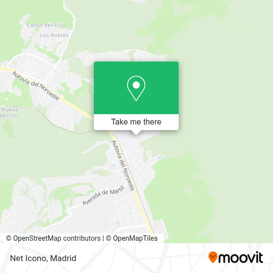
See Net Icono, Las Rozas De Madrid, on the map
Public Transit to Net Icono in Las Rozas De Madrid
Wondering how to get to Net Icono in Las Rozas De Madrid? Moovit helps you find the best way to get to Net Icono with step-by-step directions from the nearest public transit station.
Moovit provides free maps and live directions to help you navigate through your city. View schedules, routes, timetables, and find out how long does it take to get to Net Icono in real time.
Looking for the nearest stop or station to Net Icono? Check out this list of stops closest to your destination: Zamora - San José Del Pedrosillo; Ctra. A-6 - Urb. Encinar De Las Rozas; Las Matas.
Bus: 622, 625, 685, 620, 2, 611, 613, 684.Train: C10, C8B, C8A, REG, REG.
Want to see if there’s another route that gets you there at an earlier time? Moovit helps you find alternative routes or times. Get directions from and directions to Net Icono easily from the Moovit App or Website.
We make riding to Net Icono easy, which is why over 1.5 million users, including users in Las Rozas De Madrid, trust Moovit as the best app for public transit. You don’t need to download an individual bus app or train app, Moovit is your all-in-one transit app that helps you find the best bus time or train time available.
For information on prices of bus and train, costs and ride fares to Net Icono, please check the Moovit app.
Use the app to navigate to popular places including to the airport, hospital, stadium, grocery store, mall, coffee shop, school, college, and university.
Net Icono Address: Calle Castilla, 17 28290 Las Matas Las Rozas de Madrid street in Las Rozas De Madrid
- Chalets y Contratas,
- Naturcel,
- Calle San José del Pedrosillo,
- Bar La Ponderosa,
- Licencia 8293,
- Hayman Woodbury Moira,
- Mediterráneo Buying Agency,
- Circus,
- El Jamoncito,
- Boxymi,
- Desiree Arjonilla Martin,
- Pisa Fuerte,
- Marco Aldany,
- Yogeshwari Yoga y Pilates en Las Rozas,
- Calle Albacete 2,
- Grupoglobo,
- Go Sushing,
- Clínica Geriátrica Las Matas,
- Barrio Obrero Las Matas,
- Saludpsic
Places Near Net Icono (Las Rozas De Madrid)
- Sala La Riviera, Madrid,
- Plaza Mayor, Madrid,
- Mercadillo de Majadahonda, Majadahonda,
- Palacio De Vistalegre, Área Metropolitana De Madrid Y Corredor Del Henares,
- Centro Comercial Islazul, Área Metropolitana De Madrid Y Corredor Del Henares,
- Centro Comercial La Gavia, Área Metropolitana De Madrid Y Corredor Del Henares,
- Centro Comercial La Vaguada, Área Metropolitana De Madrid Y Corredor Del Henares,
- Centro Comercial Oasiz Madrid, Área Metropolitana De Madrid Y Corredor Del Henares,
- Estadio Wanda Metropolitano, Área Metropolitana De Madrid Y Corredor Del Henares,
- Estacion de Chamartin, Madrid,
- Mendez Alvaro, Madrid,
- Plenilunio, Área Metropolitana De Madrid Y Corredor Del Henares,
- Wizink Center, Madrid,
- Rastro De Madrid, Área Metropolitana De Madrid Y Corredor Del Henares,
- Hospital Universitario La Paz, Madrid,
- Nassica, Área Metropolitana De Madrid Y Corredor Del Henares,
- Hospital Clínico Universitario San Carlos, Madrid,
- Hospital Universitario Ramón y Cajal, Madrid,
- Calle de López de Hoyos 169, Madrid,
- Tres Aguas, Alcorcón
How to get to popular places in Madrid with public transit
Get around Las Rozas De Madrid by public transit!
Traveling around Las Rozas De Madrid has never been so easy. See step by step directions as you travel to any attraction, street or major public transit station. View bus and train schedules, arrival times, service alerts and detailed routes on a map, so you know exactly how to get to anywhere in Las Rozas De Madrid.
When traveling to any destination around Las Rozas De Madrid use Moovit's Live Directions with Get Off Notifications to know exactly where and how far to walk, how long to wait for your line, and how many stops are left. Moovit will alert you when it's time to get off — no need to constantly re-check whether yours is the next stop.
Wondering how to use public transit in Las Rozas De Madrid or how to pay for public transit in Las Rozas De Madrid? Moovit public transit app can help you navigate your way with public transit easily, and at minimum cost. It includes public transit fees, ticket prices, and costs. Looking for a map of Las Rozas De Madrid public transit lines? Moovit public transit app shows all public transit maps in Las Rozas De Madrid with all Bus, Train, Metro and Light Rail routes and stops on an interactive map.
Madrid has 4 transit type(s), including: Bus, Train, Metro and Light Rail, operated by several transit agencies, including Metro de Madrid, Metro Ligero, Tranvía de Parla, Renfe Cercanías - Servicios de Autobús especiales, Renfe Cercanias, Renfe Cercanías, EMT, Interurbanos, Urbanos de Alcalá de Henares, Urbanos de Alcobendas, Urbanos de Alcorcón, Urbanos de Algete, Urbanos de Aranjuez, Urbanos de Arganda del Rey and Urbanos de Arroyomolinos