How to get to Netaigraf by bus?
Click on the bus route to see step by step directions with maps, line arrival times and updated time schedules.
From San Jose De Valderas, Área Metropolitana De Madrid Y Corredor Del Henares
65 minFrom Centro Comercial Tres Aguas, Área Metropolitana De Madrid Y Corredor Del Henares
60 minFrom Hospital Universitario De Móstoles., Área Metropolitana De Madrid Y Corredor Del Henares
45 minFrom Tanatorio Getafe, Getafe
88 minFrom Cobo Calleja, Fuenlabrada
60 minFrom Parque Polvoranca, Leganés
76 minFrom La Cubierta de Leganés, Leganés
80 minFrom Universidad Rey Juan Carlos, Área Metropolitana De Madrid Y Corredor Del Henares
73 minFrom Loranca, Área Metropolitana De Madrid Y Corredor Del Henares
70 minFrom Centro Comercial Tres Aguas (Tresaguas), Alcorcón
58 min
How to get to Netaigraf by train?
Click on the train route to see step by step directions with maps, line arrival times and updated time schedules.
From San Jose De Valderas, Área Metropolitana De Madrid Y Corredor Del Henares
100 minFrom Centro Comercial Tres Aguas, Área Metropolitana De Madrid Y Corredor Del Henares
111 minFrom La Cubierta de Leganés, Leganés
74 minFrom Universidad Rey Juan Carlos, Área Metropolitana De Madrid Y Corredor Del Henares
112 minFrom Centro Comercial Tres Aguas (Tresaguas), Alcorcón
109 min
Train station near Netaigraf in Moraleja De Enmedio
- Humanes, 6 min walk,VIEW
Bus stops near Netaigraf in Moraleja De Enmedio
Metro station near Netaigraf in Moraleja De Enmedio
- Loranca, 26 min walk,VIEW
Bus lines to Netaigraf in Moraleja De Enmedio
What are the closest stations to Netaigraf?
The closest stations to Netaigraf are:
- Humanes is 472 meters away, 6 min walk.
- Av. Fuenlabrada - Pol. Ind. San Millán is 558 meters away, 8 min walk.
- Mirasierra - Av. Fuenlabrada is 563 meters away, 8 min walk.
- Av. Fuenlabrada - Urb. Los Olivos is 730 meters away, 10 min walk.
- Loranca is 2017 meters away, 26 min walk.
Which bus lines stop near Netaigraf?
These bus lines stop near Netaigraf: 495, 496, 497, 498.
Which train line stops near Netaigraf?
C5 (Humanes)
What’s the nearest metro station to Netaigraf in Moraleja De Enmedio?
The nearest metro station to Netaigraf in Moraleja De Enmedio is Loranca. It’s a 26 min walk away.
What’s the nearest train station to Netaigraf in Moraleja De Enmedio?
The nearest train station to Netaigraf in Moraleja De Enmedio is Humanes. It’s a 6 min walk away.
What’s the nearest bus station to Netaigraf in Moraleja De Enmedio?
The nearest bus stations to Netaigraf in Moraleja De Enmedio are Av. Fuenlabrada - Pol. Ind. San Millán and Mirasierra - Av. Fuenlabrada. The closest one is a 8 min walk away.
What time is the first metro to Netaigraf in Moraleja De Enmedio?
The M-12 is the first metro that goes to Netaigraf in Moraleja De Enmedio. It stops nearby at 6:05 AM.
What time is the last metro to Netaigraf in Moraleja De Enmedio?
The M-12 is the last metro that goes to Netaigraf in Moraleja De Enmedio. It stops nearby at 2:18 AM.
What time is the first train to Netaigraf in Moraleja De Enmedio?
The C5 is the first train that goes to Netaigraf in Moraleja De Enmedio. It stops nearby at 5:26 AM.
What time is the last train to Netaigraf in Moraleja De Enmedio?
The C5 is the last train that goes to Netaigraf in Moraleja De Enmedio. It stops nearby at 12:41 AM.
What time is the first bus to Netaigraf in Moraleja De Enmedio?
The N808 is the first bus that goes to Netaigraf in Moraleja De Enmedio. It stops nearby at 3:00 AM.
What time is the last bus to Netaigraf in Moraleja De Enmedio?
The 496 is the last bus that goes to Netaigraf in Moraleja De Enmedio. It stops nearby at 11:58 PM.
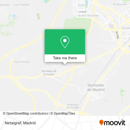
See Netaigraf, Moraleja De Enmedio, on the map
Public Transit to Netaigraf in Moraleja De Enmedio
Wondering how to get to Netaigraf in Moraleja De Enmedio? Moovit helps you find the best way to get to Netaigraf with step-by-step directions from the nearest public transit station.
Moovit provides free maps and live directions to help you navigate through your city. View schedules, routes, timetables, and find out how long does it take to get to Netaigraf in real time.
Looking for the nearest stop or station to Netaigraf? Check out this list of stops closest to your destination: Humanes; Av. Fuenlabrada - Pol. Ind. San Millán; Mirasierra - Av. Fuenlabrada; Av. Fuenlabrada - Urb. Los Olivos; Loranca.
Bus: 495, 496, 497, 498, N808.Train: C5.Metro: M-12.
Want to see if there’s another route that gets you there at an earlier time? Moovit helps you find alternative routes or times. Get directions from and directions to Netaigraf easily from the Moovit App or Website.
We make riding to Netaigraf easy, which is why over 1.5 million users, including users in Moraleja De Enmedio, trust Moovit as the best app for public transit. You don’t need to download an individual bus app or train app, Moovit is your all-in-one transit app that helps you find the best bus time or train time available.
For information on prices of bus, metro and train, costs and ride fares to Netaigraf, please check the Moovit app.
Use the app to navigate to popular places including to the airport, hospital, stadium, grocery store, mall, coffee shop, school, college, and university.
Netaigraf Address: Calle Aluminio, 73 28950 Moraleja de Enmedio street in Moraleja De Enmedio
- Serlo Vestuario,
- Calle Aluminio 63,
- Carrocerías Carralser,
- Panificadora Europa S.L.,
- Mudanzas y Guardamuebles Ambala,
- Sistemas de Autoelevacion,
- José de Paz Durán y Alejandro de Paz Durán Cdad,
- Jossan Serigrafía,
- Urbanización El Mirador,
- Lesaffre Ibérica,
- Polígono Mora, 41,
- Talleres L-Sport,
- David Rodríguez Pedroche,
- Luis León Representaciones,
- Tecnimol,
- Gutiérrez Retro y Servicios,
- Electricidad Rojas Hernández,
- Licencia,
- Siningas,
- Polígono la Mora 5
Places Near Netaigraf (Moraleja De Enmedio)
- Centro Comercial Islazul, Área Metropolitana De Madrid Y Corredor Del Henares,
- Rastro De Madrid, Área Metropolitana De Madrid Y Corredor Del Henares,
- Estacion de Chamartin, Madrid,
- Centro Comercial La Gavia, Área Metropolitana De Madrid Y Corredor Del Henares,
- Sala La Riviera, Madrid,
- Tres Aguas, Alcorcón,
- Wizink Center, Madrid,
- Hospital Clínico Universitario San Carlos, Madrid,
- Centro Comercial Oasiz Madrid, Área Metropolitana De Madrid Y Corredor Del Henares,
- Estadio Wanda Metropolitano, Área Metropolitana De Madrid Y Corredor Del Henares,
- Centro Comercial La Vaguada, Área Metropolitana De Madrid Y Corredor Del Henares,
- Mendez Alvaro, Madrid,
- Mercadillo de Majadahonda, Majadahonda,
- Palacio De Vistalegre, Área Metropolitana De Madrid Y Corredor Del Henares,
- Calle de López de Hoyos 169, Madrid,
- Plenilunio, Área Metropolitana De Madrid Y Corredor Del Henares,
- Hospital Universitario La Paz, Madrid,
- Hospital Universitario Ramón y Cajal, Madrid,
- Nassica, Área Metropolitana De Madrid Y Corredor Del Henares,
- Plaza Mayor, Madrid
How to get to popular places in Madrid with public transit
Get around Moraleja De Enmedio by public transit!
Traveling around Moraleja De Enmedio has never been so easy. See step by step directions as you travel to any attraction, street or major public transit station. View bus and train schedules, arrival times, service alerts and detailed routes on a map, so you know exactly how to get to anywhere in Moraleja De Enmedio.
When traveling to any destination around Moraleja De Enmedio use Moovit's Live Directions with Get Off Notifications to know exactly where and how far to walk, how long to wait for your line, and how many stops are left. Moovit will alert you when it's time to get off — no need to constantly re-check whether yours is the next stop.
Wondering how to use public transit in Moraleja De Enmedio or how to pay for public transit in Moraleja De Enmedio? Moovit public transit app can help you navigate your way with public transit easily, and at minimum cost. It includes public transit fees, ticket prices, and costs. Looking for a map of Moraleja De Enmedio public transit lines? Moovit public transit app shows all public transit maps in Moraleja De Enmedio with all Bus, Train, Metro and Light Rail routes and stops on an interactive map.
Madrid has 4 transit type(s), including: Bus, Train, Metro and Light Rail, operated by several transit agencies, including Metro de Madrid, Metro Ligero, Tranvía de Parla, Renfe Cercanías - Servicios de Autobús especiales, Renfe Cercanias, Renfe Cercanías, EMT, Interurbanos, Urbanos de Alcalá de Henares, Urbanos de Alcobendas, Urbanos de Alcorcón, Urbanos de Algete, Urbanos de Aranjuez, Urbanos de Arganda del Rey and Urbanos de Arroyomolinos