How to get to Netto Marken-Discount by bus?
Click on the bus route to see step by step directions with maps, line arrival times and updated time schedules.
From Amazon-DBX8, Herbrechtingen
178 minFrom Parkplatz Ratiopharm Arena, Neu-Ulm
40 minFrom Kaufland Geislingen, Vereinbarte Verwaltungsgemeinschaft Der Stadt Geislingen An Der Steige
163 minFrom Heidenheim an der Brenz, Heidenheim An Der Brenz
171 minFrom Kloster Untermarchtal, Verwaltungsgemeinschaft Munderkingen
137 min
Bus stops near Netto Marken-Discount in Staig
Bus lines to Netto Marken-Discount in Staig
What are the closest stations to Netto Marken-Discount?
The closest stations to Netto Marken-Discount are:
- Staig Harthauser Straße is 349 meters away, 5 min walk.
- Staig Ortsmitte is 637 meters away, 9 min walk.
Which bus lines stop near Netto Marken-Discount?
These bus lines stop near Netto Marken-Discount: 23, 24.
What’s the nearest bus station to Netto Marken-Discount in Staig?
The nearest bus station to Netto Marken-Discount in Staig is Staig Harthauser Straße. It’s a 5 min walk away.
What time is the first bus to Netto Marken-Discount in Staig?
The 23 is the first bus that goes to Netto Marken-Discount in Staig. It stops nearby at 5:31 AM.
What time is the last bus to Netto Marken-Discount in Staig?
The 24 is the last bus that goes to Netto Marken-Discount in Staig. It stops nearby at 10:50 PM.
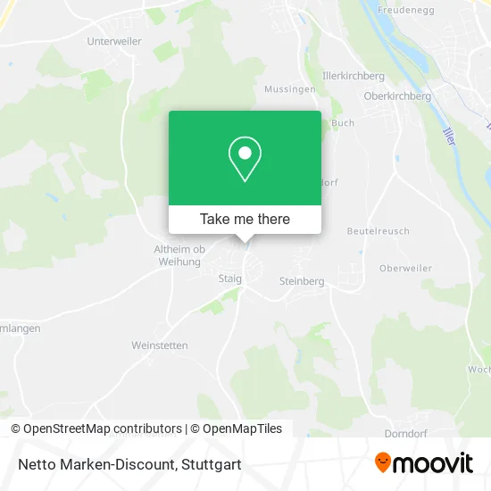
See Netto Marken-Discount, Staig, on the map
Public Transit to Netto Marken-Discount in Staig
Wondering how to get to Netto Marken-Discount in Staig? Moovit helps you find the best way to get to Netto Marken-Discount with step-by-step directions from the nearest public transit station.
Moovit provides free maps and live directions to help you navigate through your city. View schedules, routes, timetables, and find out how long does it take to get to Netto Marken-Discount in real time.
Looking for the nearest stop or station to Netto Marken-Discount? Check out this list of stops closest to your destination: Staig Harthauser Straße; Staig Ortsmitte.
Bus: 23, 24, 74.
Want to see if there’s another route that gets you there at an earlier time? Moovit helps you find alternative routes or times. Get directions from and directions to Netto Marken-Discount easily from the Moovit App or Website.
We make riding to Netto Marken-Discount easy, which is why over 1.7 million users, including users in Staig, trust Moovit as the best app for public transit. You don’t need to download an individual bus app or train app, Moovit is your all-in-one transit app that helps you find the best bus time or train time available.
For information on prices of bus and train, costs and ride fares to Netto Marken-Discount, please check the Moovit app.
Use the app to navigate to popular places including to the airport, hospital, stadium, grocery store, mall, coffee shop, school, college, and university.
Netto Marken-Discount Address: Weihungstraße 2 89195 Staig street in Staig
- Netto,
- K&U Bäckerei,
- Plu Co Immobilienvermittlungs,
- Pluco,
- Tellbach Dienstleistungen und Handel,
- Sara Catalano,
- Uwe Hörger Architekt,
- Baloise - Generalagentur Ates Görman in Staig,
- Waldkind-Desig,
- Pcr Euro Protection Car Rental,
- Auenlofts Leipzig,
- Willmann Verwaltungs,
- Willmann24 Bau,
- Hundefutter I-Feel-Good,
- Bendl Claudia Physiotherapiepraxis,
- Druckerei Pfister,
- Radiomuseum,
- Wellmentalist Maßagen und Coaching,
- a. und H. Schiele,
- Ulrike Hummel
Places Near Netto Marken-Discount (Staig)
- Pariser Platz Stuttgart, Stuttgart-Mitte,
- Wilhelma (U-Bahn Wilhelma), Bad Cannstatt,
- Waldfriedhof, Degerloch,
- Mettingen Eros-Center Puff Laufhaus, Esslingen Am Neckar,
- Geilhaus Haus 33a, Reutlingen-Betzingen,
- Gleis 101/102 (tief), Stuttgart-Mitte,
- Hauptbahnhof Stuttgart, Stuttgart-Mitte,
- Mercedes-Benz Museum, Bad Cannstatt,
- Im Wizemann (Halle), Bad Cannstatt,
- Hanns-Martin-Schleyer-Halle (Stuttgart Hans-Martin-Schleyerhalle), Bad Cannstatt,
- Gasometer Pforzheim, Pforzheim,
- SI-Centrum, Möhringen,
- Klinikum Stuttgart - Katharinenhospital, Stuttgart-Mitte,
- Porsche Museum, Zuffenhausen,
- Porsche-Arena, Bad Cannstatt,
- Schleyerhalle, Bad Cannstatt,
- FlixBus Haltestelle, Stuttgart,
- Marmorsaal Im Weissenburgpark, Stuttgart-Süd,
- Hanns-Martin-Schleyer-Halle, Bad Cannstatt,
- Mercedes-Benz Museum (Mercedes Museum Stuttgart), Bad Cannstatt
How to get to popular places in Stuttgart with public transit
Get around Staig by public transit!
Traveling around Staig has never been so easy. See step by step directions as you travel to any attraction, street or major public transit station. View bus and train schedules, arrival times, service alerts and detailed routes on a map, so you know exactly how to get to anywhere in Staig.
When traveling to any destination around Staig use Moovit's Live Directions with Get Off Notifications to know exactly where and how far to walk, how long to wait for your line, and how many stops are left. Moovit will alert you when it's time to get off — no need to constantly re-check whether yours is the next stop.
Wondering how to use public transit in Staig or how to pay for public transit in Staig? Moovit public transit app can help you navigate your way with public transit easily, and at minimum cost. It includes public transit fees, ticket prices, and costs. Looking for a map of Staig public transit lines? Moovit public transit app shows all public transit maps in Staig with all Bus, Train, Subway, Light Rail, Ferry, S-Bahn and Funicular routes and stops on an interactive map.
Stuttgart has 7 transit type(s), including: Bus, Train, Subway, Light Rail, Ferry, S-Bahn and Funicular, operated by several transit agencies, including SSB - Stadtbahn, SSB, SSB - Seilbahn / Zacke, S-Bahn Stuttgart, Rhein-Neckar-Verkehr GmbH (rnv), Karlsruher Verkehrsverbund, DB AG, DB Regiobus BW, Arverio Baden-Württemberg GmbH, DB RegioNetz Verkehrs GmbH Westfrankenbahn, DB Regio AG Baden-Württemberg, Südwestdeutsche Verkehrs-AG, DB Regio AG Mitte Region Hessen, DB and Bodensee-Oberschwaben-Bahn