How to get to Network Cabling Lauderhill by bus?
Click on the bus route to see step by step directions with maps, line arrival times and updated time schedules.
From Kamal Singh, Plantation
85 minFrom I-95, Fort Lauderdale
59 minFrom A1A, Fort Lauderdale
68 minFrom Las Olas Boulevard, Fort Lauderdale
49 minFrom Tri-Rail-Pompano Beach Station, Pompano Beach
67 minFrom Naples, Florida, Plantation
80 minFrom Las olas Blvd, Fort Lauderdale
48 minFrom Cam Transfer, Coral Springs-Margate
37 minFrom Tri-Rail-Fort Lauderdale Station, Fort Lauderdale
64 minFrom B Gruskin Arnie PA, Fort Lauderdale
61 min
How to get to Network Cabling Lauderhill by train?
Click on the train route to see step by step directions with maps, line arrival times and updated time schedules.
Bus stops near Network Cabling Lauderhill in Fort Lauderdale
Train station near Network Cabling Lauderhill in Fort Lauderdale
- Cypress Creek Station, 54 min walk,VIEW
Bus lines to Network Cabling Lauderhill in Fort Lauderdale
What are the closest stations to Network Cabling Lauderhill?
The closest stations to Network Cabling Lauderhill are:
- Powerline Road/McNab Road is 300 yards away, 4 min walk.
- McNab Road/Powerline Road is 546 yards away, 7 min walk.
- Cypress Creek Station is 4612 yards away, 54 min walk.
Which bus lines stop near Network Cabling Lauderhill?
These bus lines stop near Network Cabling Lauderhill: 14, 62.
Which train line stops near Network Cabling Lauderhill?
TRIRAIL (Northbound To Mangonia Park)
What’s the nearest bus station to Network Cabling Lauderhill in Fort Lauderdale?
The nearest bus station to Network Cabling Lauderhill in Fort Lauderdale is Powerline Road/McNab Road. It’s a 4 min walk away.
What time is the first train to Network Cabling Lauderhill in Fort Lauderdale?
The TRIRAIL is the first train that goes to Network Cabling Lauderhill in Fort Lauderdale. It stops nearby at 4:38 AM.
What time is the last train to Network Cabling Lauderhill in Fort Lauderdale?
The TRIRAIL is the last train that goes to Network Cabling Lauderhill in Fort Lauderdale. It stops nearby at 10:43 PM.
What time is the first bus to Network Cabling Lauderhill in Fort Lauderdale?
The 14 is the first bus that goes to Network Cabling Lauderhill in Fort Lauderdale. It stops nearby at 5:06 AM.
What time is the last bus to Network Cabling Lauderhill in Fort Lauderdale?
The 14 is the last bus that goes to Network Cabling Lauderhill in Fort Lauderdale. It stops nearby at 12:00 AM.
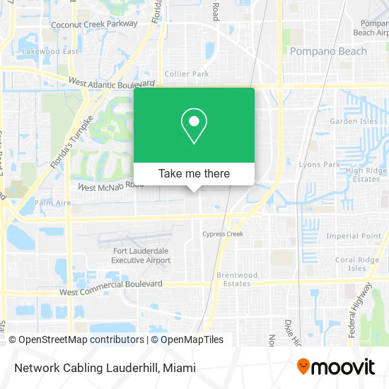
See Network Cabling Lauderhill, Fort Lauderdale, on the map
Public Transit to Network Cabling Lauderhill in Fort Lauderdale
Wondering how to get to Network Cabling Lauderhill in Fort Lauderdale? Moovit helps you find the best way to get to Network Cabling Lauderhill with step-by-step directions from the nearest public transit station.
Moovit provides free maps and live directions to help you navigate through your city. View schedules, routes, timetables, and find out how long does it take to get to Network Cabling Lauderhill in real time.
Looking for the nearest stop or station to Network Cabling Lauderhill? Check out this list of stops closest to your destination: Powerline Road/McNab Road; McNab Road/Powerline Road; Cypress Creek Station.
Bus: 14, 62.Train: TRIRAIL.
Want to see if there’s another route that gets you there at an earlier time? Moovit helps you find alternative routes or times. Get directions from and directions to Network Cabling Lauderhill easily from the Moovit App or Website.
We make riding to Network Cabling Lauderhill easy, which is why over 1.5 million users, including users in Fort Lauderdale, trust Moovit as the best app for public transit. You don’t need to download an individual bus app or train app, Moovit is your all-in-one transit app that helps you find the best bus time or train time available.
For information on prices of bus and train, costs and ride fares to Network Cabling Lauderhill, please check the Moovit app.
Use the app to navigate to popular places including to the airport, hospital, stadium, grocery store, mall, coffee shop, school, college, and university.
Network Cabling Lauderhill Address: 6555 Powerline Rd Fort Lauderdale, FL 33309 street in Fort Lauderdale
- The UPS Store,
- ACP Construction,
- Sec Purchasing Solutions,
- Pink City Beauty Supply Warehouse,
- Global Sign Studio,
- FedEx,
- Supergreen Solutions,
- Acuderm,
- Besm,
- Skilcon,
- Your First Step,
- Quality Floors & More Co.,
- The Levy Firm PLLC,
- Bioprime Medical Solutions,
- Orville Richards-Primerica Rep.,
- Barbara Flood,
- Town Locksmith,
- Casso Law,
- LOTUS Tile USA,
- Zaso Stone Group
Places Near Network Cabling Lauderhill (Fort Lauderdale)
- Wynwood, Miami,
- Sawgrass mall ( FL ), Miami Beach,
- Miami-Dade County Courthouse, Miami,
- Sawgrass Mall, Miami,
- Keiser University Flagship Campus, West Palm Beach,
- Marlins Park, Miami,
- Bayside Marketplace, Miami,
- Aventura Mall, Miami Beach,
- Zoo Miami, Miami,
- Miami Design District, Miami,
- Hard Rock Stadium, Miami Gardens,
- Miami Freedom Park, Miami,
- Dolphin Mall Bus, Miami,
- Little Havana, Miami,
- Aventura Mall, Miami,
- Miami VA Hospital, Miami,
- Brickell City Centre, Miami,
- Dolphin Mall, Miami,
- Richard E. Gerstein Justice Building, Miami,
- Port of Miami Cruise Terminal, Miami
How to get to popular places in Miami with public transit
Get around Fort Lauderdale by public transit!
Traveling around Fort Lauderdale has never been so easy. See step by step directions as you travel to any attraction, street or major public transit station. View bus and train schedules, arrival times, service alerts and detailed routes on a map, so you know exactly how to get to anywhere in Fort Lauderdale.
When traveling to any destination around Fort Lauderdale use Moovit's Live Directions with Get Off Notifications to know exactly where and how far to walk, how long to wait for your line, and how many stops are left. Moovit will alert you when it's time to get off — no need to constantly re-check whether yours is the next stop.
Wondering how to use public transit in Fort Lauderdale or how to pay for public transit in Fort Lauderdale? Moovit public transit app can help you navigate your way with public transit easily, and at minimum cost. It includes public transit fees, ticket prices, and costs. Looking for a map of Fort Lauderdale public transit lines? Moovit public transit app shows all public transit maps in Fort Lauderdale with all Bus, Train, Light Rail and Ferry routes and stops on an interactive map.
Miami has 4 transit type(s), including: Bus, Train, Light Rail and Ferry, operated by several transit agencies, including Broward County Transit, Miami-Dade Transit, Metrorail, Palm Tran, Tri-Rail, Brightline, MARTY, City of Homestead Trolley, Key West Transit, Treasure Coast Connector, GoLine IRT, Amtrak, Greyhound-us, FlixBus-us and Aventura Express Shuttle Bus