How to get to Neva Models by bus?
Click on the bus route to see step by step directions with maps, line arrival times and updated time schedules.
How to get to Neva Models by train?
Click on the train route to see step by step directions with maps, line arrival times and updated time schedules.
How to get to Neva Models by metro?
Click on the metro route to see step by step directions with maps, line arrival times and updated time schedules.
Bus stops near Neva Models in Warsaw
Light Rail stations near Neva Models in Warsaw
- Hoża, 8 min walk,VIEW
Bus lines to Neva Models in Warsaw
- 107, Esperanto,VIEW
- 108, Pl. Trzech Krzyży,VIEW
- 127, Browarna - Nowe Włochy,VIEW
- 131, Dw. Centralny - Wilanów,VIEW
- 171, Chomiczówka - Torwar,VIEW
- N33, Dw. Centralny - Zajezdnia Woronicza,VIEW
- N83, PKP Piaseczno - Dw. Centralny,VIEW
- 517, Pl. Trzech Krzyży,VIEW
- 116, Chomiczówka - Wilanów,VIEW
- 118, Mariensztat - Spartańska,VIEW
- 166, Pl. Hallera - Kabaty - STP,VIEW
- 180, Wilanów - Chomiczówka,VIEW
- 503, Konwiktorska - Natolin Płn.,VIEW
- E-2, Metro Ratusz Arsenał - Wilanów,VIEW
- 100, Dw. Centralny,VIEW
- 117, R-3 Zajezdnia Ostrobramska - Dw. Centralny,VIEW
- 128, Szczęśliwice - R-3 Zajezdnia Ostrobramska,VIEW
- 158, R-3 Zajezdnia Ostrobramska - Witolin,VIEW
- 175, Pl. Piłsudskiego - Lotnisko Chopina,VIEW
- 507, R-3 Zajezdnia Ostrobramska - Dw. Centralny,VIEW
What are the closest stations to Neva Models?
The closest stations to Neva Models are:
- Wspólna is 217 meters away, 3 min walk.
- Pl. Trzech Krzyży is 339 meters away, 5 min walk.
- Hoża is 546 meters away, 8 min walk.
- Krucza is 568 meters away, 8 min walk.
- Foksal is 718 meters away, 10 min walk.
Which bus lines stop near Neva Models?
These bus lines stop near Neva Models: 107, 116, 118, 166, 503, 525.
Which train lines stop near Neva Models?
These train lines stop near Neva Models: RL, S2.
Which metro lines stop near Neva Models?
These metro lines stop near Neva Models: M1, M2.
Which light rail lines stop near Neva Models?
These light rail lines stop near Neva Models: 16, 25.
What’s the nearest light rail station to Neva Models in Warsaw?
The nearest light rail station to Neva Models in Warsaw is Hoża. It’s a 8 min walk away.
What’s the nearest bus station to Neva Models in Warsaw?
The nearest bus station to Neva Models in Warsaw is Wspólna. It’s a 3 min walk away.
What time is the first light rail to Neva Models in Warsaw?
The 4 is the first light rail that goes to Neva Models in Warsaw. It stops nearby at 4:17 AM.
What time is the last light rail to Neva Models in Warsaw?
The 9 is the last light rail that goes to Neva Models in Warsaw. It stops nearby at 12:36 AM.
What time is the first bus to Neva Models in Warsaw?
The 118 is the first bus that goes to Neva Models in Warsaw. It stops nearby at 4:41 AM.
What time is the last bus to Neva Models in Warsaw?
The N72 is the last bus that goes to Neva Models in Warsaw. It stops nearby at 3:56 AM.
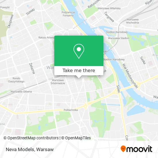
See Neva Models, Warsaw, on the map
Public Transit to Neva Models in Warsaw
Wondering how to get to Neva Models in Warsaw? Moovit helps you find the best way to get to Neva Models with step-by-step directions from the nearest public transit station.
Moovit provides free maps and live directions to help you navigate through your city. View schedules, routes, timetables, and find out how long does it take to get to Neva Models in real time.
Looking for the nearest stop or station to Neva Models? Check out this list of stops closest to your destination: Wspólna ; Pl. Trzech Krzyży; Hoża; Krucza; Foksal.
Bus: 107, 116, 118, 166, 503, 525, 108, 127, 131, 171, N33, N83, 517, 180, 100.Train: RL, S2.Metro: M1, M2.Light Rail: 16, 25.
Want to see if there’s another route that gets you there at an earlier time? Moovit helps you find alternative routes or times. Get directions from and directions to Neva Models easily from the Moovit App or Website.
We make riding to Neva Models easy, which is why over 1.5 million users, including users in Warsaw, trust Moovit as the best app for public transit. You don’t need to download an individual bus app or train app, Moovit is your all-in-one transit app that helps you find the best bus time or train time available.
For information on prices of bus, metro, light rail and train, costs and ride fares to Neva Models, please check the Moovit app.
Use the app to navigate to popular places including to the airport, hospital, stadium, grocery store, mall, coffee shop, school, college, and university.
Neva Models Address: Neva Models, ulica Wspólna, 00-505 Śródmieście street in Warsaw
- Głwny Urząd Geodezji i Kartografii,
- Wspólna 2/4,
- ul. Zurawia,
- Ts o/Warszawa,
- \Instal Amc Engineering\ sp. z o.o. Przedsiębiorstwo Budowlano-Usługowe,
- \Sushi Zushi\ Catering Karolina Wójcik,
- Cool & Chic,
- Hoża 5/7,
- Kancelaria Notarialna Notariusz Sylwester Grzebinoga Notariusz,
- Lemono Zuzanna Żółtowska,
- Paryzanka Moschino Warszawa,
- Restauracja Maghreb,
- Mood Scent Bar ul. Bracka 3,
- Veturilo 9523,
- Plac Trzech Krzyży 3/4 TOD'S,
- Mercure Grand,
- Mercure Warszawa Grand,
- Rolex,
- Hoża 11/15,
- Plac Trzech Krzyży 04
Places Near Neva Models (Warsaw)
- Domaniewska, Warsaw,
- Wołoska, Warsaw,
- Postępu, Warsaw,
- Cmentarz Bródnowski, Warsaw,
- Sejm Rp, Warsaw,
- Wołoska-Szpital 01, Warsaw,
- Torwar, Warsaw,
- Galeria Północna, Warsaw,
- Galeria Mokotów, Warsaw,
- Instytut Kardiologii w Aninie, Warsaw,
- Szpital Spartanska, Warsaw,
- Banacha - Szpital Kliniczny, Warsaw,
- Szpital Bielański, Warsaw,
- Szaserów - Szpital, Warsaw,
- Centralny Szpital Kliniczny MSWiA ul. Wołoska, Warsaw,
- Szpital Czerniakowski, Warsaw,
- Szpital Orłowskiego, Warsaw,
- PGE Narodowy, Warsaw,
- CH Arkadia, Warsaw,
- Stare Miasto, Warsaw
How to get to popular places in Warsaw with public transit
Get around Warsaw by public transit!
Traveling around Warsaw has never been so easy. See step by step directions as you travel to any attraction, street or major public transit station. View bus and train schedules, arrival times, service alerts and detailed routes on a map, so you know exactly how to get to anywhere in Warsaw.
When traveling to any destination around Warsaw use Moovit's Live Directions with Get Off Notifications to know exactly where and how far to walk, how long to wait for your line, and how many stops are left. Moovit will alert you when it's time to get off — no need to constantly re-check whether yours is the next stop.
Wondering how to use public transit in Warsaw or how to pay for public transit in Warsaw? Moovit public transit app can help you navigate your way with public transit easily, and at minimum cost. It includes public transit fees, ticket prices, and costs. Looking for a map of Warsaw public transit lines? Moovit public transit app shows all public transit maps in Warsaw with all Bus, Train, Metro, Light Rail, Ferry and Cable Car routes and stops on an interactive map.
Warsaw has 6 transit type(s), including: Bus, Train, Metro, Light Rail, Ferry and Cable Car, operated by several transit agencies, including Warszawski Transport Publiczny, Warszawska Kolej Dojazdowa, Koleje Mazowieckie, ZTP Kraków, Miasto Piastów, Miasto Ząbki, Koleje Małopolskie, Komunikacja Miejska Łomianki, Gmina Pruszków, MPK Wrocław, MZDiK Radom, UM w Grodzisku Mazowieckim, UM w Nowym Dworze Mazowieckim, UM Płońsk and Koleje Dolnośląskie