How to get to Nevada Chalk Block by bus?
Click on the bus route to see step by step directions with maps, line arrival times and updated time schedules.
From Hyde Park Middle School, Las Vegas
43 minFrom Primm Outlets, Paradise
26 minFrom VooDoo Rooftop Nightclub & Lounge, Paradise
53 minFrom University of Nevada-Las Vegas, Paradise
40 minFrom 114-115, Las Vegas
38 minFrom Madame Tussauds Las Vegas, Paradise
31 minFrom Medical Building @ 7200 Cathedral Rock, Las Vegas
55 minFrom Smoke Ranch & Tenaya, Las Vegas
62 minFrom Red Rock, Las Vegas
54 minFrom Del Sol Academy of the Performing Arts, Paradise
56 min
Bus stops near Nevada Chalk Block in Las Vegas
- Wb Clark After 4th, 2 min walk,VIEW
- Sb Las Vegas Before Clark, 4 min walk,VIEW
- Eb Bonneville After 1st, 5 min walk,VIEW
- Bonneville Transit Center Bay 1, 5 min walk,VIEW
- Bonneville Transit Center Bay 14, 5 min walk,VIEW
- Sb Casino Center After Bonneville, 5 min walk,VIEW
- Bonneville Transit Center Bay 2, 6 min walk,VIEW
- Bonneville Transit Center, 10 min walk,VIEW
Monorail station near Nevada Chalk Block in Las Vegas
- Sls Station, 22 min walk,VIEW
Bus lines to Nevada Chalk Block in Las Vegas
- 109, 109 Maryland Pkwy Southbound,VIEW
- 207, 207 Alta / Stewart Eastbound,VIEW
- 208, 208 Washington Westbound,VIEW
- 113, 113 N. Las Vegas Blvd Northbound (Ends at Craig),VIEW
- 215, 215 Bonanza Eastbound,VIEW
- CX, Centennial Express Southbound,VIEW
- 106, 106b Centennial Hills / Rancho Southbound,VIEW
- BHX, Bhx-A Boulder Hwy Express Southbound,VIEW
- 108, 108 University Center Dr. / Paradise Northbound,VIEW
- 401, 401 N. Outlets / Symphony Park,VIEW
- 105, 105 Martin L. King Southbound,VIEW
- DOWNTOWN LOOP, Loop,VIEW
What are the closest stations to Nevada Chalk Block?
The closest stations to Nevada Chalk Block are:
- Wb Clark After 4th is 132 yards away, 2 min walk.
- Sb Las Vegas Before Clark is 255 yards away, 4 min walk.
- Eb Bonneville After 1st is 332 yards away, 5 min walk.
- Bonneville Transit Center Bay 1 is 364 yards away, 5 min walk.
- Bonneville Transit Center Bay 14 is 378 yards away, 5 min walk.
- Sb Casino Center After Bonneville is 389 yards away, 5 min walk.
- Bonneville Transit Center Bay 2 is 445 yards away, 6 min walk.
- Bonneville Transit Center is 816 yards away, 10 min walk.
- Sls Station is 1818 yards away, 22 min walk.
Which bus lines stop near Nevada Chalk Block?
These bus lines stop near Nevada Chalk Block: 109, 207, 208, BHX, CX, DEUCE.
What’s the nearest bus station to Nevada Chalk Block in Las Vegas?
The nearest bus station to Nevada Chalk Block in Las Vegas is Wb Clark After 4th. It’s a 2 min walk away.
What’s the nearest Monorail station to Nevada Chalk Block in Las Vegas?
The nearest Monorail station to Nevada Chalk Block in Las Vegas is Sls Station. It’s a 22 min walk away.
What time is the first bus to Nevada Chalk Block in Las Vegas?
The 109 is the first bus that goes to Nevada Chalk Block in Las Vegas. It stops nearby at 3:00 AM.
What time is the last bus to Nevada Chalk Block in Las Vegas?
The BHX is the last bus that goes to Nevada Chalk Block in Las Vegas. It stops nearby at 4:00 AM.
What time is the first Monorail to Nevada Chalk Block in Las Vegas?
The LVM is the first Monorail that goes to Nevada Chalk Block in Las Vegas. It stops nearby at 7:00 AM.
What time is the last Monorail to Nevada Chalk Block in Las Vegas?
The LVM is the last Monorail that goes to Nevada Chalk Block in Las Vegas. It stops nearby at 12:02 AM.
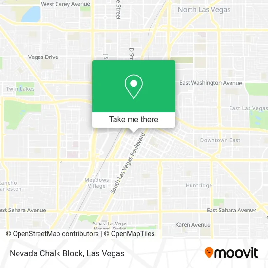
See Nevada Chalk Block, Las Vegas, on the map
Public Transit to Nevada Chalk Block in Las Vegas
Wondering how to get to Nevada Chalk Block in Las Vegas? Moovit helps you find the best way to get to Nevada Chalk Block with step-by-step directions from the nearest public transit station.
Moovit provides free maps and live directions to help you navigate through your city. View schedules, routes, timetables, and find out how long does it take to get to Nevada Chalk Block in real time.
Looking for the nearest stop or station to Nevada Chalk Block? Check out this list of stops closest to your destination: Wb Clark After 4th; Sb Las Vegas Before Clark; Eb Bonneville After 1st; Bonneville Transit Center Bay 1; Bonneville Transit Center Bay 14; Sb Casino Center After Bonneville; Bonneville Transit Center Bay 2; Bonneville Transit Center; Sls Station.
Bus: 109, 207, 208, BHX, CX, DEUCE, 113, 215, 106.Monorail: LVM.
Want to see if there’s another route that gets you there at an earlier time? Moovit helps you find alternative routes or times. Get directions from and directions to Nevada Chalk Block easily from the Moovit App or Website.
We make riding to Nevada Chalk Block easy, which is why over 1.7 million users, including users in Las Vegas, trust Moovit as the best app for public transit. You don’t need to download an individual bus app or train app, Moovit is your all-in-one transit app that helps you find the best bus time or train time available.
For information on prices of bus, costs and ride fares to Nevada Chalk Block, please check the Moovit app.
Use the app to navigate to popular places including to the airport, hospital, stadium, grocery store, mall, coffee shop, school, college, and university.
Nevada Chalk Block Address: 200 Lewis Ave street in Las Vegas
- Clark County Marriage License Bureau (Clark Cnty Marriage Services Div),
- Las Vegas Justice Court,
- Eighth Judicial District Court,
- Clark County Marriage License Bureau,
- Regional Justice Center,
- Clark County Jail,
- St Joan of Arc Catholic Church ,
- Clark County Detention Center Las Vegas,
- Lv12 Bofa Plaza DP,
- E Bonneville Ave / S Casino Center Blvd,
- Symphony Park Master Associati,
- Clark County Parking Garage,
- E Bonneville Ave / S Transit Station St,
- BTC Bay #16,
- S 1st St / E Bonneville Ave,
- 1st @ Garces (N),
- Inside the Btc,
- Laughing Station,
- Federal Courthouse,
- Golden Nugget - Gym
Places Near Nevada Chalk Block (Las Vegas)
- Las Vegas South Premium Outlets, Enterprise,
- Town Square, Enterprise,
- Gold & Silver Pawn Shop, Las Vegas,
- Allegiant Stadium, Paradise,
- Meow Wolf - Las Vegas (Meow Wolf's Omega Mart), Las Vegas,
- Area15, Las Vegas,
- Trump International Hotel Las Vegas, Paradise,
- The Neon Museum, Las Vegas,
- Las Vegas Premium Outlets-North, Enterprise,
- Arte Museum Las Vegas, Paradise,
- The Deuce Bus Stop at Fremont St, Las Vegas,
- Welcome To Fabulous Las Vegas Sign, Paradise,
- Zak Bagans Haunted Museum, Las Vegas,
- Koolsville Tattoos, Las Vegas,
- Las Vegas North Premium Outlets, Las Vegas,
- Walmart Supercenter, Las Vegas,
- Omega Mart, Las Vegas,
- Walmart, Las Vegas,
- The Palms Casino Resort, Paradise,
- Lee Canyon, Las Vegas
How to get to popular places in Las Vegas with public transit
Get around Las Vegas by public transit!
Traveling around Las Vegas has never been so easy. See step by step directions as you travel to any attraction, street or major public transit station. View bus and train schedules, arrival times, service alerts and detailed routes on a map, so you know exactly how to get to anywhere in Las Vegas.
When traveling to any destination around Las Vegas use Moovit's Live Directions with Get Off Notifications to know exactly where and how far to walk, how long to wait for your line, and how many stops are left. Moovit will alert you when it's time to get off — no need to constantly re-check whether yours is the next stop.
Wondering how to use public transit in Las Vegas or how to pay for public transit in Las Vegas? Moovit public transit app can help you navigate your way with public transit easily, and at minimum cost. It includes public transit fees, ticket prices, and costs. Looking for a map of Las Vegas public transit lines? Moovit public transit app shows all public transit maps in Las Vegas with all Bus and Monorail routes and stops on an interactive map.
Las Vegas has 2 transit type(s), including: Bus and Monorail, operated by several transit agencies, including RTCSNV, City of Las Vegas, Alvand Transportation, Vegas Airporter, Las Vegas Monorail, FlixBus-us and Greyhound-us