How to get to New Baltimore Handdance Assoc Charm City DNCRS by bus?
Click on the bus route to see step by step directions with maps, line arrival times and updated time schedules.
From I-695 @ Exit 17 (Security Blvd/MD 122)
63 minFrom Johns Hopkins Bayview Medical Center
59 minFrom Eastern Ave (eastern avenue and dundalk av)
59 minFrom Power Plant Live
41 minFrom Walmart
61 minFrom Pier Six Pavilion
47 minFrom Oriole Park At Camden Yards
53 minFrom Inner Harbor
39 minFrom I-695 Exit 29 (Loch Raven Blvd (MD 542)/Cromwell Bridge Rd)
61 minFrom I-695 @ Exit 27 (Dulaney Valley Road/MD 146)
57 min
How to get to New Baltimore Handdance Assoc Charm City DNCRS by metro?
Click on the metro route to see step by step directions with maps, line arrival times and updated time schedules.
Bus stops near New Baltimore Handdance Assoc Charm City DNCRS
Metro station near New Baltimore Handdance Assoc Charm City DNCRS
- Penn North Metro, 23 min walk,VIEW
Light Rail stations near New Baltimore Handdance Assoc Charm City DNCRS
- Woodberry, 24 min walk,VIEW
Bus lines to New Baltimore Handdance Assoc Charm City DNCRS
What are the closest stations to New Baltimore Handdance Assoc Charm City DNCRS?
The closest stations to New Baltimore Handdance Assoc Charm City DNCRS are:
- Greenspring Ave & Park Hill Ave is 272 yards away, 4 min walk.
- Greenspring Ave & Druid Park Dr FS Nb is 381 yards away, 5 min walk.
- Druid Park Dr & Greenspring Eb is 435 yards away, 6 min walk.
- Park Heights Ave & Hilldale Ave FS Nb is 1465 yards away, 18 min walk.
- Penn North Metro is 1888 yards away, 23 min walk.
- Woodberry is 1988 yards away, 24 min walk.
Which bus lines stop near New Baltimore Handdance Assoc Charm City DNCRS?
These bus lines stop near New Baltimore Handdance Assoc Charm City DNCRS: 22, 91.
Which metro line stops near New Baltimore Handdance Assoc Charm City DNCRS?
METRO (Towards Owing Mills)
What’s the nearest light rail station to New Baltimore Handdance Assoc Charm City DNCRS?
The nearest light rail station to New Baltimore Handdance Assoc Charm City DNCRS is Woodberry. It’s a 24 min walk away.
What’s the nearest metro station to New Baltimore Handdance Assoc Charm City DNCRS?
The nearest metro station to New Baltimore Handdance Assoc Charm City DNCRS is Penn North Metro. It’s a 23 min walk away.
What’s the nearest bus station to New Baltimore Handdance Assoc Charm City DNCRS?
The nearest bus station to New Baltimore Handdance Assoc Charm City DNCRS is Greenspring Ave & Park Hill Ave. It’s a 4 min walk away.
What time is the first light rail to New Baltimore Handdance Assoc Charm City DNCRS?
The LIGHT RAILLINK is the first light rail that goes to New Baltimore Handdance Assoc Charm City DNCRS. It stops nearby at 4:26 AM.
What time is the last light rail to New Baltimore Handdance Assoc Charm City DNCRS?
The LIGHT RAILLINK is the last light rail that goes to New Baltimore Handdance Assoc Charm City DNCRS. It stops nearby at 12:47 AM.
What time is the first metro to New Baltimore Handdance Assoc Charm City DNCRS?
The METRO is the first metro that goes to New Baltimore Handdance Assoc Charm City DNCRS. It stops nearby at 4:58 AM.
What time is the last metro to New Baltimore Handdance Assoc Charm City DNCRS?
The METRO is the last metro that goes to New Baltimore Handdance Assoc Charm City DNCRS. It stops nearby at 12:18 AM.
What time is the first bus to New Baltimore Handdance Assoc Charm City DNCRS?
The 22 is the first bus that goes to New Baltimore Handdance Assoc Charm City DNCRS. It stops nearby at 3:47 AM.
What time is the last bus to New Baltimore Handdance Assoc Charm City DNCRS?
The 22 is the last bus that goes to New Baltimore Handdance Assoc Charm City DNCRS. It stops nearby at 2:21 AM.
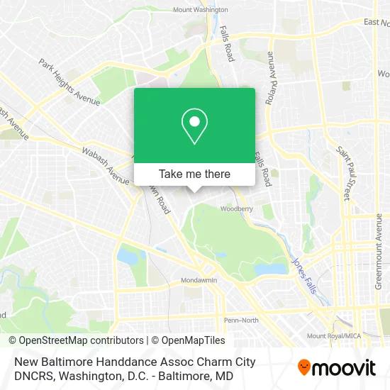
See New Baltimore Handdance Assoc Charm City DNCRS on the map
Public Transportation to New Baltimore Handdance Assoc Charm City DNCRS
Wondering how to get to New Baltimore Handdance Assoc Charm City DNCRS? Moovit helps you find the best way to get to New Baltimore Handdance Assoc Charm City DNCRS with step-by-step directions from the nearest public transit station.
Moovit provides free maps and live directions to help you navigate through your city. View schedules, routes, timetables, and find out how long does it take to get to New Baltimore Handdance Assoc Charm City DNCRS in real time.
Looking for the nearest stop or station to New Baltimore Handdance Assoc Charm City DNCRS? Check out this list of stops closest to your destination: Greenspring Ave & Park Hill Ave; Greenspring Ave & Druid Park Dr FS Nb; Druid Park Dr & Greenspring Eb; Park Heights Ave & Hilldale Ave FS Nb; Penn North Metro; Woodberry.
Bus: 22, 91, 38, 82, 85.Metro: METRO.
Want to see if there’s another route that gets you there at an earlier time? Moovit helps you find alternative routes or times. Get directions from and directions to New Baltimore Handdance Assoc Charm City DNCRS easily from the Moovit App or Website.
We make riding to New Baltimore Handdance Assoc Charm City DNCRS easy, which is why over 1.5 million users, including users in Baltimore, trust Moovit as the best app for public transit. You don’t need to download an individual bus app or train app, Moovit is your all-in-one transit app that helps you find the best bus time or train time available.
For information on prices of bus and metro, costs and ride fares to New Baltimore Handdance Assoc Charm City DNCRS, please check the Moovit app.
Use the app to navigate to popular places including to the airport, hospital, stadium, grocery store, mall, coffee shop, school, college, and university.
New Baltimore Handdance Assoc Charm City DNCRS Address: 2270 Park Hill Ave Baltimore, MD 21211 street in Baltimore
- Arbormack Tree Specialities,
- Sqe Promotions,
- Temescal Wellness,
- Johnson's Appliance Repair,
- 44 Candle,
- Gamma Graphics,
- Druid Park,
- Maggie NP Pryor Mrs,
- Speedy Heating & Cooling Repair,
- Gas Leak Detection Plumbing,
- Lamplight Inn of Balti,
- The Puptrait Studio,
- Chandra & Ryzeband,
- KB Childcare,
- Arting Gallery,
- Jessica Damen Fine Artist,
- Core Connections Yoga,
- Park Circle Historic District,
- Kind Heart Assisted Living,
- Keyser Investment Group
Places Near New Baltimore Handdance Assoc Charm City DNCRS
- PG Mall, Prince George's County,
- National Theatre, Washington,
- Washington National Cathedral, Washington,
- Warner Theatre, Washington,
- Museum Of The Bible, Washington,
- Sibley Memorial Hospital, Washington,
- Capital One Arena, Washington,
- Washington DC VA Medical Center, Washington,
- Rock Creek Tennis Center, Washington,
- M&T Bank Stadium, Baltimore,
- Camden Yards, Baltimore,
- Basilica of the National Shrine, Washington,
- Marriott Marquis Washington, DC, Washington,
- National Zoo, Washington,
- National Museum of African American History and Culture, Washington,
- Amazon Hq2, Arlington County,
- Georgetown, Washington,
- Westfield Montgomery Mall, Montgomery County,
- The Anthem, Washington,
- Pennsylvania Ave NW (3rd st and pennsylvania), Washington
How to get to popular places in Washington, D.C. - Baltimore, MD with public transit
Get around Baltimore by public transit!
Traveling around Baltimore has never been so easy. See step by step directions as you travel to any attraction, street or major public transit station. View bus and train schedules, arrival times, service alerts and detailed routes on a map, so you know exactly how to get to anywhere in Baltimore.
When traveling to any destination around Baltimore use Moovit's Live Directions with Get Off Notifications to know exactly where and how far to walk, how long to wait for your line, and how many stops are left. Moovit will alert you when it's time to get off — no need to constantly re-check whether yours is the next stop.
Wondering how to use public transit in Baltimore or how to pay for public transit in Baltimore? Moovit public transit app can help you navigate your way with public transit easily, and at minimum cost. It includes public transit fees, ticket prices, and costs. Looking for a map of Baltimore public transit lines? Moovit public transit app shows all public transit maps in Baltimore with all Bus, Train, Metro, Light Rail and Ferry routes and stops on an interactive map.
Washington, D.C. - Baltimore, MD has 5 transit type(s), including: Bus, Train, Metro, Light Rail and Ferry, operated by several transit agencies, including WMATA, Montgomery County Ride On, Fairfax Connector, TheBus, PRTC, DASH - Alexandria, Arlington Transit (ART), RTA of Central Maryland, MDOT MTA, MDOT MTA Light RailLink, MDOT MTA Commuter Bus, MDOT MTA Local Bus, FXBGO!, Virginia Railway Express (VRE) and MARC