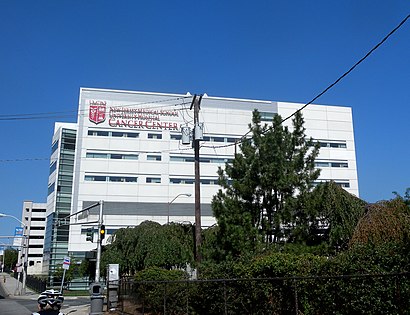
Directions to New Jersey College of Medicine and Dentistry (Newark, Nj) with public transportation
The following transit lines have routes that pass near New Jersey College of Medicine and Dentistry
How to get to New Jersey College of Medicine and Dentistry by bus?
Click on the bus route to see step by step directions with maps, line arrival times and updated time schedules.
How to get to New Jersey College of Medicine and Dentistry by train?
Click on the train route to see step by step directions with maps, line arrival times and updated time schedules.
Bus stations near New Jersey College of Medicine and Dentistry in Newark, Nj
- 12th Ave At Littleton Ave,14 min walk,
- W Market St At Wickliffe St,14 min walk,
- 9th Ave At South 16th St,32 min walk,
Light Rail stations near New Jersey College of Medicine and Dentistry in Newark, Nj
- Norfolk Street Light Rail Station,17 min walk,
Bus lines to New Jersey College of Medicine and Dentistry in Newark, Nj
- 34,34e East Orange N Park St Via Springdale Ave,
- 21,Main Street West Orange,
- 5,E Orange,
What are the closest stations to New Jersey College of Medicine and Dentistry?
The closest stations to New Jersey College of Medicine and Dentistry are:
- 12th Ave At Littleton Ave is 1112 yards away, 14 min walk.
- W Market St At Wickliffe St is 1125 yards away, 14 min walk.
- Norfolk Street Light Rail Station is 1420 yards away, 17 min walk.
- 9th Ave At South 16th St is 2653 yards away, 32 min walk.
Which bus lines stop near New Jersey College of Medicine and Dentistry?
These bus lines stop near New Jersey College of Medicine and Dentistry: 1, 99.
Which train lines stop near New Jersey College of Medicine and Dentistry?
These train lines stop near New Jersey College of Medicine and Dentistry: NC, PATH.
What’s the nearest light rail station to New Jersey College of Medicine and Dentistry in Newark, Nj?
The nearest light rail station to New Jersey College of Medicine and Dentistry in Newark, Nj is Norfolk Street Light Rail Station. It’s a 17 min walk away.
What’s the nearest bus stop to New Jersey College of Medicine and Dentistry in Newark, Nj?
The nearest bus stops to New Jersey College of Medicine and Dentistry in Newark, Nj are 12th Ave At Littleton Ave and W Market St At Wickliffe St. The closest one is a 14 min walk away.
See New Jersey College of Medicine and Dentistry, Newark, Nj, on the map
Public Transit to New Jersey College of Medicine and Dentistry in Newark, Nj
Wondering how to get to New Jersey College of Medicine and Dentistry in Newark, Nj, United States? Moovit helps you find the best way to get to New Jersey College of Medicine and Dentistry with step-by-step directions from the nearest public transit station.
Moovit provides free maps and live directions to help you navigate through your city. View schedules, routes, timetables, and find out how long does it take to get to New Jersey College of Medicine and Dentistry in real time.
Looking for the nearest stop or station to New Jersey College of Medicine and Dentistry? Check out this list of stops closest to your destination: 12th Ave At Littleton Ave; W Market St At Wickliffe St; Norfolk Street Light Rail Station; 9th Ave At South 16th St.
Bus:19921345Train:NCPATH
Want to see if there’s another route that gets you there at an earlier time? Moovit helps you find alternative routes or times. Get directions from and directions to New Jersey College of Medicine and Dentistry easily from the Moovit App or Website.
We make riding to New Jersey College of Medicine and Dentistry easy, which is why over 1.5 million users, including users in Newark, Nj, trust Moovit as the best app for public transit. You don’t need to download an individual bus app or train app, Moovit is your all-in-one transit app that helps you find the best bus time or train time available.
For information on prices of bus and train, costs and ride fares to New Jersey College of Medicine and Dentistry, please check the Moovit app.
Use the app to navigate to popular places including to the airport, hospital, stadium, grocery store, mall, coffee shop, school, college, and university.
Location: Newark, Nj, New York - New Jersey
Attractions near New Jersey College of Medicine and Dentistry
1,جامعة الطب وطب الأسنان في نيوجيرسي - مدرسة طب نيوجيرسي,Université de médecine et dodontologie du New Jersey,Campus Connect Shuttle,125,South Orange Ave South Orange Ave,185 West South Orange Avenue,Rosemary Gellene Room,# H141,# 1,Rutgers School of Health Related Professions Newark,Behavioral Health Sciences Building,150 Bergen Street,The Smith George F Library of,12th and Bruce St Gdns,183 South Orange Avenue,University Hospital - QI Department,Munchies Deli,Power Plant,Morris Ave (morris ave / 12th Ave),Morris AveHow to get to popular attractions in Newark, Nj with public transit
College Point, NY, Queens,William St, Manhattan,Las Torres Gemelas (Wtc), Manhattan,Woodbridge, NJ, Woodbridge, Nj,Pier 57, Manhattan,Flushing, Queens,Queens Center Mall, Queens,66 John Street, Manhattan,Lehman College, Bronx,Staten Island Ferry, Staten Island,25 Beaver St (Beaver St,25), Manhattan,Century 21 Department Store, Manhattan,New York Passport Agency, Manhattan,59th Street–Columbus Circle, Manhattan,Jfk Building 14, Queens,250 Vesey St, Manhattan,Gramercy Theatre, Manhattan,26 Federal Plaza, Manhattan,General Consulate Guatemala, Manhattan,Barclays CenterGet around Newark, Nj by public transit!
Traveling around Newark, Nj has never been so easy. See step by step directions as you travel to any attraction, street or major public transit station. View bus and train schedules, arrival times, service alerts and detailed routes on a map, so you know exactly how to get to anywhere in Newark, Nj.
When traveling to any destination around Newark, Nj use Moovit's Live Directions with Get Off Notifications to know exactly where and how far to walk, how long to wait for your line, and how many stops are left. Moovit will alert you when it's time to get off — no need to constantly re-check whether yours is the next stop.
Wondering how to use public transit in Newark, Nj or how to pay for public transit in Newark, Nj? Moovit public transit app can help you navigate your way with public transit easily, and at minimum cost. It includes public transit fees, ticket prices, and costs. Looking for a map of Newark, Nj public transit lines? Moovit public transit app shows all public transit maps in Newark, Nj with all bus or train routes and stops on an interactive map.
Newark, Nj has 2 transit type(s), including: bus or train, operated by several transit agencies, including MTA Subway, Metro-North Railroad, LIRR, PATH, Shore Line East, MTA Bus Company, MTA New York City Transit - Express routes, MTA Bus, NJ Transit, NYC Ferry, NICE bus, Bee-Line Bus, NJ Transit Rail, NJ Transit Rail and Norwalk Transit District