How to get to New World Development Group by bus?
Click on the bus route to see step by step directions with maps, line arrival times and updated time schedules.
From State Dept Annex SA-15, Arlington County
107 minFrom National Christmas Tree, Washington
41 minFrom Alexandria Station - AMTRAK/VRE (ALX), Alexandria
87 minFrom Yours Truly, Washington
55 minFrom FSI, Arlington County
90 minFrom The John F. Kennedy Center for the Performing Arts, Washington
58 minFrom St. Albans School, Washington
76 minFrom Hampton Inn & Suites Alexandria Old Town Area South, Fairfax County
83 minFrom Marlboro Pike, Prince George's County
88 minFrom Calvert St NW, Washington
86 min
How to get to New World Development Group by metro?
Click on the metro route to see step by step directions with maps, line arrival times and updated time schedules.
From National Christmas Tree, Washington
38 minFrom Alexandria Station - AMTRAK/VRE (ALX), Alexandria
43 minFrom Yours Truly, Washington
41 minFrom The John F. Kennedy Center for the Performing Arts, Washington
44 minFrom St. Albans School, Washington
56 minFrom Hampton Inn & Suites Alexandria Old Town Area South, Fairfax County
68 min
Bus stops near New World Development Group in Washington
Metro stations near New World Development Group in Washington
Bus lines to New World Development Group in Washington
What are the closest stations to New World Development Group?
The closest stations to New World Development Group are:
- Marion Barry Av Se+15 St SE is 124 yards away, 2 min walk.
- Ml King Jr Av Se+W St SE is 225 yards away, 3 min walk.
- Morris Rd Se+Mt View Pl SE is 363 yards away, 5 min walk.
- Navy Yard Metro Station is 371 yards away, 5 min walk.
- Eastern Market is 1250 yards away, 15 min walk.
Which bus lines stop near New World Development Group?
These bus lines stop near New World Development Group: 612-WAR, C11, C15, C31, C41, C51.
Which metro line stops near New World Development Group?
GREEN (Branch Av)
What’s the nearest metro station to New World Development Group in Washington?
The nearest metro station to New World Development Group in Washington is Navy Yard Metro Station. It’s a 5 min walk away.
What’s the nearest bus station to New World Development Group in Washington?
The nearest bus station to New World Development Group in Washington is Marion Barry Av Se+15 St SE. It’s a 2 min walk away.
What time is the first metro to New World Development Group in Washington?
The GREEN is the first metro that goes to New World Development Group in Washington. It stops nearby at 5:10 AM.
What time is the last metro to New World Development Group in Washington?
The GREEN is the last metro that goes to New World Development Group in Washington. It stops nearby at 12:23 AM.
What time is the first bus to New World Development Group in Washington?
The C31 is the first bus that goes to New World Development Group in Washington. It stops nearby at 3:00 AM.
What time is the last bus to New World Development Group in Washington?
The C53 is the last bus that goes to New World Development Group in Washington. It stops nearby at 3:29 AM.
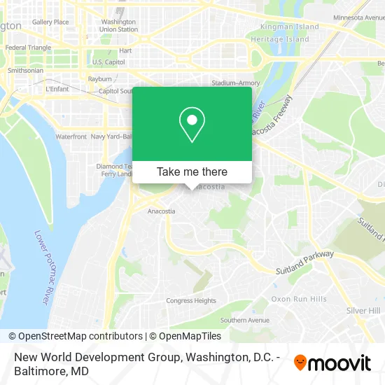
See New World Development Group, Washington, on the map
Public Transit to New World Development Group in Washington
Wondering how to get to New World Development Group in Washington? Moovit helps you find the best way to get to New World Development Group with step-by-step directions from the nearest public transit station.
Moovit provides free maps and live directions to help you navigate through your city. View schedules, routes, timetables, and find out how long does it take to get to New World Development Group in real time.
Looking for the nearest stop or station to New World Development Group? Check out this list of stops closest to your destination: Marion Barry Av Se+15 St SE; Ml King Jr Av Se+W St SE; Morris Rd Se+Mt View Pl SE; Navy Yard Metro Station; Eastern Market.
Bus: 612-WAR, C11, C15, C31, C41, C51, C53, C23, C29.Metro: GREEN, BLUE, ORANGE, SILVER.
Want to see if there’s another route that gets you there at an earlier time? Moovit helps you find alternative routes or times. Get directions from and directions to New World Development Group easily from the Moovit App or Website.
We make riding to New World Development Group easy, which is why over 1.5 million users, including users in Washington, trust Moovit as the best app for public transit. You don’t need to download an individual bus app or train app, Moovit is your all-in-one transit app that helps you find the best bus time or train time available.
For information on prices of bus and metro, costs and ride fares to New World Development Group, please check the Moovit app.
Use the app to navigate to popular places including to the airport, hospital, stadium, grocery store, mall, coffee shop, school, college, and university.
New World Development Group Address: 1301 W St SE street in Washington
- Union Temple Development,
- Union Temple Baptist Church,
- Louis Vuitton Outlet,
- St Teresa of Avila Church ,
- Sasha Bruce Youthwork,
- District of Columbia Government Mayor Executive Office,
- The Big Chair,
- Pearson Tarasha DDS,
- Childrens National Medical Center,
- You Matter Spa & Wellness Center,
- Anacostia Playhouse,
- Max Robinson Center - Whitman-Walker Health,
- Sidney Yates Building,
- Capital One Café,
- Colonial Parking Lot,
- Health Mart Pharmacy,
- Coinstar,
- Ketcham Elementary School,
- Prestige Health (Prestige Allied Health Institute),
- 16th and W St SE
Places Near New World Development Group (Washington)
- Washington DC VA Medical Center, Washington,
- National Museum of African American History and Culture, Washington,
- M&T Bank Stadium, Baltimore,
- Pennsylvania Ave NW (3rd st and pennsylvania), Washington,
- Basilica of the National Shrine, Washington,
- PG Mall, Prince George's County,
- Camden Yards, Baltimore,
- National Zoo, Washington,
- National Mall, Washington,
- Washington National Cathedral, Washington,
- Warner Theatre, Washington,
- Rock Creek Tennis Center, Washington,
- Amazon Hq2, Arlington County,
- Georgetown, Washington,
- Sibley Memorial Hospital, Washington,
- Capital One Arena, Washington,
- The Anthem, Washington,
- Marriott Marquis Washington, DC, Washington,
- Westfield Montgomery Mall, Montgomery County,
- Museum Of The Bible, Washington
How to get to popular places in Washington, D.C. - Baltimore, MD with public transit
Get around Washington by public transit!
Traveling around Washington has never been so easy. See step by step directions as you travel to any attraction, street or major public transit station. View bus and train schedules, arrival times, service alerts and detailed routes on a map, so you know exactly how to get to anywhere in Washington.
When traveling to any destination around Washington use Moovit's Live Directions with Get Off Notifications to know exactly where and how far to walk, how long to wait for your line, and how many stops are left. Moovit will alert you when it's time to get off — no need to constantly re-check whether yours is the next stop.
Wondering how to use public transit in Washington or how to pay for public transit in Washington? Moovit public transit app can help you navigate your way with public transit easily, and at minimum cost. It includes public transit fees, ticket prices, and costs. Looking for a map of Washington public transit lines? Moovit public transit app shows all public transit maps in Washington with all Bus, Train, Metro, Light Rail and Ferry routes and stops on an interactive map.
Washington, D.C. - Baltimore, MD has 5 transit type(s), including: Bus, Train, Metro, Light Rail and Ferry, operated by several transit agencies, including WMATA, Montgomery County Ride On, Fairfax Connector, TheBus, PRTC, DASH - Alexandria, Arlington Transit (ART), RTA of Central Maryland, MDOT MTA, MDOT MTA Light RailLink, MDOT MTA Commuter Bus, MDOT MTA Local Bus, FXBGO!, Virginia Railway Express (VRE) and MARC