How to get to New York Life Insurance by bus?
Click on the bus route to see step by step directions with maps, line arrival times and updated time schedules.
From 103rd Street, Manhattan
85 minFrom Brooklyn Museum, Manhattan
46 minFrom Astoria, Queens
98 minFrom The Met, Manhattan
42 minFrom East 59th Street, Manhattan
41 minFrom David H. Koch Center for Cancer Care at Memorial Sloan Kettering Cancer Center, Manhattan
63 minFrom Sheraton New York Times Square Hotel, Manhattan
46 minFrom Bayonne, NJ, Bayonne
49 minFrom North Bergen, NJ, North Bergen
91 min
How to get to New York Life Insurance by train?
Click on the train route to see step by step directions with maps, line arrival times and updated time schedules.
How to get to New York Life Insurance by subway?
Click on the subway route to see step by step directions with maps, line arrival times and updated time schedules.
From 103rd Street, Manhattan
38 minFrom Brooklyn Museum, Manhattan
43 minFrom Astoria, Queens
46 minFrom The Met, Manhattan
42 minFrom East 59th Street, Manhattan
27 minFrom David H. Koch Center for Cancer Care at Memorial Sloan Kettering Cancer Center, Manhattan
40 minFrom Sheraton New York Times Square Hotel, Manhattan
26 min
Train station near New York Life Insurance in Manhattan
- World Trade Center, 2 min walk,VIEW
Subway stations near New York Life Insurance in Manhattan
Bus stops near New York Life Insurance in Manhattan
Bus lines to New York Life Insurance in Manhattan
- SIM7, Eltvlle Trans Ctr Via Hylan Via Richmond,VIEW
- SIM9, Eltingville Via F Cap Via Hylan Bl,VIEW
- SIM33, Mariners Harbor Via N Gannon Av,VIEW
- DOWNTOWN CONNECTION, South Street Seaport,VIEW
- SIM1, Eltingville - Lower Manhattan Express,VIEW
- SIM1C, Eltingville - Manhattan Express,VIEW
- SIM2, Tottenville - Lower Manhattan Express,VIEW
- SIM3C, Pt. Richmond - Manhattan Express,VIEW
- SIM4, Eltingville - Lower Manhattan Express,VIEW
- SIM4C, Huguenot - Manhattan Express,VIEW
- SIM15, Eltingville - Lower Manhattan Express,VIEW
- SIM32, Travis - Lower Manhattan Express,VIEW
- SIM33C, Mariners Harbor - Greenwich Village Express,VIEW
- SIM34, Mariners Harbor - Lower Manhattan Express,VIEW
- QM7, Fresh Meadows - Downtown Express,VIEW
- QM8, Glen Oaks - Downtown Express,VIEW
- QM11, Forest Hills - Downtown Express,VIEW
- QM25, Glendale - Downtown Express,VIEW
- QM65, Laurelton-Rochdale-Lower Manhattan,VIEW
- M22, Battery Pk Cty Vesey St,VIEW
What are the closest stations to New York Life Insurance?
The closest stations to New York Life Insurance are:
- World Trade Center is 86 yards away, 2 min walk.
- Wtc Cortlandt is 184 yards away, 3 min walk.
- Vesey St/West St is 266 yards away, 4 min walk.
- Cortlandt St is 292 yards away, 5 min walk.
- Vesey St & North End Ave is 329 yards away, 5 min walk.
- Church St/Fulton St is 330 yards away, 5 min walk.
- Vesey St/North End Av is 348 yards away, 5 min walk.
- Church St/Vesey St is 360 yards away, 5 min walk.
- Park Place is 430 yards away, 6 min walk.
- Murray St/West Broadway is 483 yards away, 6 min walk.
Which bus lines stop near New York Life Insurance?
These bus lines stop near New York Life Insurance: 120, BXM18, M103, M20, QM11, X28.
Which train lines stop near New York Life Insurance?
These train lines stop near New York Life Insurance: BLU, GRE, RED.
Which subway lines stop near New York Life Insurance?
These subway lines stop near New York Life Insurance: 1, 2, 4, E, R, W.
What’s the nearest subway station to New York Life Insurance in Manhattan?
The nearest subway station to New York Life Insurance in Manhattan is Wtc Cortlandt. It’s a 3 min walk away.
What’s the nearest train station to New York Life Insurance in Manhattan?
The nearest train station to New York Life Insurance in Manhattan is World Trade Center. It’s a 2 min walk away.
What’s the nearest bus station to New York Life Insurance in Manhattan?
The nearest bus station to New York Life Insurance in Manhattan is Vesey St/West St. It’s a 4 min walk away.
What time is the first subway to New York Life Insurance in Manhattan?
The N is the first subway that goes to New York Life Insurance in Manhattan. It stops nearby at 3:05 AM.
What time is the last subway to New York Life Insurance in Manhattan?
The 2 is the last subway that goes to New York Life Insurance in Manhattan. It stops nearby at 4:08 AM.
What time is the first train to New York Life Insurance in Manhattan?
The RED is the first train that goes to New York Life Insurance in Manhattan. It stops nearby at 3:10 AM.
What time is the last train to New York Life Insurance in Manhattan?
The RED is the last train that goes to New York Life Insurance in Manhattan. It stops nearby at 2:55 AM.
What time is the first bus to New York Life Insurance in Manhattan?
The SIM1C is the first bus that goes to New York Life Insurance in Manhattan. It stops nearby at 3:48 AM.
What time is the last bus to New York Life Insurance in Manhattan?
The SIM1C is the last bus that goes to New York Life Insurance in Manhattan. It stops nearby at 2:48 AM.
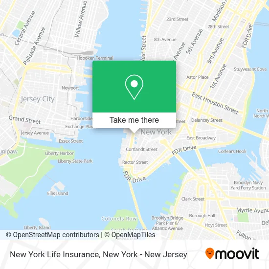
See New York Life Insurance, Manhattan, on the map
Public Transit to New York Life Insurance in Manhattan
Wondering how to get to New York Life Insurance in Manhattan? Moovit helps you find the best way to get to New York Life Insurance with step-by-step directions from the nearest public transit station.
Moovit provides free maps and live directions to help you navigate through your city. View schedules, routes, timetables, and find out how long does it take to get to New York Life Insurance in real time.
Looking for the nearest stop or station to New York Life Insurance? Check out this list of stops closest to your destination: World Trade Center; Wtc Cortlandt; Vesey St/West St; Cortlandt St; Vesey St & North End Ave; Church St/Fulton St; Vesey St/North End Av; Church St/Vesey St; Park Place; Murray St/West Broadway.
Bus: 120, BXM18, M103, M20, QM11, X28, SIM7, SIM9, SIM33.Train: BLU, GRE, RED.Subway: 1, 2, 4, E, R, W, N, Q, 3.
Want to see if there’s another route that gets you there at an earlier time? Moovit helps you find alternative routes or times. Get directions from and directions to New York Life Insurance easily from the Moovit App or Website.
We make riding to New York Life Insurance easy, which is why over 1.5 million users, including users in Manhattan, trust Moovit as the best app for public transit. You don’t need to download an individual bus app or train app, Moovit is your all-in-one transit app that helps you find the best bus time or train time available.
For information on prices of subway, bus, train and light rail, costs and ride fares to New York Life Insurance, please check the Moovit app.
Use the app to navigate to popular places including to the airport, hospital, stadium, grocery store, mall, coffee shop, school, college, and university.
New York Life Insurance Address: 1 World Trade Ctr, Floor 39th street in Manhattan
- Plandek,
- Notemyself,
- Good Vibes Every Day,
- Vip Lifestyle Group,
- Immigration Lawyer - Pandev Law,
- One Dine at One World Observatory,
- Korechain Inc.,
- Korra Capital,
- Avis Jones-Devonish, Partner With New York Life,
- Madison Hayes,
- Tramite Sin Fronteras,
- Happy New Year 2025 Images, Wishes, Wallpapers, Quotes,
- Thinkers Kids,
- Kristy Peankurdsuk,Registered Representative With Nylife Securities Llc,
- Annie,
- Sabrina Beharry, Financial Professional With New York Life,
- Gb Boutique Marketing,
- Success Hub Inc.,
- Nestify Low Budget Rental,
- Neuhaus
Places Near New York Life Insurance (Manhattan)
- Rockefeller Center, Manhattan,
- Chinatown, Manhattan,
- 376 Hudson Street, Manhattan,
- 3 Stone St, Manhattan,
- Katz's Deli, Manhattan,
- 911 Memorial, Manhattan,
- San Gennaro Feast, Manhattan,
- Wall Street, Manhattan,
- SoHo, Manhattan,
- Times Square, Manhattan,
- Bellevue Hospital, Manhattan,
- Pier 83, Manhattan,
- 111 Centre New York City Supreme Court, Manhattan,
- Queens Center Mall, Queens,
- 66 John Street, Manhattan,
- 26 Federal Plaza, Manhattan,
- Mountainside Hospital, Glen Ridge,
- qqqq, Manhattan,
- 1 Police Plaza, Manhattan,
- Hudson Yards, Manhattan
How to get to popular places in New York - New Jersey with public transit
Get around Manhattan by public transit!
Traveling around Manhattan has never been so easy. See step by step directions as you travel to any attraction, street or major public transit station. View bus and train schedules, arrival times, service alerts and detailed routes on a map, so you know exactly how to get to anywhere in Manhattan.
When traveling to any destination around Manhattan use Moovit's Live Directions with Get Off Notifications to know exactly where and how far to walk, how long to wait for your line, and how many stops are left. Moovit will alert you when it's time to get off — no need to constantly re-check whether yours is the next stop.
Wondering how to use public transit in Manhattan or how to pay for public transit in Manhattan? Moovit public transit app can help you navigate your way with public transit easily, and at minimum cost. It includes public transit fees, ticket prices, and costs. Looking for a map of Manhattan public transit lines? Moovit public transit app shows all public transit maps in Manhattan with all Bus, Train, Subway, Light Rail, Ferry and Cable Car routes and stops on an interactive map.
New York - New Jersey has 6 transit type(s), including: Bus, Train, Subway, Light Rail, Ferry and Cable Car, operated by several transit agencies, including MTA Subway, Metro-North Railroad, LIRR, PATH, MTA New York City Transit - Express routes, MTA Bus, NJ Transit, NYC Ferry, NICE bus, Bee-Line Bus, NJ Transit Rail, Norwalk Transit District, Hartford Line, River Valley Transit and HART