Directions to New York Medical Coding Academy (Queens) with public transportation
The following transit lines have routes that pass near New York Medical Coding Academy
 Bus: Q32, Q39, Q60, Q67.
- Train: LONG BEACH BRANCH, PORT WASHINGTON BRANCH, MONTAUK BRANCH, OYSTER BAY BRANCH, PORT JEFFERSON BRANCH.
- Subway: 1, 7, 7X, B, F.
How to get to New York Medical Coding Academy by bus?
Click on the bus route to see step by step directions with maps, line arrival times and updated time schedules.
From Manhattan Bridge, Manhattan
77 minFrom Amc Loews Lincoln Square 13, Manhattan
43 minFrom Flushing Hospital, Queens
77 minFrom Queens College, Queens
72 minFrom Macy's, Queens
40 minFrom Mount Sinai Hospital, Manhattan
39 minFrom 911 Memorial, Manhattan
80 minFrom Jersey City Medical Center, Jersey City
106 min
How to get to New York Medical Coding Academy by train?
Click on the train route to see step by step directions with maps, line arrival times and updated time schedules.
How to get to New York Medical Coding Academy by subway?
Click on the subway route to see step by step directions with maps, line arrival times and updated time schedules.
Bus stops near New York Medical Coding Academy in Queens
Subway stations near New York Medical Coding Academy in Queens
Train station near New York Medical Coding Academy in Queens
- Hunterspoint Avenue, 8 min walk,VIEW
Bus lines to New York Medical Coding Academy in Queens
What are the closest stations to New York Medical Coding Academy?
The closest stations to New York Medical Coding Academy are:
- Van Dam St/47 Av is 195 yards away, 3 min walk.
- Court Sq is 509 yards away, 7 min walk.
- Queens Blvd/Skillman Av is 570 yards away, 8 min walk.
- Borden Av/Van Dam St is 571 yards away, 8 min walk.
- Hunterspoint Avenue is 581 yards away, 8 min walk.
- Queens Plaza is 610 yards away, 8 min walk.
Which bus lines stop near New York Medical Coding Academy?
These bus lines stop near New York Medical Coding Academy: Q32, Q39, Q60.
Which train lines stop near New York Medical Coding Academy?
These train lines stop near New York Medical Coding Academy: LONG BEACH BRANCH, PORT WASHINGTON BRANCH.
Which subway lines stop near New York Medical Coding Academy?
These subway lines stop near New York Medical Coding Academy: 1, 7, 7X, B, F, R.
What’s the nearest subway station to New York Medical Coding Academy in Queens?
The nearest subway station to New York Medical Coding Academy in Queens is Court Sq. It’s a 7 min walk away.
What’s the nearest train station to New York Medical Coding Academy in Queens?
The nearest train station to New York Medical Coding Academy in Queens is Hunterspoint Avenue. It’s a 8 min walk away.
What’s the nearest bus station to New York Medical Coding Academy in Queens?
The nearest bus station to New York Medical Coding Academy in Queens is Van Dam St/47 Av. It’s a 3 min walk away.
What time is the first subway to New York Medical Coding Academy in Queens?
The 7 is the first subway that goes to New York Medical Coding Academy in Queens. It stops nearby at 3:01 AM.
What time is the last subway to New York Medical Coding Academy in Queens?
The E is the last subway that goes to New York Medical Coding Academy in Queens. It stops nearby at 3:24 AM.
What time is the first train to New York Medical Coding Academy in Queens?
The PORT JEFFERSON BRANCH is the first train that goes to New York Medical Coding Academy in Queens. It stops nearby at 6:32 AM.
What time is the last train to New York Medical Coding Academy in Queens?
The OYSTER BAY BRANCH is the last train that goes to New York Medical Coding Academy in Queens. It stops nearby at 6:53 PM.
What time is the first bus to New York Medical Coding Academy in Queens?
The Q60 is the first bus that goes to New York Medical Coding Academy in Queens. It stops nearby at 3:06 AM.
What time is the last bus to New York Medical Coding Academy in Queens?
The Q60 is the last bus that goes to New York Medical Coding Academy in Queens. It stops nearby at 3:26 AM.
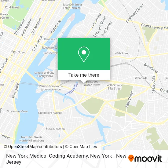
See New York Medical Coding Academy, Queens, on the map
Public Transit to New York Medical Coding Academy in Queens
Wondering how to get to New York Medical Coding Academy in Queens? Moovit helps you find the best way to get to New York Medical Coding Academy with step-by-step directions from the nearest public transit station.
Moovit provides free maps and live directions to help you navigate through your city. View schedules, routes, timetables, and find out how long does it take to get to New York Medical Coding Academy in real time.
Looking for the nearest stop or station to New York Medical Coding Academy? Check out this list of stops closest to your destination: Van Dam St/47 Av; Court Sq; Queens Blvd/Skillman Av; Borden Av/Van Dam St; Hunterspoint Avenue; Queens Plaza.
Bus: Q32, Q39, Q60, Q67.Train: LONG BEACH BRANCH, PORT WASHINGTON BRANCH, MONTAUK BRANCH, OYSTER BAY BRANCH, PORT JEFFERSON BRANCH.Subway: 1, 7, 7X, B, F, R, E, FX, G.
Want to see if there’s another route that gets you there at an earlier time? Moovit helps you find alternative routes or times. Get directions from and directions to New York Medical Coding Academy easily from the Moovit App or Website.
We make riding to New York Medical Coding Academy easy, which is why over 1.5 million users, including users in Queens, trust Moovit as the best app for public transit. You don’t need to download an individual bus app or train app, Moovit is your all-in-one transit app that helps you find the best bus time or train time available.
For information on prices of subway, bus and train, costs and ride fares to New York Medical Coding Academy, please check the Moovit app.
Use the app to navigate to popular places including to the airport, hospital, stadium, grocery store, mall, coffee shop, school, college, and university.
New York Medical Coding Academy Address: 31-00 47th Ave street in Queens
- Collier Legal, Llc,
- A+ Interpreting Solutions Inc.,
- Petite Maman,
- Millennial Tax,
- Long Island City,
- Airowings Llc,
- Technosoft Academy,
- Lex Process,
- Quality Healthcare Staffing,
- The Falchi Building,
- Nyc Black Car Service,
- Ejz Engineering,
- Brooklyn Online Tax,
- Mindful Care Psychiatry,
- Prodippernyc,
- Zpi Events,
- Farmer's Fridge,
- Transparent International Movers,
- Magical Moving & Storage,
- Law Offices Of Supriya Kichloo, P.C.
Places Near New York Medical Coding Academy (Queens)
- 26 Federal Plaza, Manhattan,
- 376 Hudson Street, Manhattan,
- Bellevue Hospital, Manhattan,
- Queens Center Mall, Queens,
- 911 Memorial, Manhattan,
- qqqq, Manhattan,
- Chinatown, Manhattan,
- 66 John Street, Manhattan,
- 111 Centre New York City Supreme Court, Manhattan,
- Wall Street, Manhattan,
- SoHo, Manhattan,
- 1 Police Plaza, Manhattan,
- Rockefeller Center, Manhattan,
- Pier 83, Manhattan,
- Mountainside Hospital, Glen Ridge,
- San Gennaro Feast, Manhattan,
- Times Square, Manhattan,
- Katz's Deli, Manhattan,
- 3 Stone St, Manhattan,
- Hudson Yards, Manhattan
How to get to popular places in New York - New Jersey with public transit
Get around Queens by public transit!
Traveling around Queens has never been so easy. See step by step directions as you travel to any attraction, street or major public transit station. View bus and train schedules, arrival times, service alerts and detailed routes on a map, so you know exactly how to get to anywhere in Queens.
When traveling to any destination around Queens use Moovit's Live Directions with Get Off Notifications to know exactly where and how far to walk, how long to wait for your line, and how many stops are left. Moovit will alert you when it's time to get off — no need to constantly re-check whether yours is the next stop.
Wondering how to use public transit in Queens or how to pay for public transit in Queens? Moovit public transit app can help you navigate your way with public transit easily, and at minimum cost. It includes public transit fees, ticket prices, and costs. Looking for a map of Queens public transit lines? Moovit public transit app shows all public transit maps in Queens with all Bus, Train, Subway, Light Rail, Ferry and Cable Car routes and stops on an interactive map.
New York - New Jersey has 6 transit type(s), including: Bus, Train, Subway, Light Rail, Ferry and Cable Car, operated by several transit agencies, including MTA Subway, Metro-North Railroad, LIRR, PATH, MTA New York City Transit - Express routes, MTA Bus, NJ Transit, NYC Ferry, NICE bus, Bee-Line Bus, NJ Transit Rail, Norwalk Transit District, Hartford Line, River Valley Transit and HART