How to get to Newfields by bus?
Click on the bus route to see step by step directions with maps, line arrival times and updated time schedules.
From Yrc/Usf Drop Lot, Indianapolis City (Balance)
64 minFrom Northern Indiana Public Service Co Indianapolis, Indianapolis City (Balance)
30 minFrom St. Mary of the Woods college, Indianapolis City (Balance)
46 minFrom W Raymond St / S Kentucky Ave, Indianapolis City (Balance)
88 minFrom S Keystone Ave / E Pleasant Run Parkway South Dr, Indianapolis City (Balance)
47 minFrom Ben Davis High School Auditorium, Indianapolis City (Balance)
63 minFrom Indianapolis Motor Speedway, Speedway
57 minFrom 80th & Keystone ave, Indianapolis City (Balance)
99 minFrom 240 S Pennsylvania St Parking, Indianapolis City (Balance)
32 minFrom Sosa Leticia, Indianapolis City (Balance)
86 min
Bus stops near Newfields in Indianapolis City (Balance)
What are the closest stations to Newfields?
The closest stations to Newfields are:
- 38th St & Private Dr is 128 yards away, 2 min walk.
- Michigan Rd & 38th St is 474 yards away, 6 min walk.
Which bus lines stop near Newfields?
These bus lines stop near Newfields: 34, 38.
What’s the nearest bus station to Newfields in Indianapolis City (Balance)?
The nearest bus station to Newfields in Indianapolis City (Balance) is 38th St & Private Dr. It’s a 2 min walk away.
What time is the first bus to Newfields in Indianapolis City (Balance)?
The 34 is the first bus that goes to Newfields in Indianapolis City (Balance). It stops nearby at 5:12 AM.
What time is the last bus to Newfields in Indianapolis City (Balance)?
The 34 is the last bus that goes to Newfields in Indianapolis City (Balance). It stops nearby at 11:10 PM.
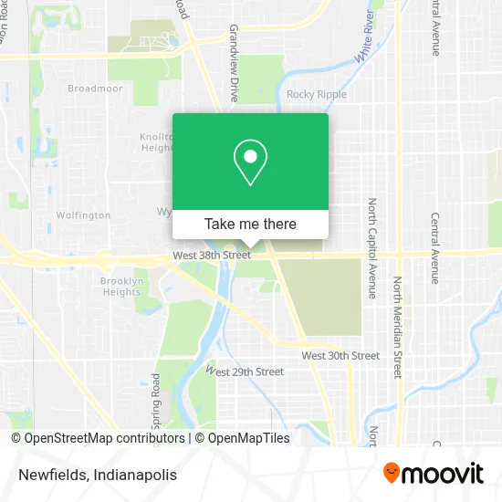
See Newfields, Indianapolis City (Balance), on the map
Public Transit to Newfields in Indianapolis City (Balance)
Wondering how to get to Newfields in Indianapolis City (Balance)? Moovit helps you find the best way to get to Newfields with step-by-step directions from the nearest public transit station.
Moovit provides free maps and live directions to help you navigate through your city. View schedules, routes, timetables, and find out how long does it take to get to Newfields in real time.
Looking for the nearest stop or station to Newfields? Check out this list of stops closest to your destination: 38th St & Private Dr; Michigan Rd & 38th St.
Bus: 34, 38.
Want to see if there’s another route that gets you there at an earlier time? Moovit helps you find alternative routes or times. Get directions from and directions to Newfields easily from the Moovit App or Website.
We make riding to Newfields easy, which is why over 1.5 million users, including users in Indianapolis City (Balance), trust Moovit as the best app for public transit. You don’t need to download an individual bus app or train app, Moovit is your all-in-one transit app that helps you find the best bus time or train time available.
For information on prices of bus, costs and ride fares to Newfields, please check the Moovit app.
Use the app to navigate to popular places including to the airport, hospital, stadium, grocery store, mall, coffee shop, school, college, and university.
Newfields Address: 4000 Michigan Rd street in Indianapolis City (Balance)
- Pop Up Wine,
- Harvest Nights at Newfields,
- Sutphin Fountain,
- The Ima Nugget Factory,
- Madeline F Elder Greenhouse & Shop,
- The Tobias Theater,
- Whitaker Commercial Locksmith,
- 38th St. & Michigan Rd./MLK,
- John Dillinger Gravesite,
- The Funky Bones,
- St. Mary of Magdala Catholic Community,
- Inspire & Elevate,
- American Baptist Churches of Greater Indianapolis,
- USPS Collection Box - Blue Box,
- Festival of Faiths,
- Saving Orphans Through Healthcare and Outreach,
- Peace Center for Forgiveness and Reconciliation,
- Indiana Network for Higher Education Ministries,
- United Church of Christ,
- Stant Farms
Places Near Newfields (Indianapolis City (Balance))
- Plainfield, IN, Plainfield,
- St. Vincent entrance #1, Indianapolis City (Balance),
- Indiana, Indianapolis City (Balance),
- Indiana Convention Center, Indianapolis City (Balance),
- THE BALT, Indianapolis City (Balance),
- Lilly Corporate Center (Eli Lilly & Co), Indianapolis City (Balance),
- Indianapolis Airport Zone 2, Indianapolis City (Balance),
- Castleton Square Mall, Indianapolis,
- Cotter's Massage Parlor With Happy Endings, Indianapolis City (Balance),
- St. Vincent Hospital - Indianapolis, Indianapolis City (Balance),
- I-465 / I-65 Interchange, Indianapolis City (Balance),
- I U Health Methodist Hospital, Indianapolis City (Balance),
- Methodist Hospital of Indianapolis, Indianapolis City (Balance),
- Lucas Oil Stadium, Indianapolis City (Balance),
- Jersey Barn, Indianapolis City (Balance),
- 119 W 19th St Parking, Indianapolis City (Balance),
- Train Ride At Castleton Mall, Indianapolis City (Balance),
- Indianapolis Motor Speedway, Speedway,
- Eskenazi Hospital, Indianapolis City (Balance),
- Gainbridge Fieldhouse, Indianapolis City (Balance)
How to get to popular places in Indianapolis with public transit
Get around Indianapolis City (Balance) by public transit!
Traveling around Indianapolis City (Balance) has never been so easy. See step by step directions as you travel to any attraction, street or major public transit station. View bus and train schedules, arrival times, service alerts and detailed routes on a map, so you know exactly how to get to anywhere in Indianapolis City (Balance).
When traveling to any destination around Indianapolis City (Balance) use Moovit's Live Directions with Get Off Notifications to know exactly where and how far to walk, how long to wait for your line, and how many stops are left. Moovit will alert you when it's time to get off — no need to constantly re-check whether yours is the next stop.
Wondering how to use public transit in Indianapolis City (Balance) or how to pay for public transit in Indianapolis City (Balance)? Moovit public transit app can help you navigate your way with public transit easily, and at minimum cost. It includes public transit fees, ticket prices, and costs. Looking for a map of Indianapolis City (Balance) public transit lines? Moovit public transit app shows all public transit maps in Indianapolis City (Balance) with all bus routes and stops on an interactive map.
Indianapolis has 1 transit type(s), including: bus, operated by several transit agencies, including IndyGo, FlixBus-us and Greyhound-us