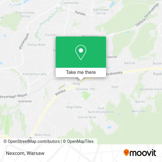
Directions to Nexcom (Warsaw) with public transportation
The following transit lines have routes that pass near Nexcom
 Train: REG.
How to get to Nexcom by train?
Click on the train route to see step by step directions with maps, line arrival times and updated time schedules.
Train station near Nexcom in Warsaw
- Kozy, 9 min walk,VIEW
What are the closest stations to Nexcom?
The closest stations to Nexcom are:
- Kozy is 643 meters away, 9 min walk.
Which train line stops near Nexcom?
REG (Bielsko-Biała Główna)
What’s the nearest train station to Nexcom in Warsaw?
The nearest train station to Nexcom in Warsaw is Kozy. It’s a 9 min walk away.
What time is the first train to Nexcom in Warsaw?
The REG is the first train that goes to Nexcom in Warsaw. It stops nearby at 3:44 AM.
What time is the last train to Nexcom in Warsaw?
The REG is the last train that goes to Nexcom in Warsaw. It stops nearby at 11:24 PM.
See Nexcom, Warsaw, on the map
Public Transit to Nexcom in Warsaw
Wondering how to get to Nexcom in Warsaw? Moovit helps you find the best way to get to Nexcom with step-by-step directions from the nearest public transit station.
Moovit provides free maps and live directions to help you navigate through your city. View schedules, routes, timetables, and find out how long does it take to get to Nexcom in real time.
Looking for the nearest stop or station to Nexcom? Check out this list of stops closest to your destination: Kozy.
Train: REG.
Want to see if there’s another route that gets you there at an earlier time? Moovit helps you find alternative routes or times. Get directions from and directions to Nexcom easily from the Moovit App or Website.
We make riding to Nexcom easy, which is why over 1.5 million users, including users in Warsaw, trust Moovit as the best app for public transit. You don’t need to download an individual bus app or train app, Moovit is your all-in-one transit app that helps you find the best bus time or train time available.
For information on prices of train and bus, costs and ride fares to Nexcom, please check the Moovit app.
Use the app to navigate to popular places including to the airport, hospital, stadium, grocery store, mall, coffee shop, school, college, and university.
Nexcom Address: ulica Krakowska, 43-340 Kozy street in Warsaw
- Ewant,
- Polcar,
- Ahu,
- Maks,
- Stolarstwo,
- Vivonet,
- Martex,
- Drew Pol,
- Nails By Nat,
- Wak-Bud,
- Ad-Gro,
- Boko,
- Zakład Fryzjerski,
- Terra,
- Hermix,
- Maja,
- Dwa Światy,
- Domi Sklep Spożywczy,
- Creative,
- Rumcajs
Places Near Nexcom (Warsaw)
- Szpital Bielański, Warsaw,
- PGE Narodowy, Warsaw,
- Cmentarz Bródnowski, Warsaw,
- Banacha - Szpital Kliniczny, Warsaw,
- Centralny Szpital Kliniczny MSWiA ul. Wołoska, Warsaw,
- Domaniewska, Warsaw,
- Sejm Rp, Warsaw,
- Szpital Czerniakowski, Warsaw,
- Szpital Spartanska, Warsaw,
- Torwar, Warsaw,
- Szpital Orłowskiego, Warsaw,
- Stare Miasto, Warsaw,
- Postępu, Warsaw,
- Szaserów - Szpital, Warsaw,
- Wołoska, Warsaw,
- Galeria Północna, Warsaw,
- CH Arkadia, Warsaw,
- Instytut Kardiologii w Aninie, Warsaw,
- Galeria Mokotów, Warsaw,
- Wołoska-Szpital 01, Warsaw
How to get to popular places in Warsaw with public transit
Get around Warsaw by public transit!
Traveling around Warsaw has never been so easy. See step by step directions as you travel to any attraction, street or major public transit station. View bus and train schedules, arrival times, service alerts and detailed routes on a map, so you know exactly how to get to anywhere in Warsaw.
When traveling to any destination around Warsaw use Moovit's Live Directions with Get Off Notifications to know exactly where and how far to walk, how long to wait for your line, and how many stops are left. Moovit will alert you when it's time to get off — no need to constantly re-check whether yours is the next stop.
Wondering how to use public transit in Warsaw or how to pay for public transit in Warsaw? Moovit public transit app can help you navigate your way with public transit easily, and at minimum cost. It includes public transit fees, ticket prices, and costs. Looking for a map of Warsaw public transit lines? Moovit public transit app shows all public transit maps in Warsaw with all Bus, Train, Metro, Light Rail, Ferry and Cable Car routes and stops on an interactive map.
Warsaw has 6 transit type(s), including: Bus, Train, Metro, Light Rail, Ferry and Cable Car, operated by several transit agencies, including Warszawski Transport Publiczny, Warszawska Kolej Dojazdowa, Koleje Mazowieckie, ZTP Kraków, Miasto Piastów, Miasto Ząbki, Koleje Małopolskie, Komunikacja Miejska Łomianki, Gmina Pruszków, MPK Wrocław, MZDiK Radom, UM w Grodzisku Mazowieckim, UM w Nowym Dworze Mazowieckim, UM Płońsk and Koleje Dolnośląskie