How to get to Niccolo Changsha by bus?
Click on the bus route to see step by step directions with maps, line arrival times and updated time schedules.
From Agricultural Bank of China (Changsha Xingsha Branch), Changsha County
44 minFrom Anta Flagship Store, Yuhua District
32 minFrom Industrial Bank 24-Hour Self-Service Bank (Hexi Branch), Yuelu District
27 minFrom Yuanda Housing Construction, Yuelu District
36 minFrom Changsha Red Star International Convention Center (South Gate), Yuhua District
44 minFrom Changsha Red Star International Convention Center - Hall 2, Yuhua District
44 minFrom National Defense University Third Courtyard, Changsha County
51 minFrom Li Jun Primary School, Yuhua District
63 minFrom Z'DORZI, Yuelu District
28 minFrom Aerospace Second Road, Yuelu District
33 min
How to get to Niccolo Changsha by metro?
Click on the metro route to see step by step directions with maps, line arrival times and updated time schedules.
From Anta Flagship Store, Yuhua District
45 minFrom Industrial Bank 24-Hour Self-Service Bank (Hexi Branch), Yuelu District
60 minFrom Yuanda Housing Construction, Yuelu District
62 minFrom National Defense University Third Courtyard, Changsha County
57 minFrom Z'DORZI, Yuelu District
48 minFrom Aerospace Second Road, Yuelu District
45 min
Bus stops near Niccolo Changsha in Furong District
Metro stations near Niccolo Changsha in Furong District
Bus lines to Niccolo Changsha in Furong District
- Route 308 Express, Dezheng Garden,VIEW
- 11, Chigangchong,VIEW
- 167, Huaxia,VIEW
- Route 202, Changsha Railway,VIEW
- 308, Changhua Residential Area,VIEW
- Route 171 Loop, Changsha Railway,VIEW
- Temp Route 124, Hunan Provincial People's Hospital,VIEW
- Route 908, Peiyuan Bridge,VIEW
- Route 803 Inner Ring, Xinkai Road Junction,VIEW
- Temporary Route 314, Chigangchong,VIEW
- Route 311, Xilong Village,VIEW
- Temporary Route 406, Huaxia,VIEW
- Route 122, South Suburb Park,VIEW
- Route 402 Loop, Xincheng Complex,VIEW
- Route 139, Houzi Rock Intersection,VIEW
- Temp Route 159, Huxiang Art Market,VIEW
- Route 102, Xiaoxiang North Road Huangni River Junction,VIEW
- Route 105, Bus Depot 105,VIEW
- Route 115, Zoomlion Overseas Company,VIEW
- Route 116, Xiufeng Park,VIEW
What are the closest stations to Niccolo Changsha?
The closest stations to Niccolo Changsha are:
- Phoenix Tower is 73 meters away, 2 min walk.
- Zhonggong Education is 98 meters away, 2 min walk.
- Tianxin Pavilion is 266 meters away, 4 min walk.
- Tianxin Pavilion Antique City (Shiziling) is 329 meters away, 5 min walk.
- Provincial Construction Bank (Liu Bridge) is 473 meters away, 7 min walk.
- South Gate is 644 meters away, 9 min walk.
- Yinbin Road Intersection is 1461 meters away, 19 min walk.
Which bus lines stop near Niccolo Changsha?
These bus lines stop near Niccolo Changsha: 11, 167, Route 308 Express, 308, Route 311, Temporary Route 314.
Which metro line stops near Niccolo Changsha?
Line 2 (Meixi Lake West)
What’s the nearest metro station to Niccolo Changsha in Furong District?
The nearest metro station to Niccolo Changsha in Furong District is South Gate. It’s a 9 min walk away.
What’s the nearest bus station to Niccolo Changsha in Furong District?
The nearest bus stations to Niccolo Changsha in Furong District are Phoenix Tower and Zhonggong Education. The closest one is a 2 min walk away.
What time is the first metro to Niccolo Changsha in Furong District?
The Line 2 is the first metro that goes to Niccolo Changsha in Furong District. It stops nearby at 6:30 AM.
What time is the last metro to Niccolo Changsha in Furong District?
The Line 1 is the last metro that goes to Niccolo Changsha in Furong District. It stops nearby at 11:29 PM.
What time is the first bus to Niccolo Changsha in Furong District?
The Route 908 is the first bus that goes to Niccolo Changsha in Furong District. It stops nearby at 6:08 AM.
What time is the last bus to Niccolo Changsha in Furong District?
The Temporary Route 314 is the last bus that goes to Niccolo Changsha in Furong District. It stops nearby at 1:14 AM.
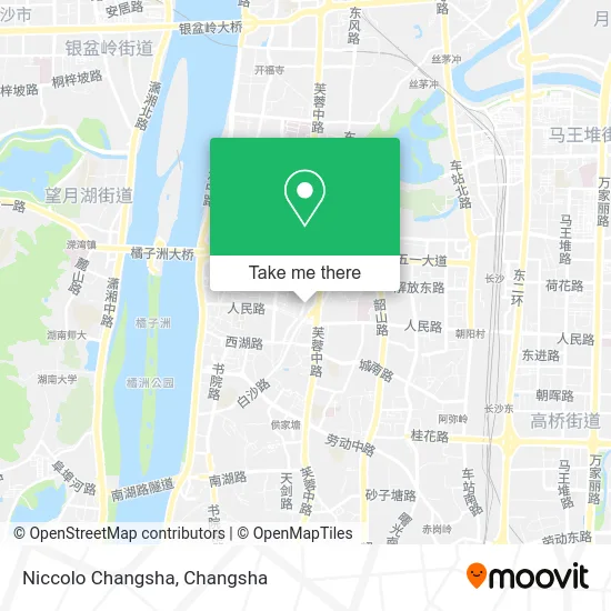
See Niccolo Changsha, Furong District, on the map
Public Transit to Niccolo Changsha in Furong District
Wondering how to get to Niccolo Changsha in Furong District? Moovit helps you find the best way to get to Niccolo Changsha with step-by-step directions from the nearest public transit station.
Moovit provides free maps and live directions to help you navigate through your city. View schedules, routes, timetables, and find out how long does it take to get to Niccolo Changsha in real time.
Looking for the nearest stop or station to Niccolo Changsha? Check out this list of stops closest to your destination: Phoenix Tower; Zhonggong Education; Tianxin Pavilion; Tianxin Pavilion Antique City (Shiziling); Provincial Construction Bank (Liu Bridge); South Gate; Yinbin Road Intersection.
Bus: 11, 167, Route 308 Express, 308, Route 311, Temporary Route 314, Route 308 Express, 11, 167, Route 202, 308, Route 171 Loop, Temp Route 124, Route 908, Route 803 Inner Ring, Temporary Route 314.Metro: Line 2, Line 1, Line 2.
Want to see if there’s another route that gets you there at an earlier time? Moovit helps you find alternative routes or times. Get directions from and directions to Niccolo Changsha easily from the Moovit App or Website.
We make riding to Niccolo Changsha easy, which is why over 1.5 million users, including users in Furong District, trust Moovit as the best app for public transit. You don’t need to download an individual bus app or train app, Moovit is your all-in-one transit app that helps you find the best bus time or train time available.
For information on prices of bus and metro, costs and ride fares to Niccolo Changsha, please check the Moovit app.
Use the app to navigate to popular places including to the airport, hospital, stadium, grocery store, mall, coffee shop, school, college, and university.
Niccolo Changsha Address: 188 Jiefang West Road street in Furong District
- English Inn,
- Monster Charging (Ruimei Style Dingwangtai Branch),
- Ding Wang Yole Port,
- Changsha City Dingwangtai Industrial and Commercial Bureau,
- 77 E Home Xiaoting Branch,
- Songhuajiang Dumpling Restaurant (Jiefang West Road Branch),
- Jinsha Li Community Health Service Station,
- Changsha Bank Dormitory,
- Golden City Parking Lot - Entrance,
- Dingwangtai Police Station Jinsha Li Police Post,
- Changsha Bank (Hualong Branch),
- Changsha Social Security Card Management Service Center,
- China Construction Bank Consulting Hunan Branch,
- Hunan Zhongxin High-tech Accounting Firm (Jianxiang Road Branch),
- Fortune Home (Dingwangtai Branch),
- Hot Wind (Changsha Jiefang West Branch),
- Burberry (Changsha IFS Golden Center Store),
- Changsha Home to Home Hotel Apartment Chain (Three Stores Universal),
- Kunxi Hotel (Dingwangtai Branch),
- Hunan Ritong Elevator Co., Ltd.
Places Near Niccolo Changsha (Furong District)
- National University of Defense Technology (North Gate), Kaifu District,
- Yuelu Mountain Juzizhou Tourist Area, Yuelu District,
- Changsha Yangming Mountain Funeral Home, Yuhua District,
- Changsha Bank (Sifang Branch), Kaifu District,
- Hunan University of Traditional Chinese Medicine First Affiliated Hospital, Yuhua District,
- Hunan Provincial Museum - Multipurpose Hall, Kaifu District,
- Central South University Xiangya Second Hospital, Furong District,
- Changsha South Station, Yuhua District,
- First Club, Kaifu District,
- Apple Authorized Dealer (Sam Changsha Store), Yuhua District,
- Changsha Bank ATM (Sifang Branch), Kaifu District,
- Hunan Province Tumor Hospital, Yuelu District,
- Zhongnan University Xiangya Hospital, Kaifu District,
- First Affiliated Hospital of Hunan University of Traditional Chinese Medicine - Outpatient Department, Yuhua District,
- Xingsha Police Station Songya Community Police Room, Changsha County,
- Desiqin City Square, Yuhua District,
- Wanjiali International Mall, Furong District,
- Hunan Provincial Maternal and Child Health Hospital - Outpatient Department, Kaifu District,
- Du Fu River Pavilion, Tianxin District,
- Changsha South Station Square, Yuelu District
How to get to popular places in Changsha with public transit
Get around Furong District by public transit!
Traveling around Furong District has never been so easy. See step by step directions as you travel to any attraction, street or major public transit station. View bus and train schedules, arrival times, service alerts and detailed routes on a map, so you know exactly how to get to anywhere in Furong District.
When traveling to any destination around Furong District use Moovit's Live Directions with Get Off Notifications to know exactly where and how far to walk, how long to wait for your line, and how many stops are left. Moovit will alert you when it's time to get off — no need to constantly re-check whether yours is the next stop.
Wondering how to use public transit in Furong District or how to pay for public transit in Furong District? Moovit public transit app can help you navigate your way with public transit easily, and at minimum cost. It includes public transit fees, ticket prices, and costs. Looking for a map of Furong District public transit lines? Moovit public transit app shows all public transit maps in Furong District with all Bus and Metro routes and stops on an interactive map.
Changsha has 2 transit type(s), including: Bus and Metro, operated by several transit agencies, including Changsha Metro and Changsha Bus Group