Directions to Nice (Colombo) with public transportation
The following transit lines have routes that pass near Nice
How to get to Nice by bus?
Click on the bus route to see step by step directions with maps, line arrival times and updated time schedules.
From Detran/Pr - Unidade Tarumã, Capão Da Imbúia
41 minFrom Hospital Angelina Caron, Campina Grande Do Sul
55 minFrom Av João Gualberto, Juvevê
41 minFrom Hospital Oswaldo Cruz, Alto Da Rua XV
41 minFrom Rua Atilio Borio, Alto Da Rua XV
39 minFrom Avenida Presidente Affonso Camargo, Cajuru
44 minFrom Vila Oficinas, Cajuru
60 minFrom Hospital Universitário Cajuru, Cristo Rei
49 minFrom Hospital Angelina Caron, Campina Grande Do Sul
56 minFrom cemitério vaticano, Almirante Tamandaré
72 min
Bus stops near Nice in Colombo
Bus lines to Nice in Colombo
- B26 JARDIM EUCALIPTOS, Sentido Horário,VIEW
- B45 BELO RINCÃO / MARACANÃ (PALMARES), Terminal Maracanã → Belo Rincão / Palmares,VIEW
- B14 PLANALTO, Planalto → Terminal Maracanã,VIEW
- B59 PLANALTO / GUARAITUBA, Terminal Maracanã → Terminal Guaraituba,VIEW
- B15 ANA TERRA (VIA ADRIANE), Ana Terra → Terminal Maracanã,VIEW
- B16 ADRIANE, Adriane → Terminal Maracanã,VIEW
- B56 ANA TERRA (VIA ADRIANE) / JARDIM EUCALIPTOS, Jardim Eucaliptos → Terminal Maracanã,VIEW
What are the closest stations to Nice?
The closest stations to Nice are:
- Rua Luís Gasparin, 317 is 201 meters away, 3 min walk.
- Rua Graciliano Ramos, 420 is 223 meters away, 4 min walk.
- R. João Licério De Brito, 188 is 300 meters away, 5 min walk.
Which bus lines stop near Nice?
These bus lines stop near Nice: B06 GUARAITUBA / RUI BARBOSA (VIA MARACANÃ / SEMIDIRETO), B41 MARACANÃ / CAPÃO DA IMBUIA, B42 MARACANÃ / ESTAÇÃO ATUBA, I90 CACHOEIRA / MARACANÃ.
What’s the nearest bus station to Nice in Colombo?
The nearest bus station to Nice in Colombo is Rua Luís Gasparin, 317. It’s a 3 min walk away.
What time is the first bus to Nice in Colombo?
The B26 JARDIM EUCALIPTOS is the first bus that goes to Nice in Colombo. It stops nearby at 5:08 AM.
What time is the last bus to Nice in Colombo?
The B14 PLANALTO is the last bus that goes to Nice in Colombo. It stops nearby at 12:37 AM.
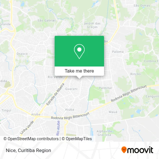
See Nice, Colombo, on the map
Public Transit to Nice in Colombo
Wondering how to get to Nice in Colombo? Moovit helps you find the best way to get to Nice with step-by-step directions from the nearest public transit station.
Moovit provides free maps and live directions to help you navigate through your city. View schedules, routes, timetables, and find out how long does it take to get to Nice in real time.
Looking for the nearest stop or station to Nice? Check out this list of stops closest to your destination: Rua Luís Gasparin; Rua Graciliano Ramos; R. João Licério De Brito.
Bus: B06 GUARAITUBA / RUI BARBOSA (VIA MARACANÃ / SEMIDIRETO), B41 MARACANÃ / CAPÃO DA IMBUIA, B42 MARACANÃ / ESTAÇÃO ATUBA, I90 CACHOEIRA / MARACANÃ, B26 JARDIM EUCALIPTOS, B45 BELO RINCÃO / MARACANÃ (PALMARES), B14 PLANALTO, B59 PLANALTO / GUARAITUBA, B15 ANA TERRA (VIA ADRIANE), B16 ADRIANE, B56 ANA TERRA (VIA ADRIANE) / JARDIM EUCALIPTOS.
Want to see if there’s another route that gets you there at an earlier time? Moovit helps you find alternative routes or times. Get directions from and directions to Nice easily from the Moovit App or Website.
We make riding to Nice easy, which is why over 1.5 million users, including users in Colombo, trust Moovit as the best app for public transit. You don’t need to download an individual bus app or train app, Moovit is your all-in-one transit app that helps you find the best bus time or train time available.
For information on prices of bus, costs and ride fares to Nice, please check the Moovit app.
Use the app to navigate to popular places including to the airport, hospital, stadium, grocery store, mall, coffee shop, school, college, and university.
Nice Address: Rua Monteiro Lobato, 31 Maracanã Colombo-PR 83409-320 street in Colombo
- Cacique Clothing,
- Supimpa Fashion Store,
- Marli Servicos Gerais,
- Lima Seg Solucoes Tecnologicas e Servic,
- Duma Moveis,
- Fotografia Shalon,
- May Especializacao Em Alisamento,
- Ari Construcao,
- Auto Center Cristiano,
- C. M. E. I. Pingo de Gente,
- Familia Schwambach,
- ergon med,
- Policar,
- Cmei Pingo de Gente,
- Espaco do Ser Consultorio de Psicologia e Psicopedagogi,
- Belezura Bolos,
- Garagem R32,
- Gluten Zero Alimentos Especiais,
- Maicon Adesivos,
- Salao Aguiar Mais Voce
Places Near Nice (Colombo)
- Jockey Plaza Shopping Center, Tarumã,
- Arena Da Baixada - Curitiba,
- Hospital Nossa Senhora Das Graças, Mercês,
- Hospital de Clínicas (HC - UFPR), Centro,
- Rua Martim Afonso 558, Mercês,
- Hospital Madalena Sofia, Bairro Alto,
- Pontifícia Universidade Católica do Paraná (PUCPR), Prado Velho,
- Parque Barigui, Mercês,
- Campo Largo, Campo,
- Hospital Universitário Evangélico de Curitiba, Bigorrilho,
- Park Shopping Barigüi, Mossunguê,
- Hospital Da Cruz Vermelha, Batel,
- Jardim Botânico de Curitiba PR, Centro,
- Hhhhh, Fazendinha,
- Rua General Mário Tourinho, Campina Do Siqueira,
- Shopping Estação, Rebouças,
- Shopping Palladium, Portão,
- Hospital Erasto Gaertner, Jardim Das Américas,
- Hospital Angelina Caron, Campina Grande Do Sul,
- Hospital do Rocio, Campo
How to get to popular places in Curitiba Region with public transit
Get around Colombo by public transit!
Traveling around Colombo has never been so easy. See step by step directions as you travel to any attraction, street or major public transit station. View bus and train schedules, arrival times, service alerts and detailed routes on a map, so you know exactly how to get to anywhere in Colombo.
When traveling to any destination around Colombo use Moovit's Live Directions with Get Off Notifications to know exactly where and how far to walk, how long to wait for your line, and how many stops are left. Moovit will alert you when it's time to get off — no need to constantly re-check whether yours is the next stop.
Wondering how to use public transit in Colombo or how to pay for public transit in Colombo? Moovit public transit app can help you navigate your way with public transit easily, and at minimum cost. It includes public transit fees, ticket prices, and costs. Looking for a map of Colombo public transit lines? Moovit public transit app shows all public transit maps in Colombo with all Bus and Cable Car routes and stops on an interactive map.
Curitiba Region has 2 transit type(s), including: Bus and Cable Car, operated by several transit agencies, including Sistema Integrado de Mobilidade (URBS), Sistema Integrado de Mobilidade (AMEP), URBS (Cartões bancários e Dinheiro), URBS (Cartões bancários / Cartão URBS), AMEP (Cartões bancários / Cartão MetroCard), AMEP (Cartões bancários / Cartão MetroCard / Dinheiro), Viação Colombo (Dinheiro), TRIAR (Cartão TRIAR / Dinheiro), Empresa Curitiba Cerro Azul (Dinheiro), Expresso Nossa Senhora da Penha (Dinheiro), Empresa Campo Alto Tijucas (Dinheiro), Auto Viação São José (Cartão VEM / Dinheiro), BRT S/A (Cartão VEM / Dinheiro), TransPiedade (Cartão Cidadão / Dinheiro) and Oceânica Sul (Cartão Transporte / Dinheiro)