Nichols Pnr station - Wednesday schedule
| Line | Direction | Time |
|---|---|---|
| MRT3 | North Avenue | 5:48 AM |
| MRT3 | North Avenue | 6:18 AM |
| MRT3 | North Avenue | 6:48 AM |
| MRT3 | Taft Avenue | 7:00 AM |
| MRT3 | North Avenue | 7:18 AM |
| MRT3 | Taft Avenue | 7:30 AM |
| MRT3 | North Avenue | 7:48 AM |
| MRT3 | Taft Avenue | 8:00 AM |
| MRT3 | North Avenue | 8:18 AM |
| MRT3 | Taft Avenue | 8:30 AM |
| MRT3 | North Avenue | 8:48 AM |
| MRT3 | Taft Avenue | 9:00 AM |
| MRT3 | North Avenue | 9:18 AM |
| MRT3 | Taft Avenue | 9:30 AM |
| MRT3 | North Avenue | 9:48 AM |
| MRT3 | Taft Avenue | 10:00 AM |
| MRT3 | North Avenue | 10:18 AM |
| MRT3 | Taft Avenue | 10:30 AM |
| MRT3 | North Avenue | 10:48 AM |
| MRT3 | Taft Avenue | 11:00 AM |
| MRT3 | North Avenue | 11:18 AM |
| MRT3 | Taft Avenue | 11:30 AM |
| MRT3 | North Avenue | 11:48 AM |
| MRT3 | Taft Avenue | 12:00 PM |
| MRT3 | North Avenue | 12:18 PM |
Directions to Nichols Pnr station (Manila) with public transit
The following transit lines have routes that pass near Nichols Pnr
 Bus: BUS, JEEP.
- Train: PNR MC, MRT3.
How to get to Nichols Pnr station by bus?
Click on the bus route to see step by step directions with maps, line arrival times and updated time schedules.
How to get to Nichols Pnr station by train?
Click on the train route to see step by step directions with maps, line arrival times and updated time schedules.
Bus stops near Nichols Pnr stop in Manila
- South Luzon Expressway, Taguig City, Manila, 4 min walk,
- Lawton Ave, Taguig City, Manila, 11 min walk,
- Sales Road, Pasay City, Manila, 20 min walk,
- South Luzon Expressway, Makati City, Manila, 37 min walk,
Train stations near Nichols Pnr station in Manila
- Taft Ave Mrt, 6 min walk,
- Fti Complex Pnr, 21 min walk,
Bus lines to Nichols Pnr station in Manila
- BUS, Monumento Sucat via EDSA,
- BUS, Pacita Complex - Navotas Term via EDSA,
- BUS, FTI - Navotas Terminal via EDSA,
- BUS, Malanday - Muntinlupa via Edsa, Monumento,
- BUS, FTI-Monumento via EDSA,
- BUS, FTI - Tungko, SJDM via Lagro, C'wealth Ave EDSA,
- BUS, GMA - Plaza Lawton via Ayala, Carmona, SSH,
- BUS, Navotas Terminal Pacita Complex via EDSA,
- BUS, Alabang - Malanday via EDSA, McArthur,
- BUS, Alabang - Novaliches via EDSA, NLEX,
- BUS, Novaliches Pacita San Pedro via Malinta,
- BUS, Alabang (Starmall) Lagro,
- BUS, Alabang-Novaliches via EDSA, MindanaoAve,
- BUS, Pacita - Novaliches Term via Malinta Ex, EDSA,
- BUS, Alabang-SM Fairview via Lagro Commonwealth,
- BUS, Pacita Complex (SP, Lag) - Letre via EDSA,
- BUS, Alabang Muntinlupa-Lawton via SSH Taft Ave,
- BUS, Alabang Fairview,
- BUS, Eastwood Libis - Marriot Terminal via Acropolis,
- BUS, Alabang Navotas,
What are the closest stations to Nichols Pnr?
The closest stations to Nichols Pnr are:
- South Luzon Expressway, Taguig City, Manila is 206 meters away, 4 min walk.
- Taft Ave Mrt is 436 meters away, 6 min walk.
- Lawton Ave, Taguig City, Manila is 851 meters away, 11 min walk.
- Sales Road, Pasay City, Manila is 1496 meters away, 20 min walk.
- Fti Complex Pnr is 1588 meters away, 21 min walk.
- South Luzon Expressway, Makati City, Manila is 2875 meters away, 37 min walk.
Which bus lines stop near Nichols Pnr?
These bus lines stop near Nichols Pnr: BUS, JEEP.
Which train line stops near Nichols Pnr?
PNR MC (Biñan PNR)
What’s the nearest train station to Nichols Pnr in Manila?
The nearest train station to Nichols Pnr in Manila is Taft Ave Mrt. It’s a 6 min walk away.
What’s the nearest bus station to Nichols Pnr in Manila?
The nearest bus station to Nichols Pnr in Manila is South Luzon Expressway, Taguig City, Manila. It’s a 4 min walk away.
What time is the first train to Nichols Pnr in Manila?
The MRT3 is the first train that goes to Nichols Pnr in Manila. It stops nearby at 5:19 AM.
What time is the last train to Nichols Pnr in Manila?
The PNR MC is the last train that goes to Nichols Pnr in Manila. It stops nearby at 1:04 AM.
What time is the first bus to Nichols Pnr in Manila?
The BUS is the first bus that goes to Nichols Pnr in Manila. It stops nearby at 3:10 AM.
What time is the last bus to Nichols Pnr in Manila?
The BUS is the last bus that goes to Nichols Pnr in Manila. It stops nearby at 3:19 AM.
See Nichols Pnr station, Manila, on the map
Public transit to Nichols Pnr station in Manila
Looking for directions to Nichols Pnr in Manila, Philippines?
Download the Moovit App to find the current schedule and step-by-step directions for Bus or Train routes that pass through Nichols Pnr.
Looking for the nearest stops closest to Nichols Pnr ? Check out this list of closest stops to your destination: South Luzon Expressway; Taft Ave Mrt; Lawton Ave; Sales Road; Fti Complex Pnr; South Luzon Expressway.
Bus: BUS, JEEP.Train: PNR MC, MRT3.
We make riding on public transit to Nichols Pnr easy, which is why over 1.5 million users, including users in Manila trust Moovit as the best app for public transit.
Use the app to navigate to popular places including to the airport, hospital, stadium, grocery store, mall, coffee shop, school, college, and university.
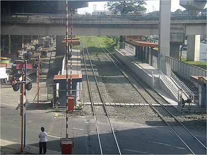
The station has the following entrances: Nichols
The first line to this station is MRT3, at 5:48 AM, and the last line is MRT3 at 1:00 AM.
This station serves MRTC’s lines
Popular routes from Nichols Pnr station, Manila
- South Luzon Expressway, Taguig City, Manila,
- Lawton Ave, Taguig City, Manila,
- Sales Road, Pasay City, Manila,
- South Luzon Expressway, Makati City, Manila
Bus stops near Nichols Pnr stop
- Taft Ave Mrt,
- Fti Complex Pnr
Train stations near Nichols Pnr station
- 18th Ave, Quezon City, Manila,
- A. Luna St, Pasig City, Manila,
- Epifanio De Los Santos Avenue, Lungsod Ng Pasay,
- 13th Ave / P. Tuazon Blvd, Quezon City, Manila,
- Eulogio Rodriguez Jr Ave, Pasig City, Manila,
- Zabarte Road / Quirino Highway Intersection, Caloocan City,
- Commerce Avenue, Ayala Alabang Village, Montinlupa City,
- Commonwealth Avenue, Quezon City,
- Terminal 3 Departures Rd, Pasay City, Manila,
- C. Cordero Street / 6th Avenue West Intersection, Caloocan City,
- Del Monte Avenue / Matutum Intersection, Quezon City,
- Villamor Health Center, Andrews Avenue, Pasay City, Manila,
- Paso De Blas, Valenzuela City,
- Avenida Rizal, 24,
- Monumento, Rizal Avenue, Caloocan City,
- M. Dela Fuente, Manila,
- Ninoy Aquino Ave, Parañaque City, Manila,
- Epifanio De Los Santos Avenue, Lungsod Ng Pasay,
- Maycauayan Camalig, City Of Meycauayan,
- Kamagong / Don Chino Roces Avenue Intersection, Manila
Popular public transit stations in Manila
Get around Manila by public transit!
Traveling around Manila has never been so easy. See step by step directions as you travel to any attraction, street or major public transit station. View bus and train schedules, arrival times, service alerts and detailed routes on a map, so you know exactly how to get to anywhere in Manila.
When traveling to any destination around Manila use Moovit's Live Directions with Get Off Notifications to know exactly where and how far to walk, how long to wait for your line, and how many stops are left. Moovit will alert you when it's time to get off — no need to constantly re-check whether yours is the next stop.
Wondering how to use public transit in Manila or how to pay for public transit in Manila? Moovit public transit app can help you navigate your way with public transit easily, and at minimum cost. It includes public transit fees, ticket prices, and costs. Looking for a map of Manila public transit lines? Moovit public transit app shows all public transit maps in Manila with all Bus and Train routes and stops on an interactive map.
Manila has 2 transit type(s), including: Bus and Train, operated by several transit agencies, including MRTC, LRTA, PNR, LTFRB, BGC Bus, P2P and UV Express