Directions to Nigloo Informatique (Reims) with public transportation
The following transit lines have routes that pass near Nigloo Informatique
 Bus: 25.
How to get to Nigloo Informatique by bus?
Click on the bus route to see step by step directions with maps, line arrival times and updated time schedules.
Bus stop near Nigloo Informatique in Reims
- Hollande, 3 min walk,VIEW
Bus lines to Nigloo Informatique in Reims
- 25, Clovis,VIEW
What are the closest stations to Nigloo Informatique?
The closest stations to Nigloo Informatique are:
- Hollande is 160 meters away, 3 min walk.
Which bus line stops near Nigloo Informatique?
25 (Zi Pompelle)
What’s the nearest bus station to Nigloo Informatique in Reims?
The nearest bus station to Nigloo Informatique in Reims is Hollande. It’s a 3 min walk away.
What time is the first bus to Nigloo Informatique in Reims?
The 25 is the first bus that goes to Nigloo Informatique in Reims. It stops nearby at 6:12 AM.
What time is the last bus to Nigloo Informatique in Reims?
The 25 is the last bus that goes to Nigloo Informatique in Reims. It stops nearby at 6:49 PM.
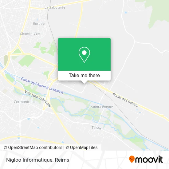
See Nigloo Informatique, Reims, on the map
Public Transit to Nigloo Informatique in Reims
Wondering how to get to Nigloo Informatique in Reims? Moovit helps you find the best way to get to Nigloo Informatique with step-by-step directions from the nearest public transit station.
Moovit provides free maps and live directions to help you navigate through your city. View schedules, routes, timetables, and find out how long does it take to get to Nigloo Informatique in real time.
Looking for the nearest stop or station to Nigloo Informatique? Check out this list of stops closest to your destination: Hollande.
Bus: 25.
Want to see if there’s another route that gets you there at an earlier time? Moovit helps you find alternative routes or times. Get directions from and directions to Nigloo Informatique easily from the Moovit App or Website.
We make riding to Nigloo Informatique easy, which is why over 1.5 million users, including users in Reims, trust Moovit as the best app for public transit. You don’t need to download an individual bus app or train app, Moovit is your all-in-one transit app that helps you find the best bus time or train time available.
For information on prices of bus, costs and ride fares to Nigloo Informatique, please check the Moovit app.
Use the app to navigate to popular places including to the airport, hospital, stadium, grocery store, mall, coffee shop, school, college, and university.
Nigloo Informatique Address: Rue Maurice Hollande 51100 Reims street in Reims
- Remotel,
- Bâtiment B,
- La Compagnie Numerique,
- Eugène Perma,
- Asp Line,
- Cabinet d'Affaires Michel Simond,
- Gousandier Anthony,
- L'Archimiste,
- Les Sacrés Lavandiers,
- Portes Métalliques Habitat,
- Efm,
- Sfr Business Distribution Sfr Business,
- Courtepaille,
- Point Retrait Cdiscount (Portes 37 / 38),
- Parc Industriel Maurice Hollande,
- Gpa Vie,
- Cabinet d'Expertise Comptable Parmantier-Toulouze,
- Station de recharge pour véhicules électriques,
- Clovis Location Location Service Reims,
- Val De Vesle
Places Near Nigloo Informatique (Reims)
- Cormontreuil, Reims,
- La Neuvillette, Reims,
- CHU, Reims,
- Tinqueux, Tinqueux,
- Bezannes, Bezannes,
- Croix Blandin, Reims,
- Carrefour, Tinqueux,
- Parc de Champagne, Reims,
- St Remi, Reims,
- Hôpital Debré, Reims,
- Gare Tgv, Bezannes,
- E. Leclerc Champfleury, Champfleury,
- Polyclinique Reims Bezannes, Bezannes,
- Leclerc, Saint-Brice-Courcelles,
- Moulin De La Housse, Reims,
- Ikea, Thillois,
- Campus Croix Rouge, Reims,
- Hôpital Maison Blanche, Reims,
- Parc Des Expositions, Reims,
- Bétheny, Bétheny
How to get to popular places in Reims with public transit
Get around Reims by public transit!
Traveling around Reims has never been so easy. See step by step directions as you travel to any attraction, street or major public transit station. View bus and train schedules, arrival times, service alerts and detailed routes on a map, so you know exactly how to get to anywhere in Reims.
When traveling to any destination around Reims use Moovit's Live Directions with Get Off Notifications to know exactly where and how far to walk, how long to wait for your line, and how many stops are left. Moovit will alert you when it's time to get off — no need to constantly re-check whether yours is the next stop.
Wondering how to use public transit in Reims or how to pay for public transit in Reims? Moovit public transit app can help you navigate your way with public transit easily, and at minimum cost. It includes public transit fees, ticket prices, and costs. Looking for a map of Reims public transit lines? Moovit public transit app shows all public transit maps in Reims with all Bus and Light Rail routes and stops on an interactive map.
Reims has 2 transit type(s), including: Bus and Light Rail, operated by several transit agencies, including Transdev Reims