How to get to Nih Building 45 * by bus?
Click on the bus route to see step by step directions with maps, line arrival times and updated time schedules.
From Meridian Hill Park, Washington
63 minFrom Wheaton, Maryland, Montgomery County
25 minFrom 1919 Connecticut Ave NW, Washington
74 minFrom MedStar Washington Hospital Center, Washington
76 minFrom Meridian Hill Park (Malcolm X Park), Washington
62 minFrom Montgomery Blair High School, Montgomery County
52 minFrom Target, Washington
62 minFrom Georgetown University Hospital, Washington
61 minFrom The Churchill Hotel, Washington
72 minFrom Rock Creek Park, Washington
60 min
How to get to Nih Building 45 * by metro?
Click on the metro route to see step by step directions with maps, line arrival times and updated time schedules.
From Meridian Hill Park, Washington
42 minFrom Wheaton, Maryland, Montgomery County
55 minFrom 1919 Connecticut Ave NW, Washington
31 minFrom MedStar Washington Hospital Center, Washington
52 minFrom Meridian Hill Park (Malcolm X Park), Washington
40 minFrom Target, Washington
36 minFrom The Churchill Hotel, Washington
30 min
Bus stops near Nih Building 45 * in Montgomery County
Train station near Nih Building 45 * in Montgomery County
- Kensington Marc Eb, 59 min walk,VIEW
Bus lines to Nih Building 45 * in Montgomery County
What are the closest stations to Nih Building 45 *?
The closest stations to Nih Building 45 * are:
- Medical Center Station & Bay E is 195 yards away, 3 min walk.
- Medical Center Station & Bay D is 218 yards away, 3 min walk.
- Medical Center Station & Bay C is 241 yards away, 3 min walk.
- Rockville Pk @ South Dr is 322 yards away, 4 min walk.
- Rockville Pike & South Dr FS Sb is 327 yards away, 4 min walk.
- Rockville Pi & South Dr is 331 yards away, 4 min walk.
- Kensington Marc Eb is 5037 yards away, 59 min walk.
Which bus lines stop near Nih Building 45 *?
These bus lines stop near Nih Building 45 *: 34, M70.
Which metro line stops near Nih Building 45 *?
RED (Shady Grove)
What’s the nearest bus station to Nih Building 45 * in Montgomery County?
The nearest bus stations to Nih Building 45 * in Montgomery County are Medical Center Station & Bay E, Medical Center Station & Bay D and Medical Center Station & Bay C. The closest one is a 3 min walk away.
What time is the first metro to Nih Building 45 * in Montgomery County?
The RED is the first metro that goes to Nih Building 45 * in Montgomery County. It stops nearby at 5:14 AM.
What time is the last metro to Nih Building 45 * in Montgomery County?
The RED is the last metro that goes to Nih Building 45 * in Montgomery County. It stops nearby at 12:27 AM.
What time is the first train to Nih Building 45 * in Montgomery County?
The MARC is the first train that goes to Nih Building 45 * in Montgomery County. It stops nearby at 5:45 AM.
What time is the last train to Nih Building 45 * in Montgomery County?
The MARC is the last train that goes to Nih Building 45 * in Montgomery County. It stops nearby at 7:42 PM.
What time is the first bus to Nih Building 45 * in Montgomery County?
The M70 is the first bus that goes to Nih Building 45 * in Montgomery County. It stops nearby at 4:59 AM.
What time is the last bus to Nih Building 45 * in Montgomery County?
The M70 is the last bus that goes to Nih Building 45 * in Montgomery County. It stops nearby at 2:14 AM.
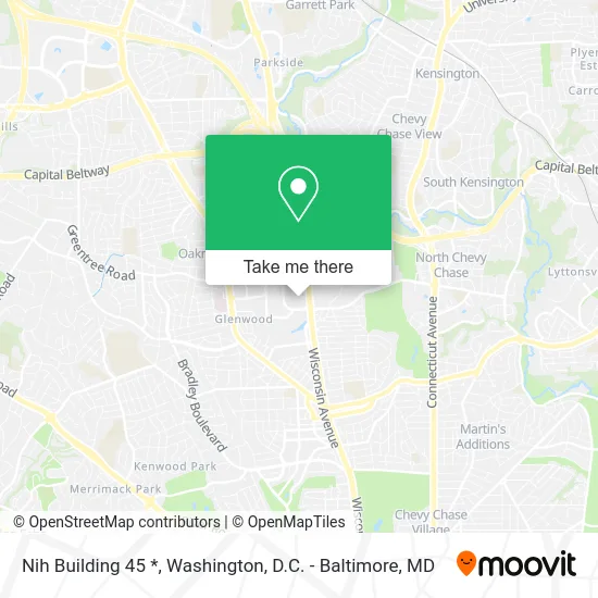
See Nih Building 45 *, Montgomery County, on the map
Public Transit to Nih Building 45 * in Montgomery County
Wondering how to get to Nih Building 45 * in Montgomery County? Moovit helps you find the best way to get to Nih Building 45 * with step-by-step directions from the nearest public transit station.
Moovit provides free maps and live directions to help you navigate through your city. View schedules, routes, timetables, and find out how long does it take to get to Nih Building 45 * in real time.
Looking for the nearest stop or station to Nih Building 45 *? Check out this list of stops closest to your destination: Medical Center Station & Bay E; Medical Center Station & Bay D; Medical Center Station & Bay C; Rockville Pk @ South Dr; Rockville Pike & South Dr FS Sb; Rockville Pi & South Dr; Kensington Marc Eb.
Bus: 34, M70, 30, 70, 101, 46, 33, 798, 203.Train: MARC.Metro: RED.
Want to see if there’s another route that gets you there at an earlier time? Moovit helps you find alternative routes or times. Get directions from and directions to Nih Building 45 * easily from the Moovit App or Website.
We make riding to Nih Building 45 * easy, which is why over 1.5 million users, including users in Montgomery County, trust Moovit as the best app for public transit. You don’t need to download an individual bus app or train app, Moovit is your all-in-one transit app that helps you find the best bus time or train time available.
For information on prices of bus and metro, costs and ride fares to Nih Building 45 *, please check the Moovit app.
Use the app to navigate to popular places including to the airport, hospital, stadium, grocery store, mall, coffee shop, school, college, and university.
Nih Building 45 * Address: Bethesda, MD 20814 street in Montgomery County
- Natcher Conference Center,
- District 7,
- Lot 871 - MLP-11 Nih,
- National Institutes of Health / Visitor Vehicle Inspection Station - Gateway Garage (MLP-11),
- Nih - Gateway Garage (Mlp-11),
- Medical Center Metro Kiss and Ride,
- Metro Bus J3,
- Bethesda Kiss and ride,
- Faes Bookstore,
- National Institutes of Health (NIH),
- NIH The Stone House,
- Navy Federal Credit Union - Restricted Access,
- Metro-Medical Center,
- City Towing,
- Cheap Affordable Towing,
- Apple Towing Company Towing,
- Towing Recovery,
- Hook Em Up Towing,
- Quick and Cheap Towing,
- Towing Towing
Places Near Nih Building 45 * (Montgomery County)
- Amazon Hq2, Arlington County,
- Rock Creek Tennis Center, Washington,
- Westfield Montgomery Mall, Montgomery County,
- Georgetown, Washington,
- Marriott Marquis Washington, DC, Washington,
- Basilica of the National Shrine, Washington,
- Sibley Memorial Hospital, Washington,
- Museum Of The Bible, Washington,
- Pennsylvania Ave NW (3rd st and pennsylvania), Washington,
- Washington DC VA Medical Center, Washington,
- National Museum of African American History and Culture, Washington,
- M&T Bank Stadium, Baltimore,
- Camden Yards, Baltimore,
- Capital One Arena, Washington,
- Warner Theatre, Washington,
- PG Mall, Prince George's County,
- National Zoo, Washington,
- The Anthem, Washington,
- National Theatre, Washington,
- Washington National Cathedral, Washington
How to get to popular places in Washington, D.C. - Baltimore, MD with public transit
Get around Montgomery County by public transit!
Traveling around Montgomery County has never been so easy. See step by step directions as you travel to any attraction, street or major public transit station. View bus and train schedules, arrival times, service alerts and detailed routes on a map, so you know exactly how to get to anywhere in Montgomery County.
When traveling to any destination around Montgomery County use Moovit's Live Directions with Get Off Notifications to know exactly where and how far to walk, how long to wait for your line, and how many stops are left. Moovit will alert you when it's time to get off — no need to constantly re-check whether yours is the next stop.
Wondering how to use public transit in Montgomery County or how to pay for public transit in Montgomery County? Moovit public transit app can help you navigate your way with public transit easily, and at minimum cost. It includes public transit fees, ticket prices, and costs. Looking for a map of Montgomery County public transit lines? Moovit public transit app shows all public transit maps in Montgomery County with all Bus, Train, Metro, Light Rail and Ferry routes and stops on an interactive map.
Washington, D.C. - Baltimore, MD has 5 transit type(s), including: Bus, Train, Metro, Light Rail and Ferry, operated by several transit agencies, including WMATA, Montgomery County Ride On, Fairfax Connector, TheBus, PRTC, DASH - Alexandria, Arlington Transit (ART), RTA of Central Maryland, MDOT MTA, MDOT MTA Light RailLink, MDOT MTA Commuter Bus, MDOT MTA Local Bus, FXBGO!, Virginia Railway Express (VRE) and MARC