Nilópolis station - Wednesday schedule
| Line | Direction | Time |
|---|---|---|
| EXTENSÃO PARACAMBI | Japeri | 4:51 AM |
| EXTENSÃO PARACAMBI | Paracambi | 5:07 AM |
| EXTENSÃO PARACAMBI | Japeri | 5:11 AM |
| EXTENSÃO PARACAMBI | Japeri | 5:31 AM |
| EXTENSÃO PARACAMBI | Japeri | 5:34 AM |
| EXTENSÃO PARACAMBI | Paracambi | 5:37 AM |
| EXTENSÃO PARACAMBI | Japeri | 5:51 AM |
| EXTENSÃO PARACAMBI | Paracambi | 5:55 AM |
| EXTENSÃO PARACAMBI | Japeri | 6:11 AM |
| EXTENSÃO PARACAMBI | Paracambi | 6:25 AM |
| EXTENSÃO PARACAMBI | Japeri | 6:31 AM |
| EXTENSÃO PARACAMBI | Japeri | 6:51 AM |
| EXTENSÃO PARACAMBI | Paracambi | 6:55 AM |
| EXTENSÃO PARACAMBI | Japeri | 7:03 AM |
| EXTENSÃO PARACAMBI | Japeri | 7:15 AM |
| EXTENSÃO PARACAMBI | Paracambi | 7:15 AM |
| EXTENSÃO PARACAMBI | Japeri | 7:27 AM |
| EXTENSÃO PARACAMBI | Paracambi | 7:35 AM |
| EXTENSÃO PARACAMBI | Japeri | 7:39 AM |
| EXTENSÃO PARACAMBI | Japeri | 7:51 AM |
| EXTENSÃO PARACAMBI | Japeri | 8:03 AM |
| EXTENSÃO PARACAMBI | Japeri | 8:04 AM |
| EXTENSÃO PARACAMBI | Paracambi | 8:07 AM |
| EXTENSÃO PARACAMBI | Japeri | 8:15 AM |
| EXTENSÃO PARACAMBI | Japeri | 8:27 AM |
Directions to Nilópolis station with public transit
The following transit lines have routes that pass near Nilópolis
 Bus: 120T, 138I, 429, 432, 451T.
- Train: RAMAL JAPERI.
How to get to Nilópolis station by bus?
Click on the bus route to see step by step directions with maps, line arrival times and updated time schedules.
How to get to Nilópolis station by train?
Click on the train route to see step by step directions with maps, line arrival times and updated time schedules.
Bus stops near Nilópolis stop
- Ponto Final - Nilópolis (Linhas 07, 106, 433i E 437i), 1 min walk,
- Lojas Americanas | Regulador Nilopolitana, 1 min walk,
- Praça Do Chafariz, 2 min walk,
- Praça Paulo De Frontin | Praça Do Chafariz, 2 min walk,
- Av. Getúlio De Moura 420 - Centro Nilópolis, 2 min walk,
- Avenida Getulio De Moura 1800 Centro Nilópolis - Rio De Janeiro 26500 Brasil, 2 min walk,
- Prezunic De Nilópolis, 2 min walk,
- Terminal Rodoviário De Nilópolis - Plataforma C, 4 min walk,
Train stations near Nilópolis station
- Édson Passos, 8 min walk,
Bus lines to Nilópolis station
- 07, Paiol - Centro (Circular),
- 106, Nilópolis - Pavuna (Via Éden / Cristal),
- 433I, Pavuna - Nilópolis (Via Éden / Gato Preto),
- 437I, Nilópolis - Coelho da Rocha (Via Nova Cidade),
- 03, Pedro Álvares Cabral - Novo Horizonte,
- 103I, Nilópolis - Shopping Grande Rio (Via Portugal Pequeno),
- 120T, Caxias - Itaguaí (Via Nova Iguaçu / Piranema),
- 129B, Nilópolis - Central (via Vila Norma),
- 138I, Duque de Caxias - Nilópolis (Via Mirandela / Metrô Pavuna),
- 429, Queimados - Caxias (Via Austin / Nilópolis / Vilar dos Teles),
- 516I, Nilópolis - Terminal Margaridas (Shopping Grande Rio),
- 04, Nova Cidade ↔ Paiol (Circular),
- 434L, Nova Iguaçu,
- 451T, Caxias,
- 104I, Nilópolis,
- 143C, Nova Iguaçu,
- 544P, Nilópolis,
- 548P, Campo Grande,
- INTERCAMPI 3, Campus 458 - Nova Iguaçu (Via Avenida Brasil),
- 06, Maria Braga - Cabral (Via Fórum - Circular),
What are the closest stations to Nilópolis?
The closest stations to Nilópolis are:
- Ponto Final - Nilópolis (Linhas 07, 106, 433i E 437i) stop is 21 meters away, 1 min walk.
- Lojas Americanas | Regulador Nilopolitana stop is 23 meters away, 1 min walk.
- Praça Do Chafariz stop is 75 meters away, 2 min walk.
- Praça Paulo De Frontin | Praça Do Chafariz stop is 89 meters away, 2 min walk.
- Av. Getúlio De Moura 420 - Centro Nilópolis stop is 122 meters away, 2 min walk.
- Avenida Getulio De Moura 1800 Centro Nilópolis - Rio De Janeiro 26500 Brasil stop is 136 meters away, 2 min walk.
- Prezunic De Nilópolis stop is 145 meters away, 2 min walk.
- Terminal Rodoviário De Nilópolis - Plataforma C is 310 meters away, 4 min walk.
- Édson Passos station is 568 meters away, 8 min walk.
Which bus lines stop near Nilópolis?
These bus lines stop near Nilópolis: 120T, 138I, 429, 432, 451T, 541L, 544, 551.
Which train line stops near Nilópolis?
RAMAL JAPERI (Central do Brasil)
What’s the nearest train station to Nilópolis?
The nearest train station to Nilópolis is Édson Passos. It’s a 8 min walk away.
What’s the nearest bus station to Nilópolis?
The nearest bus stations to Nilópolis are Ponto Final - Nilópolis (Linhas 07, 106, 433i E 437i) and Lojas Americanas | Regulador Nilopolitana. The closest one is a 1 min walk away.
What time is the first train to Nilópolis?
The RAMAL JAPERI is the first train that goes to Nilópolis. It stops nearby at 4:45 AM.
What time is the last train to Nilópolis?
The RAMAL JAPERI is the last train that goes to Nilópolis. It stops nearby at 11:20 PM.
What time is the first bus to Nilópolis?
The 429 is the first bus that goes to Nilópolis. It stops nearby at 3:07 AM.
What time is the last bus to Nilópolis?
The 429 is the last bus that goes to Nilópolis. It stops nearby at 3:47 AM.
Nilópolis station
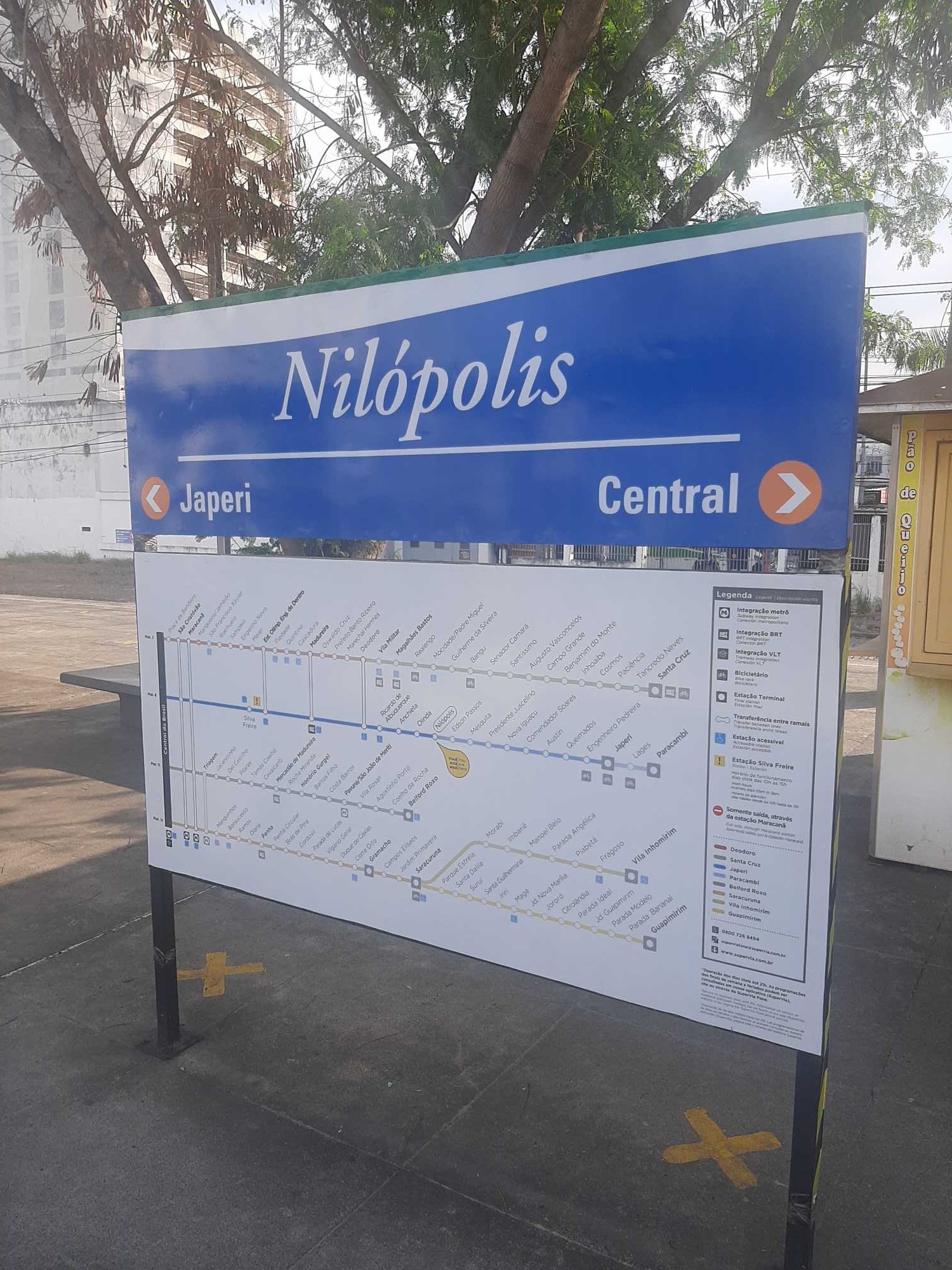 Taken by Alvaro E.
See Nilópolis station on the map
Public transit to Nilópolis station
Looking for directions to Nilópolis in Nilópolis, Brazil?
Download the Moovit App to find the current schedule and step-by-step directions for Bus or Train routes that pass through Nilópolis.
Looking for the nearest stops closest to Nilópolis ? Check out this list of closest stops to your destination: Ponto Final - Nilópolis (Linhas 07; Lojas Americanas | Regulador Nilopolitana; Praça Do Chafariz; Praça Paulo De Frontin | Praça Do Chafariz; Av. Getúlio De Moura 420 - Centro Nilópolis; Avenida Getulio De Moura 1800 Centro Nilópolis - Rio De Janeiro 26500 Brasil; Prezunic De Nilópolis; Terminal Rodoviário De Nilópolis - Plataforma C; Édson Passos.
Bus: 120T, 138I, 429, 432, 451T, 541L, 544, 551, 07, 106, 433I, 437I, 03, 103I, 129B, 04, 434L, 104I, 143C.Train: RAMAL JAPERI.
We make riding on public transit to Nilópolis easy, which is why over 1.7 billion users, including users in Nilópolis trust Moovit as the best app for public transit.
Use the app to navigate to popular places including to the airport, hospital, stadium, grocery store, mall, coffee shop, school, college, and university.
The station has the following entrances: Av. Getúlio De Moura and Av. Carmela Dutra
The first line to this station is EXTENSÃO PARACAMBI, at 4:51 AM, and the last line is EXTENSÃO PARACAMBI at 11:15 PM.
1532 Avenida Roberto Silveira, Nilópolis, Brazil
This station serves TrensRJ’s lines

Popular routes from Nilópolis station
- Ponto Final - Nilópolis (Linhas 07, 106, 433i E 437i),
- Lojas Americanas | Regulador Nilopolitana,
- Praça Do Chafariz,
- Praça Paulo De Frontin | Praça Do Chafariz,
- Av. Getúlio De Moura 420 - Centro Nilópolis,
- Avenida Getulio De Moura 1800 Centro Nilópolis - Rio De Janeiro 26500 Brasil,
- Prezunic De Nilópolis,
- Terminal Rodoviário De Nilópolis - Plataforma C
Bus stops near Nilópolis stop
- Édson Passos
Train station near Nilópolis station
- Praia De São Conrado,
- Ponto Final - Merck (Linha 990),
- Curva Do ''S'',
- Saída 7 - Linha Amarela (Sentido Barra),
- Av. Ayrton Senna | Passarela Da Gardênia | Espaço Hall,
- Colégio,
- Estrada Dos Bandeirantes | BRT Curicica,
- Rua Gregorio Santana, 51,
- Terminal Candelária - Zona Oeste,
- Avenida Venezuela | Praça Mauá,
- Estrada Das Capoeiras, 490,
- Posto Shell | Barrashopping,
- Ponto Final - Alto Da Serra (Trel),
- Avenida Ministro Edgard Romero, 460,
- Terminal Praça Saens Peña (Integração Com Metrô - 608),
- Leopoldina (Pista Central - Sentido Ponte / Term. Gentileza / São Cristóvão),
- Avenida Washington Luís, 1587,
- Unicarioca,
- Rua Jardim Botânico, 657,
- BRS 1 / 2 / 3 / 4 / 5 / I - Tribunal De Justiça Do Rio De Janeiro
Popular public transit stations in Nilópolis
Get around Nilópolis by public transit!
Traveling around Nilópolis has never been so easy. See step by step directions as you travel to any attraction, street or major public transit station. View bus and train schedules, arrival times, service alerts and detailed routes on a map, so you know exactly how to get to anywhere in Nilópolis.
When traveling to any destination around Nilópolis use Moovit's Live Directions with Get Off Notifications to know exactly where and how far to walk, how long to wait for your line, and how many stops are left. Moovit will alert you when it's time to get off — no need to constantly re-check whether yours is the next stop.
Wondering how to use public transit in Nilópolis or how to pay for public transit in Nilópolis? Moovit public transit app can help you navigate your way with public transit easily, and at minimum cost. It includes public transit fees, ticket prices, and costs. Looking for a map of Nilópolis public transit lines? Moovit public transit app shows all public transit maps in Nilópolis with all Bus, Train, Metro, Light Rail, Ferry, Cable Car, Gondola and Funicular routes and stops on an interactive map.
Rio de Janeiro Region has 8 transit type(s), including: Bus, Train, Metro, Light Rail, Ferry, Cable Car, Gondola and Funicular, operated by several transit agencies, including TrensRJ, Metrô Rio, VLT Carioca, Barcas Rio, BRT MOBI-Rio, Auto Viação Alpha, Auto Viação Tijuca, Gire Transportes, Transurb, Viação Nossa Senhora das Graças, Consórcio INTERSUL, Braso Lisboa, Caprichosa Auto Ônibus, Auto Viação Três Amigos and Rodoviária Âncora Matias