How to get to Nineteen Structure by bus?
Click on the bus route to see step by step directions with maps, line arrival times and updated time schedules.
From Galleria Mall, Fort Lauderdale
71 minFrom Sample Rd, Deerfield Beach
74 minFrom Galleria at Fort Lauderdale (Galleria Mall At Fort Lauderdale), Fort Lauderdale
69 minFrom Broward Health Medical Center, Fort Lauderdale
69 minFrom Amazon Fulfillment Center-DMF3, Pompano Beach
63 minFrom Coral Ridge Mall, Fort Lauderdale
49 minFrom Tamarac, Coral Springs-Margate
49 minFrom Broward Center for the Performing Arts, Fort Lauderdale
54 minFrom E Commercial Blvd, Fort Lauderdale
38 minFrom Coral Square Mall Shopping Center, Coral Springs-Margate
59 min
Bus stops near Nineteen Structure in Fort Lauderdale
Bus lines to Nineteen Structure in Fort Lauderdale
What are the closest stations to Nineteen Structure?
The closest stations to Nineteen Structure are:
- Commercial Boulevard/Northwest 37th Avenue is 652 yards away, 8 min walk.
- US 441/Northwest 53rd Street is 1569 yards away, 19 min walk.
Which bus lines stop near Nineteen Structure?
These bus lines stop near Nineteen Structure: 11, 441, 55.
What’s the nearest bus station to Nineteen Structure in Fort Lauderdale?
The nearest bus station to Nineteen Structure in Fort Lauderdale is Commercial Boulevard/Northwest 37th Avenue. It’s a 8 min walk away.
What time is the first bus to Nineteen Structure in Fort Lauderdale?
The 19 is the first bus that goes to Nineteen Structure in Fort Lauderdale. It stops nearby at 4:48 AM.
What time is the last bus to Nineteen Structure in Fort Lauderdale?
The 19 is the last bus that goes to Nineteen Structure in Fort Lauderdale. It stops nearby at 1:02 AM.
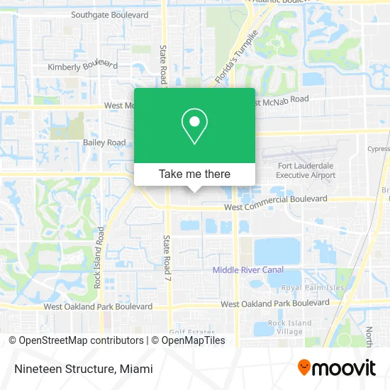
See Nineteen Structure, Fort Lauderdale, on the map
Public Transit to Nineteen Structure in Fort Lauderdale
Wondering how to get to Nineteen Structure in Fort Lauderdale? Moovit helps you find the best way to get to Nineteen Structure with step-by-step directions from the nearest public transit station.
Moovit provides free maps and live directions to help you navigate through your city. View schedules, routes, timetables, and find out how long does it take to get to Nineteen Structure in real time.
Looking for the nearest stop or station to Nineteen Structure? Check out this list of stops closest to your destination: Commercial Boulevard/Northwest 37th Avenue; US 441/Northwest 53rd Street.
Bus: 11, 441, 55, 19.
Want to see if there’s another route that gets you there at an earlier time? Moovit helps you find alternative routes or times. Get directions from and directions to Nineteen Structure easily from the Moovit App or Website.
We make riding to Nineteen Structure easy, which is why over 1.5 million users, including users in Fort Lauderdale, trust Moovit as the best app for public transit. You don’t need to download an individual bus app or train app, Moovit is your all-in-one transit app that helps you find the best bus time or train time available.
For information on prices of bus and train, costs and ride fares to Nineteen Structure, please check the Moovit app.
Use the app to navigate to popular places including to the airport, hospital, stadium, grocery store, mall, coffee shop, school, college, and university.
Nineteen Structure Address: 3560 NW 53rd St Fort Lauderdale, FL 33309 street in Fort Lauderdale
- Usa7e,
- Extraordinary Power Catamaran Charter,
- Powerfulu Healthcare Services,
- Dynamic Healing,
- Pinkys Tacos,
- Anesthesia Services,
- Asian Lilly Spa,
- Beacon Miricale Ministries,
- Bmi Broadcast Network,
- Eci Pharmaceuticals Fax Line,
- Terroir Selections,
- Pip Marketing, Signs, Print,
- Cec Plumbing,
- The Jewelry Tray Factory,
- Opticon,
- Victor Feria,
- Schroth,
- Adt Solar,
- Big Brothers Big Sisters of Broward County,
- Car Lockout Service
Places Near Nineteen Structure (Fort Lauderdale)
- Miami VA Hospital, Miami,
- Wynwood, Miami,
- Keiser University Flagship Campus, West Palm Beach,
- Miami Design District, Miami,
- Sawgrass mall ( FL ), Miami Beach,
- Marlins Park, Miami,
- Sawgrass Mall, Miami,
- Aventura Mall, Miami,
- Richard E. Gerstein Justice Building, Miami,
- Dolphin Mall, Miami,
- Brickell City Centre, Miami,
- Zoo Miami, Miami,
- Dolphin Mall Bus, Miami,
- Miami Freedom Park, Miami,
- Miami-Dade County Courthouse, Miami,
- Little Havana, Miami,
- Port of Miami Cruise Terminal, Miami,
- Hard Rock Stadium, Miami Gardens,
- Bayside Marketplace, Miami,
- Aventura Mall, Miami Beach
How to get to popular places in Miami with public transit
Get around Fort Lauderdale by public transit!
Traveling around Fort Lauderdale has never been so easy. See step by step directions as you travel to any attraction, street or major public transit station. View bus and train schedules, arrival times, service alerts and detailed routes on a map, so you know exactly how to get to anywhere in Fort Lauderdale.
When traveling to any destination around Fort Lauderdale use Moovit's Live Directions with Get Off Notifications to know exactly where and how far to walk, how long to wait for your line, and how many stops are left. Moovit will alert you when it's time to get off — no need to constantly re-check whether yours is the next stop.
Wondering how to use public transit in Fort Lauderdale or how to pay for public transit in Fort Lauderdale? Moovit public transit app can help you navigate your way with public transit easily, and at minimum cost. It includes public transit fees, ticket prices, and costs. Looking for a map of Fort Lauderdale public transit lines? Moovit public transit app shows all public transit maps in Fort Lauderdale with all Bus, Train, Light Rail and Ferry routes and stops on an interactive map.
Miami has 4 transit type(s), including: Bus, Train, Light Rail and Ferry, operated by several transit agencies, including Broward County Transit, Miami-Dade Transit, Metrorail, Palm Tran, Tri-Rail, Brightline, MARTY, City of Homestead Trolley, Key West Transit, Treasure Coast Connector, GoLine IRT, Amtrak, Greyhound-us, FlixBus-us and Aventura Express Shuttle Bus