How to get to Ninho @ Francos by bus?
Click on the bus route to see step by step directions with maps, line arrival times and updated time schedules.
From Hospital Privado de Alfena, Alfena
58 minFrom Parque Biológico de Gaia, Vila Nova De Gaia
65 minFrom Hospital-Escola Universidade Fernando Pessoa, Gondomar (São Cosme), Valbom e Jovim
49 minFrom Gulpilhares, Gulpilhares e Valadares
91 minFrom TrofaSaúde Hospital Alfena-Urgências, Alfena
58 minFrom Pavilhão Siza Vieira - Leixões SC, Matosinhos e Leça da Palmeira
33 minFrom Monte Da Virgem, Vila Nova De Gaia
64 minFrom Aeroporto do Porto-Parque Low Cost P9, Moreira
45 minFrom Shopping Mira Maia, Moreira
38 minFrom Metro João de Deus [D], Mafamude e Vilar do Paraíso
48 min
How to get to Ninho @ Francos by train?
Click on the train route to see step by step directions with maps, line arrival times and updated time schedules.
How to get to Ninho @ Francos by metro?
Click on the metro route to see step by step directions with maps, line arrival times and updated time schedules.
Bus stops near Ninho @ Francos in Ramalde
Metro station near Ninho @ Francos in Ramalde
- Viso, 5 min walk,VIEW
Bus lines to Ninho @ Francos in Ramalde
- 206, Br. Sto.eugénio (escola),VIEW
- 5024, Boavista (Casa da Música),VIEW
- 203, Marquês - Castelo do Queijo,VIEW
- 204, Hospital São João - Foz,VIEW
- 209, Pasteleira - Prelada,VIEW
- 704, Boavista (Casa da Música) - Codiceira (Largo),VIEW
- 803, Boavista (Bom Sucesso) - Rio Tinto (Escola Secundária),VIEW
- 13M, Matosinhos Mercado,VIEW
- 202, Passeio Alegre,VIEW
- 208, Aldoar Junta Freg.,VIEW
- 501, Matosinhos Praia,VIEW
- 507, Sidónio Pais,VIEW
- 601, Aeroporto,VIEW
What are the closest stations to Ninho @ Francos?
The closest stations to Ninho @ Francos are:
- Lugarinho is 117 meters away, 2 min walk.
- R. Pedro Hispano is 277 meters away, 4 min walk.
- Casa De Saúde Da Boavista is 296 meters away, 4 min walk.
- Viso is 360 meters away, 5 min walk.
Which bus lines stop near Ninho @ Francos?
These bus lines stop near Ninho @ Francos: 202, 206, 300, 501, 602, 704, 903.
Which train line stops near Ninho @ Francos?
LINHA DO MARCO (Porto Sao Bento)
Which metro lines stop near Ninho @ Francos?
These metro lines stop near Ninho @ Francos: A, B, C, E.
What’s the nearest metro station to Ninho @ Francos in Ramalde?
The nearest metro station to Ninho @ Francos in Ramalde is Viso. It’s a 5 min walk away.
What’s the nearest bus station to Ninho @ Francos in Ramalde?
The nearest bus station to Ninho @ Francos in Ramalde is Lugarinho. It’s a 2 min walk away.
What time is the first metro to Ninho @ Francos in Ramalde?
The C is the first metro that goes to Ninho @ Francos in Ramalde. It stops nearby at 6:00 AM.
What time is the last metro to Ninho @ Francos in Ramalde?
The A is the last metro that goes to Ninho @ Francos in Ramalde. It stops nearby at 1:29 AM.
What time is the first bus to Ninho @ Francos in Ramalde?
The 13M is the first bus that goes to Ninho @ Francos in Ramalde. It stops nearby at 3:09 AM.
What time is the last bus to Ninho @ Francos in Ramalde?
The 13M is the last bus that goes to Ninho @ Francos in Ramalde. It stops nearby at 2:09 AM.
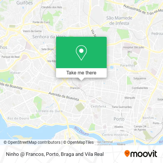
See Ninho @ Francos, Ramalde, on the map
Public Transit to Ninho @ Francos in Ramalde
Wondering how to get to Ninho @ Francos in Ramalde? Moovit helps you find the best way to get to Ninho @ Francos with step-by-step directions from the nearest public transit station.
Moovit provides free maps and live directions to help you navigate through your city. View schedules, routes, timetables, and find out how long does it take to get to Ninho @ Francos in real time.
Looking for the nearest stop or station to Ninho @ Francos? Check out this list of stops closest to your destination: Lugarinho; R. Pedro Hispano; Casa De Saúde Da Boavista; Viso.
Bus: 202, 206, 300, 501, 602, 704, 903, 5024, 203, 204, 209, 803, 13M, 208, 507.Train: LINHA DO MARCO.Metro: A, B, C, E, BX.
Want to see if there’s another route that gets you there at an earlier time? Moovit helps you find alternative routes or times. Get directions from and directions to Ninho @ Francos easily from the Moovit App or Website.
We make riding to Ninho @ Francos easy, which is why over 1.5 million users, including users in Ramalde, trust Moovit as the best app for public transit. You don’t need to download an individual bus app or train app, Moovit is your all-in-one transit app that helps you find the best bus time or train time available.
For information on prices of bus, metro and train, costs and ride fares to Ninho @ Francos, please check the Moovit app.
Use the app to navigate to popular places including to the airport, hospital, stadium, grocery store, mall, coffee shop, school, college, and university.
Ninho @ Francos Address: Rua de Francos 173 Francos, 4250-219 Porto street in Ramalde
- Decsis II - Redes de Telecomunicações,
- Decunify - Soluções de Comunicações, S.a.,
- pote velho,
- Lua de Lótus - Centro de Terapias e Formação,
- Pedro Negrão & Lina Melão,
- Lia Mártin Cabeleireiro,
- Cerejójasmim,
- Farmácia Guimarães,
- Monte de Ramalde,
- Jorge António Pereira Proença,
- Rotunda Francos,
- Rua de Francos,
- Cafe Snack-Bar Pilar,
- Subestação Monte dos Burgos,
- Pirâmide de Sorrisos - Clínica de Medicina Dentária,
- Clínica Urológica Professor Doutor Paulo Denis de Oliveira,
- Rua de Domingos Machado 186,
- Condominio Navegantes,
- Escovaria de Belomonte,
- Centro Comercial do Carvalhido
Places Near Ninho @ Francos (Ramalde)
- Arrábida Shopping, Santa Marinha e São Pedro da Afurada,
- Rua Calouste Gulbenkian, Lordelo do Ouro e Massarelos,
- Hospital Santos Silva, Vila Nova De Gaia,
- Senhor de Matosinhos, Matosinhos e Leça da Palmeira,
- Parque Aquatico Amarante - Aqua Aventura, Amarante,
- Avintes, Vila Nova De Gaia,
- El Corte Inglés de Gaia, Mafamude e Vilar do Paraíso,
- Acesso ao Shopping Parque Nascente, Campanhã,
- Maia, Maia,
- Canidelo, Vila Nova De Gaia,
- Exponor, Matosinhos e Leça da Palmeira,
- Espinho, Espinho,
- Leça da Palmeira, Matosinhos e Leça da Palmeira,
- Palácio de Cristal, Lordelo do Ouro e Massarelos,
- Hospital da Prelada, Ramalde,
- VILA do CONDE PORTO FASHION OUTLET, Modivas,
- Hospital de Santo António, Cedofeita, Santo Ildefonso, Sé, Miragaia, São Nicolau e Vitória,
- Valongo, Valongo,
- Zoo Santo Inácio, Vila Nova De Gaia,
- MAR Shopping, Matosinhos e Leça da Palmeira
How to get to popular places in Porto, Braga and Vila Real with public transit
Get around Ramalde by public transit!
Traveling around Ramalde has never been so easy. See step by step directions as you travel to any attraction, street or major public transit station. View bus and train schedules, arrival times, service alerts and detailed routes on a map, so you know exactly how to get to anywhere in Ramalde.
When traveling to any destination around Ramalde use Moovit's Live Directions with Get Off Notifications to know exactly where and how far to walk, how long to wait for your line, and how many stops are left. Moovit will alert you when it's time to get off — no need to constantly re-check whether yours is the next stop.
Wondering how to use public transit in Ramalde or how to pay for public transit in Ramalde? Moovit public transit app can help you navigate your way with public transit easily, and at minimum cost. It includes public transit fees, ticket prices, and costs. Looking for a map of Ramalde public transit lines? Moovit public transit app shows all public transit maps in Ramalde with all Bus, Train, Metro, Ferry, Funicular and Gondola routes and stops on an interactive map.
Porto, Braga and Vila Real has 6 transit type(s), including: Bus, Train, Metro, Ferry, Funicular and Gondola, operated by several transit agencies, including Metro do Porto, Metro do Porto - Metrobus, CP - Comboios de Portugal, STCP, UNIR Mobilidade da Area Metropolitana do Porto, Getbus - Aerobus, Mobiave, Valpibus, TUB - Transportes Urbanos de Braga, TuViana, Guimabus, Ave Mobilidade, Cávado Mobilidade, Transdev and Câmara Municipal de Santo Tirso