Directions to Nitzan Channa Roth, Md (Manhasset) with public transportation
The following transit lines have routes that pass near Nitzan Channa Roth, Md
 Bus: N25, N26, N25/58.
- Train: PORT WASHINGTON BRANCH.
How to get to Nitzan Channa Roth, Md by bus?
Click on the bus route to see step by step directions with maps, line arrival times and updated time schedules.
From Whitestone, NY, Queens
94 minFrom BAPS Shri Swaminarayan Mandir, Queens
89 minFrom Garden City, NY, Garden City
73 minFrom St. John's University, Queens
58 minFrom Ohel Chabad Lubavitch, Queens
87 minFrom Whitestone, Queens
91 minFrom 168-46 91st Ave, Queens
64 minFrom Queens College, Queens
75 minFrom Flushing, NY, Queens
74 minFrom Roosevelt Field Mall Bus Terminal, East Garden City
82 min
How to get to Nitzan Channa Roth, Md by train?
Click on the train route to see step by step directions with maps, line arrival times and updated time schedules.
Bus stop near Nitzan Channa Roth, Md in Manhasset
- Community Dr Opp #400, 7 min walk,VIEW
Train station near Nitzan Channa Roth, Md in Manhasset
- Manhasset, 24 min walk,VIEW
Bus lines to Nitzan Channa Roth, Md in Manhasset
What are the closest stations to Nitzan Channa Roth, Md?
The closest stations to Nitzan Channa Roth, Md are:
- Community Dr Opp #400 is 569 yards away, 7 min walk.
- Manhasset is 2008 yards away, 24 min walk.
Which bus lines stop near Nitzan Channa Roth, Md?
These bus lines stop near Nitzan Channa Roth, Md: N25, N26.
Which train line stops near Nitzan Channa Roth, Md?
PORT WASHINGTON BRANCH (Port Washington)
What’s the nearest train station to Nitzan Channa Roth, Md in Manhasset?
The nearest train station to Nitzan Channa Roth, Md in Manhasset is Manhasset. It’s a 24 min walk away.
What’s the nearest bus station to Nitzan Channa Roth, Md in Manhasset?
The nearest bus station to Nitzan Channa Roth, Md in Manhasset is Community Dr Opp #400. It’s a 7 min walk away.
What time is the first train to Nitzan Channa Roth, Md in Manhasset?
The PORT WASHINGTON BRANCH is the first train that goes to Nitzan Channa Roth, Md in Manhasset. It stops nearby at 3:47 AM.
What time is the last train to Nitzan Channa Roth, Md in Manhasset?
The PORT WASHINGTON BRANCH is the last train that goes to Nitzan Channa Roth, Md in Manhasset. It stops nearby at 2:26 AM.
What time is the first bus to Nitzan Channa Roth, Md in Manhasset?
The N25 is the first bus that goes to Nitzan Channa Roth, Md in Manhasset. It stops nearby at 5:52 AM.
What time is the last bus to Nitzan Channa Roth, Md in Manhasset?
The N25 is the last bus that goes to Nitzan Channa Roth, Md in Manhasset. It stops nearby at 11:08 PM.
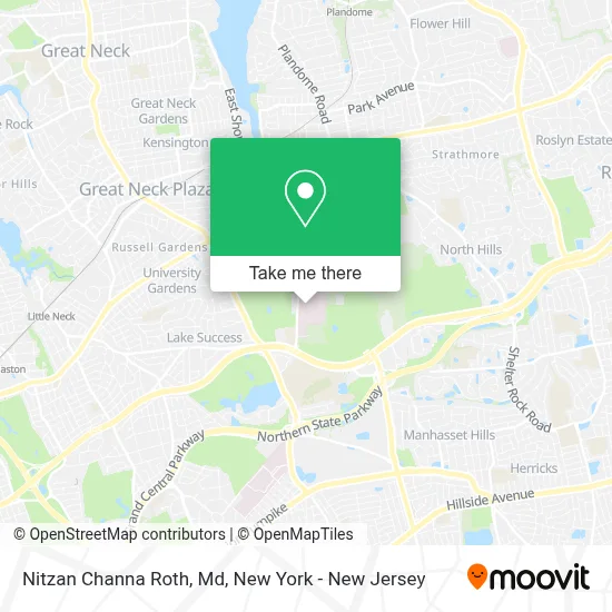
See Nitzan Channa Roth, Md, Manhasset, on the map
Public Transit to Nitzan Channa Roth, Md in Manhasset
Wondering how to get to Nitzan Channa Roth, Md in Manhasset? Moovit helps you find the best way to get to Nitzan Channa Roth, Md with step-by-step directions from the nearest public transit station.
Moovit provides free maps and live directions to help you navigate through your city. View schedules, routes, timetables, and find out how long does it take to get to Nitzan Channa Roth, Md in real time.
Looking for the nearest stop or station to Nitzan Channa Roth, Md? Check out this list of stops closest to your destination: Community Dr Opp #400; Manhasset.
Bus: N25, N26, N25/58.Train: PORT WASHINGTON BRANCH.
Want to see if there’s another route that gets you there at an earlier time? Moovit helps you find alternative routes or times. Get directions from and directions to Nitzan Channa Roth, Md easily from the Moovit App or Website.
We make riding to Nitzan Channa Roth, Md easy, which is why over 1.5 million users, including users in Manhasset, trust Moovit as the best app for public transit. You don’t need to download an individual bus app or train app, Moovit is your all-in-one transit app that helps you find the best bus time or train time available.
For information on prices of bus and train, costs and ride fares to Nitzan Channa Roth, Md, please check the Moovit app.
Use the app to navigate to popular places including to the airport, hospital, stadium, grocery store, mall, coffee shop, school, college, and university.
Nitzan Channa Roth, Md Address: 400 Community Dr 1st Fl street in Manhasset
- Timea Csak, Md,
- Ahmed Ezz Eldin Fahmy, Md,
- Lawrence Gee-Yuan Ha, Md,
- Paul Daniel Zelenetz, Md,
- Lawrence Lau, Md,
- Elliot Ian Grodstein, Md,
- Northwell Health Physician Partners Dental Medicine at Manhasset,
- Ernesto Pompeo Molmenti, Md, Phd, Mba,
- Nabil Nuhad Dagher, Md,
- David H. Shepp, Md,
- Joseph Steven Cervia, Md, Mba,
- Mersema Abate, Md, Mph,
- Vinay Nair, Do,
- Jonathan Aryeh Garellek, Do,
- Gayatri Devi Nair, Md,
- Madhu Chakkupurayil Bhaskaran, Md,
- Sanjaya K. Satapathy, Md, Mbbs, Ms,
- Harmit Singh Kalia, Do,
- James Sungsik Park, Md,
- Mustafa Al-Roubaie, Md
Places Near Nitzan Channa Roth, Md (Manhasset)
- Katz's Deli, Manhattan,
- Chinatown, Manhattan,
- SoHo, Manhattan,
- Rockefeller Center, Manhattan,
- 66 John Street, Manhattan,
- Queens Center Mall, Queens,
- Times Square, Manhattan,
- Hudson Yards, Manhattan,
- 26 Federal Plaza, Manhattan,
- San Gennaro Feast, Manhattan,
- 911 Memorial, Manhattan,
- Bellevue Hospital, Manhattan,
- 111 Centre New York City Supreme Court, Manhattan,
- Wall Street, Manhattan,
- 376 Hudson Street, Manhattan,
- Mountainside Hospital, Glen Ridge,
- Pier 83, Manhattan,
- qqqq, Manhattan,
- 3 Stone St, Manhattan,
- 1 Police Plaza, Manhattan
How to get to popular places in New York - New Jersey with public transit
Get around Manhasset by public transit!
Traveling around Manhasset has never been so easy. See step by step directions as you travel to any attraction, street or major public transit station. View bus and train schedules, arrival times, service alerts and detailed routes on a map, so you know exactly how to get to anywhere in Manhasset.
When traveling to any destination around Manhasset use Moovit's Live Directions with Get Off Notifications to know exactly where and how far to walk, how long to wait for your line, and how many stops are left. Moovit will alert you when it's time to get off — no need to constantly re-check whether yours is the next stop.
Wondering how to use public transit in Manhasset or how to pay for public transit in Manhasset? Moovit public transit app can help you navigate your way with public transit easily, and at minimum cost. It includes public transit fees, ticket prices, and costs. Looking for a map of Manhasset public transit lines? Moovit public transit app shows all public transit maps in Manhasset with all Bus, Train, Subway, Light Rail, Ferry and Cable Car routes and stops on an interactive map.
New York - New Jersey has 6 transit type(s), including: Bus, Train, Subway, Light Rail, Ferry and Cable Car, operated by several transit agencies, including MTA Subway, Metro-North Railroad, LIRR, PATH, MTA New York City Transit - Express routes, MTA Bus, NJ Transit, NYC Ferry, NICE bus, Bee-Line Bus, NJ Transit Rail, Norwalk Transit District, Hartford Line, River Valley Transit and HART