Directions to Nokomis, Florida with public transportation
The following transit lines have routes that pass near Nokomis, Florida
 Bus: 17.
How to get to Nokomis, Florida by bus?
Click on the bus route to see step by step directions with maps, line arrival times and updated time schedules.
Bus stop near Nokomis, Florida
- S Tamiami Trl @ Nippino Trl W, 4 min walk,
Bus lines to Nokomis, Florida
- 17, N Seaboard Ave @ E Venice Ave,
What are the closest stations to Nokomis, Florida?
The closest stations to Nokomis, Florida are:
- S Tamiami Trl @ Nippino Trl W is 282 yards away, 4 min walk.
Which bus line stops near Nokomis, Florida?
17 (N Lemon Ave @ 2nd St→N Seaboard Ave @ E Venice Ave)
What’s the nearest bus station to Nokomis, Florida?
The nearest bus station to Nokomis, Florida is S Tamiami Trl @ Nippino Trl W. It’s a 4 min walk away.
What time is the first bus to Nokomis, Florida?
The 17 is the first bus that goes to Nokomis, Florida. It stops nearby at 5:32 AM.
What time is the last bus to Nokomis, Florida?
The 17 is the last bus that goes to Nokomis, Florida. It stops nearby at 10:32 PM.
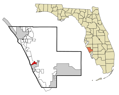
See Nokomis, Florida on the map
Public Transportation to Nokomis, Florida
Wondering how to get to Nokomis, Florida? Moovit helps you find the best way to get to Nokomis, Florida with step-by-step directions from the nearest public transit station.
Moovit provides free maps and live directions to help you navigate through your city. View schedules, routes, timetables, and find out how long does it take to get to Nokomis, Florida in real time.
Looking for the nearest stop or station to Nokomis, Florida? Check out this list of stops closest to your destination: S Tamiami Trl @ Nippino Trl W.
Bus: 17.
Want to see if there’s another route that gets you there at an earlier time? Moovit helps you find alternative routes or times. Get directions from and directions to Nokomis, Florida easily from the Moovit App or Website.
We make riding to Nokomis, Florida easy, which is why over 1.5 million users, including users in Nokomis, trust Moovit as the best app for public transit. You don’t need to download an individual bus app or train app, Moovit is your all-in-one transit app that helps you find the best bus time or train time available.
For information on prices of bus, costs and ride fares to Nokomis, Florida, please check the Moovit app.
Use the app to navigate to popular places including to the airport, hospital, stadium, grocery store, mall, coffee shop, school, college, and university.
Nokomis, Florida Address: Sarasota, FL street in Nokomis
- Venice Lighting Company,
- Angus Locksmith,
- Two Roosters Fusion,
- Gulf Coast Electrical of Manatee & Sarasota,
- Nokomis, FL,
- Your CBD Store,
- Quest Diagnostics,
- Professionals Security Systems,
- STARBUCKS,
- Hona Luana Tiki Bar & Grille,
- Lucas Lagoons,
- Wentcoastal,
- Florida Best Quote Insurance,
- Brand Realty & Associates,
- MPG Venice Venetia Bay,
- Consolidated National,
- Innovative Locksmith,
- Dr Christopher Cortman,
- Robert A Nuzum MD,
- Reel Quality SRQ
Places Near Nokomis, Florida
- Lakewood Ranch, FL,
- Booker High School, Sarasota,
- Venice High School, Venice,
- Siesta Key, Sarasota,
- St Armands Circle, Sarasota,
- North Port, FL, North Port,
- I75 Exit 207, Bee Ridge,
- Sarasota-Bradenton International Airport,
- Ringling Museum of Art, Sarasota,
- University Pkwy & Honore Ave,
- Bradenton Amtrak Bus Stop, Ellenton,
- Sarasota Memorial Hospital, Sarasota,
- Utc Mall Sarasota,
- La Pulga de Bradenton y Sarasota,Tampa,Ruskin, South Bradenton,
- Bradenton, FL, Bradenton,
- I-75 Exit 205 (Clark Rd),
- Utc Mall,
- Lido Beach, Sarasota,
- Ellenton Premium Outlets (Ellenton Outlet Mall),
- The Mall at University Town Center
How to get to popular places in Sarasota with public transit
Get around Nokomis by public transit!
Traveling around Nokomis has never been so easy. See step by step directions as you travel to any attraction, street or major public transit station. View bus and train schedules, arrival times, service alerts and detailed routes on a map, so you know exactly how to get to anywhere in Nokomis.
When traveling to any destination around Nokomis use Moovit's Live Directions with Get Off Notifications to know exactly where and how far to walk, how long to wait for your line, and how many stops are left. Moovit will alert you when it's time to get off — no need to constantly re-check whether yours is the next stop.
Wondering how to use public transit in Nokomis or how to pay for public transit in Nokomis? Moovit public transit app can help you navigate your way with public transit easily, and at minimum cost. It includes public transit fees, ticket prices, and costs. Looking for a map of Nokomis public transit lines? Moovit public transit app shows all public transit maps in Nokomis with all bus routes and stops on an interactive map.
Sarasota has 1 transit type(s), including: Bus, operated by several transit agencies, including Sarasota County Area Transit, Manatee County Area Transit and FlixBus-us