Nomentana/Stampa stop - Friday schedule
| Line | Direction | Time |
|---|---|---|
| N66 | Marx | 3:33 AM |
| N66 | Marx | 3:33 AM |
| N66 | Marx | 4:13 AM |
| N66 | Marx | 4:13 AM |
| COTRAL | Rome | Tiburtina Railway Station | 4:36 AM |
| N66 | Marx | 4:54 AM |
| N66 | Marx | 4:54 AM |
| COTRAL | Rome | Tiburtina Railway Station | 5:06 AM |
| COTRAL | Rome | Tiburtina Railway Station | 5:32 AM |
| N66 | Marx | 5:34 AM |
| N66 | Marx | 5:34 AM |
| 343 | Valtournanche | 5:36 AM |
| COTRAL | Rome | Tiburtina Railway Station | 5:52 AM |
| 343 | Valtournanche | 6:02 AM |
| COTRAL | Rome | Tiburtina Railway Station | 6:12 AM |
| 343 | Valtournanche | 6:27 AM |
| COTRAL | Rome | Tiburtina Railway Station | 6:29 AM |
| COTRAL | Rome | Tiburtina Railway Station | 6:30 AM |
| COTRAL | Rome | Tiburtina Railway Station | 6:32 AM |
| COTRAL | Rome | Tiburtina Railway Station | 6:35 AM |
| 343 | Valtournanche | 6:53 AM |
| COTRAL | Rome | Tiburtina Railway Station | 7:02 AM |
| COTRAL | Rome | Tiburtina Railway Station | 7:02 AM |
| 343 | Valtournanche | 7:15 AM |
| COTRAL | Rome | Tiburtina Railway Station | 7:35 AM |
Directions to Nomentana/Stampa stop (Roma) with public transit
The following transit lines have routes that pass near Nomentana/Stampa
 Bus: 343, COTRAL, N66, 344.
- Train: FL1.
- Metro: B.
How to get to Nomentana/Stampa stop by bus?
Click on the bus route to see step by step directions with maps, line arrival times and updated time schedules.
How to get to Nomentana/Stampa stop by train?
Click on the train route to see step by step directions with maps, line arrival times and updated time schedules.
How to get to Nomentana/Stampa stop by metro?
Click on the metro route to see step by step directions with maps, line arrival times and updated time schedules.
Bus stops near Nomentana/Stampa stop in Roma
- Nomentana/Podere Rosa, 2 min walk,
- Deledda, 3 min walk,
- Rome | Nomentana Street San Basilio Estate Street, 6 min walk,
Metro stations near Nomentana/Stampa station in Roma
- Jonio, 4 min walk,
Bus lines to Nomentana/Stampa stop in Roma
- N66, Marx,
- COTRAL, Palombara via Viale Rieti,
- COTRAL, Monterotondo Station,
- 343, Ponte Mammolo (Metro B),
- 344, Nuovo Salario Station,
- COTRAL, Sant'angelo Romano - Roma Tiburtina,
- COTRAL, Monterotondo - Roma Tiburtina,
- COTRAL, Palombara Sabina - Roma Tiburtina,
What are the closest stations to Nomentana/Stampa?
The closest stations to Nomentana/Stampa are:
- Nomentana/Podere Rosa stop is 113 meters away, 2 min walk.
- Deledda stop is 179 meters away, 3 min walk.
- Jonio station is 306 meters away, 4 min walk.
- Rome | Nomentana Street San Basilio Estate Street stop is 422 meters away, 6 min walk.
Which bus lines stop near Nomentana/Stampa?
These bus lines stop near Nomentana/Stampa: 343, COTRAL.
Which train line stops near Nomentana/Stampa?
FL1 (Fara S./Poggio M./Orte)
Which metro line stops near Nomentana/Stampa?
B (Rebibbia/Jonio)
What’s the nearest metro station to Nomentana/Stampa in Roma?
The nearest metro station to Nomentana/Stampa in Roma is Jonio. It’s a 4 min walk away.
What’s the nearest bus station to Nomentana/Stampa in Roma?
The nearest bus station to Nomentana/Stampa in Roma is Nomentana/Podere Rosa. It’s a 2 min walk away.
What time is the first metro to Nomentana/Stampa in Roma?
The B is the first metro that goes to Nomentana/Stampa in Roma. It stops nearby at 5:30 AM.
What time is the last metro to Nomentana/Stampa in Roma?
The B is the last metro that goes to Nomentana/Stampa in Roma. It stops nearby at 12:09 AM.
What time is the first bus to Nomentana/Stampa in Roma?
The N66 is the first bus that goes to Nomentana/Stampa in Roma. It stops nearby at 3:12 AM.
What time is the last bus to Nomentana/Stampa in Roma?
The N66 is the last bus that goes to Nomentana/Stampa in Roma. It stops nearby at 2:57 AM.
Nomentana/Stampa station
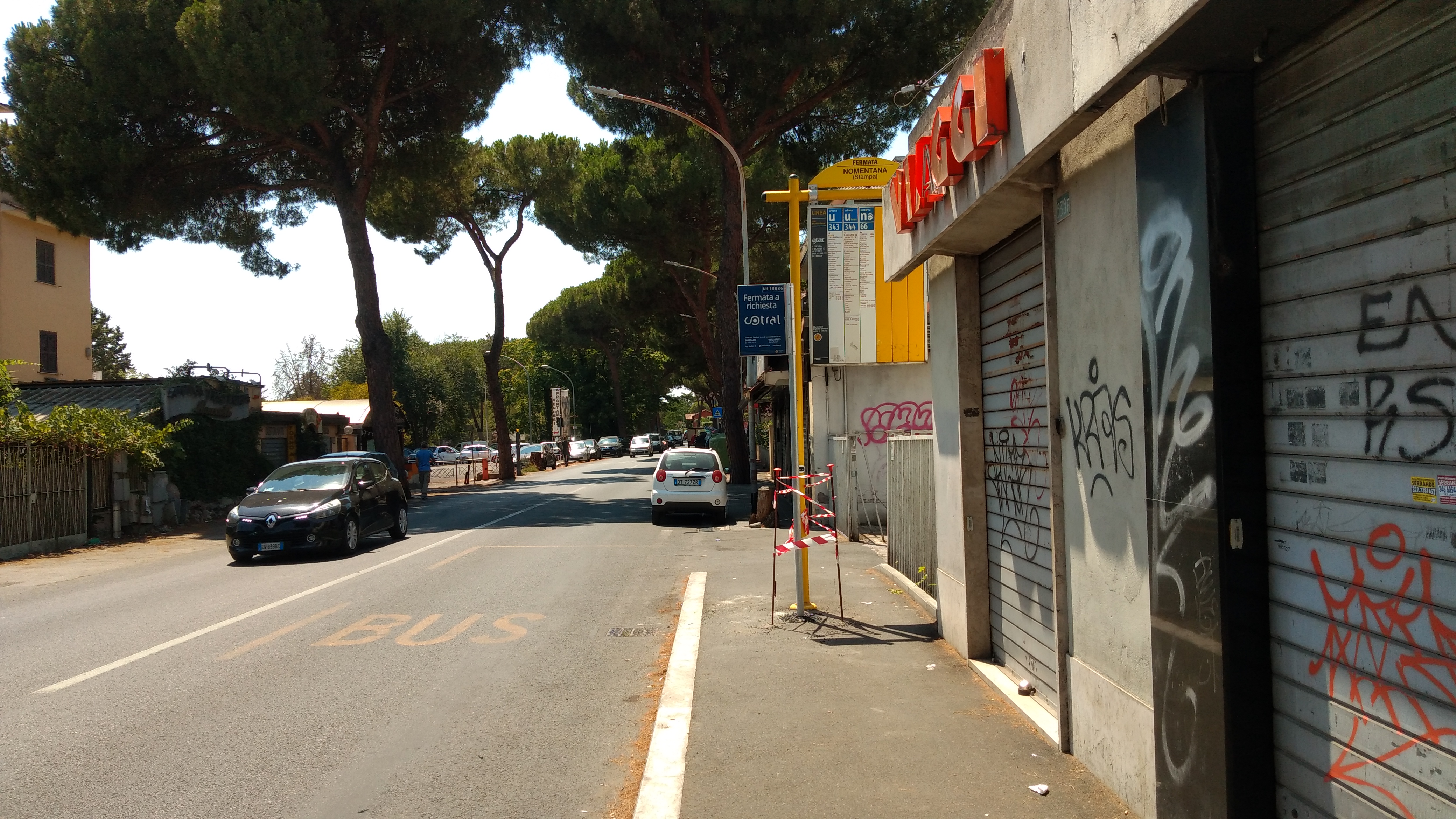 Taken by Anonymous
See Nomentana/Stampa stop, Roma, on the map
Public transit to Nomentana/Stampa stop (ID: 72582) in Roma
Looking for directions to Nomentana/Stampa in Roma, Italy?
Download the Moovit App to find the current schedule and step-by-step directions for Bus, Metro, Train or Light Rail routes that pass through Nomentana/Stampa.
Looking for the nearest stops closest to Nomentana/Stampa ? Check out this list of closest stops to your destination: Nomentana/Podere Rosa; Deledda; Jonio; Rome | Nomentana Street San Basilio Estate Street.
Bus: 343, COTRAL, N66, 344.Train: FL1.Metro: B.
We make riding on public transit to Nomentana/Stampa easy, which is why over 1.7 billion users, including users in Roma trust Moovit as the best app for public transit.
Use the app to navigate to popular places including to the airport, hospital, stadium, grocery store, mall, coffee shop, school, college, and university.
Nomentana/Stampa stop’s code is 72582
The first line to this stop is N66, at 3:33 AM, and the last line is N66 at 2:56 AM.
935B Via Nomentana, Roma, Italy
This stop serves Cotral, ATAC and Troiani Transportation Services’s lines
- Nomentana/Podere Rosa,
- Deledda,
- Rome | Nomentana Street San Basilio Estate Street
Bus stops near Nomentana/Stampa stop
- Jonio
Metro station near Nomentana/Stampa station
- Villa Cavalletti (School Institute),
- Vallebona Road,
- De Filippo/Pica,
- Flaminia/Pantaleoni,
- Ponte Mammolo (Metro B),
- La Storta,
- The Swimming Pools,
- Oslavia/Mazzini,
- Formia | Port,
- Jonio (Metro Line 1),
- Roma Nomentana,
- Longone | Fassinoro,
- Flaminio Square,
- Lido Center,
- Fiumicino Airport,
- Torre Spaccata (Mc),
- Vigne Nuove/Pasinetti,
- Via Nettunense, 21,
- Anzio | Ardeatina Road Acqua Marina Avenue,
- Monti Tiburtini/Pertini (H)
Popular public transit stations in Roma
Get around Roma by public transit!
Traveling around Roma has never been so easy. See step by step directions as you travel to any attraction, street or major public transit station. View bus and train schedules, arrival times, service alerts and detailed routes on a map, so you know exactly how to get to anywhere in Roma.
When traveling to any destination around Roma use Moovit's Live Directions with Get Off Notifications to know exactly where and how far to walk, how long to wait for your line, and how many stops are left. Moovit will alert you when it's time to get off — no need to constantly re-check whether yours is the next stop.
Wondering how to use public transit in Roma or how to pay for public transit in Roma? Moovit public transit app can help you navigate your way with public transit easily, and at minimum cost. It includes public transit fees, ticket prices, and costs. Looking for a map of Roma public transit lines? Moovit public transit app shows all public transit maps in Roma with all Bus, Train, Metro, Light Rail, Ferry, Funicular and Gondola routes and stops on an interactive map.
Rome and Lazio has 7 transit type(s), including: Bus, Train, Metro, Light Rail, Ferry, Funicular and Gondola, operated by several transit agencies, including ATAC, Cotral, Trenitalia, Troiani Transportation Services, BIS, ATR Mobility, Tuscia, Shuttle, Seatour, Troiani Bus Lines, CSC Mobility, Terravision, ATRAL, Tambus and Sitbus